Trimble Business Center (TBC) is desktop survey data processing software that adjusts GNSS baselines, registers laser scans, and produces geodetic deliverables from Trimble field instruments. SkyeBrowse is a cloud videogrammetry platform that converts any video into a measured 3D model. TBC serves licensed surveyors running Trimble hardware; SkyeBrowse serves field operators running any camera. On every dimension that matters for speed, accessibility, and cost, SkyeBrowse wins.
Contents
- Capture and Input
- Processing Speed
- Ecosystem Lock-in
- Operator Requirements
- Pricing and Total Cost
- Compliance and Security
- Output Formats and Sharing
- Head-to-Head Comparison
- The Bottom Line
- Related Comparisons
- Get a SkyeBrowse Recommendation
Capture and Input
TBC does not capture data. It processes observations collected by Trimble field instruments: GNSS receivers ($15,000-$30,000 each), total stations ($10,000-$50,000), laser scanners ($50,000-$80,000), and UAS platforms. Each instrument requires calibration, setup, and a trained operator in the field. A multi-instrument survey of a single site can involve hours of field work before TBC even opens.
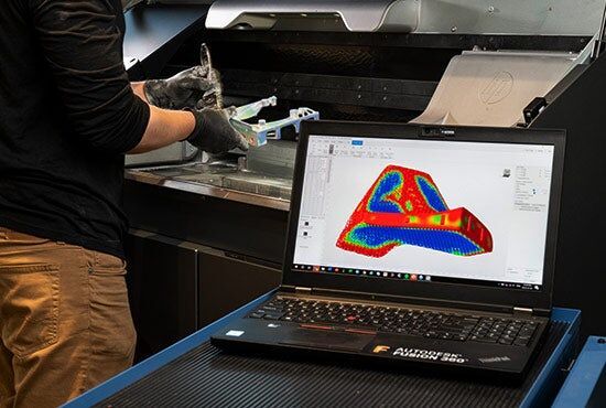
SkyeBrowse accepts video from any device recording .MP4 or .MOV. A $300 consumer drone, an iPhone, a body-worn camera, or a GoPro all feed the same upload pipeline. One operator records video of the scene. No instrument calibration, no survey control points, no multi-station setup. The video is the data, and any camera is the instrument.
Processing Speed
TBC processing time varies by data type and complexity. Simple GNSS adjustments complete in minutes. Laser scan registration for a multi-station project takes 30 minutes to several hours. Drone photogrammetry of a large site can run overnight. All processing happens on the desktop, tying a workstation to the task and an operator to the screen for quality control.
SkyeBrowse processes video at approximately a 1:1 ratio through cloud-based videogrammetry. A 10-minute video returns a finished model in about 10 minutes. No desktop workstation tied up, no overnight batch jobs, no operator babysitting the processing. A field team uploads from the scene and has a shareable 3D model before driving back to the office.
Ecosystem Lock-in
TBC is built for Trimble hardware. Its tightest integrations, including MAGNET Field, Trimble Access, Trimble Siteworks, and Trimble machine control, only materialize if your field instruments are Trimble. Mixed-vendor shops (Leica GNSS, Faro scanners, DJI drones) lose the seamless field-to-office-to-field loop that is TBC's core selling point. Even output formats favor the Trimble pipeline: JXL job files, Trimble-specific coordinate databases, and machine control exports optimized for Trimble equipment.
SkyeBrowse has no hardware allegiance. DJI, Autel, Skydio, Apple, Samsung, GoPro, Axon: if the device records video, SkyeBrowse processes it. Outputs in LAZ, GLB, and GeoTIFF are open formats that load into any GIS, CAD, or 3D viewing platform without conversion. No vendor lock-in, no format dependency, no ecosystem tax.
Operator Requirements
TBC requires a licensed professional surveyor or geodetic engineer. Operators must understand least-squares adjustment, coordinate reference systems, geoid models, error propagation, and scan registration quality metrics. Training takes months to years. The software interface reflects that complexity: dense menus, adjustment statistics panels, and coordinate system configuration dialogs.
SkyeBrowse requires the ability to record video and use a web browser. A patrol officer documents a crash scene. A construction superintendent captures a site progress update. A fire investigator records a structure. None of them need survey licenses, coordinate system knowledge, or CAD training. SkyeBrowse was built for the 99% of field personnel who are not licensed surveyors.
Pricing and Total Cost
TBC uses module-based perpetual licensing. The base software costs $3,000 to $5,000. Photogrammetry, scanning, and tunneling modules add $1,000 to $5,000 each. A fully equipped seat exceeds $20,000, plus 20% annual maintenance. That seat is useless without Trimble field instruments: a Trimble X7 scanner runs roughly $50,000, survey-grade GNSS receivers cost $15,000 to $30,000, and a total station adds $10,000 to $50,000. Total investment for a single production workflow easily exceeds $100,000 when hardware, software, and training combine.
SkyeBrowse subscriptions scale by accuracy tier without requiring specific hardware. Lite provides 2-6 inch accuracy. Premium delivers 8K resolution at 0.25 inch accuracy. Premium Advanced reaches 16K resolution with 0.1 inch accuracy and AI moving object removal. No scanner purchase, no instrument calibration, no desktop workstation, no module licensing. Scene documentation cost drops from $360 per incident with traditional methods to roughly $25 with SkyeBrowse.
Compliance and Security
TBC runs on a local desktop with standard commercial data handling. Trimble does not offer CJIS-compliant hosting, FedRAMP authorization, or GovCloud deployment for TBC-processed data. Survey files stored on office servers or Trimble cloud services follow commercial security practices, which do not meet the chain-of-custody requirements for criminal evidence or sensitive public safety documentation.
SkyeBrowse runs on AWS GovCloud (US) with FedRAMP Moderate alignment and CJIS-compliant workflows. Every upload, processing event, and share action carries an audit trail. 5-year guaranteed data retention on Premium and Premium Advanced tiers ensures models remain accessible through the full litigation lifecycle. For public safety agencies, prosecutors, and federal contractors, SkyeBrowse's compliance posture is a requirement, not a feature.
Output Formats and Sharing
TBC exports JXL job files, CAD formats (DXF, LandXML), LAS point clouds, and Trimble machine control files. Sharing data outside the survey office requires export, file transfer, and compatible software on the receiving end. Non-survey stakeholders (prosecutors, insurance adjusters, agency commanders) cannot open TBC outputs without specialized tools.
SkyeBrowse exports LAZ point clouds for forensic reconstruction and CAD analysis, GLB meshes for interactive 3D walkthroughs in any web browser, and GeoTIFF orthomosaics for GIS integration. Models are shareable through browser links with zero software installation. A prosecutor reviews the crash scene model on a laptop. An adjuster opens the property model on a tablet. A commander views the tactical pre-plan on a phone. No survey software required.
Head-to-Head Comparison
| Dimension | Trimble Business Center | SkyeBrowse |
|---|---|---|
| Input | GNSS, total station, scanner, UAS (Trimble hardware) | Any .MP4/.MOV video |
| Processing Speed | Minutes to overnight (desktop) | ~1:1 with video duration (cloud) |
| Ecosystem | Locked to Trimble instruments | Hardware-agnostic, open formats |
| Operator Skill | Licensed surveyor / geodetic engineer | Any field operator |
| Software Cost | $5,000-$20,000+ per seat + 20% maintenance | Subscription (Lite/Premium/Advanced) |
| Hardware Cost | $15,000-$80,000+ per instrument | Existing cameras (no purchase required) |
| Total Investment | $100,000+ (software + hardware + training) | Subscription + any camera |
| Compliance | Standard commercial | CJIS, FedRAMP Moderate, AWS GovCloud |
| Output | JXL, CAD formats, LAS, machine control files | LAZ, GLB, GeoTIFF (open formats) |
| Sharing | File export + survey software on receiving end | Browser link, no install |
| Data Retention | Local storage / Trimble cloud | 5-year guaranteed (Premium/Advanced) |
The Bottom Line
TBC is a professional survey tool for organizations running an end-to-end Trimble hardware pipeline and employing licensed surveyors. It excels at geodetic-grade adjustment and machine control integration. But that capability comes at extraordinary cost ($100,000+ all-in), requires specialized operators, locks you into the Trimble ecosystem, and offers no compliance pathway for public safety evidence.
SkyeBrowse eliminates the hardware, the licensing stack, the specialized operators, and the multi-hour processing timeline. Any camera, any operator, any browser. Processing completes in minutes. Output formats are open and vendor-neutral. Compliance meets CJIS and FedRAMP standards. Scene documentation drops from 3 hours with 4 staff to 10 minutes with 1 operator. For the vast majority of teams that need 3D spatial documentation without running a professional survey operation, SkyeBrowse is faster, simpler, and orders of magnitude more cost-effective.
Get a SkyeBrowse Recommendation
If your team needs 3D documentation without the overhead of professional survey instruments and desktop processing software, SkyeBrowse delivers measured models from video. Public safety agencies, construction firms, and inspection teams use it to bridge the gap between raw video and actionable 3D data, no survey license required.