Drone facade inspection uses unmanned aerial vehicles (UAVs) to capture high-resolution video and imagery of a building's exterior, replacing the scaffolding, rope access, and aerial lifts that traditional facade surveys require. When that footage is processed through a videogrammetry platform — software that converts drone video into measurable 3D models — property managers and inspection firms get a permanent, spatially accurate record of every surface, crack, and detail without putting a single worker at height. This guide covers why facade inspection has always been difficult, how the drone-plus-3D-mapping workflow solves it, safety and regulatory considerations, and what to look for in software and services.
Key Takeaways
- Traditional facade inspections require scaffolding or rope access that can cost tens of thousands of dollars for a single mid-rise building and exposes workers to significant fall risk.
- A drone facade inspection captures the same exterior coverage in a fraction of the time, with no worker deployed at height, at a cost often 60–80 percent lower than scaffold-based alternatives.
- Videogrammetry software converts raw drone video into a georeferenced 3D model with sub-inch accuracy, giving engineers and property managers a permanent, measurable digital record.
- FAA Part 107 certification is required for commercial drone inspection work in the United States; professional inspection firms handle this as standard practice.
- SkyeBrowse's cloud-based platform processes drone video into a shareable 3D model without requiring any desktop hardware or specialist software on the inspector's side.
Contents
- Why is traditional facade inspection so difficult and expensive?
- How does drone facade inspection work?
- What are the safety and regulatory requirements for drone property inspection?
- How does 3D mapping improve drone commercial property inspection outcomes?
- What should building owners look for in a drone inspection services provider?
- FAQ
Why is traditional facade inspection so difficult and expensive?
Traditional facade inspection requires workers to physically access the exterior of a building at height — via scaffolding, suspended platforms, rope access, or aerial lifts. This is expensive, time-consuming, and one of the most hazardous activities in the construction and property maintenance industries. For tall or architecturally complex buildings, a single inspection campaign can take days and cost more than the repairs it is meant to identify.
Falls from height are the leading cause of construction fatalities in the United States. OSHA's fall protection standards apply to any worker at six feet or above on a construction or maintenance site, and facade inspection work almost always triggers those requirements. Beyond the direct labor and safety costs, scaffold erection and street closure permits in dense urban areas add significant time and administrative burden. For a 20-story commercial building in a city like New York — where Local Law 11 mandates facade inspections every five years — a full scaffold drop can run upward of $100,000.
The CDC's National Institute for Occupational Safety and Health (NIOSH) reports that falls account for roughly one-third of all construction deaths annually. Reducing or eliminating worker exposure at height lowers both liability and insurance costs — which is exactly what drone-based approaches deliver.
How does drone facade inspection work?
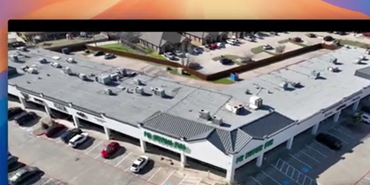
A drone facade inspection follows a straightforward four-step workflow: pre-flight planning, aerial capture, video processing, and report delivery. The operator plans an orbital or manual flight path around the building, captures systematic video of all exterior surfaces, then uploads that footage to a cloud platform that reconstructs the imagery into a 3D model. The resulting model is measured, annotated, and shared with the building owner or structural engineer.
On the day of inspection, the pilot positions the drone to capture the facade in overlapping passes — typically flying around the building's perimeter at multiple altitudes to cover every floor. Enterprise drones like the DJI Matrice 350 RTK can record 4K or higher video while maintaining precise positioning via RTK GPS. For taller structures, multiple orbital passes at different heights build up full wall coverage.
Once the video is recorded, it is uploaded to a videogrammetry platform. Videogrammetry is the process of extracting geometric measurements from video frames — similar to photogrammetry (which uses still images), but using a continuous frame sequence rather than discrete photos. SkyeBrowse accepts .MP4 or .MOV files and paired telemetry logs (.SRT files from DJI drones) through its browser-based portal, then generates a textured 3D mesh that engineers can rotate, zoom, and measure without any locally installed software.
For a broader overview of drone inspection services and the range of industries that use them, see our companion guide.
What are the safety and regulatory requirements for drone property inspection?
In the United States, any commercial drone operation — including drone property inspection — requires the operator to hold an FAA Part 107 Remote Pilot Certificate. Flights near airports or in controlled airspace require prior LAANC authorization. Additional local permits may apply in dense urban areas. Property owners hiring an inspection company should verify the operator's Part 107 certificate and proof of insurance before work begins.
The FAA's Part 107 rules for commercial UAS operations govern flight altitude (maximum 400 feet above ground level in uncontrolled airspace), visual line of sight requirements, and daylight operations. Waivers are available for nighttime and beyond-visual-line-of-sight operations, though most facade inspections are completed within standard Part 107 limits.
For buildings in Class B, C, or D airspace — which includes many urban commercial properties near airports — LAANC (Low Altitude Authorization and Notification Capability) provides near-instant automated approvals for flights below the authorized grid altitude. Operators flying in Class B airspace without prior authorization face substantial civil penalties.
Beyond federal requirements, many cities layer additional rules. New York City requires operators to obtain a permit from the Mayor's Office of Media and Entertainment for commercial flights over city streets. Building owners should ask vendors to include documentation of all applicable permits in the deliverable package.
How does 3D mapping improve drone commercial property inspection outcomes?
Turning drone video into a 3D model transforms a facade inspection from a collection of flat photos into a spatially accurate, permanent digital asset. Engineers and property managers can pull precise measurements from the model — crack widths, spalling extent, corrosion area — without returning to the site. The model can be shared with multiple stakeholders simultaneously and referenced for comparison in future inspection cycles.
The practical difference between a folder of JPEG photos and a georeferenced 3D model is significant. Photos require the reviewer to mentally reconstruct location and context; a 3D model preserves exact spatial relationships between every defect. When a structural engineer identifies a crack on floor 14, the model records its precise location and size — a data point that persists for future inspection cycles to track progression over time.
SkyeBrowse's Premium processing tier delivers accuracy within approximately 0.25 inch — sufficient for most facade condition assessments. The platform outputs the model as a GLB mesh file for visual review and as a LAZ point cloud for engineers who need raw geometric data in CAD or GIS workflows. Both files are downloadable from the same cloud-hosted model page, so the building owner, the inspection company, and the structural engineer of record can all access the same deliverable without file-transfer friction.
When the facade is only part of the scope, the same flight data can generate a drone 3D mapping output capturing rooflines, mechanical equipment, and surrounding grade alongside vertical surfaces. If a drone roof inspection is also required, the same video session feeds both deliverables.
The American Society of Civil Engineers (ASCE) has highlighted facade inspection safety programs as critical to extending the useful life of aging urban building envelopes — precisely the kind of systematic documentation that drone-derived 3D models enable.
What should building owners look for in a drone inspection services provider?
A qualified drone inspection services provider should hold an FAA Part 107 certificate, carry general liability and aviation hull insurance, and deliver structured 3D model outputs rather than raw photo sets. Ask specifically about processing software, accuracy specifications, turnaround time from flight to deliverable, and whether the model is hosted on a shareable platform or delivered as a local file only.
The deliverable format matters as much as the flight itself. A raw video file or a folder of photos requires additional processing before it has engineering value. The best providers bundle flight and processing into a single engagement, delivering a cloud-hosted 3D model within 24–48 hours of the inspection flight. That model should include measurement tools, the ability to annotate defects, and an export path to LAZ or GLB for engineering workflows.
Questions to ask a prospective provider:
- What drone platform and camera resolution do you use?
- What processing software generates the 3D model, and what is the stated accuracy?
- How is the model delivered — downloadable file, hosted link, or both?
- Can you provide a sample deliverable from a comparable project?
- What insurance coverage do you carry, and can you name the property owner as additionally insured?
For inspection companies building their own drone facade program, SkyeBrowse offers credit-based model processing with no monthly hardware investment. A Premium model — accurate to within approximately 0.25 inch — is priced at $99 per credit, making per-building pricing straightforward without fixed overhead.

FAQ
How much does a drone facade inspection cost?
A drone facade inspection typically costs between $500 and $3,000 per building, depending on height, complexity, and the deliverables required. That compares favorably with traditional scaffold-based inspections, which can run $10,000 or more for a mid-rise building when rigging, labor, and street closure permits are factored in.
Do you need FAA certification to fly a drone for commercial facade inspections?
Yes. Commercial drone operators in the United States must hold an FAA Part 107 Remote Pilot Certificate. Operations near airports or in controlled airspace also require prior authorization through the FAA's LAANC system. Most professional inspection companies already hold this certification. You can learn more about commercial UAS requirements at faa.gov/uas/commercial_operators.
What type of drone is best for facade inspections?
For facade work, a drone with a high-resolution camera, stable hover, and obstacle avoidance is ideal. DJI Mavic 3 Enterprise, DJI Matrice 350 RTK, and similar enterprise-grade platforms are commonly used. The drone's video output drives 3D model quality, so 4K or higher recording is preferred. SkyeBrowse maintains a full list of supported drones compatible with its processing platform.