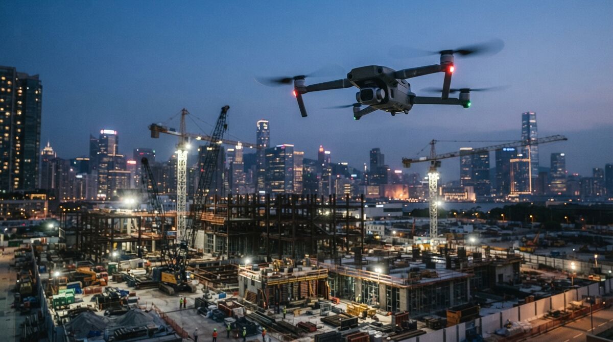
DJI Mini 4 Pro mapping is one of the easiest ways to start building measurable 3D models without owning a heavy enterprise drone. The Mini 4 Pro weighs under 249 grams, so it flies almost anywhere with minimal registration friction, and its 48MP camera captures enough detail for photogrammetry, the science of measuring real-world geometry from overlapping images. Paired with videogrammetry, which reconstructs 3D geometry from video frames instead of still photos, that footage becomes a full 3D model in the cloud. This guide covers what accuracy to expect, the exact capture workflow, where the small sensor runs out of room, and how the Mini 4 Pro handles roof inspection.
Key Takeaways
- The DJI Mini 4 Pro carries a 1/1.3-inch 48MP sensor shooting 8064 by 6048 stills and stable 4K video, enough for site documentation, small-scene 3D, and roof work.
- Without RTK or ground control points, expect visual-grade results; SkyeBrowse Lite lands around 2 to 6 inches of relative accuracy.
- The Mini 4 Pro is on the SkyeBrowse Flight App supported list with a required compatible controller; otherwise fly the orbit manually and use Universal Upload.
- At 40 meters altitude the Mini 4 Pro resolves roughly 0.74 cm per pixel, fine enough to read roof damage and site features.
- Under 249 grams means lighter registration rules for recreational flyers, though commercial mapping still requires an FAA Part 107 certificate in the United States.
Contents
- Can the DJI Mini 4 Pro do mapping?
- What accuracy can you expect from Mini 4 Pro photogrammetry?
- How do you map with the Mini 4 Pro in SkyeBrowse?
- When does the small sensor limit you?
- Is the DJI Mini 4 Pro good for roof inspection?
- FAQ
Can the DJI Mini 4 Pro do mapping? {#can-map}
Yes. The DJI Mini 4 Pro records stable 4K video and 48MP stills, which is all a videogrammetry engine needs to build a measurable 3D model. It also sits on the SkyeBrowse Flight App supported list when paired with a required compatible controller, so orbit capture can run automatically. On other controller combinations you fly a manual orbit and upload the footage.
The Mini 4 Pro uses a 1/1.3-inch CMOS sensor with 48 effective megapixels, a maximum still resolution of 8064 by 6048 pixels, a 24mm-equivalent f/1.7 lens, and a takeoff weight under 249 grams, per the DJI Mini 4 Pro specifications. Those numbers put it well ahead of earlier Mini drones for mapping duty. Because SkyeBrowse turns video into 3D rather than requiring hundreds of triggered stills, the Mini 4 Pro is a natural fit: fly a smooth arc, keep the subject framed, and let the cloud do the reconstruction. For the broader tooling picture, see the drone mapping app roundup, and confirm the aircraft's current automation level on the SkyeBrowse supported drones page.
What accuracy can you expect from Mini 4 Pro photogrammetry? {#accuracy}
A consumer sub-250g drone without RTK gives visual-grade accuracy. On SkyeBrowse Lite that is roughly 2 to 6 inches of relative accuracy, which is plenty for roof measurements, insurance documentation, and small-scene 3D. Survey-grade absolute accuracy still needs ground control points or an RTK aircraft, which the Mini 4 Pro does not have.
Be honest with yourself about what "accurate" means for your job. Relative accuracy, the distance between two points inside the model, is strong on the Mini 4 Pro because the 48MP sensor resolves fine detail. Absolute accuracy, how well the model aligns to real-world coordinates, depends on georeferencing. Uploading the drone's .SRT subtitle file lets SkyeBrowse pull GPS from every frame and place the model on the map automatically. For true survey deliverables the American Society for Photogrammetry and Remote Sensing documents how ground control and accuracy standards drive the tighter tiers. To see how altitude changes detail, the table below lists ground sample distance, the real-world size of one pixel, for the Mini 4 Pro using its 24mm-equivalent focal length.
| Altitude | Ground sample distance | Practical read |
|---|---|---|
| 40 m | 0.74 cm/px | Roof shingles, site features |
| 60 m | 1.12 cm/px | General site documentation |
| 80 m | 1.49 cm/px | Wide-area context only |
Run your own numbers for any focal length and altitude with the GSD calculator.
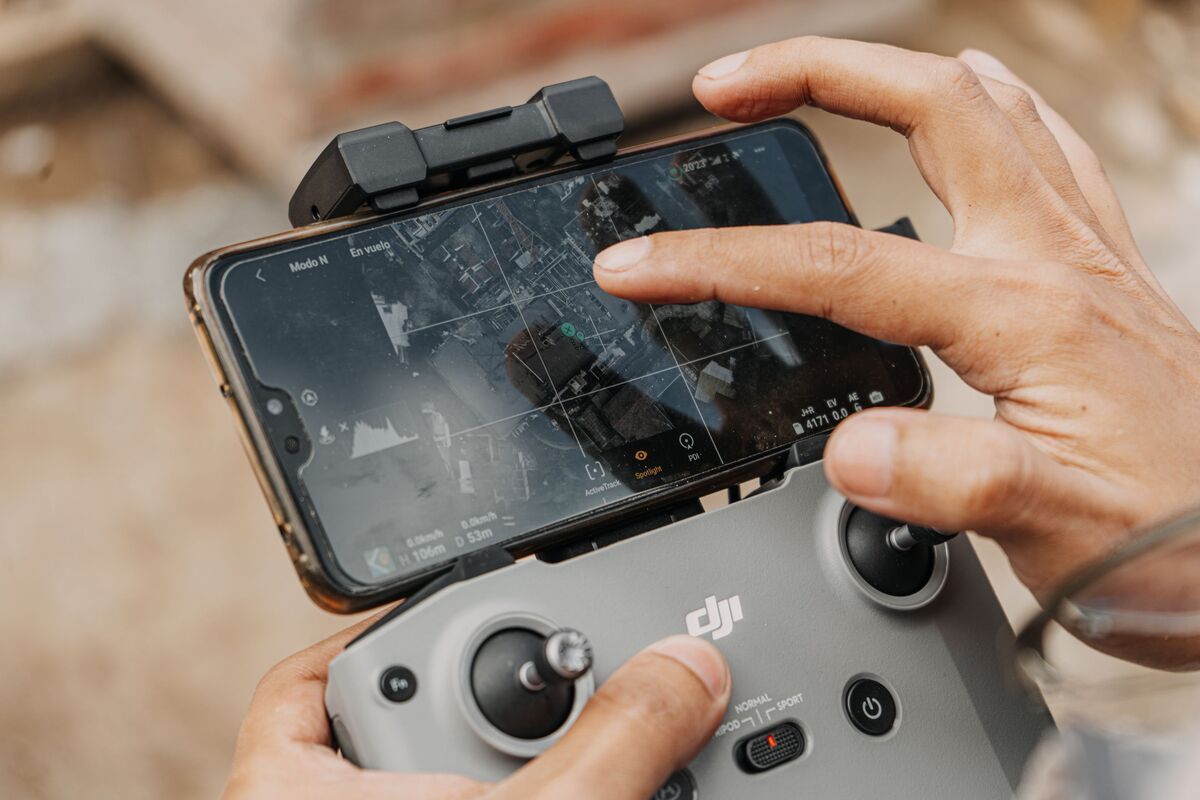
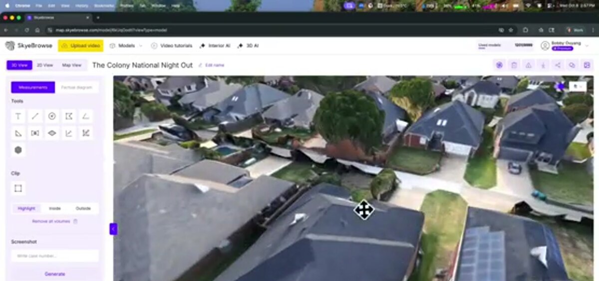
How do you map with the Mini 4 Pro in SkyeBrowse? {#workflow}
Fly two slow orbits around the subject at a 45-degree camera tilt, keep motion smooth, and lock the zoom. If your controller is on the supported list, SkyeBrowse orbit mode automates the flight. Otherwise fly manually, then upload the .MP4 plus its .SRT log at app.skyebrowse.com and the model builds in minutes.
The capture pattern is the same idea whether the flight is automated or manual: circle the subject twice, tilt the camera down about 45 degrees, and move slowly enough that frames stay sharp. For scenes under an acre the automated orbit mode is ideal. Larger sites benefit from a grid pass, though the wide grid mode is reserved for higher-end aircraft, so plan the Mini 4 Pro around compact subjects. Turn on video caption recording in the drone settings so the .SRT file is written, then pair the video and log in the upload dialog. A full walkthrough lives in how to make a 3D model with a drone.
When does the small sensor limit you? {#limits}
The Mini 4 Pro's 1/1.3-inch sensor limits you in low light and on large area grids. It gathers less light than a 1-inch or enterprise sensor, so dawn, dusk, and shaded scenes get noisier, and covering many acres at low altitude takes many batteries. For those jobs a larger drone or a higher-detail accuracy tier is the better tool.
The physics are simple: a smaller sensor collects less light per pixel, so noise rises as conditions dim. Keep Mini 4 Pro mapping flights in good daylight, avoid pointing too much sky into the frame, and hold altitude low enough to keep ground sample distance tight. Wind is the other ceiling. A 249-gram airframe gets pushed around in gusts, which softens video and breaks the smooth motion photogrammetry depends on. If you routinely map multi-acre sites, step up to a heavier aircraft; the mini drone surveying guide covers exactly where the sub-250g class stops. When you need a bigger sensor in the same easy-to-carry format, compare the DJI Mini 5 Pro mapping workflow.
Is the DJI Mini 4 Pro good for roof inspection? {#roof}
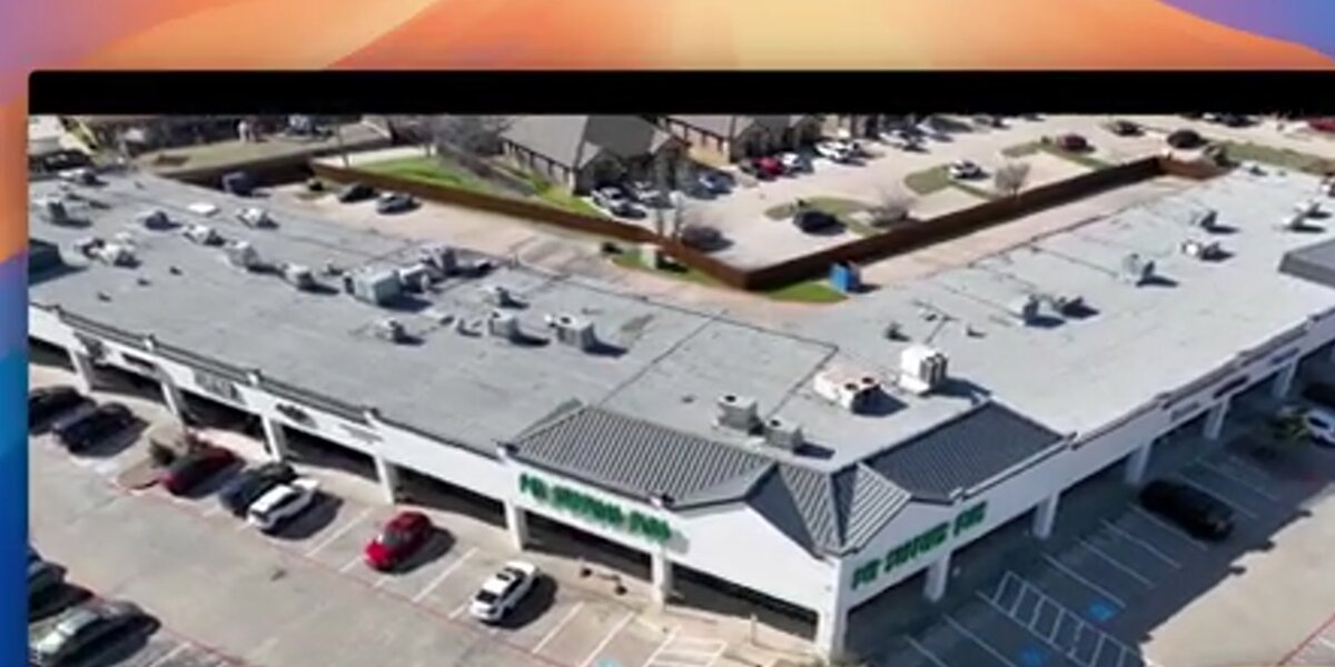
Yes. The Mini 4 Pro is one of the best-value roof inspection drones because it flies close, resolves shingle-level detail, and produces a measurable 3D model you can pull dimensions from without climbing a ladder. At 40 meters it reads roughly 0.74 cm per pixel, and the automated orbit captures every slope in one short flight.
For a typical residential roof, fly a two-orbit pass at 30 to 40 meters with the camera tilted down, then let SkyeBrowse rebuild the roof planes in the cloud. You get pitch, area, and edge measurements from a safe standoff, which the National Roofing Contractors Association notes as a core benefit of remote roof assessment for both safety and documentation. The resulting model exports as a mesh or point cloud for reporting, and the same file doubles as before-and-after evidence for insurance claims. The Mini 4 Pro will not replace an enterprise thermal rig, though for visual roof condition work it punches far above its size.
FAQ
Can you make a 3D model with a DJI Mini 4 Pro?
Yes. The Mini 4 Pro shoots stable 4K video that a videogrammetry platform like SkyeBrowse turns into a measurable 3D model in minutes. Fly a slow double orbit at a 45-degree camera tilt, upload the .MP4 with its .SRT log, and the cloud handles the reconstruction. Start free at app.skyebrowse.com.
How accurate is DJI Mini 4 Pro photogrammetry?
Without RTK or ground control points, a Mini 4 Pro produces visual-grade models. On SkyeBrowse Lite that lands around 2 to 6 inches of relative accuracy, which is fine for roof measurements, site documentation, and small-scene 3D. Survey-grade absolute accuracy needs ground control or an RTK aircraft.
Is the DJI Mini 4 Pro supported by the SkyeBrowse Flight App?
The Mini 4 Pro is on the SkyeBrowse Flight App supported list when paired with a required compatible controller, which enables automated orbit capture. On other controller combinations you fly the orbit manually and upload the video through Universal Upload.