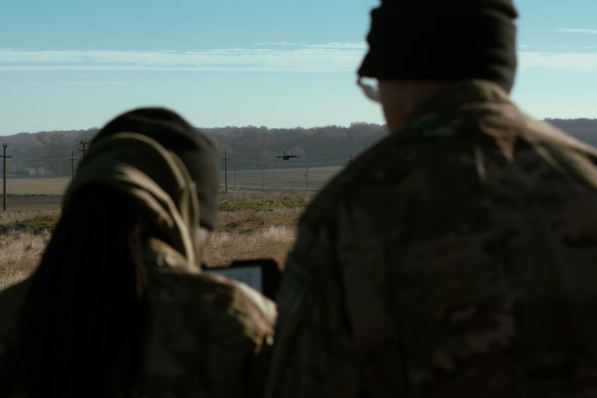
Accident scene documentation with drones has become standard practice for law enforcement and reconstruction professionals, but the speed of drone capture creates a false sense of simplicity. Every missed step — an unsecured evidence marker, a flight path that omits a critical vantage point, a broken chain of custody — undermines months of investigation and can disqualify evidence in court.
An accident reconstruction documentation checklist is a structured, step-by-step protocol for capturing, processing, and preserving drone-based scene data so it meets evidentiary standards and supports courtroom presentation. This checklist follows NHTSA-recommended practices and ASTM E3205 standards for forensic photogrammetry.

Key Takeaways
- A structured checklist is essential because even technically excellent 3D models can be excluded from court if capture, chain of custody, or processing steps are not properly documented.
- Pre-launch steps — securing the scene, placing numbered evidence markers, verifying airspace authorization, and preparing equipment — must all be completed before the drone leaves the ground.
- Flight altitude should target 1–3 cm/px GSD (typically 50–120 ft AGL), with a separate lower-altitude pass at 30–50 ft for detailed evidence areas like tire marks and point of impact.
- Chain of custody requires creating a forensic bit-for-bit copy of the SD card and recording SHA-256 hashes before any processing; never edit or rename files on the original card.
- The five most common mistakes that invalidate reconstruction data are: incomplete scene coverage, broken chain of custody, flying too high, missing oblique angles, and failing to record drone telemetry subtitle files.
Contents
- Why Do Accident Reconstructionists Need a Documentation Checklist?
- What Should You Do Before Launching the Drone?
- How Do You Plan the Drone Flight for Accident Documentation?
- What Data Should You Capture at the Scene?
- How Do You Maintain Chain of Custody for Drone Evidence?
- What Processing and Deliverable Steps Are Required?
- What Common Mistakes Invalidate Accident Reconstruction Data?
- Frequently Asked Questions
Why Do Accident Reconstructionists Need a Documentation Checklist?
A standardized documentation checklist ensures scene data is captured completely, processed consistently, and preserved in a chain of custody that withstands Daubert and Frye challenges. Without one, even technically excellent 3D models can be excluded from evidence.
Accident reconstruction — the scientific analysis of how a collision occurred, including speed, trajectory, point of impact, and contributing factors — depends on accurate, comprehensive scene documentation. The National Highway Traffic Safety Administration (NHTSA) recommends systematic documentation protocols that capture the full scene before any evidence is moved or the roadway is reopened to traffic.
Traditional methods using total stations and tape measures can take 4-8 hours for a complex multi-vehicle scene. Drone-based documentation using photogrammetry or videogrammetry can capture the same scene in 15-45 minutes, but that speed advantage only holds if the operator follows a rigorous protocol. A drone that captures video of 90% of the scene still misses 10% — and the missing area may contain the most critical evidence.
The checklist below is organized in chronological order: what to do before launching, during flight, during processing, and after export. Print it, laminate it, and keep it in your flight case.
What Should You Do Before Launching the Drone?
Pre-launch preparation covers scene safety, evidence preservation, regulatory compliance, and equipment readiness. These steps must be completed before the drone leaves the ground.
Pre-Launch Checklist
Scene Security and Evidence Preservation
☐ Confirm scene is secured by law enforcement with traffic control in place
☐ Verify no vehicles or evidence will be moved during drone capture
☐ Place numbered evidence markers at all key features: point of impact, final rest positions, gouge marks, tire marks, fluid spills, debris boundaries
☐ Photograph evidence markers at ground level before drone launch (backup documentation)
☐ Note weather conditions: temperature, wind speed, precipitation, lighting, sun angle
☐ Record scene dimensions (approximate length and width) for flight planning
☐ Identify and document all witness marks: yaw marks, scrub marks, rollover scuffs, and barrier strikes
Regulatory and Coordination
☐ Verify Part 107 certification is current for the remote pilot in command
☐ Obtain LAANC authorization if scene is in controlled airspace
☐ Check NOTAMs and TFRs for the area
☐ Coordinate with incident commander or scene supervisor
☐ Confirm airspace is clear of medical helicopters, news aircraft, or other UAS
☐ If operating under Part 107.29 (night operations), verify anti-collision lighting is active and visible for 3 statute miles
Equipment Readiness
☐ Complete standard drone preflight checklist (airframe, battery, controller, camera)
☐ Verify SD card capacity — minimum 64 GB recommended for scene capture
☐ Set camera to highest available resolution
☐ For video capture: set MP4 or MOV format at 4K minimum resolution
☐ If available, enable drone telemetry subtitle recording (DJI .SRT or Autel .ASS files)
☐ Carry at least two fully charged flight batteries
☐ Set return-to-home altitude above the tallest obstacle at the scene (light poles, overpasses, trees)
How Do You Plan the Drone Flight for Accident Documentation?
Flight planning for accident reconstruction requires capturing the full scene from multiple angles with sufficient overlap for 3D reconstruction, while maintaining the altitude and coverage needed for courtroom-grade detail.
Flight Planning Checklist
Area of Coverage
☐ Define capture area to include: all vehicle final rest positions, full extent of tire marks, debris field, approach roadway (minimum 200 feet before first evidence), and departure roadway (minimum 200 feet past last evidence)
☐ Include intersection geometry, traffic signals, signage, and sight-line obstructions in the capture area
☐ If the scene involves a pedestrian, extend coverage to include crosswalks, sidewalks, and pedestrian approach paths
Altitude and GSD
☐ Set flight altitude for 1-3 cm/px GSD (typically 50-120 feet AGL depending on camera)
☐ For detailed evidence areas (point of impact, complex tire marks), plan a lower-altitude pass at 30-50 feet AGL
☐ Verify target GSD meets your agency's documentation standard and courtroom presentation requirements
Flight Pattern
☐ Plan nadir (straight-down) passes covering the full scene area with 75-80% overlap
☐ Plan oblique passes at 30-45 degree angles to capture vertical surfaces (vehicle damage, barrier faces, embankments)
☐ For SkyeBrowse Flight App users: configure an orbit pattern centered on the scene with appropriate altitude and radius
☐ For manual video capture: plan a continuous, steady orbit at consistent altitude, followed by linear passes along the roadway
☐ Include approach and departure roadway in the flight path — these areas provide context for speed analysis and sight-distance calculations
Ground Control Points (If Used)
☐ Place GCPs at scene corners and center — minimum 5, with at least 2 held as check points
☐ Survey GCP coordinates with RTK GPS before flight
☐ Ensure GCPs are visible in aerial imagery and not obscured by vehicles or debris
What Data Should You Capture at the Scene?
Data capture goes beyond flying the drone. The evidence package includes aerial data, ground-level reference photos, scene measurements, metadata, and environmental documentation.
Data Capture Checklist
Aerial Capture
☐ Execute planned nadir flight pattern — verify overlap in real-time if flight app supports it
☐ Execute oblique passes for all vertical surfaces and vehicle damage
☐ Capture at least one complete orbit of the scene at consistent altitude
☐ If scene is large, capture in sections with adequate overlap between sections (minimum 30%)
☐ For videogrammetry: maintain smooth, steady flight — avoid jerky movements that create motion blur
☐ Record continuous video (do not stop/start recording mid-flight for each pass)
Ground-Level Reference
☐ Photograph each evidence marker with its number clearly visible
☐ Photograph each vehicle's four sides, damage areas, and VIN plate
☐ Photograph tire marks at ground level showing texture and directionality
☐ Photograph traffic signals showing active signal phase if possible
☐ Photograph roadway surface conditions (dry, wet, ice, gravel, potholes)
Measurements and Documentation
☐ Record reference measurements between known fixed points (lane widths, curb-to-curb distances) for model verification
☐ Document vehicle odometer readings if accessible
☐ Record GPS coordinates of scene center point
☐ Note the time of capture — this establishes the temporal reference for all scene data
☐ Record drone serial number, battery serial number, and firmware version
How Do You Maintain Chain of Custody for Drone Evidence?
Chain of custody tracks every person who handles the evidence data, every transfer between devices or systems, and every processing step applied to the raw capture. A break in the chain can render the entire dataset inadmissible.
Chain of Custody Checklist
☐ Record operator name, badge/ID number, and date/time on a chain of custody log at the scene
☐ Do not delete or modify any files on the SD card after capture
☐ Create a forensic copy of the SD card before any processing (bit-for-bit clone or verified hash copy)
☐ Record the SHA-256 hash of each raw video/image file at the time of copy
☐ Store the original SD card in a sealed evidence bag with case number, date, operator name, and drone serial number
☐ Upload to processing platform from the forensic copy, not the original card
☐ When using SkyeBrowse, uploads to AWS GovCloud maintain an access log and sharing controls aligned with CJIS Security Policy requirements on Premium tiers
☐ Document each processing step: software used, version, settings, date, operator
☐ Log every export, share, or access event for the processed model
The ASTM International Standard E3205 provides a framework for forensic photogrammetric documentation that includes chain of custody procedures specifically applicable to drone-captured scene data.
What Processing and Deliverable Steps Are Required?
Processing transforms raw video or images into the courtroom-ready deliverables that reconstructionists use in analysis and testimony.
Processing and Deliverable Checklist
Processing
☐ Upload raw video/images to processing platform from forensic copy
☐ Include telemetry subtitle files (DJI .SRT or Autel .ASS) for georeferencing if available
☐ Select appropriate processing tier based on required accuracy (SkyeBrowse Premium: 0.25 inch accuracy; Premium Advanced: 0.1 inch accuracy with AI moving object removal)
☐ Verify model completion and inspect for gaps, artifacts, or alignment errors
☐ If gaps exist, determine whether a supplemental capture is possible before the scene is released
Measurements and Analysis
☐ Take reference measurements in the 3D model and compare against ground-truth field measurements
☐ Document measurement accuracy: calculate the difference between model measurements and field tape/RTK measurements
☐ Measure all critical distances: tire mark lengths, scrub mark paths, point of impact to final rest positions, lane offsets, sight distances
☐ If supported, generate 2D sketch diagrams from the model for use in reports and court exhibits
Deliverables
☐ Export orthomosaic (GeoTIFF) for GIS overlay and scaled plan-view diagrams
☐ Export point cloud (LAZ) for CAD integration and cross-section analysis
☐ Export 3D mesh (GLB) for courtroom 3D visualization and jury presentation
☐ Generate shareable model link for attorneys, investigators, and expert witnesses
☐ Save all measurement screenshots and annotated views as part of the case file
☐ Archive the full dataset (raw capture + processed outputs + chain of custody log) per agency retention policy
What Common Mistakes Invalidate Accident Reconstruction Data?
Even experienced operators make errors under the time pressure of an active scene. These are the most frequent mistakes and how to avoid them.
Capturing only part of the scene. The most common error is not extending coverage far enough. Tire marks, fluid trails, and debris fields often extend hundreds of feet beyond the point of impact. Approach and departure roadway context is essential for speed calculations and sight-distance analysis. Always capture at least 200 feet beyond the last visible evidence in each direction.
Breaking chain of custody. Editing, deleting, or reorganizing files on the original SD card before creating a forensic copy breaks the chain. Even renaming files can create admissibility challenges. Copy first, verify hash, then work exclusively from the copy.
Flying at too high an altitude. At 200+ feet AGL, GSD may exceed 3-4 cm/px, which is insufficient to resolve fine evidence like scuff marks, glass shards, and paint transfers. Fly at 50-120 feet for primary passes and 30-50 feet for detailed evidence areas.
Missing oblique angles. Nadir-only (straight-down) capture misses vertical surfaces: vehicle side damage, barrier faces, curb impacts, and embankment geometry. Always include orbits or manual oblique passes at 30-45 degree angles.
Not recording telemetry data. Drone telemetry subtitle files (.SRT for DJI, .ASS for Autel) embed GPS coordinates, altitude, and timestamp for each frame. These files dramatically improve georeferencing accuracy in processing and serve as independent metadata for evidentiary purposes. Enable subtitle recording in your drone settings before every flight.
Frequently Asked Questions
What is the best drone for accident reconstruction? Any drone that captures high-resolution video or images at 4K or higher and supports stable flight in the 50-120 foot altitude range is suitable. Popular choices include the DJI Mavic 3 Enterprise, DJI Matrice 350 RTK, and Autel EVO II Pro. SkyeBrowse accepts video from any of these platforms through Universal Upload, processing MP4 or MOV files into courtroom-ready 3D models.
How long does drone-based accident documentation take? Flight capture typically takes 15-45 minutes depending on scene size and complexity. Processing on SkyeBrowse takes roughly 1 minute per minute of video, with most models ready for measurement within an hour. Compare this to 4-8 hours for traditional total station documentation — drone-based workflows can reduce road closure time by 50-75% according to departments that have adopted the technology.
Is drone-captured evidence admissible in court? Yes, when proper procedures are followed. Drone photogrammetry and videogrammetry evidence has been admitted under both Daubert and Frye standards. The key requirements are: validated methodology (established photogrammetric science), proper chain of custody, documented accuracy verification against ground-truth measurements, and a qualified operator who can testify to the capture process. SkyeBrowse models are Daubert-ready when captured and processed following proper procedures.
Do I need ground control points for accident reconstruction? GCPs improve absolute positional accuracy (tying the model to real-world coordinates), but many reconstruction analyses depend primarily on relative accuracy — the consistency of measurements within the model itself. For cases where absolute positioning is critical (multi-scene correlation, GIS overlay with road engineering data), use GCPs. For cases focused on internal measurements (distances, angles, areas within the scene), videogrammetry platforms like SkyeBrowse deliver high relative accuracy from video capture alone.
What CJIS requirements apply to drone scene data? Criminal justice information, including evidence from crash scenes involving fatalities or criminal charges, must be stored and transmitted in accordance with the FBI CJIS Security Policy. SkyeBrowse Premium tiers are hosted on AWS GovCloud with chain-of-custody tracking, user access logging, and sharing controls aligned with CJIS requirements.