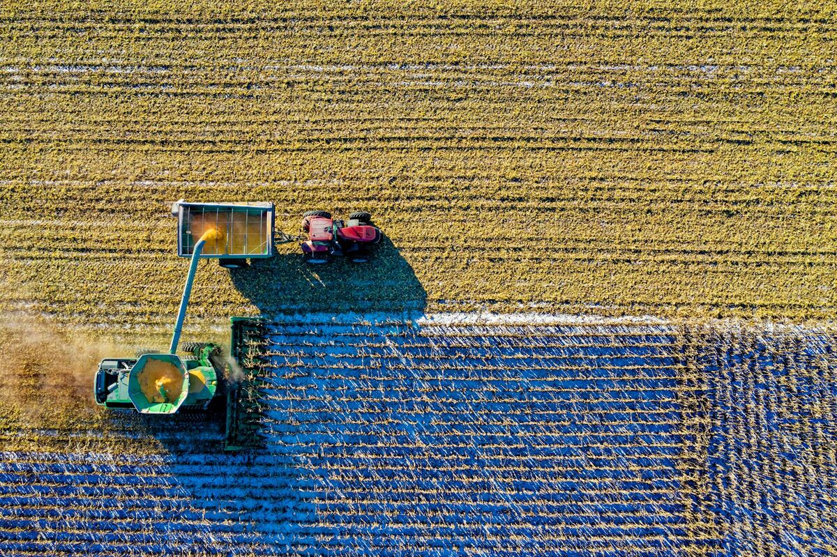
Precision agriculture relies on timely, accurate spatial data, but traditional field mapping workflows are slow and expensive. Agriculture drone mapping — the process of using unmanned aerial vehicles to capture georeferenced imagery and elevation data — gives agronomists and crop consultants actionable field intelligence the same day the drone flies. SkyeBrowse takes this further by using videogrammetry (the conversion of continuous drone video into 3D models and orthomosaics) rather than traditional photo-based photogrammetry, eliminating the mission planning and image stitching steps that slow conventional workflows.
Key Takeaways
- Agriculture drone mapping with video-based capture eliminates mission planning apps, waypoint navigation, and manual photo stitching — a single freehand flight generates both an orthomosaic and an elevation model.
- Elevation models accurate to approximately 0.25 inch (Premium tier) are sufficient for field drainage analysis, tile line planning, and irrigation layout without RTK equipment or professional survey crews.
- A 10-minute drone flight over a problem field returns a processed georeferenced model in roughly 10 minutes after upload — fast enough to review drainage data before leaving the property.
- Direct field capture costs drop to under $30 per field using internal staff, compared to $800-$1,200 for a traditional survey crew mobilization on the same acreage.
- GeoTIFF orthomosaics and LAZ point clouds export directly into John Deere Operations Center, Climate FieldView, and Ag Leader SMS without format conversion.
Contents
- Why is videogrammetry faster than photogrammetry for farm mapping?
- How do you capture a field for drone mapping without a flight planning app?
- What elevation accuracy do agriculture drone maps deliver?
- How does drone field analytics reduce farm surveying costs?
- How do agronomists use multi-season drone data for long-term field management?
- FAQ
Why is videogrammetry faster than photogrammetry for farm mapping?
Videogrammetry extracts spatial data from continuous video footage rather than a pre-planned grid of discrete photos. The farmer or agronomist flies a single manual pass over the field, uploads the video file, and receives a georeferenced orthomosaic and point cloud — no mission planning, no photo overlap calculations, no stitching delays. For time-sensitive situations like post-storm flood damage or pre-harvest stand assessment, that compression of the capture-to-model timeline is decisive.
Traditional agricultural photogrammetry — the kind used by platforms like Pix4D or DroneDeploy — requires configuring ground sample distance, setting overlap percentages, uploading individual images, and waiting through a multi-step stitching pipeline. Each step is a potential source of delay or error.
SkyeBrowse's videogrammetry approach removes those steps. The underlying technology derives 3D geometry from thousands of overlapping frames captured continuously as the drone moves. The operator flies the field; the platform extracts frames, reconstructs geometry, and delivers a georeferenced output. For consultants managing large field portfolios, that simplicity translates to more coverage per day. The drone mapping guide covers capture patterns and altitude recommendations that apply to agricultural flights.
How do you capture a field for drone mapping without a flight planning app?
Any .MP4 or .MOV video file with embedded GPS metadata qualifies for upload. Fly in manual mode — either straight parallel passes at constant altitude for large rectangular fields, or a slower orbit pattern around localized problem areas like wet spots or pest damage zones. Upload the video via the SkyeBrowse Flight App or the Universal Upload portal at app.skyebrowse.com. No configuration is required before or after capture.
The absence of flight planning software dependency is particularly valuable in agriculture because field conditions change faster than mission plans can adapt. When a grower calls about standing water after a heavy rain event, the consultant can arrive, assess the field visually, fly a 10-minute manual pass over the ponded areas, and upload from the field — without waiting to configure a mission plan on a laptop.
For DJI drones, attaching the .SRT telemetry file alongside the video improves georeferencing precision. The SRT file logs timestamp-matched GPS coordinates and altitude data that the platform uses to anchor the model spatially. Autel drones produce .ASS telemetry files that serve the same function.
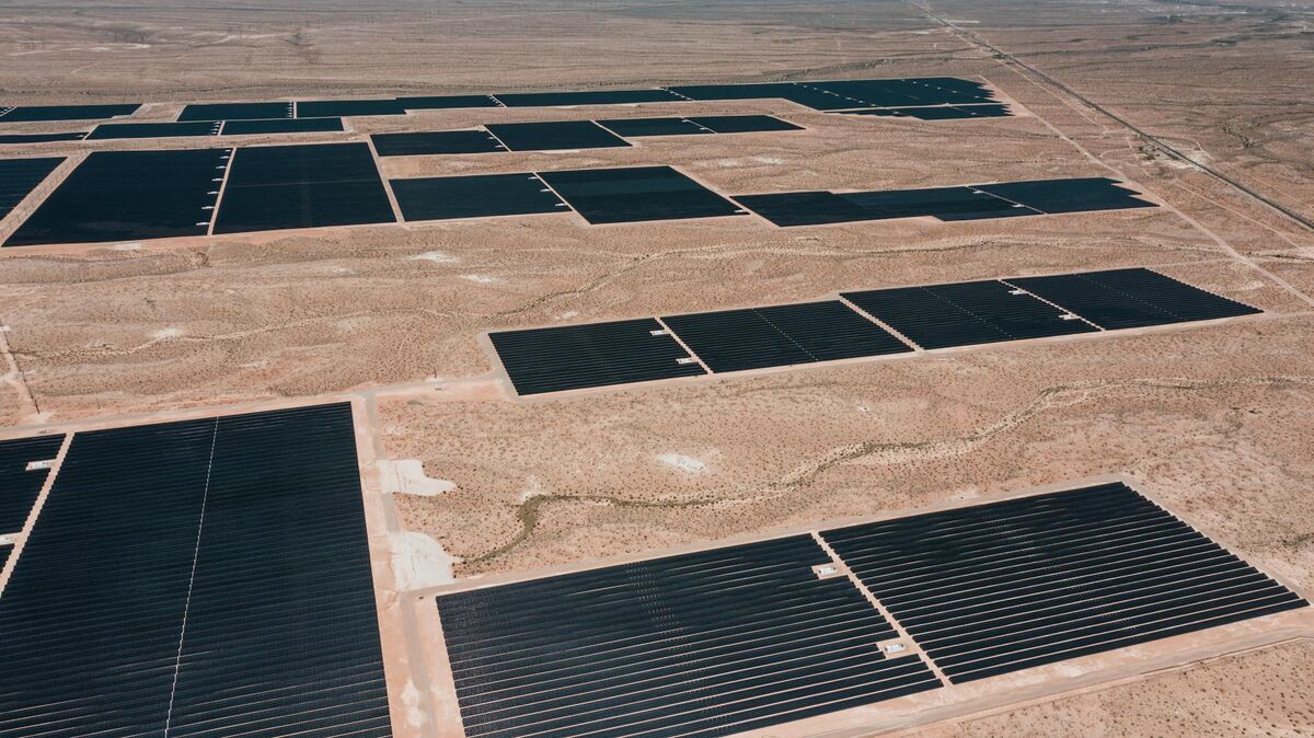
Large fields benefit from overlapping parallel runs where adjacent passes share at least 60 percent of the field of view. At 120 meters AGL — the FAA Part 107 ceiling — a standard wide-angle camera covers roughly 60 meters of width per pass. A 160-acre field typically completes in a single 20-minute flight. The drone surveying guide provides altitude-to-GSD calculations for selecting the right flight height for specific accuracy targets.

What elevation accuracy do agriculture drone maps deliver?
SkyeBrowse's Premium tier produces elevation data accurate to approximately 0.25 inch relative accuracy at 8K resolution — the level needed for drainage analysis, tile line placement, and irrigation system layout. Premium Advanced reaches approximately 0.1 inch at 16K resolution for research applications. A base Lite model provides 2 to 6 inch relative accuracy for scouting and visual documentation tasks where survey-grade precision is not required.
Relative accuracy — the precision of elevation differences within the same model — is what matters for most agronomic decisions. Drainage analysis asks which areas are lower than others, not what the absolute NGVD elevation is. The 0.25-inch tier identifies drainage divides, depressional areas, and tile outlet gradients with ample resolution.
Ground control points can push absolute positional accuracy further when applications require it. The GCP vs no-GCP accuracy guide explains when adding GCPs is worth the field time and when embedded GPS accuracy is sufficient.
All elevation outputs export as GeoTIFF files — the standard raster format accepted by John Deere Operations Center, Climate FieldView, Ag Leader SMS, and most precision agriculture prescription software. Point clouds export as LAZ files compatible with QGIS, ArcGIS, and other GIS platforms. The orthomosaic vs 3D model comparison explains which output type suits which downstream workflow. For university extension and seed company research plots, the Premium Advanced tier's 0.1-inch resolution supports variety trial spatial analysis where subtle elevation differences between plot locations must be documented and controlled for in statistical models.
How does drone field analytics reduce farm surveying costs?
A traditional survey crew mobilization on a 40-acre problem field costs $800 to $1,200 and delivers elevation contours days after the fieldwork. A video-based drone mapping flight covering the same acreage costs under $30 in direct labor when operated by internal staff, and the processed model is available within 30 minutes of landing. That cost compression makes frequent repeat coverage economically viable where it was previously prohibitive.
The cost structure of drone-based field analytics changes the economics of precision agriculture consulting. When individual field captures cost $30 or less, consultants can map the same field multiple times per season — pre-plant, canopy closure, and post-harvest — building a temporal record that traditional surveying budgets could never support.
For tile drainage contractors, video-based elevation mapping replaces expensive topographic survey mobilizations. The contractor flies the problem field, extracts flow lines and gradient data from the GeoTIFF, and designs the tile system from the model without deploying a survey crew — compressing the scoping and design phase from days to hours.
Insurance adjusters use drone mapping for hail, flooding, and wind damage documentation. Flying the affected area immediately after the event and measuring lodged crop extent from the orthomosaic provides defensible documentation before field conditions change. The insurance claims documentation guide covers that workflow in detail. The drone stockpile measurements guide shows a related application — volumetric calculations from elevation models — that extends to grain storage estimation.
How do agronomists use multi-season drone data for long-term field management?
Cloud storage with multi-year retention means each field map becomes a baseline for the next season's comparison. Stack pre-plant elevation models from consecutive years to track soil movement, compaction progression, and residue distribution across crop rotations. That longitudinal spatial dataset reveals trends that single-season snapshots cannot — including drainage performance after tile installation, field recovery following compaction remediation, and long-term yield-limiting zone identification.
Multi-season field analytics depends on data persistence and consistent georeferencing. SkyeBrowse's cloud storage on AWS infrastructure provides long-term model retention, and GPS-anchored georeference data ensures that year-two and year-three models align spatially with year-one baselines. An agronomist comparing pre-plant field conditions from three consecutive seasons can isolate areas where elevation is shifting due to erosion or compaction settling.
Crop consultants managing large grower portfolios use consistent capture protocols — same altitude, same timing within the growing season — to make cross-field comparisons valid. When every field in an operation uses the same mapping workflow, yield gap analysis becomes spatially rigorous rather than anecdotal.
For organic certification and sustainable agriculture programs, historical field models constitute verifiable spatial evidence of land management practices. Models timestamped in a traceable system support certification renewals and sustainability reporting, while the audit trail documenting access records supports data integrity requirements for peer-reviewed research.

FAQ
Do I need ground control points for agriculture drone mapping?
Ground control points are not required for relative-accuracy applications like drainage analysis, compaction mapping, and field scouting. SkyeBrowse uses embedded GPS metadata from the drone's flight log to georeference models without physical GCPs. For applications requiring absolute positional accuracy — legal boundary work or research requiring certified coordinates — adding GCPs improves results significantly. The GCP guide explains placement strategies and the accuracy gains achievable with different GCP counts.
What drone is best for agriculture field mapping?
Any drone recording .MP4 or .MOV video with GPS metadata works with SkyeBrowse. The DJI Mavic 3E is a strong choice for its RTK positioning and interchangeable lens options. The DJI Mavic 3 Pro and Air 3 cover general scouting well. Fixed-wing platforms work for large-field coverage because they fly faster and cover more acreage per battery cycle. SkyeBrowse supports DJI, Autel, Skydio, and most consumer and enterprise drones — the full list is at skyebrowse.com/supported-drones.
How accurate are drone-based elevation models for irrigation design?
SkyeBrowse's Premium tier delivers approximately 0.25-inch relative accuracy at 8K resolution — sufficient for field drainage analysis, tile line planning, and irrigation system layout. Premium Advanced reaches approximately 0.1-inch at 16K resolution for research plots and variety trials. Both tiers export GeoTIFF files that load directly into major field management platforms including John Deere Operations Center and Climate FieldView.
How long does it take to process an agriculture drone mapping flight?
SkyeBrowse processes video at roughly a one-to-one ratio with flight duration. A 10-minute field flight returns a georeferenced orthomosaic and elevation model in approximately 10 minutes after upload. No desktop rendering hardware is required — cloud processing runs automatically after the video is uploaded through the mobile app or Universal Upload portal at app.skyebrowse.com.