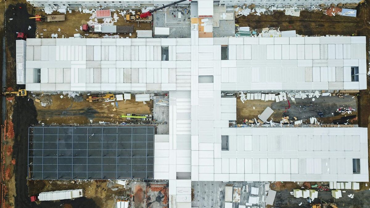
A digital twin in construction is a continuously updated 3D replica of a job site — built from recurring drone flights and processed into georeferenced orthomosaics and 3D models — that tracks progress, documents conditions, and enables measurement without manual site walks. Construction firms are adopting this technology to close the gap between what the schedule says and what the field actually shows. This article covers how construction PMs, superintendents, and owners deploy drone-based digital twins from capture through handover using SkyeBrowse's videogrammetry platform — where videogrammetry (video-to-3D reconstruction) converts standard drone video footage into accurate spatial models in minutes.
Key Takeaways
- Drone-based construction digital twins using weekly flights replace multi-hour manual site walks with a 15-minute capture that covers the entire site.
- BIM-to-field comparison overlays the design model against drone-captured as-built geometry to catch deviations — such as a 4-inch foundation offset — before subsequent trades build on top of them.
- Volume measurement tools in SkyeBrowse calculate cut-and-fill quantities directly from the 3D terrain model, replacing manual grade rod surveys and reducing report time from hours to minutes.
- OSHA's 29 CFR 1926 Subpart P requires documentation of excavation conditions; timestamped 3D models from each flight provide a defensible compliance record at no additional capture cost.
- SkyeBrowse's Premium Advanced tier delivers 0.1-inch accuracy at 16K with AI moving-object removal — the precision level needed for as-built documentation and dispute-defensible construction records.
Contents
- What does a digital twin mean in a construction context?
- How does the drone capture and processing workflow work?
- How does a digital twin enable BIM-to-field comparison?
- How do construction teams use digital twins to track earthwork volumes?
- How do timestamped 3D records protect against construction disputes?
- FAQ
What does a digital twin mean in a construction context?
A construction digital twin is a spatially accurate, time-stamped 3D model of a job site that is updated on a recurring schedule — typically weekly — to reflect actual field conditions. Unlike a static BIM model that represents design intent, the digital twin captures what exists on site at the moment of each drone flight. It serves as the authoritative record of progress, conditions, and volumes at every point in a project's lifecycle.
The concept draws from NIST's definition of digital twins as cyber-physical systems that maintain a synchronized link between a real-world asset and its virtual counterpart. In construction, this synchronization is achieved through recurring drone flights processed into georeferenced 3D models and orthomosaics (a geometrically corrected, top-down aerial map stitched from many overlapping images). Each flight adds a new timestamped layer to the site record, creating a time-lapse of the project from ground-breaking to closeout.
The practical difference from traditional site documentation is significant. A paper progress report or a set of site photos captures one person's view of one corner of the site on one day. A drone-based digital twin captures the entire site from above in a single 15-minute flight, processed into a measurable 3D model that any stakeholder can review from any device at any time. For background on the underlying technology, see the complete guide to digital twin technology.
How does the drone capture and processing workflow work?
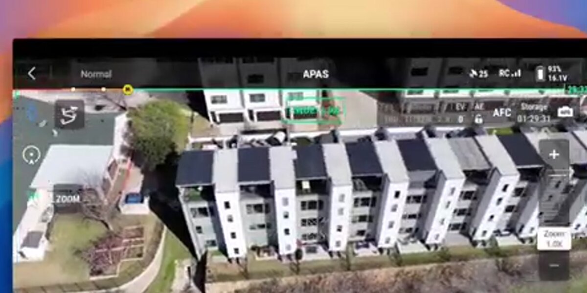
The workflow has three steps: fly the site with any compatible drone, upload the video to SkyeBrowse, and receive a georeferenced orthomosaic and 3D model — all before the crew leaves the jobsite. Field crews upload site video and receive a construction-grade digital twin before leaving the site: processing matches video length, so a five-minute walkthrough yields results in five minutes. A typical flight covering a 10–20 acre site takes 15 minutes and requires no ground control points for standard progress monitoring accuracy. Processing is fully automated in the cloud — no desktop software or dedicated hardware is needed.
Field teams use the SkyeBrowse Flight App to capture site video in an automated orbital or grid pattern, or they can fly manually and upload the .MP4 or .MOV file directly through Universal Upload at app.skyebrowse.com. Telemetry files (.SRT for DJI drones, .ASS for Autel) improve georeferencing accuracy when attached during upload.
The ROI case is direct: replacing 2–3 hours of manual site walks with a 15-minute drone flight plus automated processing saves field staff time while producing a more complete and measurable site record. Weekly flights accumulate into a full project timeline — every earthwork cut, every structural change, every deviation from plan — without any additional labor beyond the flight itself. For teams building out a recurring capture schedule, the construction progress monitoring guide covers setup in detail.
How does a digital twin enable BIM-to-field comparison?
BIM-to-field comparison overlays the design model against the as-built 3D model captured by drone to identify deviations — walls out of plumb, foundations shifted, grading off-grade. The drone model provides the actual field geometry; the BIM provides the intended geometry. Comparing the two reveals where construction has drifted from design before the deviation is buried by subsequent work.
SkyeBrowse exports models in GLB (3D mesh) and GeoTIFF (orthomosaic) formats that import directly into BIM coordination platforms. Project engineers align the drone model to the design coordinate system and inspect deviation zones visually or through clash detection tools. Catching a 4-inch foundation offset at the slab stage costs a fraction of what it costs to discover it during MEP rough-in or finish work. For building-specific digital twin creation, the digital twin building guide covers exterior and interior capture workflows for individual structures.
This workflow is particularly valuable during earthwork, foundations, and structural steel phases — the three points in a project schedule where field deviation has the highest downstream cost impact. The FAA's UAS Integration Pilot Program data shows that drone-based site capture reduces rework identification time by enabling aerial inspection rather than ground-level measurement that may miss large-scale spatial errors. For teams implementing this workflow end-to-end, see BIM coordination with drones.
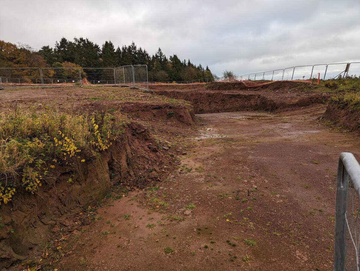
How do construction teams use digital twins to track earthwork volumes?
SkyeBrowse's volume measurement tools calculate cut-and-fill quantities directly from the 3D terrain model generated after each drone flight. Teams draw a polygon around an earthwork area in the web viewer, and the platform computes net volume relative to a reference plane or a previous flight's surface. This replaces manual grade rod surveys and reduces the time to generate a volume report from hours to minutes.
Earthwork is one of the highest-risk line items in a construction budget. Volume discrepancies between what was bid, what was excavated, and what was hauled off are a persistent source of change orders and disputes. A weekly drone digital twin with automated volume tools gives the owner, GC, and grading sub a shared, verifiable number derived from the same data set — eliminating the "my survey vs. your survey" dynamic that drives cost conflicts.
OSHA's construction industry standards (29 CFR 1926 Subpart P) also require documentation of excavation conditions, slopes, and classification. A timestamped 3D model from each flight provides photographic and geometric evidence of excavation conditions at every stage of grading work, creating a defensible compliance record. For volume-specific methodology, see cut-and-fill maps with drones and drone stockpile measurements.
How do timestamped 3D records protect against construction disputes?
Each drone flight produces a model stamped with the capture date, GPS location data, and camera telemetry — creating an immutable record of site conditions at that point in time. When disputes arise over schedule, scope, subsurface conditions, or damage claims, the digital twin archive provides timestamped, spatially accurate evidence that is far more credible than memory, photos, or paper logs.
Construction disputes frequently hinge on what the site looked like at a specific date: before a subcontractor started work, after a weather event, or when a condition was first observable. A drone-based digital twin answers these questions with 3D geometry and measurement — not interpretation. SkyeBrowse's controlled sharing lets GCs, subs, and owners access the same model via secure link — no file transfers, no version confusion — ensuring every party references identical timestamped geometry when a dispute arises. For as-built documentation accuracy, SkyeBrowse Premium Advanced delivers 0.1-inch precision at 16K resolution with AI moving-object removal, making the models defensible in legal and insurance contexts; Premium reaches 0.25-inch at 8K for standard progress documentation.
The handover use case extends this value to project closeout. Owners increasingly require as-built 3D documentation as a condition of substantial completion, and the accumulated flight archive from a digital twin program delivers this without any additional capture work. The final flight's orthomosaic and 3D model become the drone as-built documentation record; the full archive becomes the warranty and liability record for the facility's life.
FAQ
What is a digital twin in construction?
A digital twin in construction is a continuously updated 3D replica of a job site that mirrors current field conditions. It is created from recurring drone flights processed into orthomosaics and 3D models, allowing project managers to track progress, measure volumes, and document site conditions without leaving the office. Learn more at what is a digital twin.
How often should a construction digital twin be updated?
Most construction teams update their digital twin weekly, aligning capture flights with the project schedule reporting cycle. High-activity phases such as earthwork grading or structural steel erection may benefit from twice-weekly flights to catch deviations before they compound into costly rework.
Can a construction digital twin replace BIM?
No. A construction digital twin complements BIM rather than replacing it. BIM provides the design intent model, while the drone-based digital twin captures actual field conditions. Overlaying the two reveals deviations between what was designed and what was built — which is the core value of the combined workflow. See BIM coordination with drones for implementation details.