Choosing the right surveying drone — a UAV configured specifically for photogrammetry (the science of extracting measurements from photographs) or LiDAR-based mapping — determines both the quality of your deliverables and the speed of your workflow. This guide covers what hardware specifications actually matter for drone surveying, reviews the leading models available in 2026, and explains how pairing any of them with SkyeBrowse's video-based processing removes the most time-consuming step in the pipeline.
Key Takeaways
- RTK-equipped drones achieve 1–3 cm horizontal accuracy and can reduce or eliminate the need for physical ground control points on most survey sites.
- Camera sensor size matters more than megapixel count: a larger sensor captures better overlap data in low-light conditions and at higher altitudes.
- Flight time directly caps your coverage area per battery — plan for 30–45 minutes of usable time per charge when evaluating total site area.
- SkyeBrowse's video-to-3D workflow lets surveyors upload one continuous flight video instead of hundreds of individual stills, cutting upload and processing time significantly.
- FAA Part 107 certification is required for commercial drone surveying in the United States, and some survey firms require Part 107 Remote ID compliance as a contract prerequisite.
Contents
- What specs make a drone suitable for surveying?
- Which surveying drones lead the market in 2026?
- How does RTK vs PPK affect accuracy in the field?
- How does SkyeBrowse simplify post-flight processing?
- What regulations apply to commercial drone surveying?
- FAQ
What specs make a drone suitable for surveying?
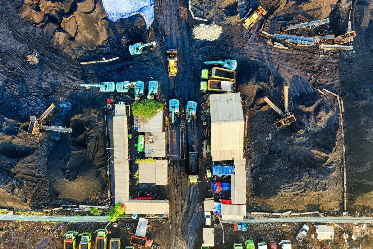
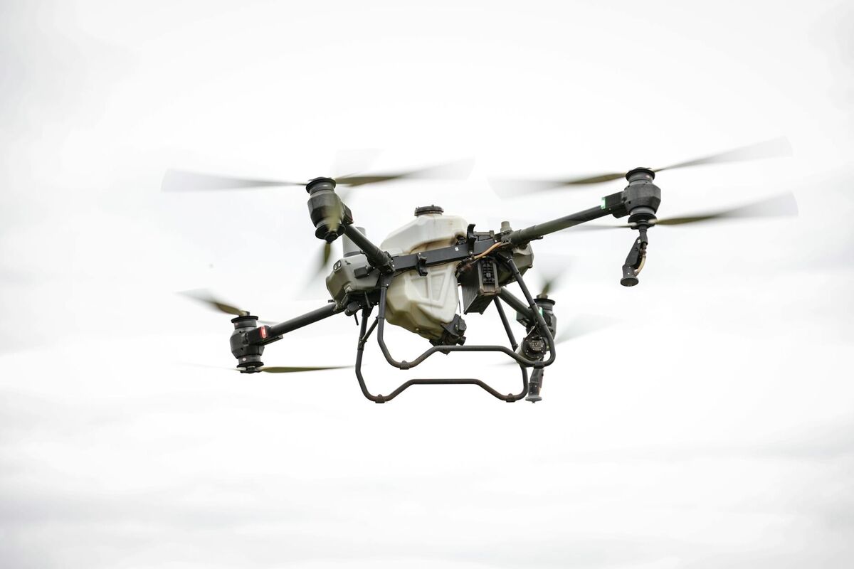
A survey-grade drone needs four core capabilities: a high-resolution camera (20 MP or better) mounted on a stabilized gimbal, an RTK or PPK GNSS receiver for centimeter-level positioning, sufficient flight time to cover the target area in a single sortie, and a reliable obstacle avoidance system that keeps the aircraft safe during low-altitude grid flights. Any drone missing one of these tends to create gaps or rework in the field.
Camera and sensor. Resolution alone does not determine mapping quality — sensor size and lens geometry matter more. A 4/3-inch sensor captures far more light per pixel than a smaller 1/2-inch sensor, which translates to sharper texture in the orthomosaic and cleaner point clouds. Look for cameras with a mechanical shutter (not a rolling shutter) to prevent the motion blur that creates jagged edges in 2D maps.
Positioning system. RTK (real-time kinematic) receivers lock onto a correction signal from a base station or NTRIP network and deliver 1–3 cm horizontal accuracy on the fly. This is the specification cited in the ASPRS Positional Accuracy Standards for Digital Geospatial Data as the threshold for most engineering and land survey deliverables. Drones without RTK rely on standard GPS (1–3 meter accuracy) and need ground control points placed across the site before flight.
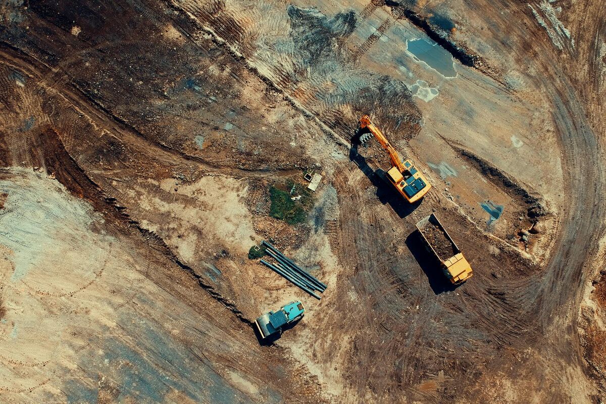
Flight time. Battery life caps coverage. A drone that delivers 40 minutes of actual flight time allows roughly 80–100 acres of mapping per battery at 200-foot altitude with 75% overlap. If your typical job site exceeds that, count your spare batteries before committing to a platform.
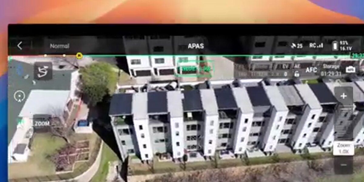
Obstacle avoidance. Construction sites and agricultural land are full of trees, power lines, and structures. Omnidirectional sensing (DJI's APAS or similar) dramatically reduces the risk of a flyaway that destroys both the hardware and your liability position.
Which surveying drones lead the market in 2026?
The DJI Mavic 3 Enterprise and DJI Matrice 350 RTK are the two most widely deployed survey drones in North America as of 2026. Autel's EVO II Pro and EVO Max series offer a compelling alternative for operators who need a China-independent supply chain. WingtraOne GEN II targets professional survey firms that need the absolute highest ground sampling distance from fixed-wing endurance.
The table below compares the leading models on the specifications that matter most for land and construction survey work.
| Drone | Sensor | RTK/PPK | Max Flight Time | Best For |
|---|---|---|---|---|
| DJI Mavic 3 Enterprise | 4/3" CMOS, 20 MP | RTK module add-on | 45 min | General land survey, inspections |
| DJI Matrice 350 RTK + P1 | Full-frame 45 MP | Built-in RTK | 55 min | Large-area topographic survey |
| DJI Phantom 4 RTK | 1" CMOS, 20 MP | Built-in RTK | 30 min | Small-site boundary survey |
| Autel EVO II Pro RTK | 1" CMOS, 6K | RTK module | 40 min | NDAA-compliant operations |
| Autel EVO Max 4T | 1/2" CMOS + thermal | RTK module | 42 min | Utility and infrastructure survey |
| WingtraOne GEN II | Full-frame 61 MP | PPK | 59 min | Wide-area topographic mapping |
| senseFly eBee X | 24 MP | PPK / RTK | 90 min | Large corridor surveys |
The mapper drone category has expanded significantly — most enterprise-class drones above $3,000 now include some form of precision GNSS. The decision for most survey teams comes down to payload flexibility (can you swap sensors?) and parts availability in your region.

How does RTK vs PPK affect accuracy in the field?
RTK corrects GNSS positions in real time during flight, requiring a live data link to a base station or NTRIP network. PPK (post-processed kinematic) records raw satellite observations during flight and applies corrections afterward using software. Both methods achieve similar final accuracy — typically 1–3 cm horizontal — but PPK is more resilient when the correction link is interrupted mid-flight.
The RTK vs PPK decision is primarily an operational one. RTK works best when you have a reliable cellular or radio link to a base station, want to verify accuracy before leaving the site, and need to hand deliverables to a client the same day. PPK is preferable in remote areas where a data link is unreliable, or when you are logging raw observations for later quality control.
The National Society of Professional Surveyors (NSPS) recommends that licensed surveyors document which positioning method was used and confirm that the root-mean-square error (RMSE) of check points meets the accuracy standard specified in the project scope before signing and sealing any deliverable. Either RTK or PPK can satisfy that standard when executed correctly.
How does SkyeBrowse simplify post-flight processing?
SkyeBrowse is a cloud-based videogrammetry platform that generates georeferenced 3D models and orthomosaics from a single drone video file. Instead of transferring and processing 500–1,000 individual photos through desktop photogrammetry software, a surveyor uploads one .MP4 or .MOV file and receives a processed model within minutes — no workstation GPU required.
Traditional survey workflows involve three steps after landing: transferring images, running photogrammetry software for hours, and then exporting deliverables. SkyeBrowse compresses that into an upload and a wait. For construction teams, the payoff is receiving a same-day 3D model they can share with the subcontractor meeting rather than the following morning.
Accuracy tiers for different survey needs. For reconnaissance and progress monitoring, SkyeBrowse's standard processing delivers approximately 2–6 inches of spatial accuracy — sufficient for volume estimates, cut-and-fill checks, and site layout reviews. For work that approaches certified survey tolerances, the Premium tier (8K processing) reaches approximately 0.25-inch accuracy, and Premium Advanced (16K, with AI moving-object removal) reaches approximately 0.1-inch accuracy. These tiers are available as per-model credits at skyebrowse.com/pricing-premium.
Supported drones and telemetry. SkyeBrowse works with the full range of DJI and Autel hardware listed at skyebrowse.com/supported-drones. Pairing the video file with a .SRT telemetry log (DJI) or .ASS subtitle file (Autel) improves georeferencing by embedding GPS coordinates at the frame level. Exports include LAZ point clouds, GLB 3D meshes, and GeoTIFF orthomosaics — formats that drop directly into AutoCAD Civil 3D, ArcGIS, or any GIS workflow a survey firm already uses.
What regulations apply to commercial drone surveying?
Commercial drone surveying in the United States requires FAA Part 107 certification for every remote pilot in command. Operations over people, at night, or beyond visual line of sight require either a waiver or specific Part 107 operational authorizations. Most survey sites also fall under airspace authorizations managed through the FAA's LAANC system or DroneZone portal.
The FAA Part 107 rule sets the baseline: pilots must pass a knowledge test, register their aircraft, and comply with airspace restrictions. Beginning in 2023, all drones above 250 grams operating commercially must broadcast Remote ID. Survey firms working near airports, heliports, or controlled airspace need to obtain Low Altitude Authorization and Notification Capability (LAANC) approval before each flight.
Beyond federal rules, many states have adopted supplemental regulations governing surveying with drones. For example, some states require that the licensed land surveyor of record review and certify drone-derived deliverables even when a separate drone operator performs the flight. The NSPS provides state-by-state guidance for surveyors navigating these requirements. Staying current with both FAA and state rules protects the survey firm from liability and keeps project timelines intact.

FAQ
What is the best drone for land surveying?
The DJI Mavic 3 Enterprise is the most versatile choice for most land and construction survey teams, combining RTK capability, a large 4/3-inch sensor, and 45-minute flight time in a portable package. Teams running large-area topographic projects often step up to the DJI Matrice 350 RTK with a P1 payload for maximum resolution and endurance.
Do I need RTK for drone surveying?
RTK is strongly recommended when you need 1–3 cm horizontal accuracy and want to minimize time spent placing and surveying ground control points. PPK is a practical alternative when a live correction link is unavailable. Standard GPS with well-distributed GCPs can achieve decimeter-level accuracy for applications where certified survey tolerances are not required.
Can SkyeBrowse process footage from any surveying drone?
SkyeBrowse accepts .MP4 and .MOV video from a broad range of drones, including DJI and Autel platforms. Pairing video with the drone's telemetry file improves georeferencing accuracy. The video-to-3D approach means a surveyor can fly a continuous orbital pattern and upload one video rather than hundreds of photos — a faster capture method that suits time-pressured construction site visits.
How much does a surveying drone cost?
Entry-level survey drones with standard GPS start around $1,500 (DJI Mini 4 Pro with accessories). Purpose-built RTK platforms like the DJI Phantom 4 RTK run $6,000–$7,000. Enterprise-class systems like the DJI Matrice 350 RTK with a P1 camera payload reach $15,000–$20,000. Fixed-wing platforms designed for corridor mapping (WingtraOne, senseFly eBee) typically exceed $25,000. Budget for spare batteries, a base station if not using NTRIP, and annual software subscriptions when calculating total project cost.