Drone crime scene mapping — the practice of flying an unmanned aircraft over a scene and converting that video into a spatially accurate 3D model — is rapidly replacing traditional tape-and-sketch documentation for major incidents. Using a process called videogrammetry (reconstructing geometry from overlapping video frames), investigators can capture an entire outdoor scene in minutes, preserve every spatial relationship digitally, and produce court-ready models without a laser scanner or survey crew. This guide explains how the workflow operates, why it matters for evidence integrity, and what law enforcement agencies should look for in crime scene mapping software.
Key Takeaways
- A single drone flight of 5–10 minutes can document an outdoor crime scene at sub-inch accuracy, generating a permanent, measurable 3D record before evidence degrades.
- 3D crime scene models can be used directly in courtroom presentations, giving juries an immersive spatial understanding that flat photographs cannot provide.
- Cloud-based crime scene mapping software eliminates the need for expensive desktop workstations — investigators upload video from the field and the model is ready within minutes.
- CJIS-compliant hosting and FedRAMP Moderate Authorization are non-negotiable requirements for any platform handling criminal justice information.
- Agencies using SkyeBrowse have documented scenes ranging from fatal traffic collisions to homicide sites, with measurable outputs accepted in sworn testimony.
Contents
- Why is traditional crime scene documentation insufficient for complex cases?
- How does drone crime scene documentation work in practice?
- What makes a 3D crime scene model court-admissible?
- How does crime scene mapping software handle CJIS compliance?
- What is the end-to-end workflow for drone crime scene mapping?
- FAQ
Why is traditional crime scene documentation insufficient for complex cases?
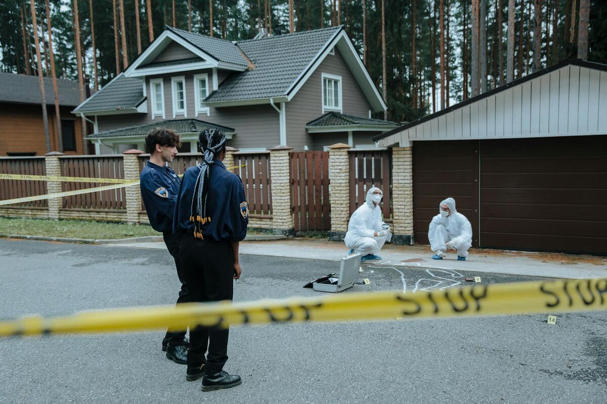
Traditional crime scene documentation — tape measures, sketch diagrams, and still photographs — creates a patchwork record that is difficult to reassemble into a complete spatial picture. Measurements are taken between specific points but cannot capture the full geometry of a scene. Photographs lack scale references, and 2D sketches depend on the individual investigator's accuracy. For large or complex scenes, these methods also extend road closures and investigation time significantly.
The National Institute of Justice (NIJ) emphasizes that thorough documentation is foundational to evidence integrity. When measurements are approximate or photographs lack context, reconstructing events becomes an interpretive exercise rather than a data-driven one — and defense attorneys routinely challenge those gaps.
Large outdoor scenes amplify every limitation. A homicide site spanning a parking lot or an arson covering half an acre each demand hundreds of individual measurements with traditional tools, keeping scenes closed far longer than necessary. The International Association for Identification (IAI) has increasingly recognized drone-based documentation as a best practice for preserving perishable scenes under time pressure.
How does drone crime scene documentation work in practice?
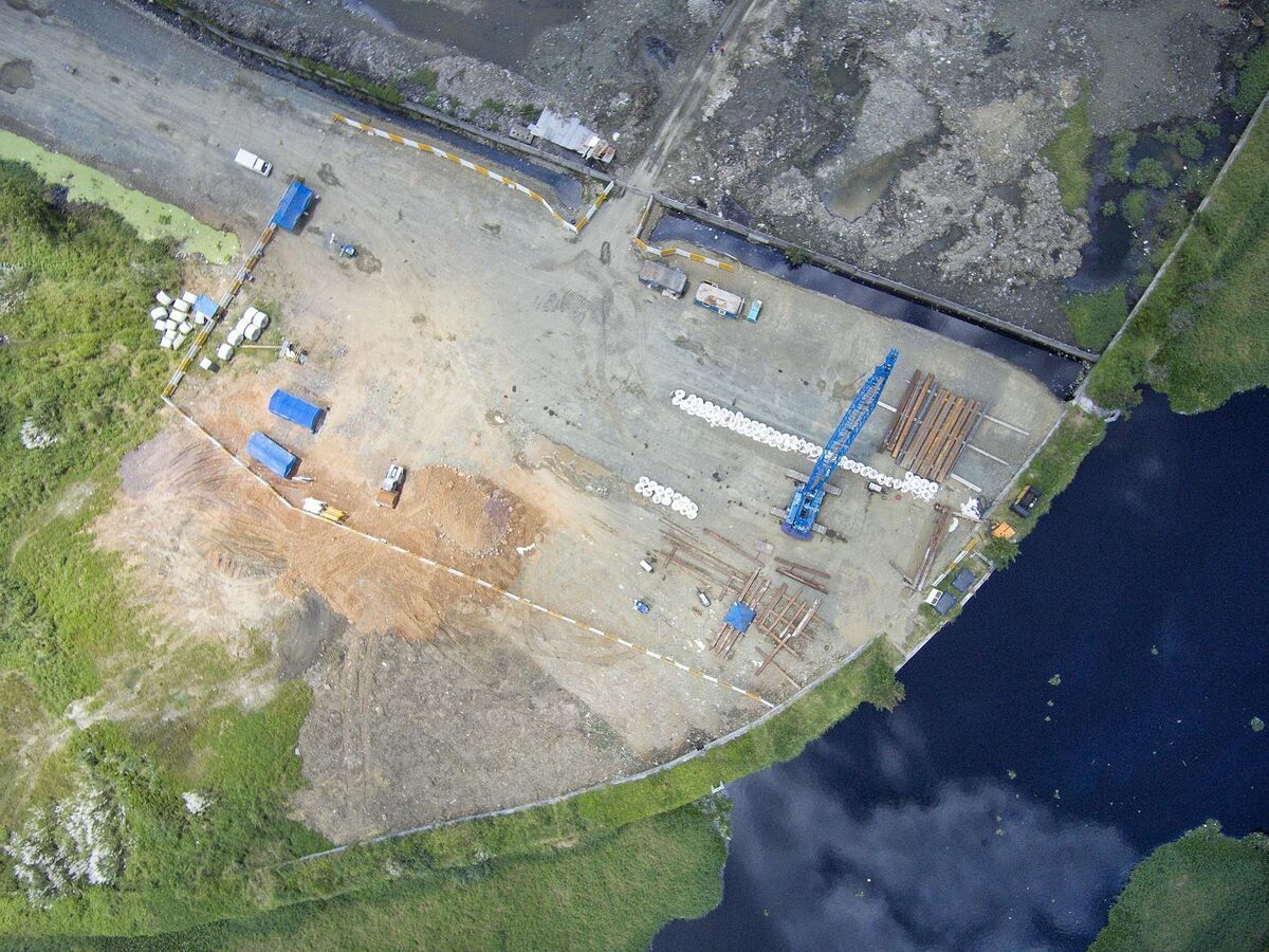
A trained operator flies a drone in an orbital or grid pattern over the scene, capturing overlapping video from multiple angles. That video is uploaded to cloud-based crime scene mapping software, which uses photogrammetry algorithms to reconstruct the scene as a georeferenced 3D model with real-world measurements. The entire capture flight typically takes 5–10 minutes; the processed model is ready within a similar time frame after upload.
The core technology is videogrammetry — a variant of photogrammetry that works from continuous video rather than individually triggered photos. The software identifies thousands of matching feature points across overlapping frames, triangulates their positions, and builds a dense point cloud that can be converted into a 3D mesh or 2D orthomosaic map. Accuracy depends on flight altitude, overlap percentage, and the processing tier selected.
For crime scene documentation equipment, the drone itself is only one part of the system. Telemetry files — GPS logs embedded in the video by DJI (.SRT format) or Autel (.ASS format) drones — allow the processing platform to georeference the model automatically, eliminating manual ground control point placement for most scenes. This is critical for scenes where placing physical targets would disturb evidence.
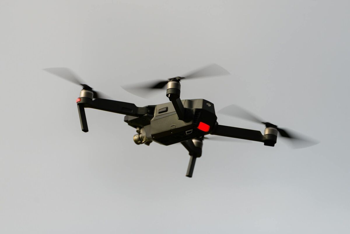
Agencies selecting drones for crime scene mapping typically prioritize hover stability, video resolution (4K minimum), and the ability to operate in low-light conditions. Enterprise-class platforms from DJI and Autel are most common, though the processing software — not the drone hardware — ultimately determines the quality and usability of the output model.

What makes a 3D crime scene model court-admissible?
Court admissibility of 3D crime scene models depends on four factors: a documented collection methodology, a repeatable and validated processing pipeline, preserved chain of custody for the source video, and testimony from a qualified expert who can explain the technology and its accuracy. When these conditions are met, courts in multiple jurisdictions have accepted drone-derived 3D models as demonstrative evidence.
Demonstrative evidence — exhibits used to help a jury understand a fact rather than prove it directly — follows a lower evidentiary threshold than direct evidence. A 3D model showing scene geometry, vehicle positions, or wound site locations helps jurors visualize spatial relationships that flat photographs cannot convey. This is the most common use of drone crime scene models in trial settings.
Measurement accuracy is a frequent point of expert challenge. Processing platforms that generate models accurate to sub-inch tolerances give investigators a defensible position on the stand. SkyeBrowse's Premium tier produces models accurate to approximately 0.25 inch, while the Premium Advanced tier delivers approximately 0.1-inch accuracy with AI-assisted moving object removal — a valuable feature for scenes where people, vehicles, or emergency responders are present during the capture flight.
Chain of custody begins at the drone: original video files should be preserved unmodified, with each processing run recorded in the platform's audit log. Note flight conditions, the drone's serial number, and the operator's credentials in case documentation — a paper trail that mirrors NIJ's physical evidence standards. Investigators working complex cases can also reference forensic engineering principles, which apply the same spatial analysis rigor to structural failure investigations.
How does crime scene mapping software handle CJIS compliance?
CJIS compliance requires that any platform storing or transmitting criminal justice information meet the FBI's security standards: encrypted data in transit and at rest, multi-factor authentication, role-based access controls, audit logging, and personnel screening requirements. For cloud-based crime scene mapping software, this means government-authorized infrastructure and contractual data handling agreements aligned with the FBI CJIS Security Policy.
The FBI CJIS Security Policy is the governing document for law enforcement technology vendors handling criminal justice information (CJI). Version 5.9 and later require cloud service providers to meet specific controls around data residency, encryption standards, and incident response procedures. Agencies that upload crime scene video to a non-compliant cloud platform may be in violation of their state CJIS agreements, exposing the agency — and potentially the investigation — to legal challenge.
SkyeBrowse addresses this directly through its hosting architecture. Premium tiers run on AWS GovCloud (US), which holds FedRAMP Moderate Authorization — the same compliance level required by many federal law enforcement applications. Data never leaves U.S. government-authorized infrastructure. Access controls allow agency administrators to restrict model viewing to named personnel, and all access events are logged for audit purposes.
For agencies evaluating platforms against these standards, selecting a CJIS-compliant mapping platform requires more than a vendor's self-attestation. Ask for documentation of FedRAMP authorization status, the platform's data processing agreement, and confirmation of where video and model data are stored at rest.
What is the end-to-end workflow for drone crime scene mapping?
The workflow has four phases: scene assessment and flight planning, aerial capture, cloud processing, and model delivery. From scene arrival to a completed, measurable 3D model, the entire process typically takes under 30 minutes for a standard outdoor scene. The resulting model can be shared with prosecutors, defense counsel, or expert witnesses through a secure web link without requiring specialized software on the recipient's end.
Scene assessment and flight planning. The drone operator evaluates the scene perimeter, identifies flight hazards (power lines, tree canopy, overhead obstruction), and determines the optimal altitude for the required resolution. For most crime scenes, an altitude of 100–150 feet provides sufficient detail while keeping the entire scene within a single flight battery. Night operations may require supplemental lighting or thermal-capable hardware.
Aerial capture. The operator flies an orbital or automated grid pattern, capturing continuous video with 70–80% overlap between passes. For SkyeBrowse, video is recorded to the drone's onboard storage as .MP4 or .MOV, with GPS telemetry embedded automatically by DJI and Autel platforms. A typical crime scene capture requires one 8–12 minute flight.
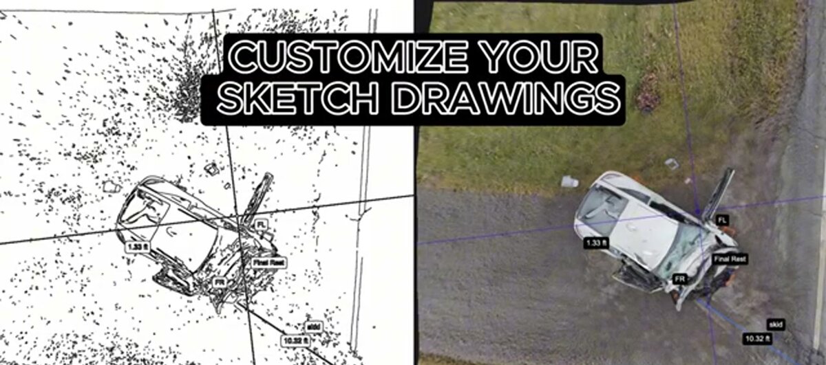
Cloud processing. The video file is uploaded through the SkyeBrowse web platform or mobile app. No dedicated workstation is required — investigators upload from a phone or tablet at the scene. The platform processes the footage using its photogrammetry engine and returns a georeferenced 3D model, a 2D orthomosaic map, and an auto-generated sketch diagram with measurements. Premium Advanced processing also applies AI-based moving object removal, cleaning the model of bystanders or vehicles that passed through during capture.
Model delivery and case integration. The completed model is stored securely in the agency's SkyeBrowse account with full audit logging. Investigators can take measurements directly in the web viewer, add annotations, and export the model in standard formats — LAZ point cloud, GLB mesh, or GeoTIFF orthomosaic — for use in case management systems, courtroom presentation software, or expert analysis. A shareable link allows prosecutors or defense experts to view the model in a standard web browser.
FAQ
Can drone footage be used as evidence in court?
Yes. Drone footage and the 3D models derived from it are admissible in court when collected using a documented, repeatable methodology. Investigators should record the drone make and model, flight parameters, and processing software used. 3D models generated by platforms like SkyeBrowse include metadata and measurement data that can be cited in expert testimony.
What is the best drone for crime scene mapping?
Enterprise-class drones such as the DJI Mavic 3 Enterprise, DJI Matrice 350 RTK, and Autel Evo II Pro are widely used by law enforcement for crime scene documentation. The right choice depends on scene size, lighting conditions, and required resolution. Any drone that records video or captures photos can be processed in SkyeBrowse to produce measurable 3D models. See our full guide to drones for crime scene mapping for agency-specific recommendations.
What does CJIS compliance mean for crime scene mapping software?
CJIS (Criminal Justice Information Services) compliance refers to meeting the FBI's security standards for systems that store or transmit criminal justice information. For mapping platforms, this means encrypted data transfer, role-based access controls, audit logging, and hosting on government-authorized infrastructure. SkyeBrowse's premium tiers offer CJIS-focused workflows hosted on AWS GovCloud with FedRAMP Moderate Authorization. Agencies can review the full requirements in the FBI CJIS Security Policy documentation.