A digital twin is a virtual replica of a physical asset — a building, infrastructure system, or job site — that mirrors real-world conditions and is updated with real data over time. What is a digital twin in practice? It is the bridge between physical reality and the teams making decisions about it: contractors verifying progress, insurers documenting claims, or emergency responders planning access. Until recently, creating one required expensive LiDAR scanners, specialist crews, and months of processing. Drones have changed that equation entirely.

Key Takeaways
- A digital twin is a virtual replica of a physical asset that mirrors real-world conditions and must be updated with current data over time — a stale model is a historical artifact, not an operational twin.
- Traditional digital twin creation required LiDAR hardware costing $50,000–$200,000 per unit plus specialist crews and weeks of processing; videogrammetry from a consumer drone now compresses the entire cycle to under an hour.
- The digital twin market is projected to reach $34–48 billion by 2026, but accessible entry has lagged — drone-based videogrammetry is closing that gap for construction, inspection, and public safety teams.
- SkyeBrowse processes a drone orbit upload into a shareable 3D model in approximately two minutes, with accuracy tiers from 2–6 inches (Lite) up to 0.1 inch at 16K (Premium Advanced) with AI moving-object removal.
- Over 1,200 law enforcement and public safety agencies use SkyeBrowse for rapid scene preservation — the same platform that handles construction progress monitoring and insurance documentation.
Contents
- What does digital twin technology actually mean?
- How was a digital twin traditionally created?
- How do drones create a digital twin in minutes?
- What industries use drone-based digital twins?
- How does SkyeBrowse fit into a digital twin workflow?
- FAQ
What does digital twin technology actually mean?
Digital twin technology refers to the software, sensors, and data pipelines that create and maintain a live virtual copy of a physical asset. The twin is only as useful as the data feeding it — a stale model is not a twin, it is a historical artifact.
The concept of a digital twin originates in industrial IoT and manufacturing. Enterprises like Siemens, IBM, and McKinsey have written extensively about digital twins as enterprise-grade infrastructure: sensors embedded in factory equipment streaming data to cloud models, enabling predictive maintenance and remote operations monitoring. IBM defines a digital twin as a virtual representation that serves as the real-time digital counterpart of a physical object or process. NIST's digital twin framework similarly emphasizes that the model must be synchronized with the physical entity to remain operationally useful.
The digital twin market is projected to reach $34–48 billion by 2026, driven by adoption across construction, manufacturing, utilities, and public infrastructure. What has lagged behind the market projections is accessible entry — most implementations have required significant capital, specialist integrators, and long deployment timelines. Drone-based videogrammetry is closing that gap.
How was a digital twin traditionally created?
Traditional digital twin creation relied on LiDAR scanners, photogrammetry workstations, and specialist survey crews. A single site capture could require days of field work, weeks of processing, and six-figure hardware investments before any model was usable.
The classic enterprise digital twin workflow runs through ground-based or aerial LiDAR — a technology that emits laser pulses and measures return time to build dense point clouds. Hardware from manufacturers like Leica or FARO can run $50,000–$200,000 per unit. Processing those point clouds into usable models typically required powerful desktop workstations and software like Autodesk ReCap or Bentley ContextCapture. The result was a high-fidelity model, but the timeline and cost kept digital twins out of reach for most construction contractors, inspection firms, and public safety agencies. For a side-by-side breakdown of when LiDAR is worth the investment versus when drone-based approaches suffice, see the LiDAR vs. photogrammetry comparison.
McKinsey's research on digital twins in construction identifies the capture-to-decision lag as a core barrier: when the model arrives too late to influence a decision, the twin provides historical value but no operational value.
How do drones create a digital twin in minutes?
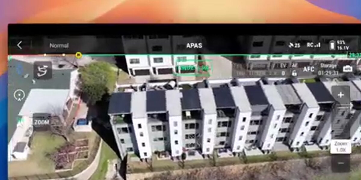
A drone equipped with a standard camera can capture an orbit flight around a site and upload video to a cloud processing platform. Videogrammetry — the process of extracting spatial geometry from video frames — then reconstructs the site as a navigable 3D model in minutes, not weeks.
Videogrammetry (the process of building spatial models from video rather than structured photo sets) is the enabling technology behind fast drone-based digital twins. Unlike photogrammetry, which requires carefully planned grid flights with overlapping stills, videogrammetry accepts standard .MP4 or .MOV video from a single orbit pass. The cloud platform extracts frames, matches geometry across them, and builds a dense 3D mesh automatically.
The workflow compresses to four steps: fly an orbit, upload video, wait for processing, share the model link. A field team with a consumer-grade drone and a smartphone can complete this cycle in under an hour. The outputs — including GLB mesh files, LAZ point clouds, and GeoTIFF orthomosaics — are compatible with downstream BIM, GIS, and project management platforms.

What industries use drone-based digital twins?
Construction, insurance, public safety, and facility management are the leading adopters of drone-based digital twins. Each relies on current-condition site data that is too expensive or slow to obtain with traditional survey methods on a recurring basis.
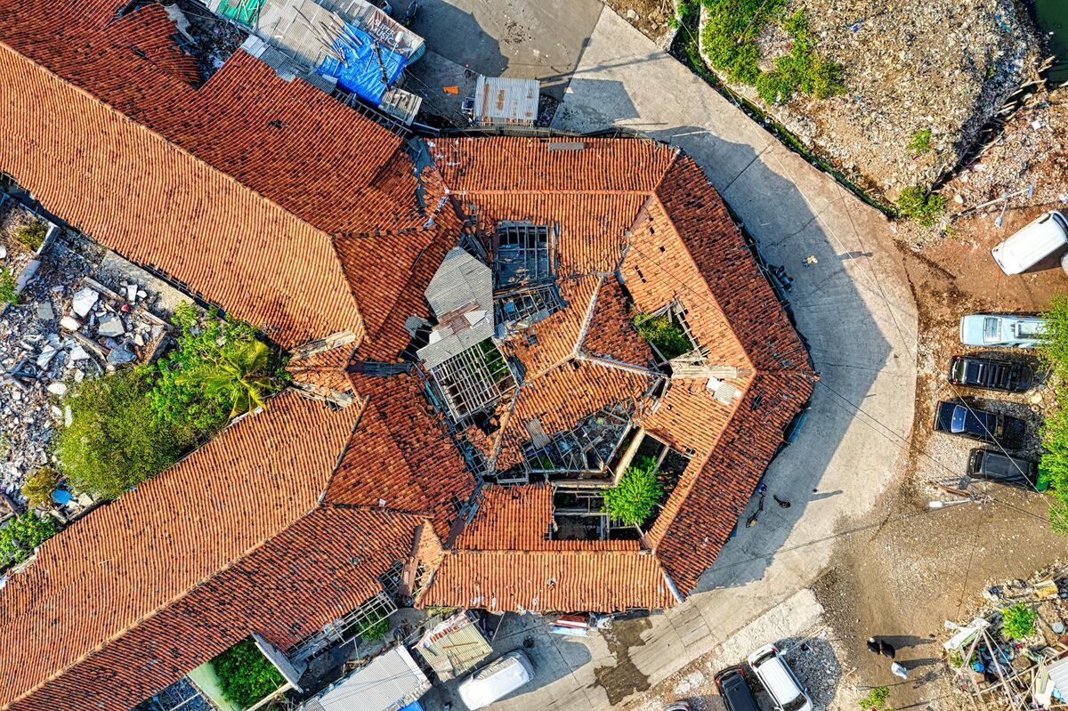
Construction progress monitoring is the highest-volume use case. Project owners and general contractors need current exterior conditions — what has been built, what is behind schedule, what changed since last week — without waiting for a monthly survey. Drone twins make weekly or even daily capture economically viable. The construction progress monitoring workflow describes how teams use recurring drone models to drive schedule accountability and owner reporting.
Insurance documentation is another high-value application. Adjusters who can document a property immediately after a weather event, fire, or accident create a permanent, defensible spatial record instead of a photo set. The model can be shared with underwriters, attorneys, or contractors without site revisits. The insurance claims documentation workflow details how adjusters integrate drone twins into standard claims platforms.
Public safety scene preservation uses drone-based twins to lock in a crime scene, accident site, or disaster area before evidence degrades. Law enforcement agencies across 1,200+ jurisdictions already use SkyeBrowse for exactly this reason — rapid orbit capture followed by a model that can be reviewed by investigators, prosecutors, and expert witnesses without returning to the scene.
Facility and infrastructure management extends the twin across the lifecycle. A building that was captured at construction handoff becomes the reference baseline for maintenance, renovation planning, and code compliance review years later. Teams building site twins for active job sites can go deeper in the digital twin in construction guide.
How does SkyeBrowse fit into a digital twin workflow?
SkyeBrowse is a cloud-based videogrammetry platform that turns drone video into shareable 3D models with no workstation, desktop software, or specialist crew required. SkyeBrowse delivers a finished digital twin in roughly the same time as the source video — a two-minute drone orbit returns a measurable model in two minutes.
Field teams use the SkyeBrowse Flight App to capture an orbit pattern, or upload existing video via Universal Upload at app.skyebrowse.com. SkyeBrowse processes the video in the cloud — hosted on AWS GovCloud with enterprise-grade security — and returns a navigable 3D model and orthomosaic that can be shared by link with no proprietary viewer required. Accuracy tiers span the full range of project needs: Lite (2–6 inch) for rapid situational awareness, Premium (0.25 inch at 8K) for progress documentation, and Premium Advanced (0.1 inch at 16K with AI moving-object removal) for documentation-grade deliverables.
The drone digital twin workflow article covers the recurring-capture cadence in depth. For teams integrating drone output into BIM environments, the BIM coordination drone guide explains how SkyeBrowse exports fit into Revit and IFC workflows. Teams doing foundational 3D mapping work can also reference the drone 3D mapping guide for capture best practices.
FAQ
What is a digital twin in simple terms?
A digital twin is a virtual replica of a physical asset — a building, site, or piece of infrastructure — that mirrors real-world conditions and can be updated with new data over time to support decisions.
How long does it take to create a digital twin with a drone?
With SkyeBrowse, a field team can fly an orbit pattern around a site, upload the video, and receive a processed 3D model in approximately two minutes. The entire field-to-model cycle can be completed in under an hour.
Do I need LiDAR to create a digital twin?
No. Videogrammetry platforms like SkyeBrowse produce accurate 3D models from standard drone video without LiDAR hardware. For most construction, inspection, and documentation use cases, drone video delivers sufficient accuracy at a fraction of the cost and setup time. See skyebrowse.com/supported-drones for compatible hardware.