Photogrammetry is the science of deriving precise measurements and three-dimensional geometry from photographs — turning flat images into spatially accurate models of the real world. The discipline dates back to the mid-1800s but has been radically transformed by drone hardware, cloud computing, and modern algorithms. Today, photogrammetry powers everything from topographic surveys and construction site documentation to crash reconstruction, insurance claims, and digital twin creation. This guide explains how photogrammetry works, covers its major types — including the video-based extension called videogrammetry used by platforms like SkyeBrowse — and surveys the industries putting it to work right now.
Key Takeaways
- Photogrammetry derives real-world measurements from overlapping photographs by calculating where the same physical point appears across multiple images taken from different positions.
- The four main types — aerial, terrestrial, close-range, and videogrammetry — share the same geometric principles but differ in platform, subject scale, and capture method.
- Modern drone photogrammetry software can generate a georeferenced 3D model, orthomosaic, and point cloud from a single flight in under an hour with no desktop hardware required.
- Survey-grade accuracy of 0.1 to 0.25 inch is achievable with ground control points and high-overlap capture; workflows without GCPs typically yield 2 to 6 inch absolute accuracy — sufficient for most public safety, insurance, and construction applications.
- Videogrammetry extends traditional photogrammetry by using continuous video rather than discrete still frames, letting operators capture a scene by simply flying or walking with a camera and uploading the footage.
Contents
- What is the photogrammetry definition?
- How does photogrammetry work?
- What are the types of photogrammetry?
- What are the advantages and disadvantages of photogrammetry?
- What industries use photogrammetry today?
- How does videogrammetry extend traditional photogrammetry?
- FAQ
What is the photogrammetry definition?
Photogrammetry is the science of making measurements and 3D reconstructions from photographs. By analyzing how the same physical point appears across multiple overlapping images captured from different positions, software calculates real-world coordinates, distances, and surface geometry without any physical contact. The American Society for Photogrammetry and Remote Sensing (ASPRS) defines it as "the art, science, and technology of obtaining reliable information about physical objects and the environment through the process of recording, measuring, and interpreting photographic images."
The word itself is derived from three Greek roots: photos (light), gramma (something written or drawn), and metron (to measure) — literally, "light-written measurement." The ASPRS has maintained the definitive professional standards for photogrammetric practice since 1934, and its Manual of Photogrammetry remains the canonical technical reference for practitioners.
A related term you will encounter frequently is "photogrammetric," the adjective form — as in "photogrammetric mapping," "photogrammetric survey," or "photogrammetric reconstruction." When search queries use "what is photogrammetric," they are almost always asking about the same underlying discipline.
Photogrammetry is often discussed alongside remote sensing, LiDAR, and structured-light scanning. The key distinction is that photogrammetry uses ordinary photographic imagery — visible-light photographs taken by standard cameras — as its raw input, making it accessible to any operator with a camera-equipped drone or smartphone.
How does photogrammetry work?
Photogrammetry works by identifying the same physical point in multiple overlapping photographs and using the known geometry of the camera to triangulate that point's position in three-dimensional space. Modern software extends this with Structure from Motion (SfM) algorithms, which simultaneously solve for camera positions and 3D scene geometry from an unordered image set — no pre-calibrated camera rig required.
The core process involves three sequential stages:
1. Image alignment and sparse reconstruction. The software detects thousands of distinctive features (corners, edges, texture patterns) in each image and matches them across the image set. Using these correspondences, it reconstructs approximate camera positions and produces a sparse point cloud — a skeleton of 3D points that represents shared visible surfaces.
2. Dense reconstruction. With camera positions known, the software computes depth for every pixel in every image and fuses the results into a dense point cloud containing millions or billions of georeferenced points. This is the foundation for all subsequent outputs.
3. Mesh, orthomosaic, and export generation. The dense point cloud is meshed into a solid 3D surface and textured with pixels from the source images, producing a photorealistic 3D model. The software also projects imagery onto a flat plane to create an orthomosaic — a geometrically corrected top-down map suitable for measurement and GIS integration.
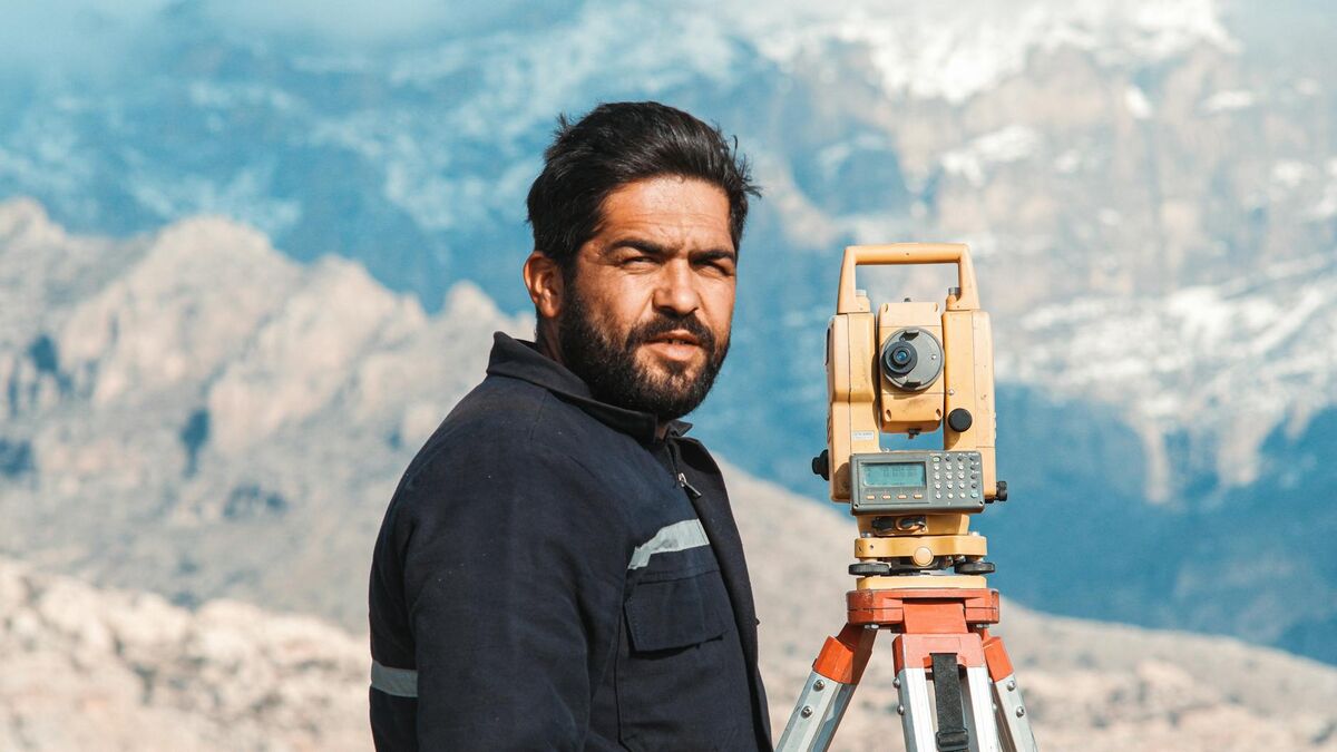
Accuracy improves with higher image overlap (typically 70–80% front overlap and 60–70% side overlap for aerial surveys), lower flight altitude, higher camera resolution, and the inclusion of ground control points — surveyed reference markers on the ground whose precise coordinates anchor the model to real-world coordinates. The USGS National Geospatial Program relies on photogrammetric mapping as a core method for producing topographic data across the United States.

What are the types of photogrammetry?
The four major types of photogrammetry are aerial photogrammetry (camera mounted on aircraft or drone, capturing wide areas from above), terrestrial photogrammetry (camera on the ground pointing at a distant scene), close-range photogrammetry (camera very close to the subject, used for objects or small structures), and videogrammetry (video footage rather than still frames as the image source). All share the same geometric principles; they differ in platform, scale, and capture method.
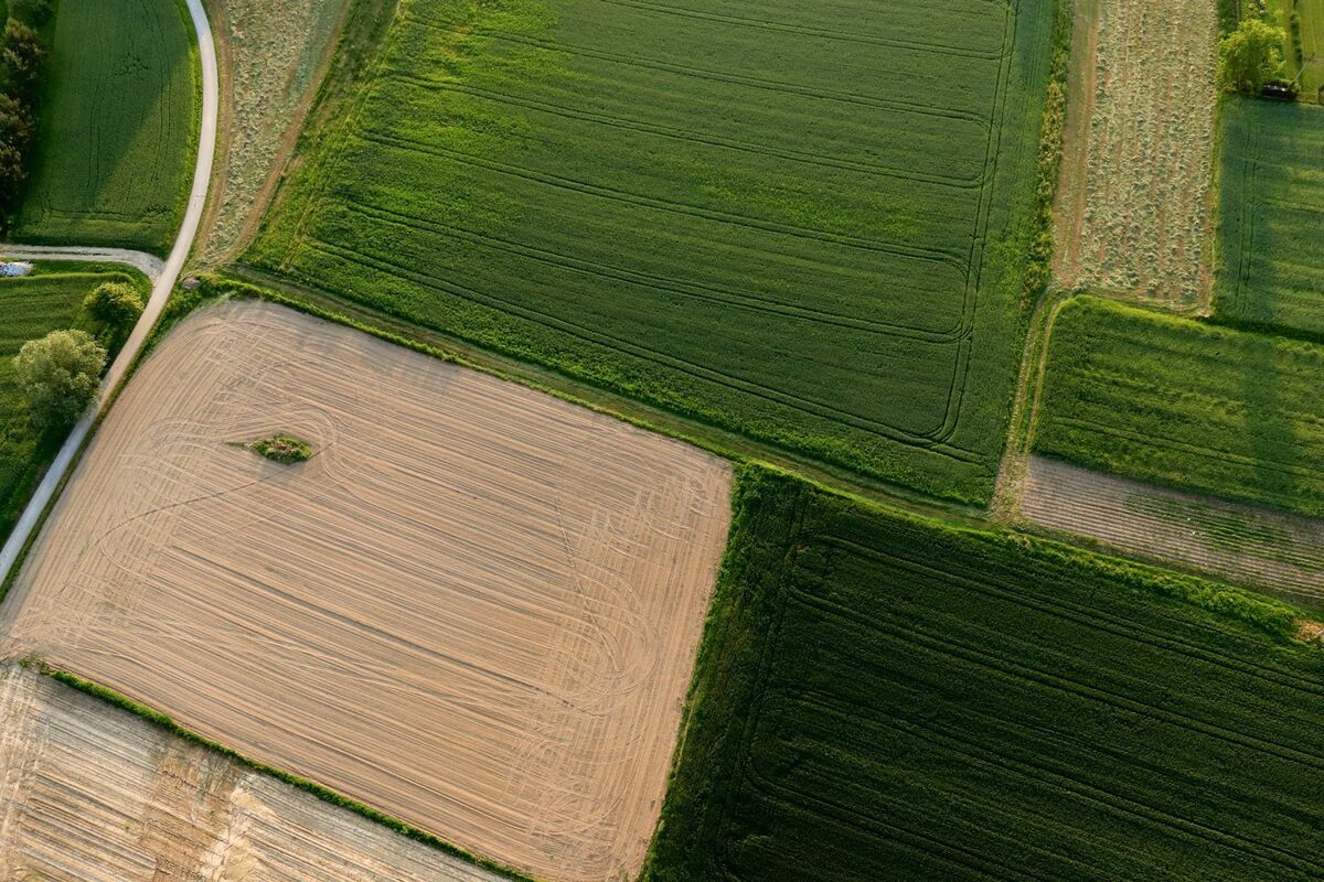
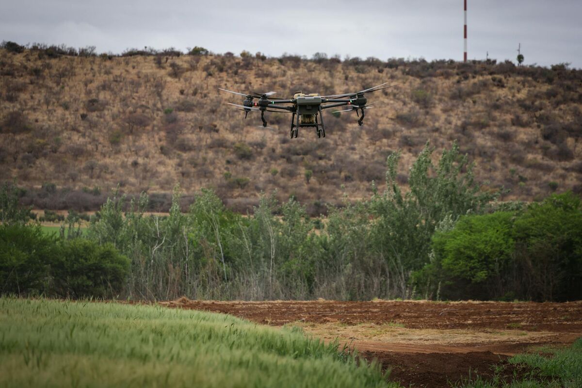
Aerial photogrammetry is the most widely deployed type today, driven by the explosion of consumer and enterprise drone hardware. A drone flies a pre-planned grid or orbit pattern over the target area, capturing overlapping still images or video. The outputs — point clouds, orthomosaics, and 3D meshes — are used for land surveying, construction progress monitoring, infrastructure inspection, and emergency response mapping. For a detailed look at the capture and software workflow, see the drone 3D mapping guide.
Terrestrial photogrammetry positions the camera on a tripod or handheld mount at ground level, directed at a distant subject such as a building facade, cliff face, or archaeological excavation. This type produces highly accurate surface models of vertical or angled subjects that aerial capture cannot reach from above. It is common in forensic engineering, heritage documentation, and structural inspections.
Close-range photogrammetry brings the camera within a few meters — or even centimeters — of the subject. Industrial applications include dimensional quality control on manufactured parts, deformation monitoring of structures, and 3D digitization of artifacts for museum collections.
Videogrammetry is the video-native extension of photogrammetry. Instead of requiring an operator to manually trigger individual shots with specific overlap, the system samples frames from a continuous video stream. This dramatically lowers the skill barrier for capture: operators fly or walk while recording, then submit the footage to a processing platform. Videogrammetry is particularly well-suited to time-critical environments — crash scenes, fire scenes, and active construction sites — where replanning and reflying individual photo passes is not practical.
What are the advantages and disadvantages of photogrammetry?
Photogrammetry's main advantages are low cost, photorealistic textured output, and accessibility — any camera-equipped drone or smartphone can capture data, with no specialized laser hardware required. Its limitations are dependence on adequate lighting and surface texture, reduced accuracy through vegetation canopy, and sensitivity to image overlap and capture quality. For texture-rich subjects in good light, photogrammetry rivals far more expensive scanning methods; for bare-earth mapping under dense canopy, LiDAR remains superior.
Advantages of photogrammetry
- Low equipment cost. A standard camera or off-the-shelf drone is the only capture hardware required — no laser scanner or specialized sensor payload.
- Photorealistic output. Because the source data is ordinary imagery, the resulting 3D models and orthomosaics carry true-color texture, making them readable as visual evidence as well as measurement data.
- Accessibility and scale. Any operator who can fly a drone or hold a phone can capture a scene, and cloud processing removes the need for high-end desktop hardware.
- Rich measurement data. A single capture yields point clouds, meshes, orthomosaics, and volumetric measurements from one dataset.
Disadvantages of photogrammetry
- Lighting and texture dependent. Flat, reflective, or untextured surfaces (still water, glass, fresh snow) produce gaps because the software cannot match features across images.
- Limited vegetation penetration. Unlike LiDAR, photogrammetry cannot see through tree canopy to capture bare-earth terrain beneath foliage.
- Capture-quality sensitive. Insufficient image overlap, motion blur, or inconsistent exposure degrades accuracy and can force a reflight.
- Processing time on large datasets. Very large or high-resolution captures require meaningful compute, though cloud platforms now absorb most of this burden.
How photogrammetry stacks up against the two methods it is most often compared with:
| Factor | Photogrammetry | LiDAR | Videogrammetry |
|---|---|---|---|
| Source data | Overlapping still photos | Laser pulse returns | Continuous video frames |
| Hardware cost | Low (any camera) | High (laser scanner) | Low (any video camera) |
| Output texture | Photorealistic color | Geometry only (no color) | Photorealistic color |
| Vegetation penetration | Poor | Excellent | Poor |
| Capture skill required | Moderate (overlap planning) | Moderate | Low (just record) |
| Best for | Low-cost textured 3D models | Bare-earth & canopy mapping | Fast, time-critical scenes |
Videogrammetry — covered in detail below — keeps photogrammetry's low-cost, photorealistic strengths while removing the overlap-planning burden that is one of its biggest practical disadvantages.
What industries use photogrammetry today?
Photogrammetry is in active use across construction, public safety, land surveying, insurance, archaeology, agriculture, and infrastructure inspection. The common thread is any workflow that requires accurate spatial measurements or 3D documentation of a physical environment — faster and safer than manual measurement, and more spatially complete than photographs alone.
Construction and civil engineering. Project owners use drone photogrammetry to track earthwork volumes, verify as-built conditions against design models, and document progress for lender draws. A weekly orthomosaic over a large excavation site captures stockpile volumes and grade changes that would take a survey crew days to measure on foot.
Public safety and law enforcement. Police departments, fire investigators, and accident reconstructionists use photogrammetry to document scenes before evidence is cleared. A 3D model of a crash scene or fire origin can be shared with prosecutors, defense counsel, and expert witnesses without requiring anyone to revisit the location. Drone mapping software purpose-built for this workflow can close a major highway faster by compressing scene documentation from hours to minutes.
Land surveying. Drone photogrammetry has become a standard supplement to traditional ground surveying. The USGS National Map and similar national mapping agencies use aerial photogrammetry to maintain topographic datasets at national scale. Private surveyors use drone photogrammetry for boundary surveys, volume calculations, and corridor mapping on infrastructure projects.
Insurance and property claims. Adjusters use drone photogrammetry to document storm damage, roof conditions, and property loss without physically accessing unsafe structures. A georeferenced 3D model provides defensible spatial evidence for coverage decisions and dispute resolution.
Archaeology and cultural heritage. Photogrammetric documentation of excavation trenches, monuments, and artifacts creates permanent 3D records before material is disturbed or removed. For current developments across these fields, the photogrammetry news roundup tracks software releases, regulatory changes, and industry case studies.
How does videogrammetry extend traditional photogrammetry?
Videogrammetry is the practice of deriving 3D geometry from video footage rather than a discrete set of still photographs. It applies the same Structure from Motion and dense reconstruction algorithms as traditional photogrammetry, but uses frames sampled from a continuous video stream as the image input. The practical benefit is a simpler, faster capture workflow: operators record video during a standard flight or walkthrough, then upload the file to a cloud platform for processing — no shot-by-shot planning required.
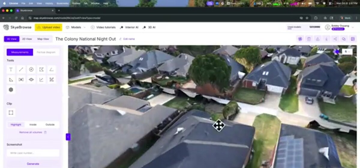
SkyeBrowse is a cloud-based videogrammetry platform built specifically for time-sensitive documentation. Operators upload an .MP4 or .MOV file — captured from any supported drone or handheld camera — to app.skyebrowse.com. The platform pairs the video with telemetry data (.SRT files from DJI drones or .ASS files from Autel drones) for accurate georeferencing, then processes the footage into a deliverable 3D model without requiring the operator to manage individual frame selection or overlap calculations.
The accuracy tiers reflect the processing investment: standard processing delivers spatial accuracy in the 2 to 6 inch range, suitable for incident documentation and construction progress. Premium processing at 8K resolution reaches approximately 0.25 inch accuracy, and Premium Advanced at 16K — with AI-assisted moving object removal — delivers approximately 0.1 inch accuracy for court-admissible forensic and survey-grade applications.
For organizations handling sensitive data, the platform runs on AWS GovCloud infrastructure with FedRAMP Moderate Authorization, supporting CJIS-focused workflows on premium tiers. No desktop processing hardware is required; models are accessible through the browser viewer, and exports are available as LAZ point clouds, GLB 3D meshes, and GeoTIFF orthomosaics for integration with GIS, CAD, and legal presentation tools.
The key distinction between SkyeBrowse's videogrammetry approach and traditional photogrammetry software is the capture barrier. Photogrammetry tools built around still images require pilots to plan grid missions, verify overlap settings, and often reflying sections with insufficient coverage. Videogrammetry removes that barrier: any footage that adequately covers the scene — including footage captured for other purposes — can be submitted for processing.
FAQ
What is the photogrammetry definition?
Photogrammetry is the science of making precise measurements and 3D reconstructions from photographs. The American Society for Photogrammetry and Remote Sensing (ASPRS) defines it as the art, science, and technology of obtaining reliable information about physical objects and the environment through the process of recording, measuring, and interpreting photographic images. The term encompasses both aerial mapping and close-range object documentation.
What is the difference between photogrammetry and LiDAR?
Photogrammetry reconstructs 3D geometry from photographs using software algorithms, while LiDAR (Light Detection and Ranging) measures distance by timing laser pulses reflected off surfaces. LiDAR captures accurate geometry even in areas with little visual texture and can penetrate vegetation canopy to reach the ground. Photogrammetry is generally lower cost, produces photorealistic textured surfaces, and requires only a standard camera — making it more accessible for routine documentation. Many high-accuracy survey workflows combine both: LiDAR for bare-earth topography and photogrammetry for surface texture and visual evidence.
What photogrammetry software is most commonly used?
Professional photogrammetry software platforms include Pix4D, Agisoft Metashape, DroneDeploy, and ESRI Site Scan for ground-up still-photo workflows. For video-native capture, SkyeBrowse is purpose-built for public safety, construction, and insurance workflows that prioritize speed and ease of capture over manual flight planning. The right choice depends on the use case: survey-grade topographic mapping favors platforms with robust GCP management, while incident documentation and insurance claims favor platforms like SkyeBrowse that accept any drone footage and deliver models in minutes.
How accurate is drone photogrammetry?
Accuracy depends on flight altitude, camera resolution, image overlap, and whether ground control points are used. At low altitude with high overlap and surveyed GCPs, professional platforms can achieve 0.1 to 0.25 inch absolute accuracy. Without GCPs, typical absolute accuracy is 2 to 6 inches — adequate for construction progress, insurance documentation, and public safety applications. Relative accuracy (measurements taken within the same model) is consistently tighter than absolute accuracy.