Nighttime accident reconstruction has always presented significant challenges for law enforcement and forensic teams. According to a National Center for Statistics and Analysis study, nighttime fatalities are approximately equal to daytime fatalities in traffic accidents, with the passenger vehicle occupant fatality rate at night being about three times higher than during the day. This reality puts considerable pressure on first responders who must investigate these scenes under challenging lighting conditions.
The Critical Need for Efficient Investigation
With over 36,000 fatalities occurring in motor vehicle traffic crashes annually, the need for efficient and accurate accident site investigation is paramount. Research indicates that for every minute spent in accident investigation, 4-5 minutes are wasted in associated traffic delays. Major accidents can cause road closures ranging from 30 minutes to 3 hours or more, leading to significant congestion, potential secondary accidents, and compromised safety for response crews.
Recent advancements in drone-based 3D modeling platforms have created opportunities to revolutionize how law enforcement conducts these investigations. These technologies allow comprehensive documentation of accident scenes without requiring extensive training on complex survey-grade software packages.
The Quality Control Study
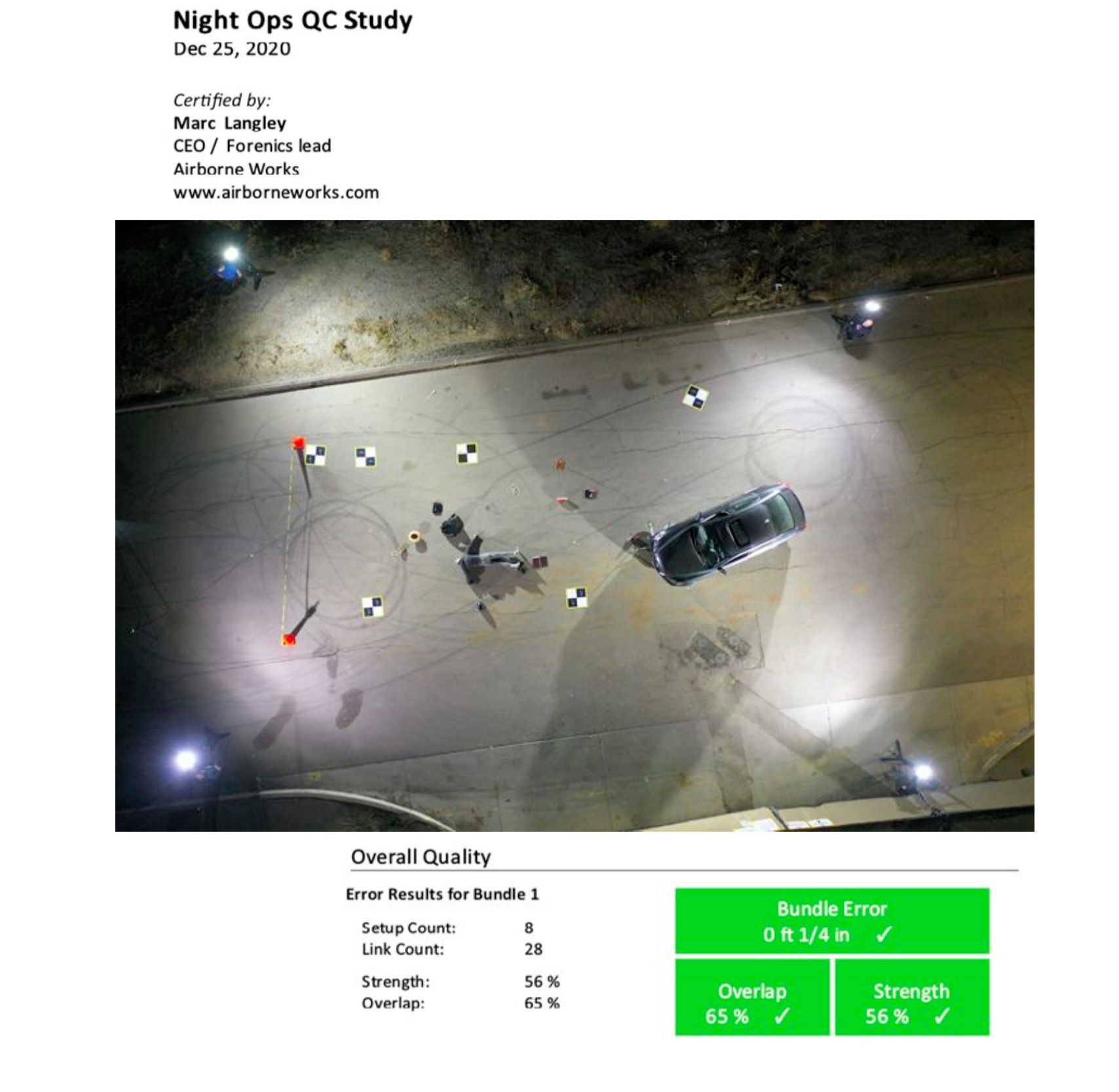
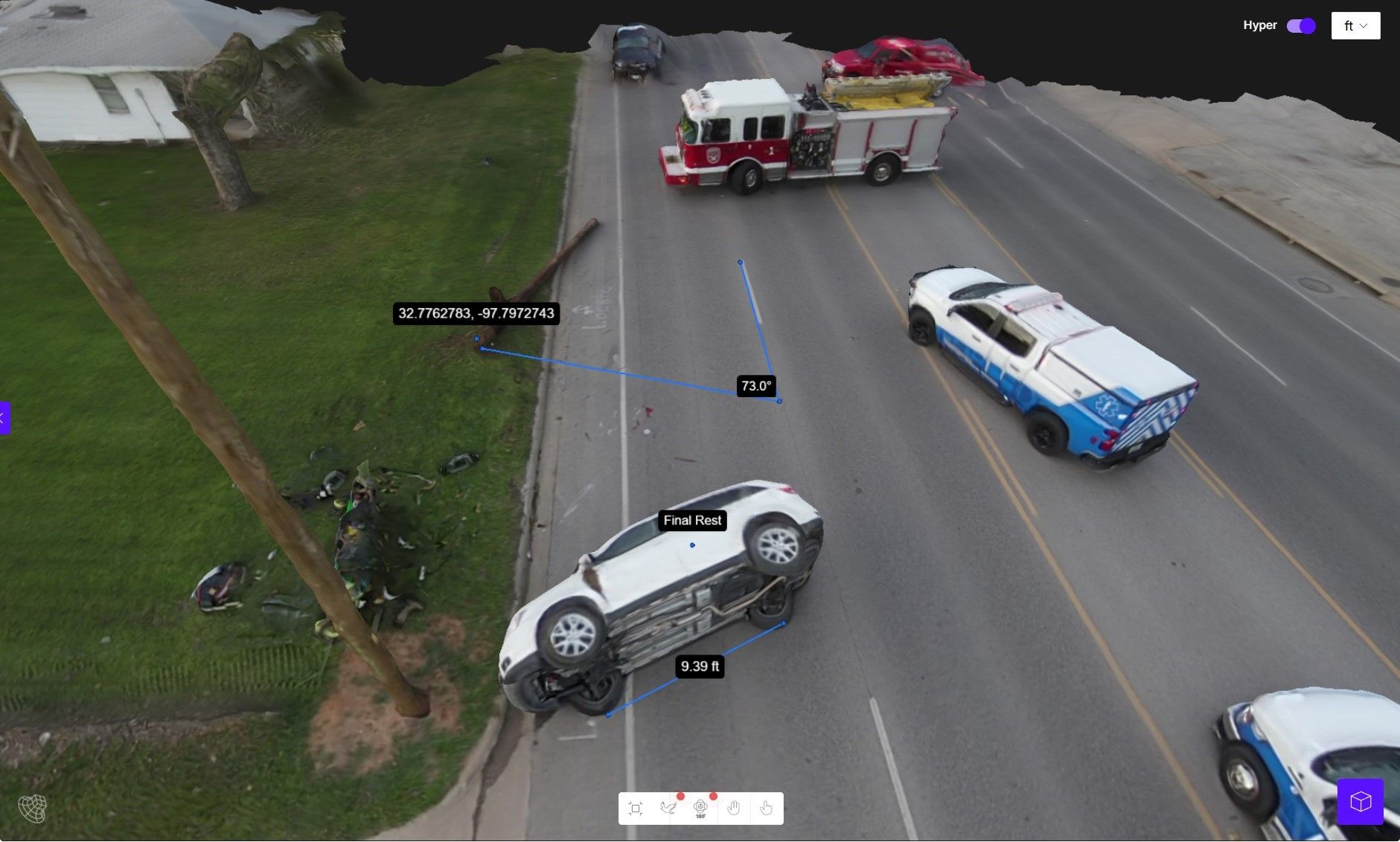
AirBorne Works conducted a comprehensive quality control study to evaluate the performance of leading drone-based 3D modeling platforms specifically for nighttime accident site reconstruction. The study configured a staged accident site with actual vehicles and common objects at an intersection near the sports complex in Oceanside, CA.
Four different 3D modeling platforms were tested:
1. Leica BLK360 (using LiDAR laser scanning technology) - established as the ground truth
2. Leica BLK3D (calibrated twin optics sensor)
3. Pix4D Mapper (photogrammetry software)
4. SkyeBrowse (videogrammetry software)
The team compared measurements taken for nine pre-selected lines from the 3D point clouds generated by each platform, focusing on accuracy against the control data established by the Leica BLK360.
Key Findings
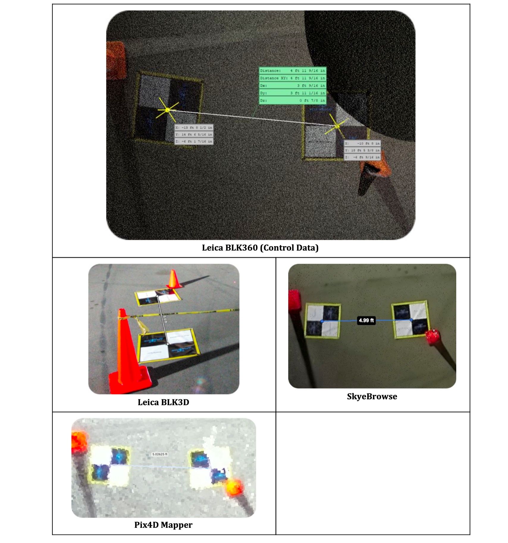
The results demonstrated that all three platforms (Leica BLK3D, Pix4D, and SkyeBrowse) achieved measurement errors of less than 3% across all nine measurement locations when compared to the Leica BLK360 control data. However, SkyeBrowse distinguished itself by outperforming the other two platforms in eight of the nine measurement locations.
SkyeBrowse demonstrated remarkable precision with error measurements at the 1cm (0.39 inches) level at all but one measurement location. This is particularly impressive considering the challenging lighting conditions of nighttime operations.
SkyeBrowse
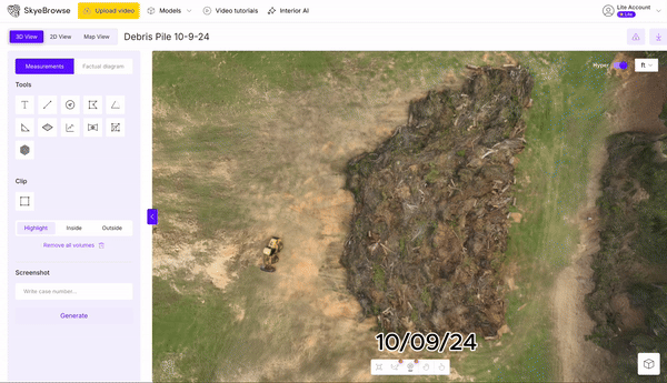
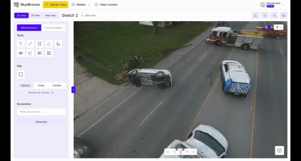
SkyeBrowse utilizes videogrammetry rather than photogrammetry, creating 3D models from video footage. The study showed that SkyeBrowse nearly perfected video 3D reality capture technology. Using a 20MP sensor at 45' AGL provided sharper data with better vertical detail. The platform completed the flight in just 2:02 minutes and processed the final point cloud model in 25 minutes post-upload.
Leica BLK360
The Leica BLK360 represents the gold standard in 3D reality capture LiDAR. Used globally and recognized in forensics for providing accurate, court-ready data, the BLK360 captures 360,000 points per second with panoramic HDR imagery. This technology served as the control standard for the study due to its exceptional precision.
Leica BLK3D
The BLK3D offers real-time, in-picture 3D measurement capabilities. By combining measurement sensors, software, and on-device edge data processing, it delivers professional-grade accuracy in real-time. Every image captured becomes a complete and precise 3D measurement record. While not point-cloud based (limiting viewing perspectives), it proved highly accurate for fast measurements.
Pix4D Mapper
A prominent photogrammetry platform, Pix4D creates 3D reconstruction models from still images. While versatile for developing dense point clouds, 3D models, and orthophoto maps, the study revealed that pic-points on the Pix4D point cloud were less clear and defined, likely due to the 110' above ground level (AGL) flight altitude and lack of orbital data capture.
Achieving Sub-Centimeter: 0.1-Inch Accuracy
While the baseline quality control study demonstrated impressive 1cm (0.39 inches) precision under challenging nighttime conditions, SkyeBrowse's technology is capable of pushing these boundaries even further. Under optimal flight parameters—such as flying at targeted lower altitudes with high-resolution sensors—SkyeBrowse's videogrammetry engine can achieve hyper-precise reconstructions with measurements accurate down to 0.1 inches.
This sub-centimeter accuracy is a game-changer for forensic reconstruction teams. It allows investigators to capture the most minute details with unparalleled confidence, including faint skid marks, small debris fields, or highly specific vehicle impact points. By providing such rigorous accuracy, SkyeBrowse ensures that the resulting court-ready models are practically flawless and leave zero room for doubt.
Practical Applications
For public safety agencies seeking to implement drone technology for nighttime accident investigation, this study provides valuable insights into platform selection. All platforms tested offer viable solutions, but SkyeBrowse stands out for its combination of accuracy, speed, and ease of use.
The integration of drones in public safety operations has accelerated in recent years with cost reductions in drone platforms and developments in aerial video analytics and 3D modeling. Police departments, sheriff offices, and fire departments are among the leading adopters of these technologies.
Conclusion
As nighttime accidents continue to present significant challenges for law enforcement, the adoption of accurate and efficient 3D modeling platforms becomes increasingly important. This quality control study demonstrates that modern drone-based platforms can deliver the precision needed for forensic analysis while significantly reducing investigation time.
For agencies looking to implement these technologies, SkyeBrowse offers a compelling solution with its combination of accuracy, speed, and user-friendly interface. By adopting these advanced technologies, public safety agencies can conduct more thorough investigations while minimizing road closure times, ultimately enhancing public safety and reducing the impact of accident-related congestion.
Disclaimer: This report is based on independent research conducted by AirBorne Works, which serves as an authorized dealer of Leica Geosystems and SkyeBrowse brands. The study was not funded by any of the technology providers mentioned and was conducted with the goal of helping public safety professionals identify the best solutions for forensic investigations.
Ready to Transform Your Department's Documentation Process and Emergency Response System? Learn how SkyeBrowse can help your agency achieve similar results.