Commercial drone services have become a standard offering across construction, infrastructure, insurance, and public safety — enabling clients to capture aerial data that would otherwise require helicopters, scaffolding, or manual survey crews. Drone services encompass any work performed by a licensed operator using an unmanned aerial vehicle (UAV) to collect, process, and deliver spatial data or imagery. This guide covers the main service types, typical pricing ranges, how to evaluate providers, and how processing software like SkyeBrowse helps operators deliver faster, more affordable results.
Key Takeaways
- Commercial drone services span mapping, inspection, surveying, and construction monitoring
- Pricing ranges from $200-$500 for aerial photography to $500-$2,500 for mapping with 3D deliverables
- Qualified providers need FAA Part 107 certification, liability insurance, and open-format deliverables
- SkyeBrowse's cloud processing lets operators deliver 3D models same-day without desktop hardware or expensive software licenses
Contents
- What types of commercial drone services are most in demand?
- What does drone services pricing look like in practice?
- How do you evaluate a drone service provider?
- How does SkyeBrowse make drone service delivery faster?
- How can drone operators offer more services using SkyeBrowse?
- FAQ
What types of commercial drone services are most in demand?
Commercial drone services fall into four main categories: aerial mapping, 3D modeling, asset inspection, and construction monitoring. Mapping and inspection together account for the majority of billable work. Each category produces a different type of deliverable — orthomosaics, point clouds, inspection reports, or progress photos — which determines how the data is used downstream.
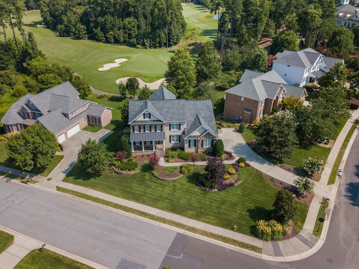
Drone mapping services use photogrammetry — the science of deriving measurements from overlapping photographs — to produce georeferenced 2D maps (orthomosaics) and 3D terrain models. They are widely used in land surveying, environmental assessment, and site planning. See our drone mapping guide for a full breakdown of flight planning, overlap settings, and output formats.
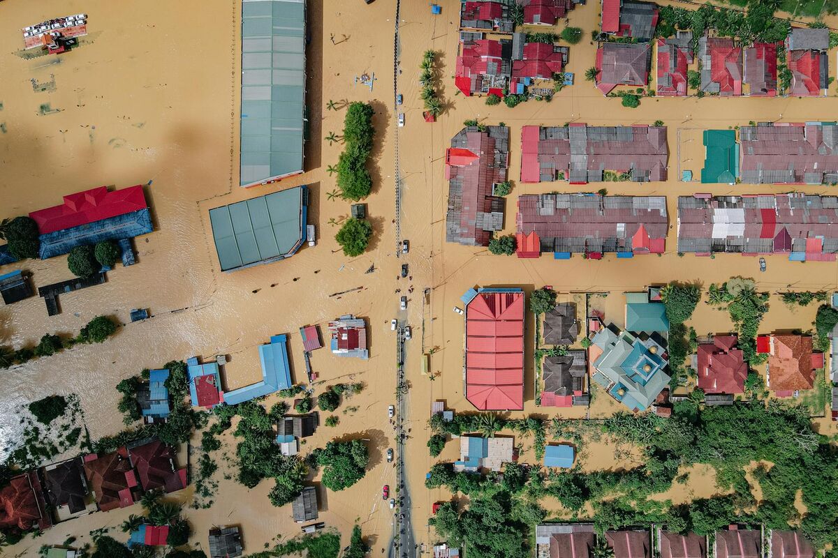
Drone inspection services let operators examine hard-to-reach assets without placing personnel at height. Common targets include roofing systems, bridges, cell towers, power lines, and pipelines. Instead of a physical walkthrough, the operator flies the structure and generates a visual record — often supplemented with a 3D model for distance and area measurements. See our full drone inspection services guide for a comprehensive breakdown of asset types and deliverable formats, and learn how this applies to roofing specifically in our drone roof inspection guide.
Drone surveying services bridge the gap between traditional land surveying and photogrammetry. Providers collect aerial imagery, apply ground control points (GCPs) to improve georeferencing accuracy, and export deliverables compatible with GIS and CAD platforms. The drone surveying guide covers accuracy expectations and GCP placement in detail.
Construction progress monitoring involves recurring flights over a job site — weekly or monthly — to document earthwork progress, material stockpiles, and grading conformance. Deliverables typically include orthomosaics and volumetric cut/fill reports.
Utility and infrastructure inspections represent a fast-growing segment. Operators fly transmission lines, substations, and pipeline corridors to detect vegetation encroachment, damaged hardware, or corrosion. Read our utility infrastructure inspections guide for workflow details.
What does drone services pricing look like in practice?
Drone services pricing depends on the deliverable complexity, project size, and turnaround time. Basic aerial photography jobs run $200–$500 per half-day. Drone mapping services for a small construction site (under 50 acres) typically cost $500–$2,500, scaling up with acreage and output format. Drone inspection services for a single commercial roof or bridge span range from $400–$2,000. 3D model deliverables add $99–$300 per model in software processing fees on top of field time.
Several factors drive price variation in drone services:
- Deliverable type. Raw video or stills are cheapest. Orthorectified maps and 3D models carry higher rates because they require post-processing time and licensed software.
- Project size and flight time. Most operators price mapping by acreage. Expect a per-acre rate of $15–$50 for standard orthomosaic work, with volume discounts on larger sites.
- Accuracy requirements. Survey-grade outputs using GCPs and RTK GPS cost significantly more than centimeter-approximate mapping. ASPRS accuracy standards define positional tolerances that determine whether a GCP workflow is needed.
- Turnaround time. Rush deliverables — needed within 24–48 hours — often carry a 25–50% premium over standard 5–7 day delivery windows.
- FAA authorizations. Flights in controlled airspace (Class B, C, or D) require LAANC authorization, which adds administrative time. Some operators charge a flat authorization fee of $50–$150 per flight.
For reference, SkyeBrowse's processing credits run $99 for Premium (approx. 0.25-inch accuracy) and $199 for Premium Advanced (0.1-inch, with AI moving-object removal). This gives service providers a predictable cost floor when quoting 3D model deliverables. For roofing-specific pricing benchmarks — including how per-model processing fees affect per-inspection margins — see the drone roof inspection cost guide. Contractors adding a roofing drone service line will find those figures especially relevant when setting competitive rates.

How do you evaluate a drone service provider?
A qualified commercial drone service provider should hold an FAA Part 107 Remote Pilot Certificate, carry general liability and aviation hull insurance, and be able to demonstrate sample deliverables from comparable projects. Clients should ask for references, confirm airspace authorization procedures, and verify that data is delivered in an open format compatible with their downstream tools.
When vetting providers, check these items specifically:
FAA certification. Under Part 107, any drone operation for compensation requires a Remote Pilot Certificate. Operators flying in controlled airspace need active LAANC authorization. Verify the certificate number directly through the FAA Airmen Inquiry database.
Insurance. Reputable providers carry at minimum $1 million general liability and hull insurance covering the drone. For projects near structures or people, $2 million aggregate is a common client requirement.
Deliverable format. Confirm that outputs are provided in open, standard formats: GeoTIFF for orthomosaics, LAZ or LAS for point clouds, and OBJ or GLB for 3D models. Avoid providers who lock deliverables inside proprietary platforms with no export.
Data handling. For sensitive projects — insurance claims, legal proceedings, public safety work — ask about chain of custody, encryption in transit, and storage location. Government clients should confirm whether the provider uses FedRAMP-authorized cloud infrastructure.
Turnaround guarantees. Service-level agreements (SLAs) defining delivery windows protect both parties. Providers using cloud processing platforms like SkyeBrowse can often commit to same-day or next-day turnaround on 3D deliverables.
How does SkyeBrowse make drone service delivery faster?
SkyeBrowse is a cloud-based videogrammetry platform that converts drone video into georeferenced 3D models, orthomosaics, and point clouds in minutes. Operators upload an .MP4 or .MOV flight video via the SkyeBrowse Flight App or Universal Upload — no desktop hardware or specialized workstation is required. Processing runs on AWS GovCloud servers, and results are shareable via a browser link as soon as they are ready.
Traditional photogrammetry workflows require capture in photo mode (hundreds of individual still frames), import into desktop software, and processing runs that can take hours on a capable workstation. For service providers, this translates to long gaps between flight and deliverable, which limits how many jobs can be turned around in a day.
SkyeBrowse's videogrammetry approach — where the platform derives 3D geometry directly from continuous video frames — collapses this workflow. A typical 15-minute inspection or mapping flight produces a video file that uploads in a few minutes and processes in the cloud within 10–20 minutes. The finished deliverable — a shareable 3D model, a GeoTIFF orthomosaic, or a LAZ point cloud — is available without leaving the field.
Accuracy tiers scale to project requirements:
- Lite (2–6 inch): fast processing for site overviews and documentation
- Premium (0.25 inch, 8K): suitable for insurance claims, roof documentation, and construction monitoring
- Premium Advanced (0.1 inch, 16K, AI moving-object removal): survey-grade output for infrastructure inspection and legal proceedings
SkyeBrowse supports a wide range of drones. See the full supported drone list at skyebrowse.com/supported-drones.
How can drone operators offer more services using SkyeBrowse?
Drone operators can expand their service menu by adding 3D modeling, orthomosaic mapping, and inspection reports as standard deliverables — without investing in workstation hardware. Because SkyeBrowse processes video captured during a normal flight, operators do not need to change their existing capture workflow to unlock these higher-value deliverables.
For operators looking to build or grow a drone services business, SkyeBrowse functions as the back-end processing layer that converts raw flight footage into billable deliverables. The business case is straightforward: a mapping or inspection job that previously required a desktop processing setup — representing $3,000–$10,000 in hardware and software licensing — can now be offered using a cloud subscription with per-model credits.
Key service expansions enabled by SkyeBrowse:
- 3D property documentation for insurance adjusters, attorneys, and property managers — export GLB or shareable browser links
- Construction progress reporting with orthomosaics and volume measurements delivered within hours of the flight
- Infrastructure inspection packages combining visual inspection photos with a georeferenced 3D model for distance and area markup
- Public safety and emergency response documentation — SkyeBrowse is used by 1,200+ agencies worldwide, and its CJIS-focused workflows on premium tiers make it viable for law enforcement contracts
Operators can start with a free trial at app.skyebrowse.com and review pricing at skyebrowse.com/pricing-premium.

FAQ
How much do drone services typically cost?
Drone services pricing varies widely by deliverable type and project complexity. Basic aerial photography starts around $200–$500 per half-day. Drone mapping services for a construction site or property range from $500–$2,500 depending on acreage and output format. Drone inspection services for roofs, bridges, or utility infrastructure typically run $400–$2,000 per asset. Specialized deliverables like 3D models or georeferenced orthomosaics command premium rates, with SkyeBrowse's Premium processing credit at $99 per model serving as a typical cost floor for providers.
Do I need a licensed pilot for commercial drone services?
Yes. Under FAA Part 107 rules, anyone providing drone services for compensation must hold a Remote Pilot Certificate. This requires passing the FAA Aeronautical Knowledge Test. Operators working in controlled airspace must also obtain airspace authorization through LAANC or a waiver. Clients should always verify that a provider holds a current Part 107 certificate before hiring.
What software do drone service providers use to process data?
Most providers use photogrammetry or videogrammetry software to turn raw drone footage into actionable deliverables. SkyeBrowse uses a video-to-3D workflow — operators upload .MP4 or .MOV flight video, and the cloud platform returns georeferenced orthomosaics, 3D models (GLB), and point clouds (LAZ) in minutes, without requiring desktop hardware. This makes it particularly well-suited for service providers who need fast turnaround on every job. A full list of compatible drones is at skyebrowse.com/supported-drones.