Police UAV programs — fleets of unmanned aerial vehicles operated by police, sheriff, and public safety agencies — have become one of the fastest-growing tools in modern policing. Agencies deploy them to document crime scenes, reconstruct traffic fatalities, locate missing persons, and support tactical operations, all while keeping officers out of dangerous positions. This guide covers the core use cases, program setup requirements, FAA and CJIS compliance obligations, and the data security standards agencies should expect from any mapping platform they deploy.
What Is a Police UAV?
A police UAV — unmanned aerial vehicle — is a drone operated by law enforcement agencies for official public safety missions. Unlike hobbyist drones, a police UAV is flown under FAA Part 107 authority or a government COA, governed by a written use policy, and paired with CJIS-compliant data handling so footage collected at active scenes meets evidentiary standards.
Key Takeaways
- Law enforcement drones are deployed by 1,200+ public safety agencies worldwide, covering crime scene documentation, accident reconstruction, search and rescue, and tactical pre-planning.
- FAA Part 107 certification is required for most operational drone flights; night waivers are frequently needed for law enforcement scenarios.
- CJIS compliance is non-negotiable for any cloud platform storing aerial footage or 3D models tied to criminal investigations.
- SkyeBrowse's videogrammetry workflow — converting patrol drone video into court-ready 3D models in under five minutes — removes the need for dedicated mapping drones or laser scanners at most scenes.
- FedRAMP Moderate Authorization and CJIS-focused workflows on premium tiers mean evidence data stays under the same security standards as any other criminal justice information.
Contents
- What is a police UAV?
- What can law enforcement drones be used for?
- What FAA rules apply to police department drone programs?
- How do agencies handle CJIS compliance for drone data?
- How does 3D mapping software fit into a law enforcement drone program?
- How should an agency set up a drone-as-first-responder program?
- FAQ
What can law enforcement drones be used for?
A police UAV serves six primary operational roles: crime scene documentation, traffic accident reconstruction, search and rescue, tactical pre-planning, crowd monitoring, and perimeter surveillance. Each use case leverages the drone's ability to capture overhead perspectives quickly and safely, reducing officer exposure while producing documentation that holds up in court.
Crime scene documentation is the most common first deployment for new programs. A drone can capture the complete scene geometry in minutes — before evidence is disturbed — giving detectives a spatial record that no walkthrough video or photo set can replicate. Pairing drone footage with a platform like SkyeBrowse produces a georeferenced 3D model investigators can measure and annotate long after the scene is released. For more on the equipment side, see drones for crime scene mapping.
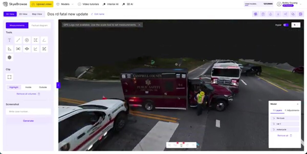
Traffic fatality reconstruction is where agencies often see the fastest return. Road closures after a fatal crash cost municipalities thousands of dollars per hour and create public safety hazards. A drone orbit of the scene — uploaded immediately — can generate a measurable 3D model that satisfies investigators' documentation requirements in a fraction of the time a manual total station survey would take. The ACTAR certification standard for accident reconstructionists increasingly recognizes drone-derived models as admissible spatial evidence.
Search and rescue leverages thermal and optical cameras to cover large terrain quickly. A police UAV deployed on a search mission can survey hundreds of acres per hour — far beyond what foot teams can cover. The NIJ has documented UAV-assisted searches reducing grid-search time by 50 percent or more in open terrain.
Tactical operations — including pre-entry building surveys, hostage situations, and barricaded subjects — give incident commanders a live overhead view without exposing personnel. Pre-mission 3D models of target locations let teams rehearse entry routes. For purpose-built planning tools, see tactical planning software.
What FAA rules apply to police department drone programs?
Most police UAV operations require pilots to hold an FAA Part 107 Remote Pilot Certificate. Government agencies may alternatively operate under a Certificate of Waiver or Authorization (COA), but Part 107 is the faster path for most patrol and investigative uses. Night operations — essential for law enforcement — require either a Part 107 night waiver or operations under a COA that includes nighttime authority.
The FAA Part 107 rule sets baseline operating conditions: maximum altitude of 400 feet above ground level, visual line of sight required, no operations over moving vehicles without a waiver, and mandatory airspace authorization near controlled airports. Automated LAANC authorization covers most altitudes near airports and eliminates the week-long manual process.
Public safety agencies can apply for a blanket COA that pre-authorizes a defined flight area for recurring operations without filing individual authorizations. The International Association of Chiefs of Police (IACP) recommends agencies designate a drone program coordinator responsible for pilot currency, maintenance logs, and incident reporting.
How do agencies handle CJIS compliance for drone data?
The FBI's CJIS Security Policy requires that any system handling criminal justice information — including aerial imagery and 3D models tied to active investigations — meet specific controls for encryption, access management, audit logging, and personnel vetting. Agencies must confirm that their drone mapping platform is either CJIS-compliant by design or restricted to data that does not touch CJIS-covered information.
The FBI CJIS Security Policy applies to any electronic system that stores, processes, or transmits criminal justice information. Drone footage uploaded to a public cloud bucket with no access controls would be a direct policy violation. Platforms designed for law enforcement must provide encryption in transit and at rest, role-based access, multi-factor authentication, and audit trails that satisfy CJIS requirements.
SkyeBrowse runs on AWS GovCloud infrastructure with FedRAMP Moderate Authorization — the federal cloud security baseline that CJIS-covered systems must meet. Premium tier accounts include CJIS-focused workflow controls, ensuring that models generated from crime scene footage are accessible only to authorized personnel within the agency. For a deeper breakdown of compliant platform options, see CJIS-compliant mapping.
Agencies should also address data retention policies before deployment. CJIS guidelines require that data be purged or archived according to the agency's records retention schedule. A mapping platform that gives administrators control over deletion and export — rather than holding data indefinitely on vendor servers — is critical for long-term compliance.
How does 3D mapping software fit into a law enforcement drone program?
Drone mapping software converts raw aerial video into measurable 3D models, 2D orthomosaics (geometrically corrected overhead maps), and point clouds that investigators can use for court exhibits, depositions, and reports. The right platform processes footage in the field without requiring a desktop workstation, turning a patrol officer's drone flight into court-ready spatial evidence before they leave the scene.
Videogrammetry — the process of extracting 3D geometry from video frames — is the underlying technology behind SkyeBrowse's platform. Officers upload drone footage directly from the SkyeBrowse Flight App or via Universal Upload at app.skyebrowse.com, and the cloud processes the model automatically. No laser scanner, no survey-grade GPS, and no GIS software experience required.
For accident reconstruction, this matters most in time-sensitive cases. A 3D model generated before the scene is cleared lets the reconstructionist start distance and angle measurements while the responding officer is still writing their report. Premium processing delivers accuracy down to 0.25 inch, which satisfies ACTAR and most court evidentiary standards for scene geometry. The model can then be exported as a GLB file for court exhibits or a LAZ point cloud for further analysis in third-party CAD tools.
For crime scenes, the ability to create annotations inside the 3D model — pinning photos, notes, and measurements to specific spatial coordinates — produces an evidentiary record that is far more defensible than a flat photo array.
How should an agency set up a drone-as-first-responder program?
A drone-as-first-responder (DFR) program deploys a police UAV ahead of officers to provide live situational awareness before ground units arrive. Setting one up requires selecting appropriate hardware, obtaining FAA authority for beyond visual line of sight (BVLOS) or nighttime operations, establishing data handling procedures, and training dispatchers to integrate the drone feed into incident command workflows.
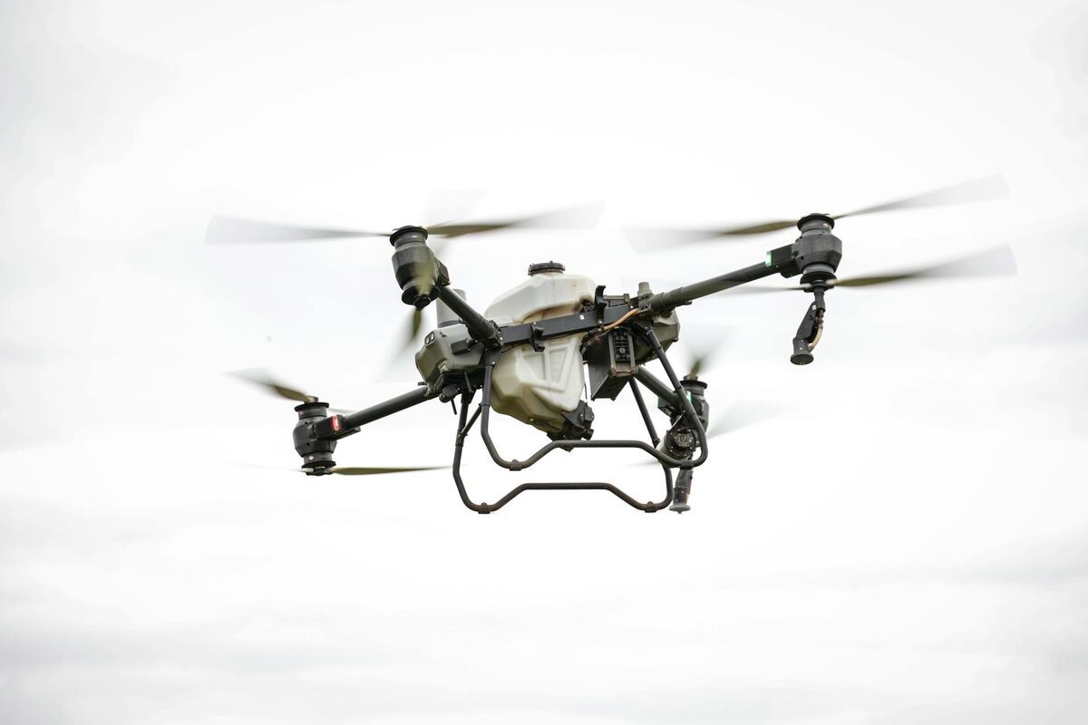
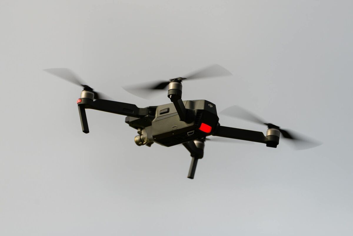
The hardware selection depends on the mission profile. For DFR, agencies typically choose a fixed-base drone with automated launch capability — DJI Dock or similar — paired with a high-resolution daylight and thermal sensor. For scene documentation, a compact foldable drone like the DJI Mavic 3 Enterprise covers most use cases and can be carried in a patrol vehicle without dedicated equipment storage.
Program governance is as important as hardware. The IACP's model drone policy template recommends written policies covering: authorized uses, prohibited uses (such as warrantless surveillance of private property), data retention, community notification, and supervisory oversight. Agencies without a written policy face civil liability exposure even when individual flights are technically lawful.
Training should cover two tiers: full Part 107 certification for designated drone pilots, and situational awareness training for supervisors and dispatchers receiving the drone feed. The NIJ recommends piloting new tools in a single unit before agency-wide rollout, letting policy gaps surface in a controlled environment.
Once operational, footage should flow directly into the department's case management system — not onto an officer's personal device or a consumer cloud service. A platform that exports to prosecutorial formats (GLB models, GeoTIFF orthomosaics, PDF reports) reduces friction at every step of the evidentiary chain.

FAQ
How is a police UAV different from a regular drone?
A police UAV uses the same commercial airframe as many hobbyist drones, but the operational context is fundamentally different. Law enforcement agencies pair the hardware with encrypted data links, thermal sensors, and CJIS-compliant cloud platforms. Pilots fly under FAA Part 107 authority or a government COA, and every flight is governed by a written use policy covering authorized missions, data retention, and chain-of-custody requirements that civilian recreational use does not face.
Do law enforcement drones require FAA certification?
Yes. Officers piloting drones for official law enforcement operations must hold an FAA Part 107 Remote Pilot Certificate or operate under a government Certificate of Waiver or Authorization (COA). Part 107 requires passing a knowledge test at an FAA-approved testing center and passing TSA security vetting. Agencies frequently pursue waivers for night operations and flights over people, which are common in public safety work. The FAA Part 107 page outlines the full certification process.
What is CJIS compliance and why does it matter for police drone programs?
CJIS (Criminal Justice Information Services) compliance refers to the FBI's security policy governing how criminal justice data is stored, transmitted, and accessed. For drone programs, it matters because aerial footage and 3D models captured at crime scenes or accident sites may contain criminal justice information. Any cloud platform used to store or process that data must meet CJIS standards — encryption, access controls, and audit logging — to keep evidence legally defensible and the agency compliant.
How much does it cost to start a police department drone program?
Entry-level law enforcement drone programs typically range from $5,000 to $20,000 for hardware, training, and initial software licensing. A DJI Mavic 3 Enterprise or similar platform costs $3,000–$7,000. FAA Part 107 training runs $500–$1,500 per pilot. SkyeBrowse offers per-model pricing starting at $99 for Premium processing, which lets agencies scale costs to actual case volume rather than paying flat annual fees. Contact SkyeBrowse for a quote tailored to your agency's mission profile.