Collision investigators face mounting caseloads where measurement accuracy affects prosecution outcomes, civil liability determinations, and insurance subrogation recovery. Traditional reconstruction methods using tape measures and total stations consume hours on-scene, exposing investigators to traffic hazards while delaying roadway reopening. The reconstruction software you deploy determines whether cases close with defensible analysis or founder on disputed measurements that undermine expert testimony.
Contents
Evaluation Criteria
Implementation Checklist
Buyer Checklist
Change Management and Training
Pricing Models and Procurement
Risk and Compliance Considerations
Decision Matrix Template
Extended FAQ
Practical Tips for Selection
Evaluation Workflow Example
Stakeholder Alignment
FAQ
Reconstruction methodology and measurement requirements
Platform comparison for collision investigation
Pedestrian vs. vehicle-vehicle vs. commercial vehicle crashes
Expert testimony preparation and Daubert standards
Multi-disciplinary team coordination
How Are Drones Used in Accident Reconstruction?
Get a SkyeBrowse quote
Reconstruction Methodology and Measurement Requirements
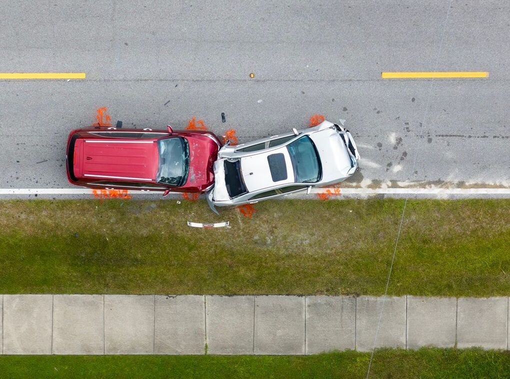
Collision reconstruction depends on measured evidence: skid mark lengths establish pre-impact speed, vehicle final positions demonstrate post-impact dynamics, debris field patterns indicate impact points, and roadway geometry affects visibility and reaction distance calculations. ASTM D6917 establishes measurement best practices—accuracy standards, documentation requirements, and quality control procedures that courts recognize as professional standards.
Expert witness testimony explaining reconstruction opinions must survive Daubert challenges to methodology and Frye admissibility standards. Defense experts attack measurements questioning: How accurate are the distances? What measurement method was used? Were measurements independently verified? Can you demonstrate measurement uncertainty? Reconstruction software supporting verifiable measurements with documented accuracy resists these challenges better than estimates or unverified data.
Platform Comparison for Collision Investigation
| Software Platform | Investigation Application | Accuracy & Documentation |
|---|---|---|
| 3D Mapping + Reconstruction Software (SkyeBrowse + HVE/v-Crash) | Scene measurement + analysis integration | Video-derived measurements (0.1-0.25" accuracy) import to reconstruction tools for simulation |
| Traditional Total Station + Software | Forensic-grade measurement accuracy | Gold standard but slow (2-4 hours on-scene), expensive equipment, specialist operation |
| Handheld Measurement + Diagrams | Low-tech reconstruction | Measurement accuracy concerns, difficult verification, labor-intensive field work |
| Laser Scanners + Point Cloud Software | High-accuracy complex scenes | Equipment cost ($30K+), processing complexity, overkill for routine collisions |
Pedestrian vs. Vehicle-Vehicle vs. Commercial Vehicle Crashes
Pedestrian collision reconstruction: A vehicle strikes a pedestrian in a marked crosswalk. Prosecution charges failure to yield, but defense claims pedestrian entered against signal. Reconstruction must establish: vehicle approach speed, pedestrian walking speed, signal timing, sight distances. A 3D model captured within hours of the collision preserves evidence—vehicle final position, pedestrian impact location, sight obstructions, crosswalk geometry.
Process through Premium Advanced (0.1-inch accuracy) supporting precise distance measurements that speed calculations require. Measure vehicle-to-crosswalk distance at various points along approach, calculate available sight distance, and demonstrate driver had adequate opportunity to perceive the pedestrian and react. Expert testimony references the model measurements, explaining calculations that demonstrate excessive speed or inadequate attention. Defense challenges focus on methodology—documented photogrammetric accuracy and field verification data withstand cross-examination.
Expert Testimony Preparation and Daubert Standards
Daubert admissibility requirements: Federal courts (and many states) apply Daubert standards assessing expert testimony reliability. Courts examine: (1) whether methodology is scientifically valid, (2) whether it's been peer-reviewed and published, (3) known error rates, (4) acceptance within the relevant scientific community. Collision reconstruction methods using photogrammetry satisfy these requirements—peer-reviewed methodology, established accuracy standards, broad professional acceptance.
Preparing expert witness testimony: Reconstruction experts testifying about 3D model measurements should address foundation elements proactively:
Multi-Disciplinary Team Coordination
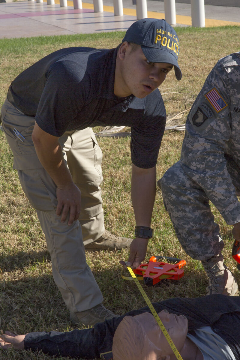
Patrol, investigators, and reconstruction specialists: Complex crashes involve multiple law enforcement responses—patrol secures the scene and manages traffic, investigators document evidence and interview witnesses, reconstruction specialists perform detailed measurement and analysis. Coordination challenges arise when each discipline needs spatial data but uses different documentation methods.
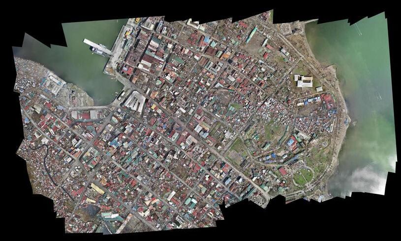
Patrol-captured 3D documentation benefits all disciplines. Patrol documents the scene immediately using drone or smartphone video, uploading for processing. Investigators access the model remotely, taking preliminary measurements supporting investigative decisions without returning to the scene. Reconstruction specialists import model data into analysis software, performing detailed calculations. This workflow gets patrol off the scene faster (reducing roadway exposure), provides investigators with measurement tools, and gives specialists verifiable data supporting analysis—all from a single capture event.
Accident Diagram: From Hand-Drawn Sketches to Scaled 3D Scene Maps
An accident diagram is the visual record that ties every measurement, witness statement, and physical evidence marker to a spatial location within the collision scene. Traditional accident diagrams are hand-drawn field sketches transferred to CAD software hours or days later — a process that introduces transcription errors, depends on the sketcher's spatial judgment, and produces flat representations of three-dimensional scenes.
Modern reconstruction software generates accident diagrams directly from 3D scene data. A drone or smartphone video capture feeds into photogrammetry processing that outputs a scaled, measurable model. From that model, investigators extract top-down diagrams with accurate distances, vehicle positions, skid mark geometry, debris fields, and sight lines — all tied to real-world coordinates rather than estimated field notes.
Why software-generated accident diagrams outperform manual sketches:
- Dimensional accuracy — measurements are derived from the 3D model (0.1–6 inch accuracy depending on processing tier) rather than estimated by an officer holding a tape measure in traffic
- Completeness — the model preserves the entire scene, so investigators can add diagram elements weeks later without returning to the location
- Reproducibility — opposing experts can independently verify measurements from the same model, reducing disputes over diagram accuracy
- Courtroom presentation — jurors understand 3D walkthroughs and annotated overhead views more readily than hand-drawn sketches, strengthening case presentation
- Speed — a patrol officer captures the scene in 10–15 minutes; the reconstruction specialist generates the diagram remotely instead of spending hours on-scene with surveying equipment
For agencies still producing hand-drawn accident diagrams, transitioning to 3D-derived diagrams compresses the diagram creation timeline from days to hours while producing outputs that are measurably more defensible under cross-examination.
ROI: Scene Documentation Time Efficiency
Traditional collision scene documentation requires 2-4 hours on-scene with reconstruction specialists, exposing investigators to traffic hazards while roadways remain closed. Manual measurements using total stations, GPS equipment, and tape measures consume investigator time and delay scene clearance.
Video-based 3D documentation compresses scene capture to 10-15 minutes using smartphone or drone—single officer captures comprehensive spatial data, uploads for processing, and releases the scene. Roadway reopening accelerates by 80-90%, reducing traffic impact and investigator exposure.
For agencies processing 100+ annual collision investigations, this efficiency saves approximately 200-300 investigator hours annually (valued at $8K-$15K at $40-$50/hour loaded rates) while improving documentation completeness and measurement defensibility for courtroom testimony.
Evaluation Criteria
A strong evaluation compares accuracy, processing speed, output formats, and compliance needs. Teams should also assess how the tool fits existing workflows and hardware.
Core criteria:
- Accuracy requirements (evidence‑grade vs reference‑grade).
- Processing speed and turnaround time.
- Export formats like LAZ, GLB, and GeoTIFF.
- Compliance and retention policies.
Scoring each tool consistently makes vendor comparisons defensible.
Implementation Checklist
A successful rollout depends on training, capture standards, and data governance.
Checklist:
- Define capture protocols and QA steps.
- Train operators with a short playbook.
- Establish file naming and storage policies.
- Validate exports inside the tools your team already uses.
These steps reduce adoption friction and prevent inconsistent outputs.
FAQ
How long does setup take? Most teams can pilot within days using existing cameras.
What data do we keep? Retention should match operational and legal requirements.
Is training required? A short workflow checklist is usually enough for consistent capture.
Buyer Checklist
A structured checklist keeps procurement focused on outcomes rather than feature lists.
Checklist questions:
- Does the tool meet required accuracy thresholds?
- Are exports compatible with existing CAD/GIS tools?
- What training and support are included?
A checklist helps teams compare platforms consistently and defend their selection.
Change Management and Training
Even the best platform fails without adoption. A short change‑management plan keeps teams aligned during rollout.
Training tips:
- Start with a pilot group and expand.
- Provide short capture checklists.
- Establish a QA reviewer for early models.
This approach reduces friction and helps standardize results across teams.
Pricing Models and Procurement
Pricing structures vary by provider. Understanding pay‑per‑model versus subscription models helps teams select the right fit for their usage volume.
Procurement tips:
- Estimate annual capture volume before choosing a plan.
- Compare storage and retention policies.
- Validate contract terms around data ownership.
A clear procurement plan prevents cost surprises later.
Risk and Compliance Considerations
Compliance requirements influence platform choice. Public safety teams need CJIS‑ready workflows, while commercial teams may prioritize flexibility.
Considerations:
- Audit trails and access controls.
- Data retention timelines.
- Export formats required for legal or regulatory review.
Aligning risk requirements with platform capabilities avoids costly re‑work.
Decision Matrix Template
A decision matrix makes procurement defensible. Scoring each tool across key categories provides a clear justification for selection and simplifies stakeholder reviews.
Suggested categories:
- Accuracy and resolution options.
- Processing speed and turnaround.
- Export formats and interoperability.
- Compliance, retention, and security.
- Total cost of ownership.
Teams can weight categories based on mission requirements, then compare results across vendors. This creates a transparent selection process and reduces the risk of choosing a tool that does not align with operational needs.
Extended FAQ
How do we choose the right accuracy tier? Select evidence‑grade tiers for legal workflows and lighter tiers for reference use.
How fast can teams onboard? Many teams can run a pilot within days using existing equipment.
What exports are essential? LAZ, GLB, and GeoTIFF cover most operational needs.
Is CJIS required for commercial use? Typically not, but public safety or government work may require it.
How do we estimate cost? Compare usage volume against pay‑per‑model and subscription options.
Can we use existing hardware? Yes, most tools accept standard drone or phone video.
How do we manage storage? Define retention policies and archive completed projects.
What training is needed? A short capture checklist and QA review process is usually sufficient.
Practical Tips for Selection
Selecting a platform is easier when teams focus on operational fit rather than feature lists. Short pilots and clear scoring criteria reduce decision risk.
Tips:
- Run a small pilot with real operators, not only vendors.
- Score tools against a small set of mission‑critical criteria.
- Gather feedback from downstream users like analysts or project managers.
This approach creates buy‑in and reduces the chance of adoption issues later.
Evaluation Workflow Example
An evaluation workflow starts with a pilot on a real project. Operators run the capture, exports are reviewed by analysts, and leadership scores the tool against the decision matrix. Feedback is collected from field staff and report reviewers. If the tool meets requirements, rollout begins with a small group before expanding organization‑wide.
This workflow ensures that the selection is grounded in operational reality rather than marketing claims.
Stakeholder Alignment
Procurement decisions are smoother when stakeholders agree on goals. Aligning operations, finance, and IT early prevents late‑stage objections.
Alignment steps:
- Define success metrics before evaluating tools.
- Confirm compliance requirements with IT and legal.
- Establish budget expectations with finance.
This alignment shortens the decision cycle and supports faster adoption.
In practice, the best choice balances accuracy with operational speed. A slightly lower‑accuracy option can outperform a higher‑accuracy tool if it enables faster capture and consistent use across the department.
Teams should also confirm that export formats match existing analysis tools before finalizing a purchase.
Finally, confirm that the vendor’s support model matches your operational tempo, especially for after‑hours incidents.
Documenting support SLAs and escalation paths also helps ensure continuity for critical cases.
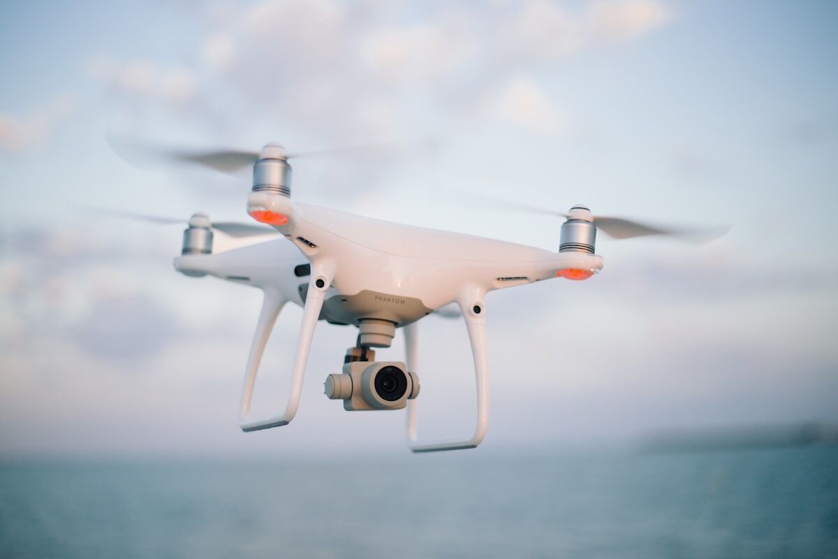
How Are Drones Used in Accident Reconstruction?
Drone accident reconstruction uses aerial video to generate measurable 3D scene models within minutes of a collision. A drone orbits the crash scene, capturing continuous video that processes into a scaled point cloud and mesh accurate to 0.1–0.25 inches. Investigators extract skid mark lengths, vehicle final positions, sight line distances, and debris field geometry from the model — eliminating hours of manual measurement while producing court-ready spatial evidence.
Beyond speed, drone-based scene documentation reduces investigator exposure on active roadways and preserves evidence that degrades as traffic resumes. The resulting model supports reconstruction software like HVE and v-Crash, with LAZ and GLB exports connecting directly to simulation and CAD platforms. For agencies processing dozens of fatal or injury collisions annually, drone accident reconstruction compresses the gap between scene clearance and defensible expert analysis.
Get a SkyeBrowse Quote
Collision reconstruction demands measurement tools that compress on-scene documentation time while producing defensible data supporting expert analysis and testimony. If your agency needs faster scene documentation reducing investigator roadway exposure, accurate measurements supporting reconstruction software analysis, or spatial evidence withstanding Daubert challenges and expert witness cross-examination, SkyeBrowse provides the processing accuracy and workflow efficiency that professional reconstruction requires.