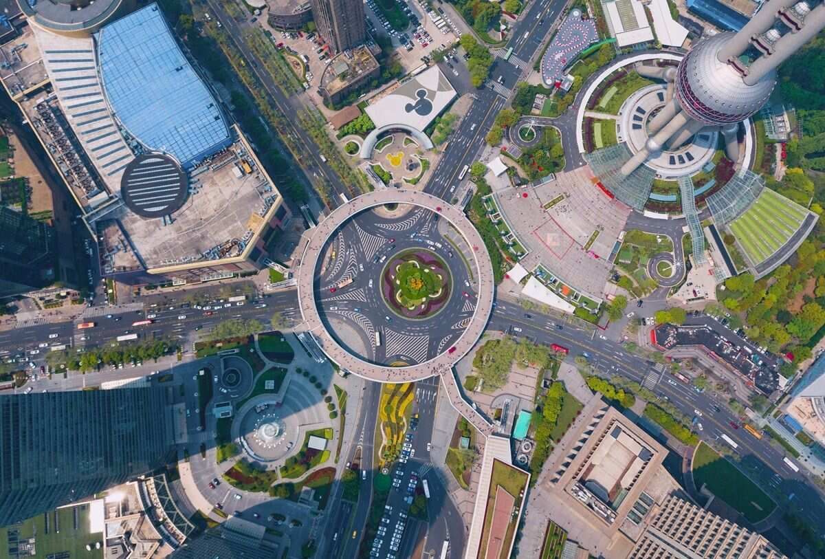
An orthomosaic is a georeferenced aerial image created by stitching multiple drone photos — each corrected for perspective distortion, terrain variation, and camera tilt — into a single, geometrically accurate map where every pixel corresponds to a real-world geographic coordinate. Unlike a standard aerial photo, an orthomosaic maintains consistent scale across the entire image, so distances and areas can be measured directly. Modern orthomosaic software, including SkyeBrowse's videogrammetry platform at app.skyebrowse.com, has reduced generation time from hours to minutes.
Key Takeaways
- An orthomosaic is a georeferenced, measurement-ready aerial image stitched from hundreds of drone photos — every pixel corresponds to a real-world coordinate, unlike a standard drone photo.
- SkyeBrowse processes drone video into a GeoTIFF orthomosaic in minutes using cloud-based videogrammetry, replacing the multi-hour desktop workflows required by Pix4D and Agisoft Metashape.
- GSD (ground sample distance) drives accuracy: at 100 ft altitude, GSD is roughly 0.5–1 inch per pixel; SkyeBrowse Premium Advanced reaches sub-0.1 inch accuracy at 16K resolution for forensic and courtroom use.
- Orthomosaics export as GeoTIFF and integrate directly with ArcGIS, QGIS, AutoCAD Civil 3D, and other GIS/CAD platforms without conversion.
- ASPRS Positional Accuracy Standards define acceptable horizontal error thresholds for professional mapping — ground control points anchor mosaics to surveyed coordinates for legally defensible measurements.
Contents
- What is an orthomosaic map and how does it differ from a standard drone photo?
- What is an orthomosaic image and how is it different from a regular aerial photo?
- How is an orthomosaic created?
- What are orthomosaics used for?
- What accuracy standards apply to orthomosaic mapping?
- Which orthomosaic software should you use?
- What is the best orthomosaic software?
- FAQ
What is an orthomosaic map and how does it differ from a standard drone photo?
An orthomosaic map is a composite aerial image where each individual photo has been orthorectified — corrected for perspective, camera tilt, and terrain relief — so the final mosaic presents a true top-down view with uniform scale across the entire scene. Unlike a single drone photograph, which distorts distances based on camera angle and flight altitude, an orthomosaic can be directly overlaid on GIS data and used for accurate distance and area measurement.
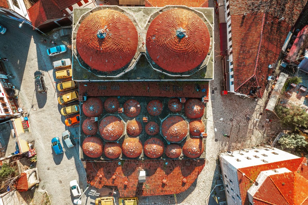
When you capture a standard drone photograph, the image contains inherent geometric distortions. Buildings appear to lean outward from the center of the frame, terrain variations shift the apparent position of features, and scale changes from the center to the edges of the image. A single orthorectified aerial image — called an orthophoto — corrects these distortions for one frame. An orthomosaic extends this to hundreds or thousands of frames, seamlessly stitched together to cover an entire site.
The practical difference is significant. A standard aerial photo might look visually appealing but is unsuitable for measurement. An orthomosaic map, by contrast, is a measurement-ready deliverable that can be loaded into any GIS or CAD platform as a georeferenced raster. This makes orthomosaics the standard output for drone mapping workflows in construction, public safety, surveying, and infrastructure inspection.
What is an orthomosaic image and how is it different from a regular aerial photo?
An orthomosaic image is a single, geometrically corrected composite photograph created by stitching hundreds of overlapping aerial images or video frames together. Unlike a regular aerial photo, which distorts distances and angles due to camera tilt and terrain relief, an orthomosaic image is orthorectified so every pixel represents a consistent ground distance, making it measurable like a map.
Standard aerial photographs suffer from radial distortion near the frame edges and perspective distortion from the camera angle. Orthomosaic imagery eliminates these errors through a multi-step process: the software identifies matching features across overlapping captures, calculates the camera position for each frame, builds a 3D surface model of the terrain, and then projects each image onto that surface to remove distortion. The result is a single seamless image where a ruler placed anywhere on the map reads the correct ground distance. This entire pipeline is applied photogrammetry — the formal photogrammetry definition explains how overlapping images become measurable 3D geometry.
For teams generating orthomosaic imagery from drone video, SkyeBrowse produces a GeoTIFF orthomosaic as part of every processing job alongside the 3D point cloud and mesh. Photo-based platforms like Pix4D and DroneDeploy also produce orthomosaic images but require grid-flight capture and longer processing windows. See the aerial photogrammetry guide for a deeper comparison of capture methods.
How is an orthomosaic created?
Orthomosaic creation follows three stages: aerial capture with sufficient image overlap, photogrammetric or videogrammetric processing to align frames and extract ground geometry, and orthorectification to apply terrain corrections and stitch the images into a single georeferenced output. The final deliverable is typically a GeoTIFF file compatible with ArcGIS, QGIS, AutoCAD, and similar platforms.
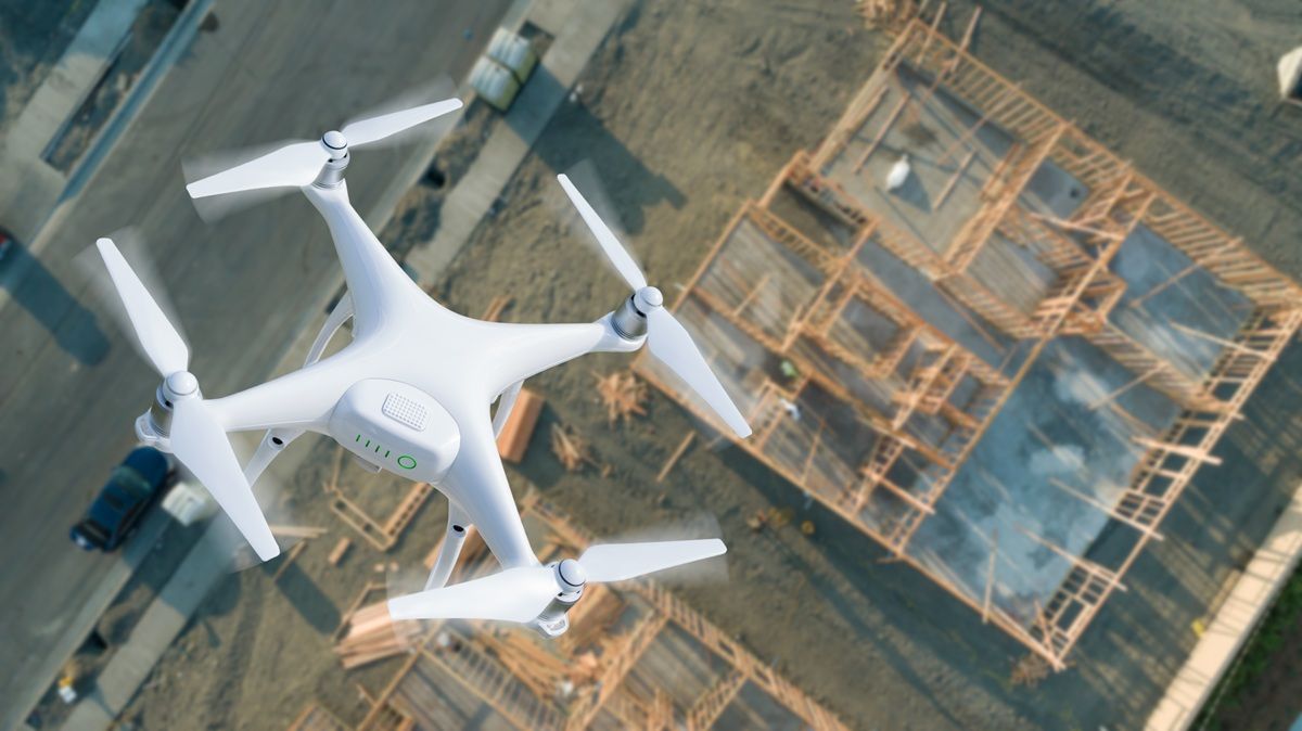
The capture phase requires a grid flight collecting still photos with 70-85% overlap, or — in videogrammetry workflows — a continuous video flight. As documented by the USGS unmanned aircraft systems program, sufficient image overlap is critical: too little results in gaps or stitching errors in the final orthomosaic.
During processing, the software identifies matching features across overlapping frames, reconstructs a 3D terrain model, and uses that geometry to project each image onto a flat plane at consistent scale. The mosaic is tagged with geographic coordinates from the drone's GPS data and optionally refined with ground control points for higher absolute accuracy. For a deeper look at capture considerations, see the oblique vs nadir capture comparison.
SkyeBrowse uses videogrammetry to automate this pipeline in the cloud, returning both a GeoTIFF orthomosaic and a 3D model (OBJ/LAZ) from a single drone video upload at app.skyebrowse.com.
What are orthomosaics used for?
Orthomosaics serve any application that requires spatially accurate aerial imagery: construction site monitoring, accident and crime scene documentation, infrastructure inspection, insurance claims, agricultural field analysis, and environmental surveys. Because they carry real-world coordinates, orthomosaics can be layered with other GIS datasets — property boundaries, utility lines, zoning overlays — for combined spatial analysis.
In public safety, law enforcement and fire departments use orthomosaics to document crash scenes, fires, and disaster areas with precise spatial context. SkyeBrowse processes video from a single drone flight into a georeferenced orthomosaic and a 3D model simultaneously, giving agencies an immediate base layer for measurement and analysis. In construction, engineers compare orthomosaics captured weeks apart to track earthwork, verify grading against design plans, and document as-built conditions. In surveying and infrastructure, orthomosaics produced at known accuracy levels meet ASPRS Positional Accuracy Standards for Digital Geospatial Data, which define acceptable horizontal and vertical error thresholds for professional mapping deliverables. For a full breakdown of how drone mapping software fits into these workflows, see our software guide.
Which orthomosaic software should you use?
The right orthomosaic software depends on your capture method, speed requirements, and budget. Video-based cloud platforms produce orthomosaics in minutes from a single drone flight. Photo-based desktop applications offer higher-resolution outputs for large-area surveys but require a GPU workstation and hours of processing time.
| Platform | Input | Processing | Orthomosaic Output | Best For |
|---|---|---|---|---|
| SkyeBrowse | MP4/MOV video | Cloud, 2-10 min | GeoTIFF | Rapid site documentation, public safety, insurance |
| Pix4D | Photos (200-500+) | Desktop, 1-12 hrs | GeoTIFF | Large-area surveys, agriculture |
| DroneDeploy | Photos | Cloud, 1-4 hrs | GeoTIFF, tiles | Construction fleet management |
| OpenDroneMap | Photos | Self-hosted | GeoTIFF | Budget-conscious, open-source preference |
| Agisoft Metashape | Photos | Desktop, 2-8 hrs | GeoTIFF | Academic research, archaeology |
For a broader comparison of drone processing platforms, see the drone mapping software guide. Teams evaluating free options should also review our free drone mapping software comparison.
What accuracy standards apply to orthomosaic mapping?
Orthomosaic accuracy is described in terms of ground sample distance (GSD) — the real-world size of each pixel — and horizontal positional accuracy, typically expressed as root mean square error (RMSE) in inches or centimeters. Higher-altitude flights produce larger GSD and lower resolution. Adding ground control points significantly improves absolute accuracy for applications where measurements must be legally defensible.
GSD is the fundamental accuracy driver. At 100 feet altitude, GSD is roughly 0.5 to 1 inch per pixel. At 400 feet (the FAA Part 107 ceiling for unwaivered operations), GSD increases to around 2 inches per pixel. Ground control points anchor the mosaic to surveyed coordinates for applications where measurements must be legally defensible.
SkyeBrowse's processing tiers scale to different accuracy requirements: Lite provides documentation-grade output (2-6 inch relative accuracy); Premium reaches up to 8K resolution (0.25 inch accuracy) for construction measurement; and Premium Advanced supports up to 16K resolution with sub-0.1 inch accuracy for forensic and courtroom applications.
What is the best orthomosaic software?
The best orthomosaic software depends on whether speed or maximum resolution is the priority. SkyeBrowse delivers orthomosaics in minutes from drone video with no desktop hardware, making it the fastest option for field-deployed teams. Pix4D and Agisoft Metashape offer the highest resolution outputs for large-area photogrammetric surveys but require GPU workstations and multi-hour processing.
SkyeBrowse is a cloud-based videogrammetry platform that processes drone video into GeoTIFF orthomosaics and 3D models at app.skyebrowse.com. The workflow requires no desktop hardware — upload the video, and the orthomosaic is ready for download within minutes. GeoTIFF exports are compatible with ArcGIS, QGIS, and AutoCAD. A single orbit flight replaces the planned grid mission required for photo-based mapping. For a detailed comparison of orthomosaic vs 3D model outputs for different applications, see orthomosaic vs 3D model.
Photo-based alternatives include Pix4D, Agisoft Metashape, and DroneDeploy. These produce high-resolution orthomosaics from grid-flight photo sets but require a GPU workstation and 1-12 hours of processing. Open-source tools like OpenDroneMap and WebODM provide free processing with self-hosted infrastructure.
See our full drone mapping software guide for a side-by-side breakdown of leading orthomosaic software options.
FAQ
What file format does an orthomosaic use?
The standard output format is GeoTIFF — a TIFF file with embedded geographic coordinate data compatible with ArcGIS, QGIS, AutoCAD Civil 3D, and most other GIS or CAD platforms. SkyeBrowse exports orthomosaics as GeoTIFF from its cloud processing pipeline.
How does orthomosaic mapping differ from 3D mapping?
Orthomosaic mapping produces a 2D georeferenced image. 3D mapping produces a point cloud, mesh, or model with height data. Both outputs can be generated from the same drone flight using SkyeBrowse. For guidance on when each output type is more appropriate, see our drone 3D mapping guide.
For the latest developments in orthomosaic mapping and photogrammetry technology, see our photogrammetry news roundup.