Construction sites change daily, and traditional survey crews struggle to keep pace with drone construction monitoring demands. 3D mapping with drone video compresses a half-day survey into a 10-minute flight, delivering georeferenced models and orthomosaics while the crew moves to the next task. SkyeBrowse converts continuous drone footage into measurable 3D site models through videogrammetry — no flight planning software, no photo grids, and no multi-hour desktop processing.
Key Takeaways
- SkyeBrowse processes video at 1:1 speed — a 5-minute site flyover returns a model in about 5 minutes, compressing a half-day survey into a 10-minute flight plus 10-minute processing window.
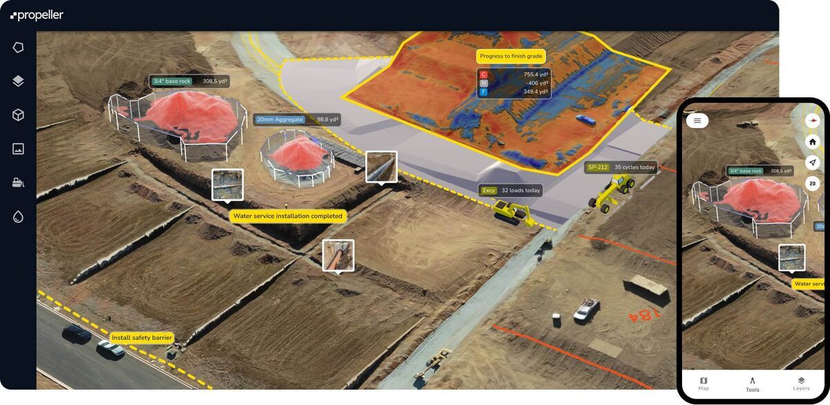
- A single MP4 upload produces orthomosaics, LAZ point clouds, and GLB meshes suitable for GIS overlays, engineering review, and stakeholder walkthroughs.
- Direct cost per survey drops from approximately $360 (four hours of two-person crew) to under $25 with a single drone operator.
- Premium delivers 0.25-inch accuracy for routine volume takeoffs; Premium Advanced provides 0.1-inch accuracy with AI moving object removal for bid disputes and final as-builts.
- AWS GovCloud storage with 5-year retention and audit trails supports warranty claims and construction disputes that arise years after project close-out.
Contents
- Why Do Construction Teams Use Drone 3D Mapping?
- How Does Video-to-3D Replace Traditional Survey Workflows?
- What Accuracy Do You Need for Volume Calculations?
- How Does Secure Documentation Work for Multi-Year Projects?
Why Do Construction Teams Use Drone 3D Mapping?
Videogrammetry lets a single operator capture an entire construction site with continuous drone footage and receive a georeferenced 3D model in minutes. That speed advantage compounds across weekly progress checks and multiple active sites.
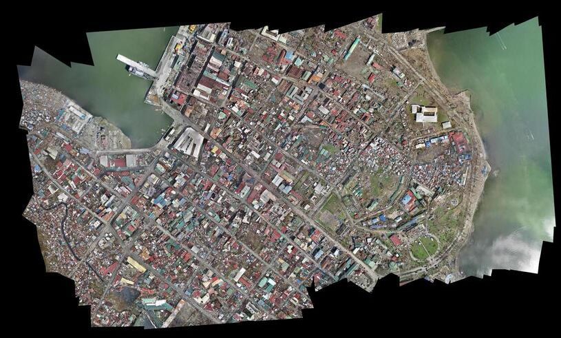
Traditional photogrammetry requires grid flight plans and hundreds of overlapping photos, plus hours of desktop processing. With SkyeBrowse, a single video pass covers the site, and cloud processing finishes while the team drives to the next job. The same capture supports orthomosaics for GIS overlays, LAZ point clouds for engineering review, and GLB meshes for stakeholder walkthroughs — all from one MP4 uploaded through Universal Upload.
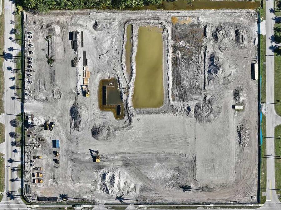
Subcontractors need cut/fill calculations by end-of-day. Weather limits flight windows. When earthwork volumes are available the same morning, project managers approve haul-offs immediately instead of waiting days for survey reports. Faster approvals mean fewer idle days and tighter schedules.
How Does Video-to-3D Replace Traditional Survey Workflows?
SkyeBrowse processes video at roughly 1:1 speed — a 5-minute site flyover returns a model in about 5 minutes. The resulting LAZ point cloud and GeoTIFF orthomosaic import directly into Civil 3D, Trimble Business Center, or any GIS platform for volume takeoffs and grading verification.
Traditional surveying sends a two-person crew to the site for half a day, then waits for office processing before numbers are available. A drone operator completes the same task in a 10-minute flight and 10-minute processing window. Cost comparison: four hours of crew time at loaded rates runs $360 or more, while one operator with a drone finishes for under $25 in direct costs.
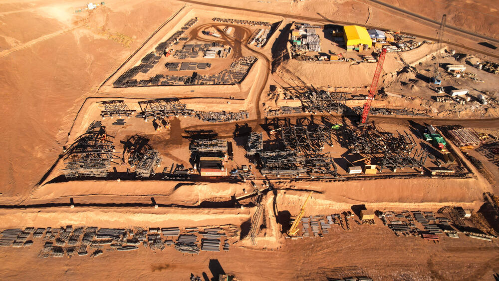
For stockpile measurements, fly an orbit around the pile. For large sites, fly a grid pattern and upload as a single video. SkyeBrowse handles both without additional configuration. The same workflow applies to foundation inspections, roofing audits, and facade progress checks — one video file becomes a measurable 3D record.
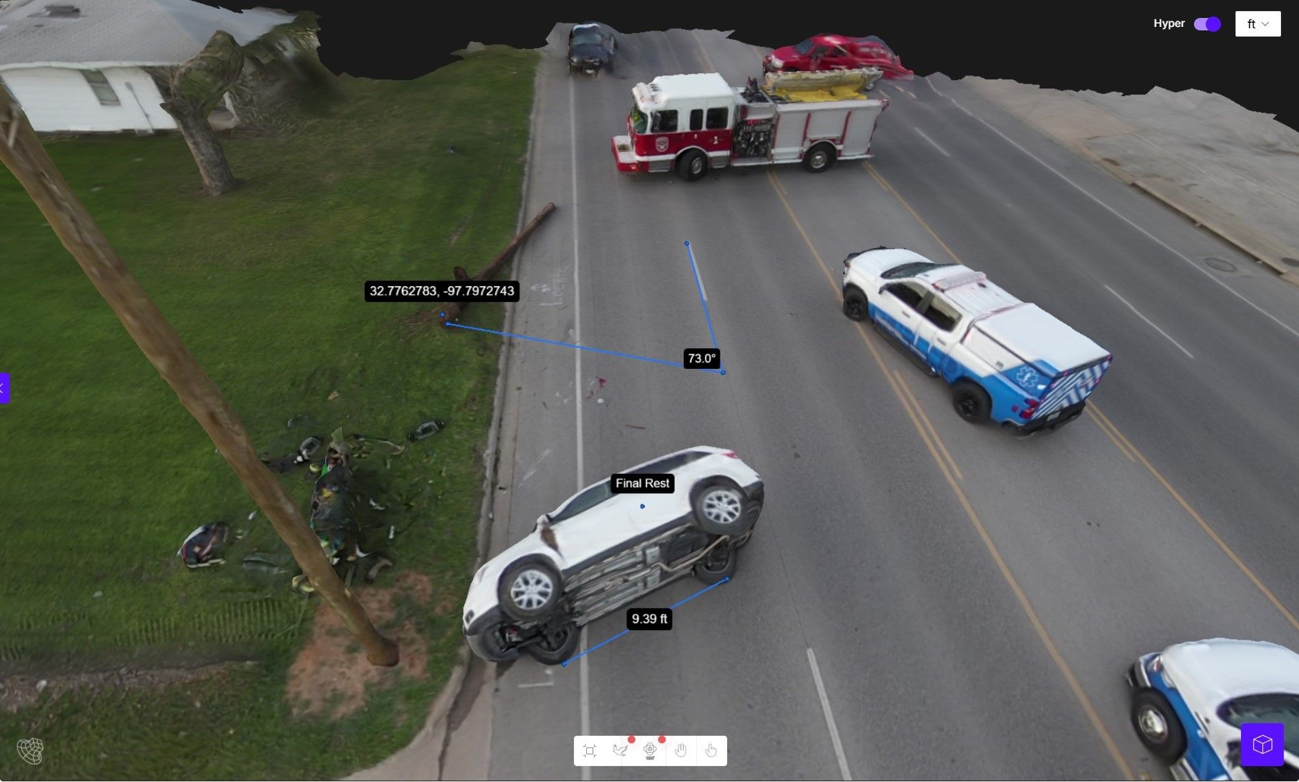
Fly the same pattern monthly, stack models in sequence, and visualize grading progress over time. That temporal record resolves disputes faster than comparing static survey points and provides long-term value when tenant improvements require as-built drawings years later.
What Accuracy Do You Need for Volume Calculations?
SkyeBrowse offers three accuracy tiers so construction teams can match processing quality to the job. Most general contractors use Premium for routine site monitoring; tighter-tolerance work calls for Premium Advanced.
Premium delivers 0.25-inch accuracy at 8K resolution — suitable for volume takeoffs, grading verification, and monthly progress documentation where relative accuracy meets project needs.
Premium Advanced provides 0.1-inch accuracy at 16K resolution with AI-powered moving object removal. This tier is appropriate when bidding disputes require third-party verification or when tight tolerances matter for concrete pours and final as-builts.
Lite offers 2-6 inch relative accuracy for quick reference models where speed outweighs precision. It works for early-stage site walkthroughs and stakeholder briefings before exact measurements are critical.
All tiers export LAZ point clouds, GLB meshes, and GeoTIFF orthomosaics. QA teams check the point cloud, project managers review the orthomosaic, and estimators calculate volumes from the same dataset.
How Does Secure Documentation Work for Multi-Year Projects?
AWS GovCloud (US) hosting keeps project data secure. Premium tiers include audit trails, controlled sharing, and 5-year data retention — critical when construction projects span multiple years or warranty claims require historical documentation.
Project owners review models in any web browser without installing specialized software. Subcontractors access shared models via web links without managing file transfers or version control. Chain of custody is straightforward: upload timestamp, processing log, export record. If disputes arise later, the audit trail shows exactly when the model was captured and who accessed it.
Subcontractor coordination improves when everyone references the same base model. Upload once, share the link, and let trades measure their own areas without requesting custom survey shots. Quality control becomes proactive — compare this week's grading model against design surfaces and catch deviations before concrete is poured.
Get a SkyeBrowse Quote
If construction progress tracking and volume calculations need to happen faster, SkyeBrowse provides the workflow and accuracy tiers to match your site conditions.