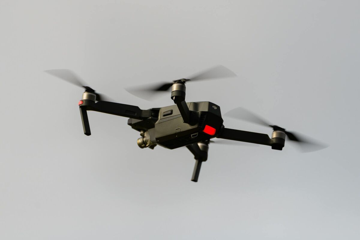
Drone HOA inspection is the practice of using an unmanned aerial vehicle to document residential properties, common areas, and shared structures on behalf of a homeowner association. Where a traditional walk-through requires scheduling access and produces only photographs taken from ground level, a drone inspection captures every rooftop, fence line, and amenity area from above in a single flight — giving community managers a complete aerial record of the property's condition. Videogrammetry, the science of generating 3D spatial geometry from continuous video, lets platforms like SkyeBrowse convert that footage into a shareable 3D model within minutes of landing.
Key Takeaways
- A drone HOA inspection captures every rooftop, fence line, and amenity area from above in a single flight — closing the visibility gap that ground-level walk-throughs cannot address.
- SkyeBrowse processes drone video into a shareable 3D model in 2 to 10 minutes, allowing a community manager to inspect dozens of properties in one morning with same-day documentation ready.
- Drone inspections are used for covenant compliance, storm damage triage, insurance claims documentation, and dispute resolution — producing timestamped records that handwritten notes cannot match.
- All commercial HOA drone operations require a FAA Part 107 Remote Pilot Certificate, and associations must comply with applicable state drone privacy laws before launching an inspection program.
- SkyeBrowse is used by more than 1,200 agencies and organizations for aerial documentation workflows, with a cloud-based architecture requiring no desktop hardware for model review.
Contents
- What is a drone HOA inspection and why do associations use them?
- What property issues can a drone inspection identify?
- How does drone video turn into a usable HOA inspection record?
- How does drone inspection support storm damage and insurance claims?
- Can HOA use drones for inspections? Legal and regulatory considerations
- FAQ
What is a drone HOA inspection and why do associations use them?
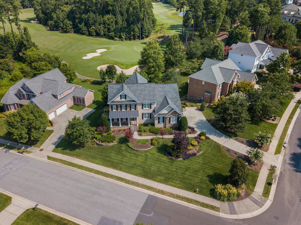
A drone HOA inspection uses a remotely piloted aircraft to photograph and video-record properties, rooftops, and common amenities that an association manages. Associations use them to reduce the time and cost of manual compliance walks, create timestamped visual records for dispute resolution, and document conditions before and after significant weather events.
Traditional HOA compliance inspections rely on a manager walking or driving the community, photographing violations from the street. Roofs — one of the most common sources of insurance claims and neighbor disputes — are nearly invisible from ground level. According to the Community Associations Institute (CAI), roofing and exterior maintenance are among the top maintenance categories in community association budgets.
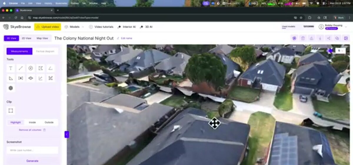
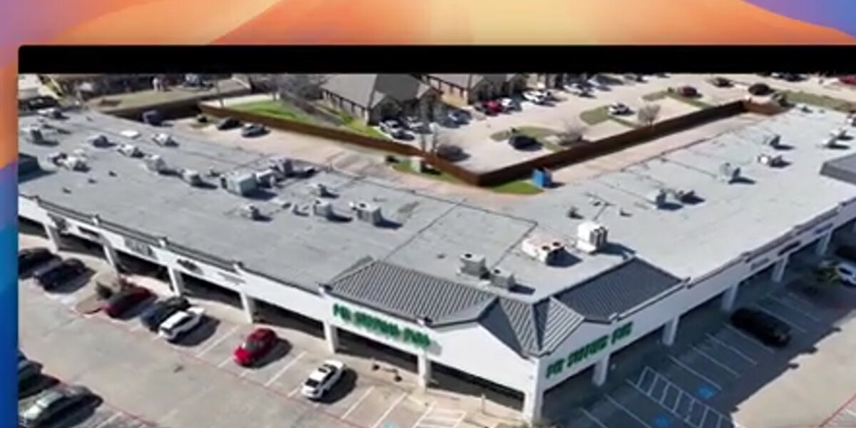
A drone inspection closes that visibility gap. The pilot flies an orbit around each building, capturing high-resolution video of the entire roof plane, gutters, flashing, and any attached structures. For a community with dozens of units, a single morning of drone flights produces more usable documentation than weeks of manual walkthrough scheduling. See our drone roof inspection guide for capture best practices.
What property issues can a drone inspection identify?
Drone property inspection from above reveals conditions that are invisible or difficult to assess from ground level. Common findings include missing or curling shingles, damaged gutters, unauthorized rooftop equipment, overgrown common-area landscaping, pool deck cracking, fence damage, and unpermitted structures that may violate CC&Rs.
Associations enforce covenant compliance across a wide range of visual conditions. Drones enable systematic coverage of all of them:
- Roof condition: Missing shingles, ponding water, flashing separation, and moss growth are visible from directly above but not from the street.
- Exterior paint and siding: Faded, peeling, or non-compliant colors show clearly in high-resolution aerial video.
- Landscaping: Overgrown vegetation, dead trees overhanging common areas, and prohibited structures like large sheds are easy to identify.
- Amenity areas: Pool surrounds, tennis courts, playground equipment, and parking lots can all be surveyed in a single pass for surface damage or safety concerns.
- Storm damage triage: After a hail or wind event, a drone can prioritize which properties need contractor visits before a single roofer is dispatched. For a systematic look at how aerial data supports condition scoring and claim documentation, see our roof assessment guide.
How does drone video turn into a usable HOA inspection record?
The pilot uploads the video file — in .MP4 or .MOV format — to a cloud videogrammetry platform like SkyeBrowse. The platform processes the frames into a georeferenced 3D model that community managers can navigate, annotate, and share without any desktop hardware. No photogrammetry expertise or specialized software installation is required.
The workflow for a drone HOA inspection with SkyeBrowse has three steps:
- Capture: A Part 107-certified pilot flies an orbit around each building, recording continuous video. The SkyeBrowse Flight App automates the orbit path on supported drones, but any camera that outputs .MP4 or .MOV video works through Universal Upload.
- Process: The video is uploaded to app.skyebrowse.com. Cloud processing generates a 3D model in 2 to 10 minutes at SkyeBrowse's Lite tier, which delivers approximately 2 to 6 inch relative accuracy — sufficient for covenant compliance documentation and insurance records.
- Share: The completed model is accessible via a shareable link. A community manager can annotate specific roof sections, add notes for the board, and archive the record alongside the homeowner's account.
For communities that need precision measurements — exact square footage of a damaged area, for example — SkyeBrowse's Premium tiers offer up to 8K resolution and sub-inch accuracy. See our drone 3D mapping guide for a full explanation of processing tiers.
How does drone inspection support storm damage and insurance claims?
After a storm, a drone HOA inspection creates a same-day visual record of every damaged roof and common area structure. That timestamped documentation — submitted as a 3D model or as exported video — gives the association's insurer objective evidence of the damage scope, reducing claim disputes and accelerating adjuster approvals.
Hail and wind events affect dozens of units simultaneously. Without aerial documentation, associations rely on contractor estimates and homeowner photographs that may be incomplete or taken days after the event. A drone flown within hours of a storm captures the full damage footprint before cleanup alters any evidence.
SkyeBrowse's cloud platform exports models in formats accepted by most insurance adjusters, and the video source file itself serves as a time-stamped record. For associations managing master policies that cover all roofs under one umbrella, this documentation accelerates the claims process for the entire community rather than requiring each homeowner to file separately. For more on this workflow, see our insurance claims documentation guide.
Can HOA use drones for inspections? Legal and regulatory considerations
Homeowner associations can use drones for inspections provided the operation follows FAA regulations and complies with applicable state privacy laws. All commercial drone operations in the United States require a Part 107 Remote Pilot Certificate. Several states have enacted laws limiting drone surveillance over private property, so associations should review their state's statutes before beginning a drone inspection program.
The FAA Part 107 rule governs all commercial drone operations in the United States. Associations contracting with a drone services company should confirm the pilot holds a valid Part 107 certificate. The National Conference of State Legislatures tracks state-level drone privacy laws, which vary significantly — some states require notice before flying over residential property, others restrict data retention periods.
HOA boards budgeting for a drone inspection program can reference the drone roof inspection cost guide for typical per-property pricing and software overhead benchmarks.
Best practices for HOA drone inspection programs:
- Notify homeowners in advance via community newsletter or board notice.
- Restrict inspections to common areas and building exteriors visible from above; avoid capturing interior spaces or private yards at low altitude.
- Retain video and 3D model records in a secure, access-controlled system.
- Document the legal basis for the inspection in the association's governing documents.
SkyeBrowse is used by more than 1,200 agencies and organizations for aerial documentation workflows. Its cloud-based architecture means no desktop hardware is required — a community manager can review a completed 3D model on a tablet the same morning the drone flight occurs.
FAQ
Can HOA use drones for inspections?
Yes, provided the operation uses a Part 107-certified pilot and complies with applicable state drone privacy laws. Associations should review their CC&Rs and state statutes before launching a drone inspection program, and should notify homeowners in advance of scheduled flights.
What can a drone see during an HOA inspection?
A drone can capture roof surface condition, missing or displaced shingles, pooling water, HVAC placement, fence integrity, landscaping compliance, pool area condition, and storm damage to common structures. Video-based processing software converts this footage into a 3D model that managers can review and annotate without scheduling a second visit.
How long does a drone HOA inspection take?
A single-property drone inspection typically takes 10 to 20 minutes of flight time. With SkyeBrowse, the video processes into a shareable 3D model within 2 to 10 minutes. A community manager can inspect dozens of properties in a single morning and have complete documentation ready the same day.
What is the difference between a home inspection drone and a traditional home inspection?
A home inspection drone captures exterior and rooftop conditions from above, providing aerial perspective and enabling videogrammetry-based 3D documentation. A traditional home inspection covers interior systems including electrical, plumbing, and HVAC — areas a drone cannot assess. For HOA purposes, drone inspections complement rather than replace licensed home inspectors.
How does drone property inspection data get stored and shared?
Through SkyeBrowse, completed 3D models are hosted in the cloud at app.skyebrowse.com and accessible via shareable link. Associations can grant board members, insurers, or property managers view access without transferring large files. Models are archived and timestamped for record-keeping.