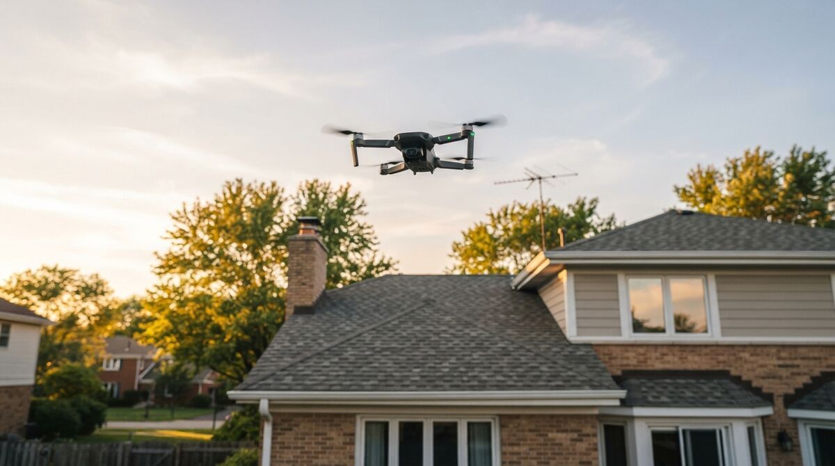
DJI Mini 5 Pro mapping is very doable, and the short answer to the question everyone asks is yes: the Mini 5 Pro can make measurable 3D models. It carries the first 1-inch sensor in a sub-250g drone, which means cleaner footage for photogrammetry, the practice of measuring real geometry from overlapping imagery. SkyeBrowse turns that footage into 3D through videogrammetry, which reconstructs geometry from video frames rather than triggered stills. The one thing to know up front is that the Mini 5 Pro is not on the SkyeBrowse Flight App supported list, so you fly the capture manually and upload the video afterward. This guide walks through the exact workflow, the georeferencing step, and what the bigger sensor buys you.
Key Takeaways
- The DJI Mini 5 Pro maps well through manual capture plus Universal Upload; it is not on the SkyeBrowse Flight App supported list, so automated flight is unavailable.
- Its 1-inch (Type 1) 50MP sensor shoots up to 8192 by 6144 stills, the first drone under 250 grams with a sensor this large.
- Uploading the .SRT video caption file auto-georeferences the model, placing it on the map without ground control.
- Ground sample distance is close to the Mini 4 Pro at any altitude because both use a 24mm-equivalent lens; the real win is low-light and dynamic-range quality.
- Without RTK, expect visual-grade results, roughly 2 to 6 inches of relative accuracy on SkyeBrowse Lite.
Contents
- Can the DJI Mini 5 Pro do mapping?
- Is the Mini 5 Pro supported by the SkyeBrowse Flight App?
- How do you map with the Mini 5 Pro?
- What does the 1-inch sensor mean versus the Mini 4 Pro?
- What mapping accuracy can you expect?
- FAQ
Can the DJI Mini 5 Pro do mapping? {#can-map}
Yes, the DJI Mini 5 Pro can do mapping. It shoots stable 4K video and 50MP stills from a 1-inch sensor, which is everything a videogrammetry engine needs to build a measurable 3D model. Because it is not on the SkyeBrowse Flight App supported list, you fly the orbit manually and then upload the footage rather than running automated capture.
The Mini 5 Pro pairs a 1-inch (Type 1) 50MP CMOS sensor with a 24mm-equivalent f/1.8 lens, a maximum still resolution of 8192 by 6144 pixels, a takeoff weight of 249.9 grams, and up to 36 minutes of flight time, per specifications reported by DPReview. That sensor is the headline: it is the first Type 1 chip in an ultralight drone, and larger sensors capture cleaner light, which photogrammetry rewards with less noise and better feature matching. For the full landscape of mapping tools, see the drone mapping app roundup.
Is the Mini 5 Pro supported by the SkyeBrowse Flight App? {#support}
No. As of now the DJI Mini 5 Pro is not on the SkyeBrowse Flight App supported list, so automated orbit and grid capture are unavailable. You still map with it by flying the pattern manually and using Universal Upload, which accepts any .MP4 or .MOV from any drone. Compatibility changes, so confirm the current status on the supported drones page.
This is worth stating plainly so you plan correctly. The Flight App automates capture only for specific aircraft and controller combinations, and the Mini 5 Pro is not among them today. That does not block mapping at all; it simply means the flight is on you rather than the app. Always check the SkyeBrowse supported drones page before a job, because DJI releases and SDK updates shift the list over time. If you want automated orbit capture in the same tiny form factor right now, the DJI Mini 4 Pro mapping workflow covers the supported-controller path.

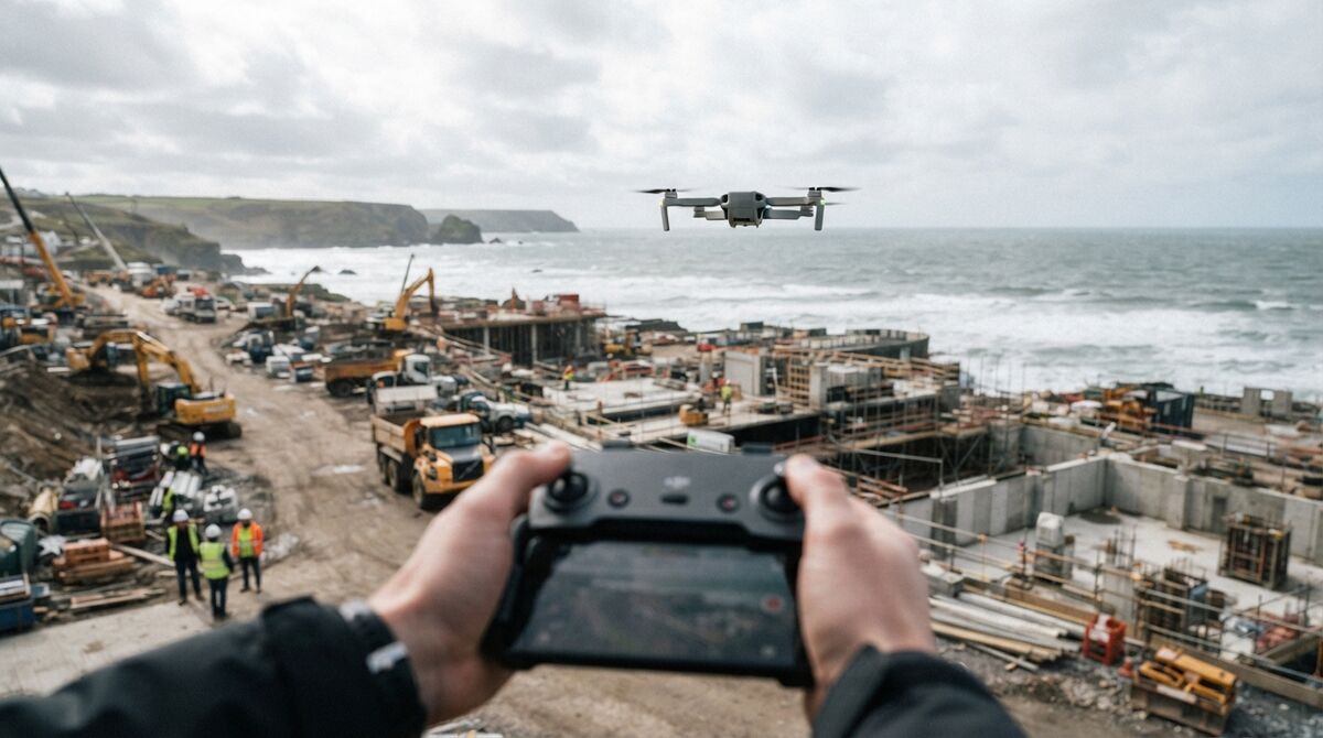
How do you map with the Mini 5 Pro? {#workflow}
Fly two slow orbits around the subject at a 45-degree camera tilt, keep the motion smooth, and lock the zoom. For a larger site add a grid pass over the top, then finish with an orbit. Enable video caption recording so the .SRT log is written, then upload the .MP4 and .SRT together at app.skyebrowse.com. The cloud builds the model in minutes.
Manual capture is a rhythm, not a guess. Circle the subject twice at a steady speed, tilt the camera down about 45 degrees for small scenes, and avoid pointing large amounts of sky into the frame. Slow, smooth motion keeps every frame sharp, which is what videogrammetry needs to lock features together. Before you fly, turn on the video subtitle or caption setting so the drone writes its GPS track to a .SRT file; feeding that file to SkyeBrowse georeferences the finished model automatically. The step-by-step is in how to make a 3D model with a drone. For sites that push past what a mini airframe handles well, the mini drone surveying guide explains where to stop.
What does the 1-inch sensor mean versus the Mini 4 Pro? {#sensor}
The Mini 5 Pro's 1-inch sensor mainly improves low-light performance and dynamic range, so frames stay cleaner at dawn, dusk, and in shade. Ground sample distance at a given altitude is close to the Mini 4 Pro because both use a 24mm-equivalent lens, so the ground detail per pixel is similar. The upgrade you feel is image quality, which helps feature matching and model cleanliness.
It helps to separate two ideas. Ground sample distance, the real-world size of one pixel, is driven by focal length, sensor pixel count, and altitude. Since the Mini 5 Pro and Mini 4 Pro share a 24mm-equivalent lens and similar pixel widths, their per-pixel ground detail tracks closely, shown below using the equivalent focal length. What the larger sensor changes is how much clean signal each pixel carries, which is why the Mini 5 Pro holds up better in marginal light. That cleaner signal reduces noise-driven errors in the reconstruction.
| Altitude | Mini 5 Pro GSD | Read |
|---|---|---|
| 40 m | 0.73 cm/px | Roof and facade detail |
| 60 m | 1.10 cm/px | General site documentation |
| 80 m | 1.46 cm/px | Wide-area context |
What mapping accuracy can you expect? {#accuracy}
Without RTK or ground control points, the Mini 5 Pro produces visual-grade models. On SkyeBrowse Lite that is roughly 2 to 6 inches of relative accuracy, suitable for roof work, site documentation, and small-scene 3D. Survey-grade absolute accuracy still requires ground control or an RTK aircraft, which the Mini 5 Pro does not carry.
For most inspection and documentation jobs, relative accuracy is what matters, and the Mini 5 Pro's clean frames help SkyeBrowse resolve edges and surfaces tightly. Georeferencing from the .SRT file gives good map placement for context, but it is not a substitute for surveyed control if you need certified coordinates. The American Society for Photogrammetry and Remote Sensing publishes the positional accuracy standards that professional deliverables reference, and hitting the tighter tiers means adding ground control. Used within its class, the Mini 5 Pro is a capable, pocketable mapping tool that starts free.

FAQ
Can the DJI Mini 5 Pro do mapping?
Yes. The Mini 5 Pro can map even though it is not on the SkyeBrowse Flight App supported list. Fly a slow manual double orbit at a 45-degree tilt, record the video caption file for GPS, then upload the .MP4 and .SRT through Universal Upload at app.skyebrowse.com and the 3D model builds in minutes.
Is the DJI Mini 5 Pro on the SkyeBrowse supported drones list?
No. As of now the DJI Mini 5 Pro is not on the SkyeBrowse Flight App supported list, so automated capture is unavailable. You still map with it by flying manually and using Universal Upload. Check skyebrowse.com/supported-drones for the latest status, since compatibility changes.
Does the Mini 5 Pro one-inch sensor improve 3D models over the Mini 4 Pro?
The larger Type 1 sensor mainly helps in low light and dynamic range, giving cleaner frames at dawn, dusk, and in shade. Ground sample distance at a given altitude is close to the Mini 4 Pro because both use a 24mm-equivalent lens, so the biggest gain is image quality rather than raw resolution on the ground.