Drone construction programs give general contractors, owners, and project managers timely, accurate aerial documentation without the cost of manned aircraft or ground survey crews. By using unmanned aircraft systems (UAS) to photograph, video, and map active job sites, construction teams replace slow manual processes with same-day data. Videogrammetry — extracting 3D geometry from video footage rather than still photos — has made drone construction workflows faster and more practical than ever for small-to-mid-size GCs. This guide explains how construction firms use drone services for weekly progress monitoring, as-built records, cut-and-fill analysis, and stakeholder reporting, and why SkyeBrowse is the fastest video-to-3D platform for teams that want results without hiring GIS staff.
Key Takeaways
- Construction drone services deliver weekly aerial progress records, as-built orthomosaics, and 3D models that replace manual photo logs and sporadic survey visits.
- SkyeBrowse's video-to-3D workflow requires only a standard .MP4 or .MOV flight video — no specialized photogrammetry flight plans or expensive lidar hardware.
- Premium tier accuracy reaches approximately 0.25 inch (8K processing), enabling reliable as-built comparisons against design plans for mid-size commercial and infrastructure projects.
- FAA Part 107 certification is required for all commercial construction drone operations in the United States; operators should verify airspace authorizations before each flight.
- Drone-generated orthomosaics (georeferenced aerial images corrected for camera tilt and terrain) and 3D point clouds can be exported as GeoTIFF and LAZ files for import into AutoCAD, Revit, or GIS platforms.
Contents
- What do construction drone services actually deliver?
- How does drone construction monitoring work on a job site?
- Drone Construction ROI in 2026
- What construction drone software do contractors use to process aerial data?
- How are drone-generated models used for as-built documentation?
- How can small contractors afford construction drone services?
- FAQ
What do construction drone services actually deliver?
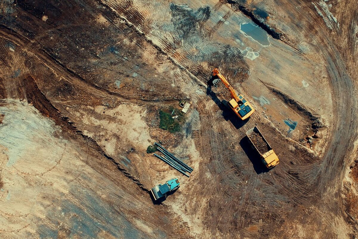
Construction drone services produce four core deliverables: georeferenced orthomosaics (top-down aerial maps), 3D point clouds or mesh models of the site, cut-and-fill volumetric calculations, and timestamped progress photos tied to GPS coordinates. These outputs replace manual photo logs, reduce the frequency of expensive ground surveys, and give project managers an aerial record they can review remotely.
An orthomosaic is a georeferenced, distortion-corrected aerial image assembled from hundreds of overlapping drone frames — the construction equivalent of a satellite image, but captured at much higher resolution and on demand. A 3D point cloud adds elevation data, letting engineers compare current earthwork elevations against design grades and calculate material volumes without sending a survey crew to the site.
Timestamped progress documentation is particularly valuable for contract compliance and dispute resolution. The OSHA Construction Industry Standards (29 CFR 1926) do not mandate aerial documentation, but owners and general contractors increasingly specify it in project agreements as a risk management tool. Having a weekly aerial record of site conditions, material stockpile volumes, and completed work protects all parties if schedule delays or change-order disputes arise.
For infrastructure projects such as road widening or utility corridors, cut-and-fill maps derived from drone surveys help earthwork contractors verify that excavation and fill quantities match contract estimates before final billing.
How does drone construction monitoring work on a job site?
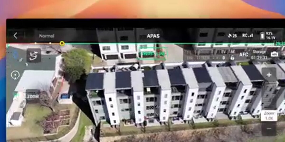
Drone construction monitoring on a job site typically follows a fixed weekly or bi-weekly schedule negotiated between the service provider and the general contractor. A Part 107-certified pilot arrives at the site, flies a preprogrammed grid or orbit pattern, and uploads the flight video to cloud processing software. The service provider then shares a link to the processed 3D model or orthomosaic with the project team — usually the same day. Professional drone service agreements specify the deliverable format, turnaround window, data retention period, and escalation path if weather or airspace restrictions force a reschedule. No surveying equipment is deployed, and the pilot's time on site is usually under 30 minutes for most mid-size commercial projects.
The flight pattern chosen depends on the deliverable needed. Nadir (straight-down) grid flights are efficient for generating flat orthomosaics used in progress reports and subcontractor coordination drawings. Oblique or orbit passes add facade and elevation data, which is essential for multi-story structure documentation. Many contractors run a quick nadir pass for weekly reports and schedule a more thorough oblique capture monthly for as-built comparison.
Pilots operating commercially must hold a FAA Part 107 Remote Pilot Certificate and check airspace authorizations before each flight using tools such as the FAA's UAS Data Delivery System. Sites near airports or in controlled airspace require LAANC (Low Altitude Authorization and Notification Capability) authorization, which can be obtained in minutes through approved apps.
SkyeBrowse's construction progress monitoring workflow accepts standard .MP4 or .MOV video from any compatible drone, eliminating the need for purpose-built mapping drones. Drone service providers using SkyeBrowse deliver same-day 3D site models — video captured in the morning becomes a measurable deliverable by lunch. That turnaround allows providers to schedule multiple site visits in a single day and still deliver processed outputs to each client before end of business, which changes the unit economics of running a drone service operation.
Drone Construction ROI in 2026
For mid-size general contractors, drone construction programs deliver measurable returns across four categories: survey time, labor cost, rework prevention, and safety incidents. A fleet of one or two drones paired with cloud processing software typically pays back within three to six months — often on the avoided cost of a single rework event.
Survey time. A ground survey crew covering a 5-acre active site typically requires four to eight hours of field time plus one to two days of office processing before deliverables reach the project manager. A drone construction survey of the same site takes 20–40 minutes of flight time and produces processed orthomosaics and 3D models the same day through platforms like SkyeBrowse. That represents a 70–90% reduction in total survey cycle time — enough to shift from monthly surveys to weekly cadences without adding headcount.
Labor cost. Third-party survey crews for mid-size commercial projects bill $800–$2,500 per visit depending on scope and mobilization distance. An in-house drone operator using a consumer-grade aircraft and a cloud subscription delivers equivalent documentation for $99–$199 per processed model. For a GC running eight active sites and ordering monthly surveys, the shift to in-house drone construction can reduce survey spend by $60,000–$150,000 annually.
Rework prevention. Industry research consistently shows that construction rework consumes 5–15% of total project costs. Drone-generated as-built comparisons — run against design drawings at each major milestone — catch out-of-tolerance work while correction is still cheap. Catching a misaligned footing during framing might cost a few hours of labor to fix; catching the same error at punch list can trigger structural remediation costing tens of thousands. Regular drone construction documentation does not eliminate rework, but it shortens the detection window enough to meaningfully reduce its cost.
Safety incident reduction. Sending survey crews onto active sites with heavy equipment introduces exposure that drone construction surveys eliminate. With drones handling documentation passes, crews spend less time in high-traffic equipment zones. OSHA recordable incident rates in construction average 2.5–3.0 per 100 workers per year — and even a modest reduction in site exposure hours contributes to lower incident frequency and the associated workers' compensation and project delay costs.
Payback period. A typical starter kit — one commercial-grade drone ($1,500–$3,000), Part 107 certification for one operator (~$150 exam fee), and an annual cloud processing subscription — carries an all-in first-year cost of roughly $3,000–$5,000. For a GC that was previously ordering four third-party survey visits per month at $1,000 per visit, that spend is recovered in five to six weeks of in-house operations.
Traditional Survey vs Drone Construction Survey
| Traditional Ground Survey | Drone Construction Survey | |
|---|---|---|
| Time per site | 4–8 hrs field + 1–2 days processing | 20–40 min flight + same-day processing |
| Cost per visit | $800–$2,500 | $99–$199 (in-house) |
| Positional accuracy | Survey-grade (±0.1 in with GCPs) | 0.1–2 in depending on tier and GCPs |
| Safety risk | Crew exposed to active site traffic | Pilot maintains safe separation from equipment |
What construction drone software do contractors use to process aerial data?
Most construction drone software platforms — including Pix4D, DroneDeploy, and SkyeBrowse — use photogrammetry or videogrammetry algorithms to reconstruct 3D geometry from overlapping aerial images or video frames. The key differences are processing speed, hardware requirements, accuracy tier, and cost per deliverable. SkyeBrowse processes video directly in the cloud with no desktop workstation required, making it practical for contractors who don't have dedicated GIS staff.
Photogrammetry reconstructs 3D scenes from still photographs by identifying common feature points across overlapping images — a process that typically requires structured grid flights with 70–80% image overlap. Videogrammetry, the method used by SkyeBrowse, extracts frames directly from continuous video, which means pilots do not need specialized flight planning apps or precise overlap settings. This makes videogrammetry more forgiving for general contractors who want usable data without hiring a specialist.
Export formats matter for downstream workflows. SkyeBrowse outputs GeoTIFF orthomosaics, LAZ point clouds, and GLB 3D meshes — all standard formats that import directly into AutoCAD Civil 3D, Revit, Bentley MicroStation, and Esri ArcGIS. For teams already using 3D mapping for construction workflows, this compatibility eliminates conversion steps and keeps project data in familiar tools.
Data security is a practical concern for any drone service provider working on private or sensitive job sites. Site imagery, survey models, and proprietary site layouts need appropriate access controls. SkyeBrowse stores project data on secure cloud infrastructure with project-level access controls, so general contractors can share deliverables with specific team members or subcontractors without exposing the full site archive to all parties.
How are drone-generated models used for as-built documentation?
Drone as-built documentation compares a 3D model of the completed or in-progress structure against the original design drawings or BIM model to identify deviations before they become costly change orders. A drone-generated point cloud can be overlaid on design geometry in AutoCAD or Revit, flagging areas where construction is out of tolerance with color-coded deviation maps. This process, which once required days of ground-based laser scanning, now takes a single flight and a few hours of processing.
As-built surveys have traditionally been performed at project closeout, but drone workflows enable continuous as-built verification throughout construction. Catching a footing poured 6 inches out of position during framing is far less expensive than discovering the error at final inspection. Regular drone surveys tied to construction milestones — slab on grade, structural steel erection, exterior envelope completion — create a defensible, timestamped record that supports owner acceptance and lien waiver processes.
For detailed guidance on structuring a drone as-built program, see drone as-built documentation. SkyeBrowse's Premium tier achieves approximately 0.25-inch accuracy with 8K processing, and the Premium Advanced tier reaches approximately 0.1-inch accuracy with 16K processing and AI-based moving object removal — sufficient for most commercial construction tolerance requirements.
Owners and general contractors on larger projects can pair drone as-built records with ground control points (GCPs) — physical survey markers with known coordinates placed around the site — to anchor the drone model to a surveyed coordinate system. This raises absolute accuracy to survey-grade levels and makes the model legally defensible for contract documentation purposes.
How can small contractors afford construction drone services?
Small and mid-size contractors can afford construction drone services either by hiring a third-party drone service provider on a per-visit basis, or by equipping an in-house employee with a consumer drone and a pay-per-model cloud processing subscription. A typical drone service provider charges $300–$600 per site visit for mapping, plus travel and mobilization fees that add up quickly on multi-site schedules. Teams processing in-house with SkyeBrowse reduce per-model cost to $99–$199 per deliverable — keeping documentation affordable enough to run at every construction milestone rather than just at scheduled service intervals.
The economics of in-house drone programs have improved dramatically as consumer drones capable of high-quality video have dropped below $2,000. A DJI Mini 4 Pro or Mavic 3 Classic can produce flight video sufficient for SkyeBrowse Lite processing (approximately 2–6-inch accuracy), which is adequate for progress photo documentation and rough volumetric estimates. Premium processing using a DJI Mavic 3E or similar higher-resolution platform delivers the tighter tolerances needed for formal as-built comparison.
For contractors who prefer to outsource the flying, a growing network of FAA Part 107 pilots offers on-demand construction site drone services in most metropolitan areas. The construction drone software component remains the same — pilots deliver processed orthomosaics and 3D models rather than raw video, and project managers review deliverables through a browser-based viewer with no software installation required.
Regardless of whether a contractor uses in-house or third-party drone services, the value is clearest when drone data replaces activities that already consume budget: monthly survey visits, weekly photo documentation walks, and reactive measurement requests when subcontractor work is questioned. For a tool-by-tool breakdown of platforms suited to this workflow, see the best construction progress monitoring tools comparison. Most firms that track their time find that even one avoided survey visit per month covers the annual cost of a drone subscription.

FAQ
How much do construction drone services cost?
Construction drone service pricing varies widely based on site size, deliverable type, and frequency. A single-visit aerial survey for a small commercial site can cost $500–$1,500, while ongoing monthly progress monitoring programs for mid-size projects typically run $1,000–$3,000 per month. Firms using in-house drones with cloud software like SkyeBrowse can reduce per-model costs to as low as $99–$199 per 3D deliverable at skyebrowse.com/pricing-premium.
What drone is best for construction site mapping?
The DJI Mavic 3E and DJI Phantom 4 RTK are popular choices for construction site mapping because they combine portability with high-resolution sensors and RTK GPS for accurate georeferencing. SkyeBrowse supports a wide range of consumer and enterprise drones — see the full list at skyebrowse.com/supported-drones. Any drone capable of recording .MP4 or .MOV video can submit footage for cloud 3D processing, including the DJI Mini series and Autel EVO platforms.
Do I need a Part 107 license to fly a drone for construction?
Yes. In the United States, commercial drone operations — including construction site documentation — require a FAA Part 107 Remote Pilot Certificate. Operators must also comply with airspace authorizations, site-specific waivers, and any local regulations. The FAA UAS Data Delivery System provides current airspace data to support compliant flight planning. Non-commercial recreational flights follow a separate recreational flyer rules framework and are not permitted for paid construction documentation work.
Is drone construction worth the investment in 2026?
Yes — for most mid-size general contractors, a 1–2 drone fleet paired with cloud software pays back within months (often a few weeks for crews replacing recurring third-party survey visits). Drone construction surveys cut site survey time by 70–90%, reduce labor costs, and catch punch-list errors early. The avoided cost of a single rework event or missed change-order claim typically covers the annual program budget.