Real estate drone marketing has shifted from a luxury add-on to a practical listing tool that agents use to shorten sales cycles and differentiate properties in crowded markets. Videogrammetry — the process of converting continuous video footage into dimensionally accurate 3D models — lets a single agent produce a navigable real estate 3D virtual tour within minutes of completing a walkthrough, without hiring a specialized photographer or renting scanning equipment. This guide explains how the workflow operates, what resolution tiers to choose for different property types, and where drone-based marketing pays off most for buyers, sellers, and agents alike.
Key Takeaways
- A 5-minute interior walkthrough video can return a navigable 3D property model in approximately the same amount of time — same-day listing materials without scheduling a photographer.
- Listings with 3D virtual tours and drone footage receive significantly more online views and longer session durations than photo-only listings, according to National Association of Realtors research.
- SkyeBrowse accepts video from smartphones, drones, and action cameras, so agents can capture both interior walkthroughs and exterior aerials with gear they already own.
- Premium Advanced 16K models render architectural finishes — crown molding, custom tilework, designer fixtures — crisply enough for out-of-state buyers to evaluate craftsmanship without traveling.
- In-house capture eliminates the $300–$800 per-property cost of outsourced 3D scanning services, making immersive tours practical for every price tier — not just luxury listings.
Contents
- Why is drone marketing effective for real estate listings?
- How does videogrammetry turn a walkthrough into a 3D virtual tour?
- Which resolution tier fits different property types?
- How do agents share and embed 3D property models?
- Where does real estate drone marketing pay off beyond residential sales?
- FAQ
Why is drone marketing effective for real estate listings?
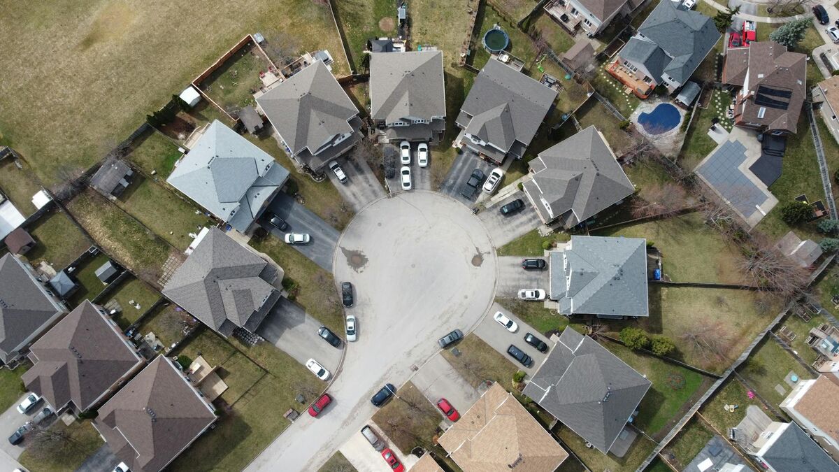
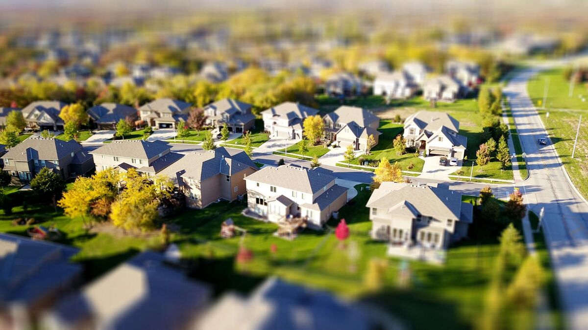
Drone photography and 3D virtual tours give buyers spatial context that flat images cannot — they convey scale, neighborhood position, roof condition, landscaping, and room proportions in a single browsing session. The result is a qualified, better-informed buyer who asks more targeted questions and wastes less time on in-person visits to properties that don't fit their actual needs.
The National Association of Realtors' technology surveys consistently show that buyers start their search online and rely heavily on visual content to filter properties before contacting an agent. A listing backed by aerial drone footage and an interactive 3D tour holds attention longer on listing portals, which drives higher click-through rates and more showing requests. The FAA's commercial UAS operations guidelines outline Part 107 requirements that agents or hired drone pilots must follow — straightforward compliance for daytime residential missions.
Beyond click-through rates, drone marketing benefits the seller's side of the transaction. Accurate 3D models reduce the number of unqualified showings. A buyer who has already rotated through the living room, measured the master suite, and assessed the backyard from the aerial view is substantially more motivated when they arrive in person. Agents who offer drone marketing as a standard listing service also win more seller consultations, because the visual portfolio differentiates them from competitors who deliver only static photography.
For background on how aerial capture produces accurate spatial data, see our guide to aerial mapping.
How does videogrammetry turn a walkthrough into a 3D virtual tour?
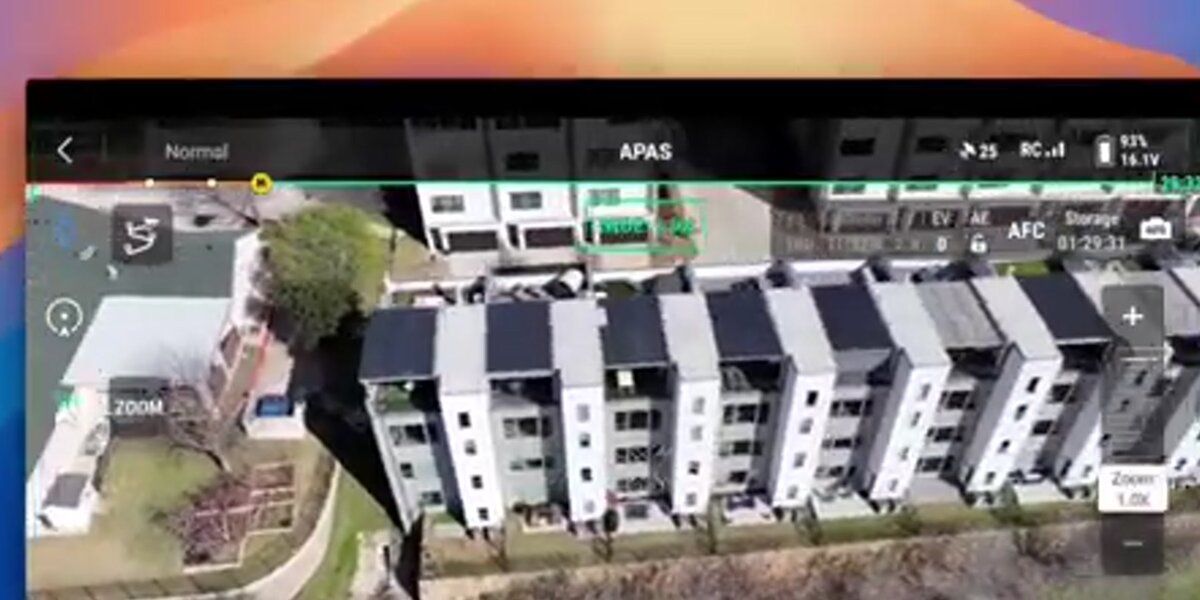
Videogrammetry extracts thousands of overlapping frames from a continuous video and uses computer vision algorithms to calculate the position and depth of every visible surface, then stitches the result into a navigable 3D mesh. The agent uploads the video file, and the platform handles the heavy computation in the cloud — no desktop processing hardware required.
SkyeBrowse accepts .MP4 and .MOV files uploaded through the Universal Upload portal at app.skyebrowse.com. For interior walkthroughs, a smartphone mounted on a gimbal stabilizer produces the smooth, overlap-rich footage the algorithm needs. For exterior capture — rooflines, landscaping, lot boundaries — a drone flight provides a top-down and oblique perspective that reveals features invisible from ground level. Agents who already own a DJI or Autel drone can pair the telemetry file (.SRT for DJI, .ASS for Autel) with the video upload to improve georeferencing without ground control points.
Processing speed tracks closely to video length. A 5-minute interior walkthrough typically returns a completed model in about 5 minutes. The output is a GLB mesh (3D model), an orthomosaic (flat aerial map), and optionally a LAZ point cloud for high-precision workflows. The GLB format is compatible with popular listing platforms and embeds directly into brokerage websites without format conversion.
For agents new to drone capture, our complete how-to guide for making a 3D model with a drone covers flight planning, altitude settings, and overlap ratios that produce the best model quality.
Which resolution tier fits different property types?
SkyeBrowse offers three processing tiers: Lite (2–6 inch relative accuracy) for fast overviews of land and commercial properties, Premium (8K, 0.25 inch accuracy) for standard residential listings, and Premium Advanced (16K, 0.1 inch accuracy with AI moving-object removal) for luxury estates where fine architectural detail drives buyer decisions.
For most residential listings in the $400K–$1.5M range, the Premium tier delivers more than sufficient visual quality. Room dimensions are accurate enough for buyers to test furniture placement, and the 8K resolution renders paint colors, flooring materials, and fixture styles clearly. Premium Advanced at 16K is a meaningful upgrade for high-end properties: custom millwork, designer lighting, and stone tile patterns render with enough fidelity that remote buyers can genuinely evaluate craftsmanship without traveling to the property.
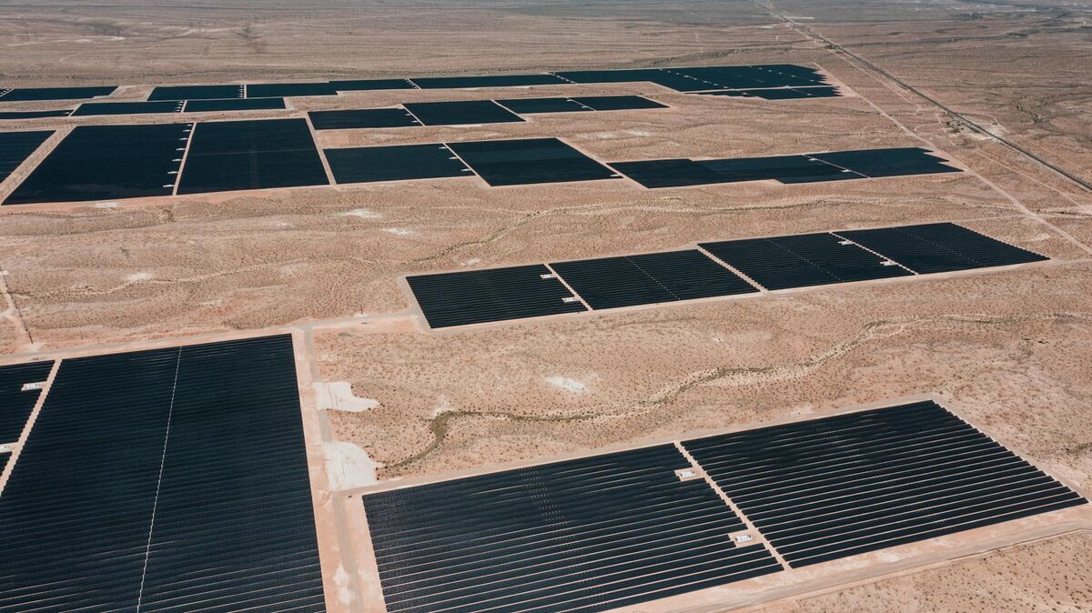
Lite processing serves a different use case: investors evaluating land parcels, commercial tenants assessing warehouse or retail square footage, and property managers conducting rapid condition surveys across a portfolio. The faster processing cycle — and the lower per-model cost — makes it practical to run a model on every property in a portfolio rather than reserving 3D capture for standout listings.
All three tiers produce models viewable in a standard browser. Premium and Premium Advanced models also support VR viewing through Apple Vision Pro and Meta Quest headsets, which opens the door to fully immersive property tours for out-of-state and international buyers who cannot visit in person.
The comparison between what an orthomosaic versus a 3D model conveys to buyers is worth reviewing if you are deciding which output to lead with in your listings.
How do agents share and embed 3D property models?
Models hosted on SkyeBrowse's cloud infrastructure share via a direct link or an embed code that drops into MLS listings, brokerage websites, and email campaigns. No software installation is required on the buyer's end — they click the link and navigate the property instantly from any browser or device.
Controlled access options let agents restrict model viewing to pre-qualified leads or set temporary access windows during the showing period. For off-plan and pre-construction sales, developers can grant buyers link access to track construction progress over time — the same drone flight that documents a pour also becomes a marketing touchpoint that builds buyer confidence between milestones.
AWS infrastructure handles model hosting, which means load times remain consistent regardless of where the buyer is browsing. A buyer in Japan viewing a listing in Phoenix gets the same responsive experience as a local buyer. That reliability matters for international real estate transactions, relocation purchases, and luxury markets where overseas buyers represent a significant share of closings.
Property managers also use the sharing workflow for tenant turnover documentation. A before-and-after model pair creates a timestamped record of unit condition that resolves security deposit disputes faster and with less friction than photographs alone. Our article on drone roof inspection shows how the same capture workflow extends to exterior condition documentation that agents can share with buyers before offers are submitted.
Where does real estate drone marketing pay off beyond residential sales?
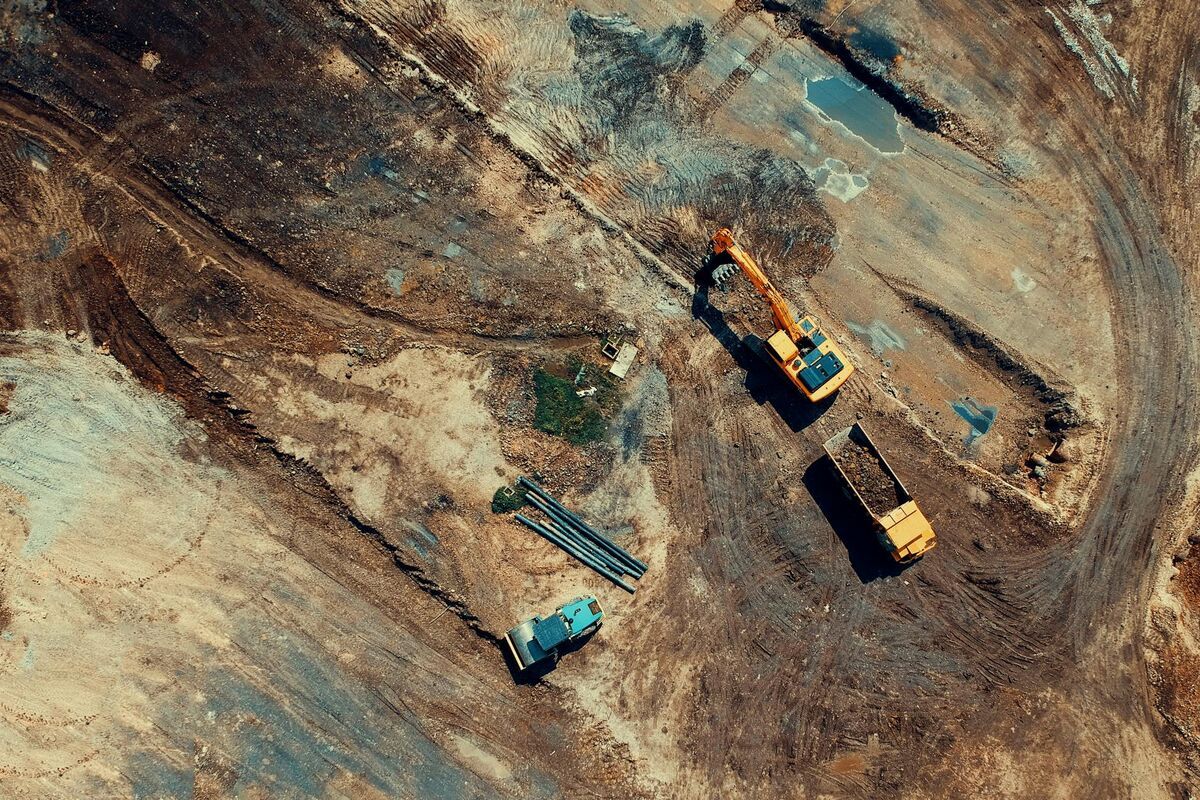
Commercial real estate, vacation rentals, land transactions, and property management portfolios all generate strong returns from drone-based 3D documentation — in many cases larger returns than residential sales, because the decision-making cycle is longer, remote review is more common, and unqualified site visits are more costly.
For commercial leasing, a 3D model of an industrial space, retail unit, or office floor allows prospective tenants to assess column spacing, ceiling clearance, loading dock access, and HVAC placement before committing to a site visit. Brokers report that tenants who tour a 3D model first ask more specific and actionable questions when they arrive, shortening negotiation cycles.
Land sales benefit from the aerial perspective in a way that ground-level photography cannot replicate. Topography, drainage patterns, access road locations, and proximity to utilities read clearly in a drone-captured orthomosaic. Buyers assessing buildability or agricultural suitability get the spatial context they need without multiple field visits. For a deeper look at how aerial data transforms land documentation, see our guide to aerial photogrammetry.
Vacation rental operators use 3D tours to increase booking conversion. Guests who explore a property in detail before reserving cancel less often and arrive with realistic expectations — both of which improve review scores. Portfolio property managers use the same capture workflow to audit condition across dozens of units in a single day, then share the model library internally for maintenance scheduling and capital planning.
Real estate photographers who add videogrammetry to their service menu can double their deliverable count without doubling shoot time. The same property visit that generates standard listing photos also produces video footage for 3D processing — two products from one appointment.
FAQ
What is a real estate 3D virtual tour and how is it different from a photo slideshow?
A real estate 3D virtual tour is an interactive, navigable model of a property that lets buyers rotate views, measure rooms, and explore spatial flow at their own pace. Unlike a photo slideshow, the 3D model preserves accurate geometry so buyers can judge ceiling heights, room proportions, and how spaces connect — all without a site visit. SkyeBrowse produces these models from standard video footage in minutes, not the hours that traditional scanning hardware requires.
Do I need a drone to create a 3D virtual tour with SkyeBrowse?
No. SkyeBrowse accepts video from smartphones, action cameras, and drones. For interior walkthroughs, a smartphone on a gimbal stabilizer produces smooth footage suitable for 3D processing. A drone is most useful for exterior aerials, large estates, or land parcels where coverage area exceeds what a ground-level walkthrough can capture. Agents often use both: a smartphone for interior rooms and a drone for the exterior, uploading both as separate models or combining coverage in one session.
How does real estate drone marketing help sell homes faster?
Listings with drone photography and 3D virtual tours attract significantly more online views and longer session durations than photo-only listings, based on National Association of Realtors research. Buyers arrive at showings better informed and more motivated, which reduces the number of visits needed before an offer and shortens average days on market. The effect is strongest for unique properties, large lots, and homes with standout exterior features that static photos fail to convey at scale.
What resolution tier does SkyeBrowse recommend for luxury real estate?
Premium Advanced is the right choice for luxury properties. It produces 16K resolution models with 0.1 inch accuracy and includes AI moving-object removal that cleans up footage captured in occupied, furnished homes. Architectural finishes — custom cabinetry, stone countertops, hand-laid tile — render with enough detail for remote buyers to evaluate craftsmanship without traveling. For standard residential listings, Premium (8K, 0.25 inch) covers the vast majority of use cases at a lower per-model cost.