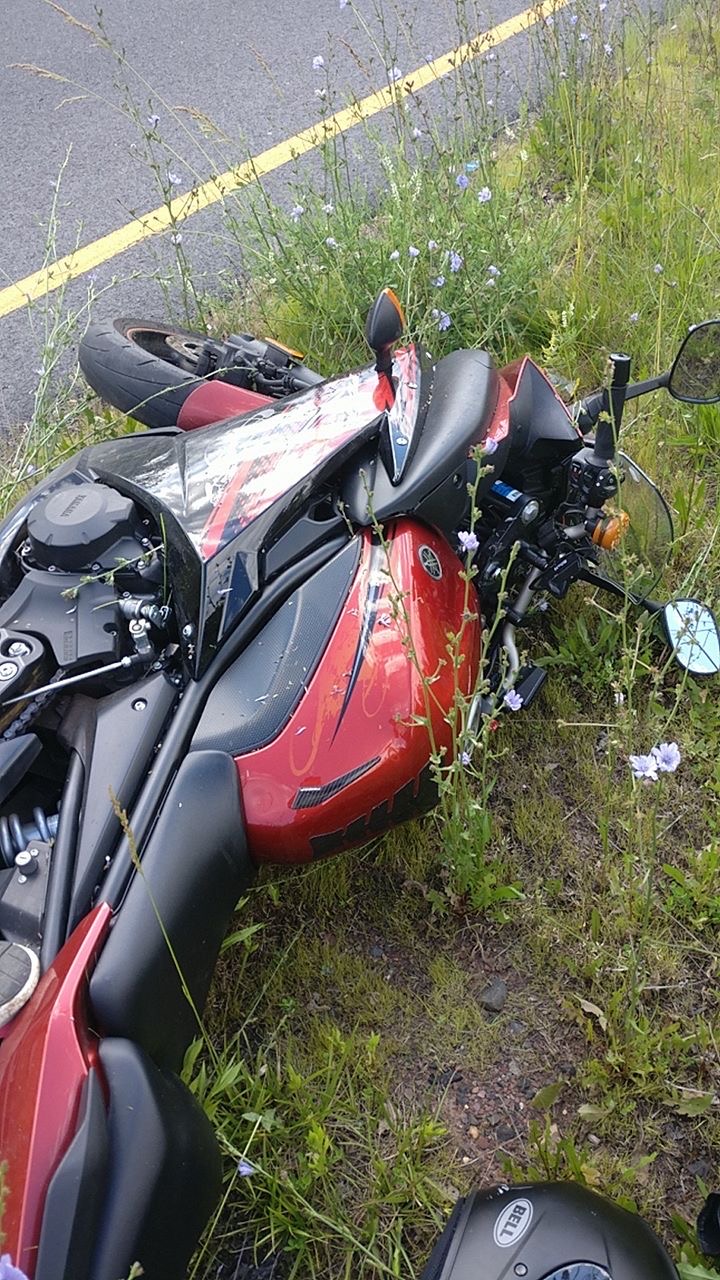
Most public safety innovations begin with a technical idea, a budget cycle, or a procurement need. SkyeBrowse began differently. It started with a real crash, a long recovery, and one difficult question: why does accident reconstruction still keep officers in dangerous roadways for hours?
That question came after Bobby Ouyang's motorcycle accident in 2017. What he saw from the hospital was not just personal fallout from a crash. He saw first responders still on scene hours later, working through a process that was thorough but slow. That moment connected his Rutgers videogrammetry research to a field problem that agencies across the country face every day.
Key Takeaways
- SkyeBrowse was founded after CEO Bobby Ouyang observed first responders spending hours on-scene after his own 2017 motorcycle accident, exposing a systemic inefficiency in accident reconstruction.
- The platform grew directly from Ouyang's videogrammetry research at Rutgers University, connecting academic work to a real field problem.
- Videogrammetry can reduce scene documentation from roughly 3 hours with 4 officers to about 10 minutes with 1 officer, cutting per-event cost from $360 to $25.
- Universal Upload accepts standard .MP4 and .MOV files from existing department hardware, eliminating the need for specialized equipment.
- Before adopting any 3D mapping platform, agencies should evaluate five areas: capture flexibility, processing speed, evidence quality, CJIS security compliance, and training overhead.
Contents
- Why This Story Matters for Public Safety Leaders
- The Accident That Exposed a Critical Gap
- Turning Videogrammetry Research Into Field Operations
- How SkyeBrowse Changed Accident Reconstruction Workflows
- What Agencies Should Evaluate Before Adopting 3D Mapping
- Related Reading for Public Safety Teams
- Build a Faster, Safer Scene Documentation Program
Why This Story Matters for Public Safety Leaders
Accident reconstruction is one of the most important responsibilities in public safety, and one of the most resource-intensive. Agencies need precise documentation for investigations, insurance claims, and court proceedings. At the same time, every extra minute on a roadway increases risk to officers and delays traffic restoration for the public.
Traditional workflows often require multiple personnel on scene for extended periods. Agencies commonly move from about 3 hours with 4 officers to roughly 10 minutes with 1 officer when using video-based 3D documentation. The cost impact is also significant, with scene documentation dropping from around $360 to about $25 per event.
For command staff and reconstruction teams, this is more than a technology upgrade. It is an operational safety decision that affects staffing, response coverage, and evidence quality.
The Accident That Exposed a Critical Gap
After his 2017 crash, Bobby Ouyang expected a standard emergency response timeline. Instead, he learned that responders remained at the scene for hours to manually document and reconstruct the incident. That observation changed the direction of his work.
At the time, he was already focused on videogrammetry research at Rutgers University — work that would eventually help SkyeBrowse raise a $2.3M seed round to bring the technology to market. He understood how continuous video could capture dense scene data that still images often miss in fast-moving environments. The challenge was turning that research into a workflow that patrol and traffic units could run under real field conditions.
The core insight was simple: if capture and processing could be streamlined enough for regular officers, agencies could protect evidence quality and reduce exposure time at the same time.
Turning Videogrammetry Research Into Field Operations
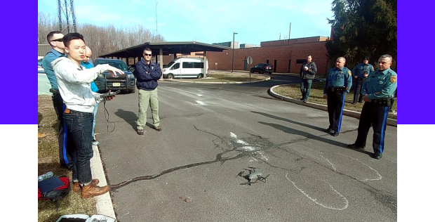
SkyeBrowse developed around one practical requirement: any trained officer should be able to document a scene quickly with equipment already available to the department. That is why Universal Upload supports standard .MP4 and .MOV files from drones, phones, body-worn cameras, and 360 cameras.
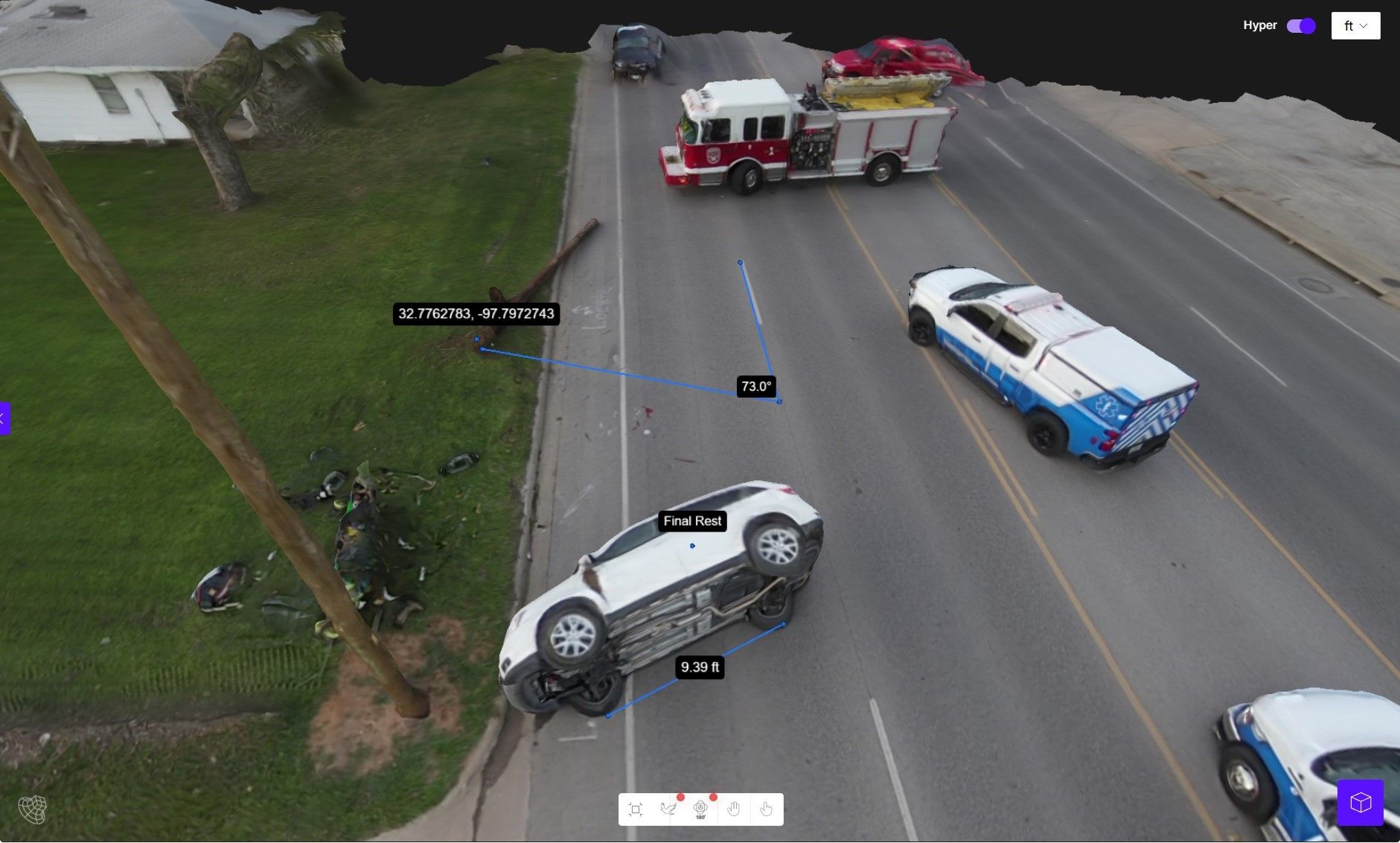
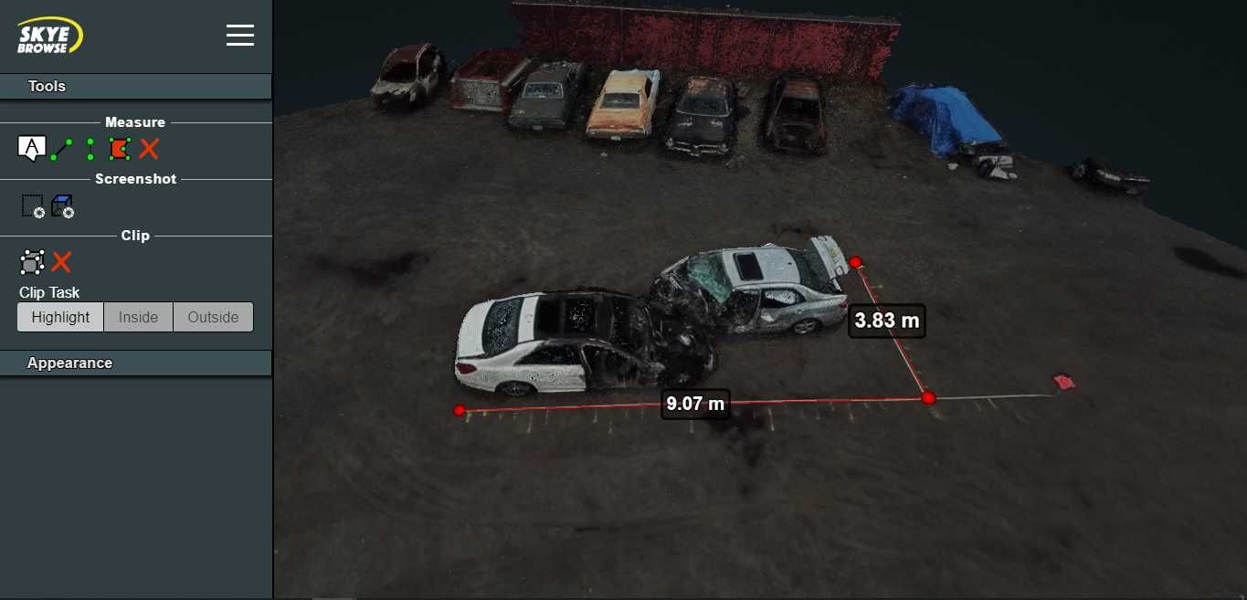
On the processing side, the platform's patented videogrammetry pipeline is designed around speed without sacrificing forensic detail. A common field expectation is close to a 1:1 processing ratio, about one minute of processing for one minute of video. This allows investigators, supervisors, and prosecutors to review scene models much sooner than traditional hand-measurement workflows.
For agencies that need higher precision and defensibility, SkyeBrowse Premium Advanced supports 16K output, 0.1 inch accuracy, and AI moving-object removal. Combined with CJIS-compliant workflows and AWS GovCloud infrastructure, the platform is aimed at departments that need operational speed and evidentiary rigor in the same system.
How SkyeBrowse Changed Accident Reconstruction Workflows
What started as a personal response to one crash evolved into a repeatable public safety process. Agencies now use SkyeBrowse to capture vehicle positions, roadway geometry, debris fields, and scene context in a short flight or walkthrough. Instead of waiting on lengthy manual mapping sessions, teams can generate interactive 3D models rapidly and continue analysis off-scene.
This changes daily operations in several ways:
- Fewer personnel tied up on long closures
- Faster scene clearance and reduced secondary traffic risk
- Better continuity between patrol, reconstruction, and prosecution teams
- More consistent documentation quality across shifts and experience levels
The wider impact is visible in how departments plan staffing and investigations. When documentation is predictable and fast, supervisors can keep more officers available for calls while still maintaining evidentiary standards.
What Agencies Should Evaluate Before Adopting 3D Mapping
The origin story is compelling, but agencies still need a disciplined evaluation process. Teams considering a 3D mapping platform should pressure-test five areas before rollout:
- Capture flexibility: Can officers use existing drone and camera hardware?
- Processing speed: How quickly can a usable model be delivered during active investigations?
- Evidence quality: Are resolution and accuracy sufficient for reconstruction and court use?
- Security and retention: Does the system align with CJIS requirements and long-term evidence storage needs?
- Training overhead: Can non-specialists follow the workflow reliably under field pressure?
SkyeBrowse's growth came from aligning product design to these operational questions, not from asking agencies to redesign their entire process around software constraints.
Build a Faster, Safer Scene Documentation Program
SkyeBrowse is a reminder that many public safety breakthroughs start with field reality, not theory. A single crash exposed a systemic delay in reconstruction. Videogrammetry turned that pain point into a faster workflow that helps agencies protect officers, preserve evidence, and restore normal operations sooner.
If your agency is reviewing modernization priorities for accident reconstruction, start with the workflows that carry the most risk and manpower burden. That is often where 3D documentation delivers the fastest return.