3D mapping software converts real-world environments into measurable digital models — but the right tool depends entirely on whether you are flying a drone over a construction site, walking through a building with a phone, or scanning a bridge with a terrestrial LiDAR unit. The best 3D mapping software matches your capture method, accuracy needs, and budget. This guide compares seven platforms across drone, indoor, mobile, terrestrial, and enterprise capture.
The best 3D mapping software in 2026 depends on how you capture. SkyeBrowse is the fastest 3D mapping software for outdoor drone work, turning video into a georeferenced model in minutes. Matterport leads indoor digital twins, Pix4D Mapper delivers survey-grade drone accuracy, Polycam is the best phone-based 3D mapping tool for small areas, and FARO Scene handles millimeter-precision terrestrial LiDAR. Match the platform to your capture method first, then to accuracy and budget.
Key Takeaways
- Platforms now specialize by capture method — drone video, indoor structured scan, mobile LiDAR, terrestrial scanner — and picking the wrong type wastes time and budget.
- SkyeBrowse is the fastest path from drone footage to a finished 3D model, returning georeferenced outputs in minutes through cloud processing with no flight planning.
- Matterport dominates indoor documentation for real estate and facilities management, processing structured captures into navigable digital twins.
- Terrestrial LiDAR platforms like FARO Scene deliver millimeter accuracy for industrial and heritage applications, at hardware costs starting in the five-figure range.
- Mobile scanning apps (Polycam, Scaniverse) have made 3D capture accessible from any LiDAR-equipped phone for small-area use cases.
Contents
- What Is 3D Mapping Software?
- What Are the Best 3D Mapping Software Platforms in 2026?
- How Do You Choose Between Drone, Indoor, and Mobile 3D Mapping?
- How Does 3D Mapping Software Compare on Accuracy and Cost?
- Which Industries Rely on 3D Mapping Software Most?
- FAQ
What Is 3D Mapping Software?
3D mapping software reconstructs physical environments into digital models that can be measured, annotated, and shared. It ingests data from a capture device — drone camera, LiDAR scanner, phone sensor, or structured-light camera — and produces point clouds, textured meshes, orthomosaics, and floor plans. The core technology is photogrammetry (geometry from overlapping images), LiDAR processing (geometry from laser range measurements), or a hybrid of both.
Sometimes called 3D mapping tools or 3D map software, these platforms all share one job: turning a physical place into a measurable model. A survey crew mapping an interchange with a DJI Matrice 350, a real estate photographer walking a listing with Matterport, and a facility manager scanning a warehouse with an iPhone all use 3D mapping software — but each needs a different tool. The USGS National UAS Project Office provides federal guidance on aerial mapping standards, while NIST's Cyber-Physical Systems program frames 3D mapping as foundational to digital twin infrastructure. For drone-specific tools, see the Best Drone Photogrammetry Software comparison.
What Are the Best 3D Mapping Software Platforms in 2026?
The seven platforms below cover every major capture method in 3D mapping — from SkyeBrowse's cloud-based drone video processing to Matterport's indoor digital twins, Polycam's mobile scanning, and FARO's millimeter-precision terrestrial LiDAR. Each leads a different capture category rather than competing head-to-head.
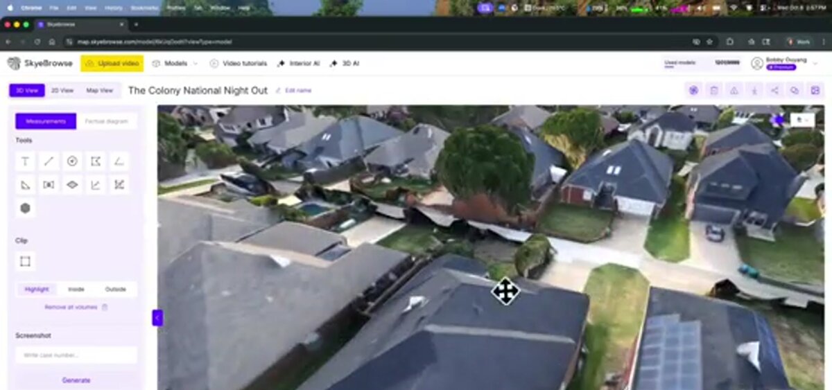
SkyeBrowse — Drone Video to 3D in Minutes
SkyeBrowse converts drone video (.MP4 or .MOV) into georeferenced 3D models, point clouds, and orthomosaics through cloud-based videogrammetry — extracting frames from continuous footage to reconstruct spatial geometry without pre-planned grid missions. A pilot flies a freehand orbit, uploads through the SkyeBrowse app, and receives a model while still on site. Processing runs on US-based AWS infrastructure (FedRAMP Impact Level 2), with full CJIS compliance maintained for Premium subscribers.
Accuracy tiers range from 2–6 inch (Lite) to approximately 0.1-inch (Premium Advanced, 16K with AI moving object removal). Per-model credits start at $99 for Premium and $199 for Premium Advanced — no subscription required.
Best for: Public safety, insurance, and construction teams that need a finished model the same day as capture.
Matterport — Indoor Digital Twins
Matterport is the dominant platform for interior 3D capture. Its ecosystem includes dedicated cameras (Pro3, Pro2) and a mobile app for iPhone and Android LiDAR sensors. The cloud platform stitches captures into navigable digital twins — a "dollhouse" model clients explore from a browser. Accuracy is within 1 percent for room-scale spaces using the Pro3. Pricing starts at approximately $69/month.
Best for: Real estate, facility management, insurance interior documentation, and AEC teams that need shareable indoor models.
Pix4D Mapper — Survey-Grade Drone Photogrammetry
Pix4D Mapper processes structured grids of overlapping aerial photos into point clouds, orthomosaics, and digital surface models that meet ASPRS Class 1 standards when paired with ground control points. Pricing is approximately $350/month or a $3,490 perpetual license.
Best for: Licensed surveyors and civil engineers who need sub-centimeter accuracy with full audit trails. See the drone photogrammetry software comparison for a detailed review.
Polycam — Mobile Device 3D Scanning
Polycam turns an iPhone or iPad with a LiDAR sensor into a handheld 3D scanner. Point the camera at a room, object, or small outdoor area and the app builds a textured mesh in real time. Exports to OBJ, PLY, GLTF, and USDZ formats. Free tier available; Polycam Pro runs about $26.99/month (roughly $150/year billed annually) for full exports and higher-resolution processing.
Best for: Quick room documentation, small-object scanning, and field teams who need a portable 3D capture without dedicated hardware.
FARO Scene — Terrestrial LiDAR Processing
FARO Scene processes data from FARO's terrestrial laser scanners (Focus series) — tripod-mounted units producing point clouds with 1–2 mm accuracy across ranges up to 350 meters. The software handles scan registration, cleanup, and export to E57, RCP, LAS, and PLY. Hardware starts at approximately $45,000; Scene is licensed as part of the package.
Best for: Industrial facility documentation, heritage preservation, and projects requiring millimeter-level accuracy across large volumes.
Bentley ContextCapture — Infrastructure Reality Modeling
Bentley ContextCapture ingests imagery from drones, ground cameras, and mobile platforms to produce engineering-grade reality meshes from datasets of millions of photos. Outputs feed directly into Bentley's ProjectWise, OpenRoads, and iTwin tools. Enterprise pricing only.
Best for: DOTs, utilities, and infrastructure owners managing bridges, highways, and facilities at scale.
Esri Site Scan for ArcGIS — GIS-Native Drone Mapping
Esri Site Scan integrates drone flight planning and cloud photogrammetry directly into ArcGIS Online. Outputs land in living GIS maps without export/import friction. Requires an existing ArcGIS subscription; add-on pricing through Esri sales.
Best for: Government agencies and enterprise GIS departments already in the Esri ecosystem.
How Do You Choose Between Drone, Indoor, and Mobile 3D Mapping?
Match the capture method to the environment first, then filter by accuracy and budget. Drones cover outdoor sites from single buildings to multi-acre developments. Indoor platforms handle rooms and enclosed facilities. Phone scanning works for quick small-area captures. Terrestrial LiDAR fills the gap when millimeter accuracy is required across large volumes.
The decision tree is simpler than the market makes it look:
Outdoor, larger than a single building? Use a drone. SkyeBrowse for speed (freehand orbit, model in minutes), Pix4D Mapper for sub-centimeter survey accuracy, Bentley ContextCapture for infrastructure-scale datasets.
Interior space? Matterport for structured digital twins; Polycam on a phone for quick one-off captures; FARO terrestrial LiDAR for millimeter-precision as-built documentation.
Need the model inside a GIS? Esri Site Scan avoids export/import friction for ArcGIS teams.
Budget-constrained? SkyeBrowse and Polycam both offer free tiers. Open-source tools like OpenDroneMap provide drone photogrammetry at no licensing cost. See the free drone mapping software guide.
How Does 3D Mapping Software Compare on Accuracy and Cost?
Accuracy spans three orders of magnitude — from phone-based captures at 1–5 cm to terrestrial LiDAR at 1–2 mm. Cost ranges from free apps to six-figure hardware investments. The table below maps each platform to its accuracy ceiling and entry price.
| Platform | Capture Method | Typical Accuracy | Entry Price |
|---|---|---|---|
| SkyeBrowse | Drone video | 0.1 inch (Premium Advanced) | Free tier; $99/model Premium |
| Matterport | Structured indoor scan | Within 1% dimensional | $69/month business plan |
| Pix4D Mapper | Drone photo grid | Sub-cm with GCPs | $350/month or $3,490 perpetual |
| Polycam | Phone LiDAR / photo | 1–5 cm | Free; Pro ~$26.99/month |
| FARO Scene | Terrestrial LiDAR | 1–2 mm | Scanner hardware from $45,000 |
| Bentley ContextCapture | Multi-source | Survey-grade | Enterprise quote |
| Esri Site Scan | Drone photo grid | Inspection-grade | ArcGIS subscription + add-on |
A common mistake is over-specifying accuracy. A construction manager tracking earthwork progress does not need millimeter LiDAR — a SkyeBrowse capture covers the weekly standup. A surveyor certifying a plat cannot use a phone scan. Match accuracy to the deliverable.
Which Industries Rely on 3D Mapping Software Most?
Construction, public safety, real estate, surveying, and infrastructure management are the five largest adopters of 3D mapping software. Each gravitates toward a different capture method and accuracy tier based on operational tempo and deliverable standards.
Construction: Project managers use drone-based 3D construction mapping software for progress tracking and as-built comparison against BIM designs, generating a 3D building model of the whole site from one flight. SkyeBrowse's per-credit model fits teams that need periodic site snapshots without a subscription.
Public safety: Law enforcement and fire investigation teams need a 3D model before clearing the scene. SkyeBrowse is deployed by more than 1,200 agencies worldwide, with US-based, CJIS-compliant hosting (Premium) that clears government procurement.
Real estate: Matterport is the industry standard for virtual tours and floor plans. Polycam fills a lighter-weight role for agents who need a quick capture without dedicated hardware.
Surveying: Licensed surveyors require sub-centimeter accuracy with GCPs and auditable quality reports. Pix4D Mapper and FARO hardware serve this market.
Facilities and heritage: Factory digital twins and historical preservation rely on terrestrial LiDAR for millimeter-precision scans. NIST's Cyber-Physical Systems program identifies facility digital twins as a key enabler of smart building operations.

FAQ
What is the best 3D mapping software overall?
It depends on capture method. SkyeBrowse is fastest for outdoor drone mapping (video to 3D in minutes). Matterport leads for indoor digital twins. Pix4D Mapper delivers the highest accuracy for survey-grade work. Polycam turns any LiDAR-equipped iPhone into a portable scanner.
Can I do 3D mapping with just a phone?
Yes. Polycam and Apple's Room Plan API turn LiDAR-equipped iPhones and iPads into 3D scanners suitable for rooms, objects, and small outdoor areas. For larger sites, drone-based platforms like SkyeBrowse provide the coverage and accuracy that phone scanning cannot match.
What is the difference between 3D mapping and 3D scanning?
3D scanning typically refers to capturing geometry from a handheld or fixed device (LiDAR scanner, phone sensor). 3D mapping usually implies georeferenced outputs tied to real-world coordinates. In practice, most modern platforms handle both. For more on the technique behind drone-based 3D mapping, see What Is Photogrammetry?.
How accurate is 3D mapping software?
Accuracy ranges from centimeter-level (phone scanning) to sub-centimeter (drone photogrammetry with GCPs) to millimeter-level (terrestrial LiDAR). SkyeBrowse Premium Advanced reaches approximately 0.1-inch accuracy from drone video. Matterport is within 1 percent dimensional accuracy for indoor spaces. FARO terrestrial scanners achieve 1–2 mm, meeting ASPRS positional accuracy standards.
What is the best 3D mapping software for construction?
For construction, drone-based platforms win. SkyeBrowse turns a single freehand flight into a georeferenced 3D building model, orthomosaic, and point cloud in minutes — enough to track weekly progress and compare as-built conditions against BIM without a subscription. Infrastructure programs at larger scale use Bentley ContextCapture, while surveyors certifying plats use Pix4D Mapper with ground control points.