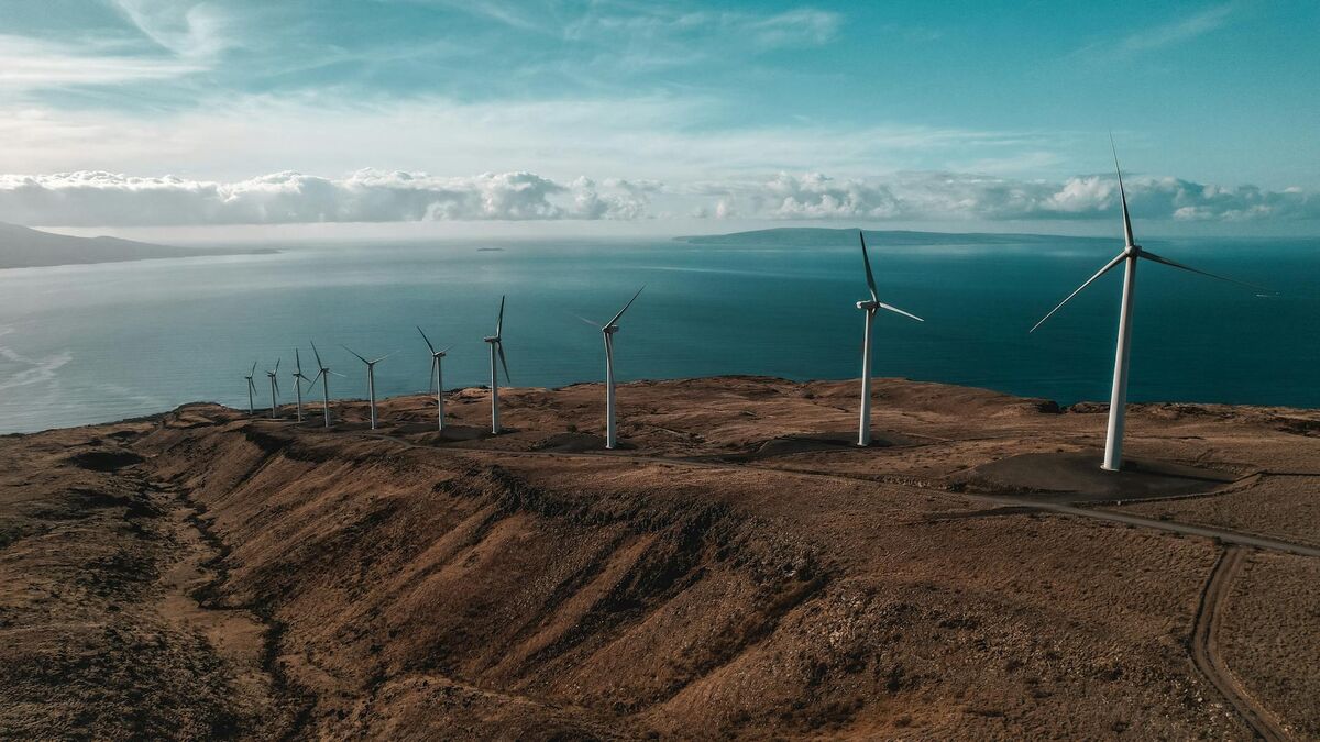
Wind turbine inspection is one of the most hazardous and expensive recurring tasks in renewable energy operations. Traditional methods — rope access technicians rappelling from nacelles or bucket trucks positioning crews at blade height — are slow, weather-dependent, and increasingly difficult to staff. Videogrammetry, the process of converting continuous drone video into measurable 3D models, gives operations and maintenance (O&M) teams a safer and faster alternative: fly a standard drone orbit, upload the footage, and receive a spatially accurate turbine model ready for damage measurement within minutes.
Key Takeaways
- Traditional rope access wind turbine inspections consume 4–6 hours per turbine and cost $800–$1,500 in direct labor and equipment; drone videogrammetry completes the same inspection in under 30 minutes.
- A single O&M operator can inspect 15–20 turbines per day using drone video — roughly 10 times the throughput of a rope access crew.
- SkyeBrowse's Premium Advanced tier delivers 0.1 inch accuracy at 16K resolution, sufficient for OEM warranty documentation and defect reporting without a manufacturer site visit.
- Turbine shutdown windows shrink from hours to 10–15 minutes per unit, directly protecting annual energy production (AEP) at high-capacity-factor sites.
- 3D model exports in LAZ, GLB, and GeoTIFF formats integrate with blade repair contractor software, asset management platforms, and SCADA databases.
Contents
- Why are traditional wind turbine inspections so expensive?
- How does drone videogrammetry work for blade inspection?
- What damage can drone inspection actually detect?
- How does videogrammetry support warranty claims and documentation?
- What does a wind farm inspection workflow look like with SkyeBrowse?
- FAQ
Why are traditional wind turbine inspections so expensive?
Rope access and bucket truck inspections are expensive because they require specialized crews, dedicated equipment mobilization, and long turbine shutdowns — all of which compound for large fleets. A farm with 50 turbines faces annual inspection bills that routinely exceed $75,000 in direct costs alone, before accounting for lost generation during extended downtime windows.
The cost drivers stack quickly. Rope access technicians hold specialized certifications that limit crew availability and push day rates higher. Bucket trucks require ground conditions suitable for vehicle access — a constraint that becomes a real scheduling problem at sites with soft terrain or severe weather seasons. Both methods are highly weather-dependent; inspections postponed by wind or precipitation push costs further as mobilized crews wait on standby.
OSHA's wind energy standards classify nacelle and blade access as confined space and elevated work, requiring additional safety protocols and oversight that add time and overhead to every inspection event. For fleet operators managing dozens of sites, coordinating specialized crews within seasonal inspection windows is a logistical burden with no clean solution under the traditional model.
The FAA's commercial drone operations framework has made it significantly easier for energy operators to integrate drone programs directly into O&M workflows, removing a regulatory barrier that previously made in-house aerial inspection impractical.
How does drone videogrammetry work for blade inspection?
Drone videogrammetry captures continuous video footage of all blade surfaces during a single automated orbit around each turbine. That footage is uploaded to a cloud platform, which reconstructs the spatial geometry of every blade surface into a measurable 3D model — no specialized photogrammetry training or ground control points required.
The key distinction between videogrammetry and conventional photogrammetry lies in the capture method. Photogrammetry requires carefully planned discrete photo sets with significant overlap at controlled intervals. Videogrammetry uses continuous video, meaning every frame contributes to the reconstruction. For turbine blades — curved, featureless surfaces that are notoriously difficult to reconstruct accurately — continuous orbital video provides the consistent coverage needed to produce reliable geometry.
SkyeBrowse accepts standard .MP4 and .MOV video from DJI Industrial, Autel, or any GPS-enabled platform. When telemetry files (.SRT for DJI, .ASS for Autel) accompany the video upload, the platform uses embedded GPS metadata to improve georeferencing accuracy without requiring manually placed ground control points on the turbine structure itself.
For a deeper comparison of capture approaches relevant to industrial inspection work, see the videogrammetry vs photogrammetry guide and the breakdown of LiDAR vs photogrammetry for 3D capture.

What damage can drone inspection actually detect?
Drone-based videogrammetry detects leading edge erosion, delamination, lightning strike damage, surface cracking, and structural defects across all blade surfaces — with measurement accuracy ranging from 0.25 inch at standard resolution to 0.1 inch at the highest processing tier. That level of detail supports engineering-grade damage assessment and OEM warranty review.
The resolution tier selected for processing determines what defect sizes are reliably measurable. For utility-scale O&M teams tracking incremental erosion across annual inspection cycles, the Premium tier produces 8K resolution models where erosion progression, surface pitting, and trailing edge separation are clearly distinguishable and can be measured directly in the platform's viewer.
When findings need to support warranty claims, regulatory submissions, or insurance audits, the Premium Advanced tier produces 16K resolution at 0.1 inch accuracy. At that resolution, blade manufacturing defects, delamination boundaries, and lightning receptor damage render with enough spatial fidelity for OEM engineering teams to assess warranty eligibility from the 3D model alone — without dispatching their own inspection crews to the site.
For fleets where initial triage matters more than measurement precision — particularly following severe weather events that may have affected dozens of turbines simultaneously — the Lite tier enables rapid fleet-wide assessment. Teams identify which turbines sustained visible damage and prioritize detailed Premium or Premium Advanced inspections for the units most likely to need immediate repair.
How does videogrammetry support warranty claims and documentation?
Videogrammetry produces spatial evidence of blade damage that OEMs and insurers can evaluate directly from the 3D model, removing the need for manufacturer site visits during initial warranty assessment. Time-stamped models with embedded damage measurements create a verifiable audit trail that supports both warranty claims and insurance subrogation cases.
Blade warranty disputes often hinge on whether damage resulted from a manufacturing defect or from operational causes like lightning strikes or maintenance errors. A temporal sequence of inspection models — showing damage appearing and progressing between specific inspection dates — provides spatial evidence that traditional static photo documentation cannot match. When the 3D model from last year's inspection shows no cracking at a specific blade station, and this year's model shows a measurable crack at the same location, the spatial record is difficult to dispute.
Cloud-hosted model storage supports the long timelines that warranty and litigation cases require. Access control features let O&M teams share specific turbine models with engineering consultants, insurance adjusters, or OEM technical teams through permissioned links — eliminating the file transfer friction that slows claim review cycles. Audit logs record who accessed each model and when, establishing chain of custody for data used in warranty negotiations or legal proceedings.
For teams managing blade documentation alongside broader infrastructure inspection programs, the same platform workflow applies to utility infrastructure inspections and bridge and roadway condition assessments — allowing a single drone operator and software investment to serve multiple inspection programs across an organization.
What does a wind farm inspection workflow look like with SkyeBrowse?
A complete wind farm inspection cycle with SkyeBrowse runs from flight to finished 3D model in under 30 minutes per turbine: fly a 10–15 minute automated blade orbit, upload the video with telemetry file to app.skyebrowse.com, and receive a measurable point cloud and 3D mesh ready for damage annotation and export. A single operator can process 15–20 turbines per day.
The capture phase requires only a GPS-enabled drone and the SkyeBrowse Flight App or Universal Upload. Automated orbit patterns provide consistent standoff distance across all blade surfaces — leading edge, trailing edge, suction side, and pressure side — in a single pass. Turbine shutdown is required during the flight window, but the short capture duration keeps each shutdown to 10–15 minutes rather than the multi-hour windows rope access requires.
After upload, cloud processing handles reconstruction with no desktop hardware or specialized software needed on the operator's end. Models appear at app.skyebrowse.com within minutes, and damage measurements can be completed before the crew moves to the next turbine.
At the fleet scale, the economics shift entirely. Annual rope access campaigns become quarterly drone programs managed by existing O&M staff. Earlier detection of erosion reduces catastrophic blade failure risk, and performance monitoring teams can correlate power curve deviations with specific blade findings by comparing inspection model history against SCADA output data.
For an overview of how drone inspection services integrate into broader energy and infrastructure asset programs, the drone inspection services guide covers fleet planning, regulatory considerations, and cost structures. Teams new to the workflow may also find the drone 3D mapping primer useful for understanding how video-to-3D reconstruction differs from traditional survey-grade mapping.

FAQ
How long does a drone wind turbine inspection take?
A single turbine drone flight takes 10–15 minutes to capture all three blades. SkyeBrowse processes the video at approximately a 1:1 ratio, so the 3D model is ready in roughly the same amount of time after upload. From flight start to a fully measurable turbine model, total elapsed time is typically under 30 minutes — compared to 4–6 hours for a traditional rope access inspection.
What types of blade damage can drone inspection detect?
Drone videogrammetry detects leading edge erosion, delamination, lightning strike damage, surface cracking, and structural defects across all blade surfaces. At Premium Advanced resolution (0.1 inch accuracy, 16K), findings are spatially precise enough for OEM engineering teams to assess warranty eligibility directly from the 3D model without a manufacturer site visit.
Do turbines need to be shut down for drone inspections?
Yes — turbines must be stationary during the drone flight for crew safety and capture quality. The shutdown window is short: typically 10–15 minutes per turbine. Compare that to 4–6 hour shutdowns for rope access crews, and the impact on annual energy production (AEP) is dramatically reduced with the drone approach.
What file formats does SkyeBrowse export for wind turbine inspection reports?
SkyeBrowse exports LAZ point clouds for blade repair contractor planning software, GLB 3D mesh files for stakeholder review and client reporting, and GeoTIFF orthomosaics for integration with asset management platforms and SCADA databases. All exports link to the cloud-hosted model for direct stakeholder access via permissioned link.