Modern farm operations run on data — elevation models for drainage design, surface maps for conservation compliance, and field imagery for agronomic decisions. The right 3D mapping software for agriculture compresses what used to take days of RTK survey work into a 30-minute drone flight, delivering digital elevation models (DEMs) and orthomosaic outputs that feed directly into drainage design tools and USDA documentation workflows.
Key Takeaways
- Videogrammetry captures continuous field surface data from drone video — no discrete grid points to interpolate between, and no compaction from equipment passes during narrow planting windows.
- Video-based drone mapping costs 70-80% less than traditional RTK field surveys for drainage design, with a typical 80-acre survey dropping from $2,000-$3,000 to $400-$600.
- A 0.1-foot elevation error in a field DEM can misplace tile drainage lines by 20-30 feet, leaving chronic wet spots that compound yield losses year over year.
- SkyeBrowse exports GeoTIFF orthomosaics and 3D models that satisfy USDA NRCS documentation requirements for EQIP and CSP conservation program compliance.
- Tile drainage corrected by accurate elevation data can recover 25+ bushels per acre on affected acreage, paying for the mapping investment within the first growing season.
Contents
- What does precision agriculture actually need from 3D mapping software?
- How does video-based mapping compare to RTK surveys and photogrammetry?
- How does drone mapping improve tile drainage design?
- Can drone video replace in-season crop scouting?
- How do you document conservation practices for USDA compliance?
- FAQ
What does precision agriculture actually need from 3D mapping software?
Precision agriculture demands field-level elevation data accurate enough to design tile drainage, spatial imagery that reveals stress patterns before they cause yield loss, and exportable outputs that satisfy USDA conservation program documentation. Speed matters as much as accuracy — data collected outside the narrow windows between planting, growing, and harvest has limited operational value.
Modern farms integrate data from yield monitors, soil sampling, variable-rate controllers, and satellite imagery. Each source covers part of the picture. Yield monitors show harvest results but not the causes; soil tests sample points but miss spatial variability between them; satellite imagery provides broad coverage but struggles with cloud cover and revisit frequency that can stretch to 10 days or more.
Elevation data is the layer that ties everything else together. It explains why wet spots form where they do, where surface runoff concentrates, and where manure applications should be adjusted for slope. The USDA Natural Resources Conservation Service requires spatial documentation of conservation practices — terraces, buffer strips, grassed waterways — at a resolution that connects installed acreage to GPS-referenced coordinates. Point-based GPS surveys have served this role, but video-based surface capture now delivers equivalent or better spatial resolution at a fraction of the time investment.
How does video-based mapping compare to RTK surveys and photogrammetry?
RTK ground surveys provide high-accuracy elevation at specific shot points but require interpolation between them, missing subtle grade breaks. Traditional photogrammetry (photo-to-3D) requires pre-planned flight missions with fixed image intervals. Videogrammetry — SkyeBrowse's approach — processes continuous drone video into a dense 3D surface model, covering every square foot of ground without discrete sampling gaps.
Here is how the main approaches stack up for typical farm mapping tasks:
| Approach | Field Coverage | Accuracy | Setup Required | Typical Cost (80 acres) |
|---|---|---|---|---|
| RTK grid survey | Point-based | Sub-inch | High — dedicated equipment and operator | $2,000–$3,000 |
| Photo photogrammetry | Full surface | Sub-inch with GCPs | Medium — mission planning, GCP placement | $800–$1,500 |
| Video-based (SkyeBrowse) | Full surface | 0.25 inch Premium | Low — fly and upload | $400–$600 |
| Satellite multispectral | Full coverage | 3–10 m pixels | None | Subscription |
Video-based mapping, or videogrammetry, processes the thousands of overlapping frames embedded in a drone video file to reconstruct a dense point cloud and surface mesh. Because video records continuously, the resulting surface has no interpolation gaps — every drainage swale, field depression, or elevation break that a grid survey might miss between shot points shows up in the model.
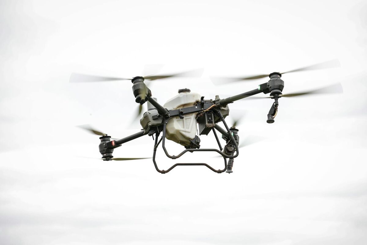
For farm operators who need to fit a drainage survey between fieldwork and weather windows, the workflow difference is significant. Fly the drone on a manual or automated grid pattern, upload the .MP4 file through the SkyeBrowse app or the web uploader at app.skyebrowse.com, and receive a processed DEM within hours — not days. DJI drones that generate .SRT telemetry files embed GPS data directly into the video, improving georeferencing without the need to set and survey ground control points across the field first.
For a broader comparison of how these methods handle accuracy and ground control, see GCP vs No GCP Accuracy: When Ground Control Points Matter in Drone Mapping.

How does drone mapping improve tile drainage design?
Tile drainage design depends on accurate surface elevation to place lines along the correct grade and route them to outlets. A drone video DEM with 0.1-to-0.2-foot vertical accuracy gives drainage engineers a continuous elevation surface across the entire field, revealing subtle grade breaks and depressions that traditional grid surveys often miss between shot points.
Poor drainage costs corn and soybean growers 20-40 bushels per acre in chronically wet zones — losses that compound every year until the drainage problem is corrected. Tile placement errors traced back to coarse elevation data can leave wet spots in the wrong location, requiring additional tile runs and excavation after installation.
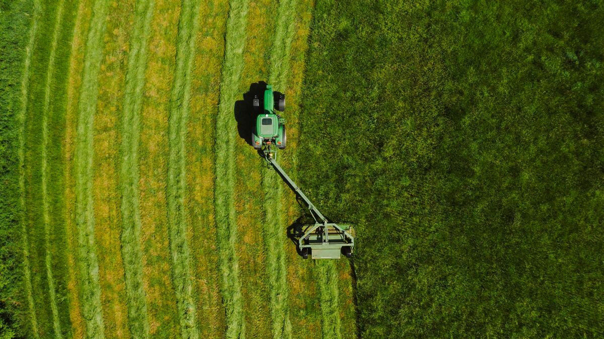
The optimal windows for field capture are fall after harvest and early spring before planting, when bare ground provides maximum elevation visibility with no crop canopy interfering with the drone's view of the surface. A 30-minute flight over an 80-acre field at 200 feet altitude generates enough video footage for Premium-tier processing, which delivers a digital elevation model at approximately 0.25-inch horizontal accuracy and 0.1-to-0.2-foot vertical accuracy across the full field extent.
Export the DEM as a GeoTIFF for direct import into drainage design software — the resulting surface model provides the topographic foundation for automated tile layout that follows the actual field grade rather than interpolated estimates. For farms with multiple fields, the same workflow scales: fly each field, batch upload, and download a complete set of DEMs without multiplying equipment or operator time linearly.
The economics favor this approach even at the single-field scale. An RTK field survey for drainage design on an 80-acre field typically costs $2,000–$3,000 in operator time and equipment. Drone video capture and Premium-tier processing runs $400–$600. The time savings also fits surveys into operational schedules without dedicating full days to a surveyor's visit — especially valuable during the compressed windows of spring fieldwork.
See Drone 3D Mapping: How to Build Site-Scale 3D Maps from UAV Video for a step-by-step walkthrough of the video capture and upload workflow.
Can drone video replace in-season crop scouting?
Drone video mapping supplements traditional agronomic scouting by detecting spatial stress patterns — drainage-related yellowing, compaction zones, nutrient variability — across entire fields rather than the sample areas an agronomist can walk. Rapid processing compresses the decision timeline so that treatment applications can be adjusted before stress becomes visible from the ground.
Traditional scouting samples small areas and extrapolates across fields, missing spatial patterns until problems are severe enough to see at walking scale. Drone video collected every 7-10 days during critical growth stages builds a repeatable record of vegetative vigor patterns. Overlaying these patterns on historical soil maps and yield data identifies underlying causes: drainage issues tracking low-elevation areas, compaction concentrated at field entrances and headlands, nutrient variability following manure application patterns.
The key advantage for in-season use is processing speed. Unlike satellite imagery that may be unavailable during cloudy periods or delayed by 3-10 day revisit schedules, drone video can be collected on demand and uploaded immediately after the flight. This matters during narrow treatment windows — a fungicide application timed correctly on disease-infected patches rather than applied broadcast across the entire field reduces input costs and residue risks.
Lite-tier processing delivers field-wide outputs within hours of upload. Growers and agronomists can review developing stress patterns on the same day as the flight, share the model link with their agronomist or co-op specialist, and make application decisions before the field dries out after rain.
For farms operating larger fleets or multiple fields simultaneously, the Drone Surveying: A Complete Guide to UAV Survey Methods, Accuracy, and Cost article covers multi-field workflow planning and batch upload strategies.
How do you document conservation practices for USDA compliance?
USDA EQIP and CSP payments require documentation showing that conservation practices — buffer strips, terraces, grassed waterways — were installed per engineering specifications. A 3D model with GPS-referenced coordinates and measurable surface geometry provides spatial verification of as-built conditions, supporting payment requests and protecting against compliance audits.
Conservation program payments hinge on two things: installed acreage and compliance with design specifications. A grassed waterway must be the designed width and grade; a terrace must run at the engineered elevation interval. Paper records and photographs document intent but struggle to prove spatial compliance when a USDA NRCS reviewer wants to verify that a 300-foot waterway was actually installed at the planned dimensions across GPS-referenced field coordinates.
A drone video model captured immediately after installation provides a time-stamped, georeferenced record of as-built conditions. The GLB 3D mesh export allows reviewers to measure installed widths and surface grades directly from the model. The GeoTIFF orthomosaic overlays the installation on GPS-referenced field imagery, matching the installed location to the design drawing coordinates.
This documentation workflow also protects growers during compliance audits. If a practice is challenged years after installation — because the original field evidence has been obscured by crop growth or erosion — the archived model provides the spatial record that a site visit can no longer recover.
SkyeBrowse stores uploaded models and their associated data files at app.skyebrowse.com with no time limit on access, meaning a model created at practice installation remains available for the full duration of the conservation agreement — typically 5-10 years for EQIP contracts. The FAA's Part 107 framework covers commercial drone operations for service providers who capture this documentation on behalf of landowners.
For construction and earthwork contexts where similar documentation is needed, 3D Mapping for Construction: Drone Site Models in Minutes covers as-built verification workflows.

FAQ
Can I use SkyeBrowse for USDA EQIP or CSP documentation?
Yes. SkyeBrowse exports GeoTIFF orthomosaics and GLB 3D models that show as-built conservation practices — buffer strips, terraces, and grassed waterways — at measurable accuracy levels. These outputs support payment requests and protect against compliance audits by providing GPS-referenced spatial documentation. Models are stored at app.skyebrowse.com with no expiration, so the record remains available for the full life of the conservation agreement.
How accurate is drone video mapping for agricultural drainage design?
SkyeBrowse's Premium processing tier achieves approximately 0.25-inch horizontal accuracy and 0.1-to-0.2-foot vertical accuracy across the full field surface — accurate enough for tile drainage layout. Traditional RTK grid surveys interpolate between discrete shot points and can miss subtle grade breaks that a continuous video-based surface capture records. For the highest-accuracy requirements, the Premium Advanced tier processes at 16K resolution with AI moving-object removal.
What drones work with SkyeBrowse for farm mapping?
SkyeBrowse accepts .MP4 and .MOV video from any drone. DJI models like the Mavic 3E and Matrice 350 RTK generate .SRT telemetry files that embed GPS coordinates into the video, improving georeferencing without requiring ground control points. Autel drones use .ASS telemetry files with the same effect. The full list of tested platforms is at skyebrowse.com/supported-drones.
How does videogrammetry differ from traditional photogrammetry for farm use?
Videogrammetry reconstructs 3D geometry from continuous video frames rather than individual photographs. For farm operations this means a single flight generates thousands of overlapping frames automatically — no pre-planned photo intervals, no checkerboard ground targets to set and survey, and no post-flight re-flying of missed areas. The resulting surface model covers every square foot of the field rather than interpolating between discrete sample points, which matters most in subtle terrain where grade changes of a few tenths of a foot determine where water flows.