Enabling Subtitle Files on Autel Evo Max 4T and Evo II for Georeferenced 3D Models
This tutorial will guide you through enabling subtitle files on your Autel Evo Max 4T and Evo II drones. These subtitle files are crucial for automatically georeferencing your 3D models when used with platforms like SkyeBrowse, allowing you to take precise GPS coordinate measurements directly within your models.
Why Enable Subtitle Files (.ASS)?
The .ASS subtitle files recorded by your drone contain valuable metadata including:
- Latitude
- Longitude
- Altitude
- Timestamps
When this file is paired with your drone video, it allows your 3D model to be automatically georeferenced, meaning its position in the real world is accurately recorded. This enables you to take precise GPS coordinate measurements from your 3D model.
Method 1: For Autel Evo II V3 Series (using the Smart Controller)
Estimated Time: Less than 1 minute
- Power on your Autel Evo II V3 drone and the Smart Controller.
- On the Smart Controller, locate and press the camera icon in the bottom right corner of the screen.
- Within the camera settings menu, you will see an option for "subtitle .ASS file".
- Toggle this setting ON.
That's it! Your Evo II V3 is now configured to record the necessary subtitle files alongside your video.
Method 2: For Autel Evo Max 4T
Estimated Time: Less than 1 minute
- Power on your Autel Evo Max 4T drone.
- On the drone's interface (or connected controller), locate and press the settings button. This is often represented by a gear icon.
- Scroll down through the settings options until you find "Subtitles".
- Click on "Subtitles" to open its options.
- Toggle the subtitle setting ON.
You're done! Your Evo Max 4T will now record the essential subtitle files with your video footage.
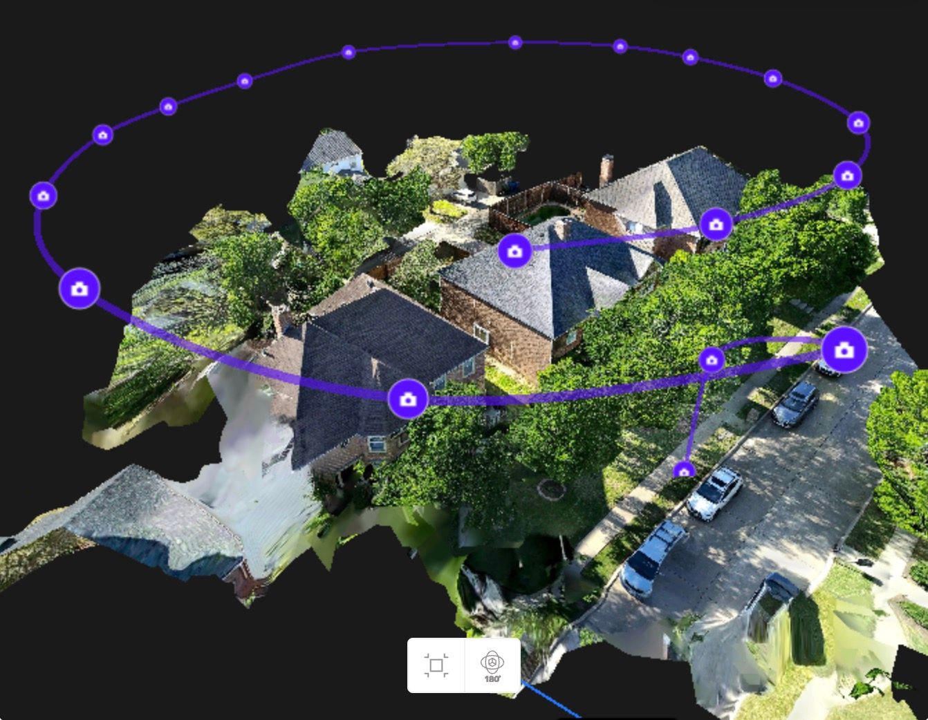
Autel Evo Max 4T 3D Model
What Happens Next?
Once these settings are enabled, your drone will automatically generate a .ASS subtitle file alongside your video recordings. When you upload these files to a compatible platform (like SkyeBrowse), the platform will use the data within the .ASS file to automatically georeference your 3D model. This greatly simplifies the process of creating accurate, measurable 3D representations of your sites.
If you haven’t already, you can make a free account with SkyeBrowse and create your first 3D model today!