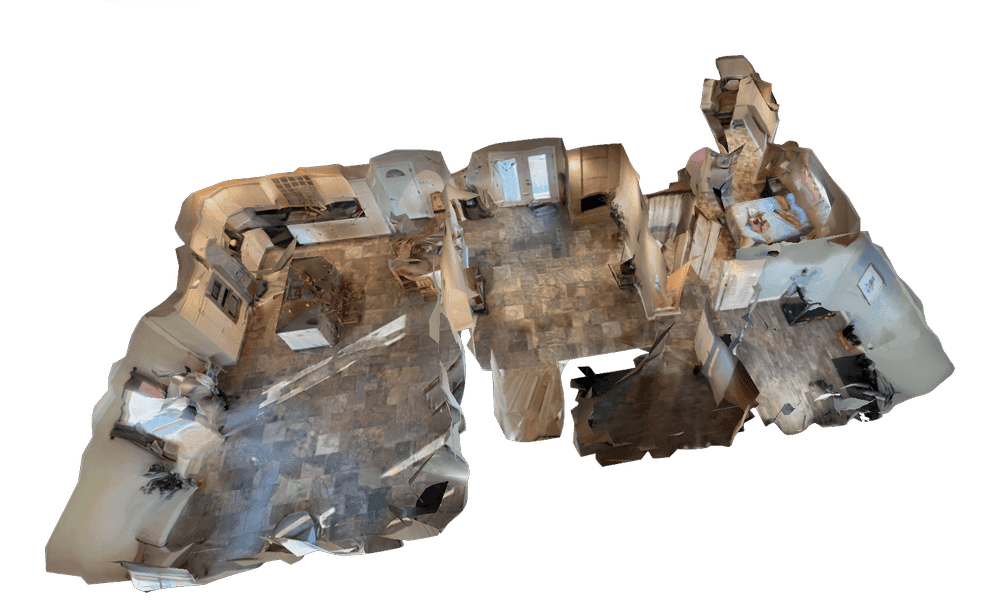
Multi-hazard disasters require coordinated response across jurisdictions while infrastructure is damaged and conditions evolve hourly. SkyeBrowse—a cloud-based videogrammetry platform that converts drone video into georeferenced 3D maps and 2D orthomosaics—gives incident commanders actionable disaster maps within minutes of a reconnaissance flight, enabling evidence-based resource allocation while response operations are still underway.
Key Takeaways
- In disaster response, every minute matters — SkyeBrowse matches video length to processing time, turning a three-minute aerial pass into a usable damage model in three minutes, enabling incident commanders to brief unified command within the same operational period as the flight.
- Traditional aerial damage assessment waits 3–7 days for commercial contractors; SkyeBrowse compresses reconnaissance into same-hour intelligence delivery, supporting resource requests and federal assistance applications based on quantified evidence instead of estimates.
- GeoTIFF orthomosaics overlay directly onto WebEOC, ArcGIS Emergency Operations, and other incident management platforms, while LAZ point cloud exports integrate with FEMA damage assessment tools.
- FEMA and state emergency management agencies require federal data handling standards — SkyeBrowse's FedRAMP Moderate authorization and AWS GovCloud hosting meet those requirements for disaster documentation, enabling secure real-time multi-agency data sharing with controlled zone-level permissions for state, county, federal, and mutual aid partners.
- Premium Advanced tier delivers 16K resolution at 0.1-inch accuracy with AI moving-object removal, providing engineering-level triage of structure collapse and infrastructure damage without requiring site visits.
Contents
- Why do emergency managers use videogrammetry for disaster response?
- How does SkyeBrowse deliver real-time situational awareness during active incidents?
- How does drone mapping support multi-hazard documentation and resource prioritization?
- How does SkyeBrowse enable secure multi-agency data sharing?
- How does real-time aerial mapping improve disaster decision cycles?
- FAQ
Why do emergency managers use videogrammetry for disaster response?
Videogrammetry—the process of extracting precise spatial measurements from video footage—lets incident management teams produce georeferenced damage maps within 10 minutes of a drone flight, far faster than commercial satellite or aerial photography contractors. Unlike delayed satellite imagery, which can take days to acquire and process, videogrammetry delivers actionable spatial intelligence while operations are still underway. The result is quantified situational awareness instead of preliminary estimates during the critical first hours of response.
Traditional disaster mapping relies on satellite imagery delayed by days, aerial photography contractors with week-long mobilization times, or ground teams unable to safely access affected areas. None of these methods provide the real-time spatial intelligence that emergency operations centers need during active response. According to the USGS National Geospatial Program, timely geospatial data is among the most critical resources during disaster events, directly influencing search-and-rescue prioritization and resource deployment decisions.
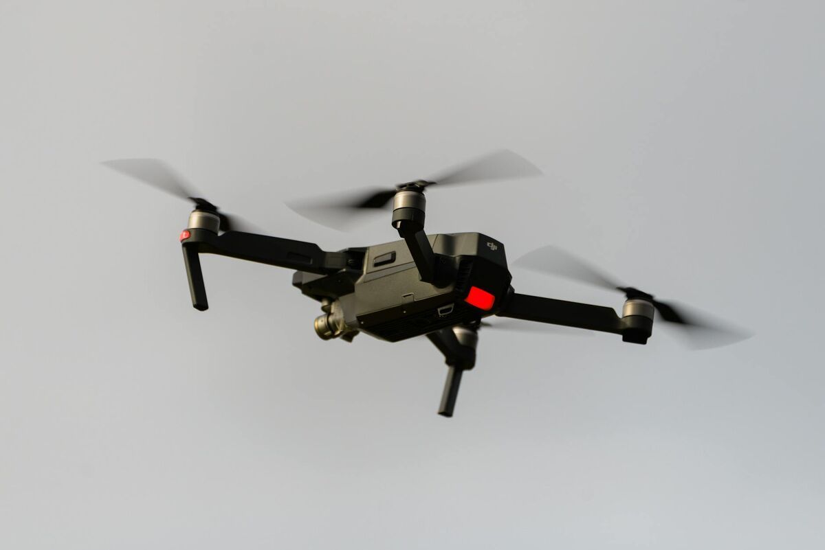
First responders upload video from whatever device is available — patrol drones, smartphones, body cameras — through a single web interface at app.skyebrowse.com. Operators launch from incident command posts and upload footage via mobile hotspot or satellite uplink; processing begins immediately in the cloud with no desktop hardware required.
How does SkyeBrowse deliver real-time situational awareness during active incidents?
In disaster response, every minute matters — SkyeBrowse matches video length to processing time, turning a three-minute aerial pass into a usable damage model in three minutes — making it possible to brief unified command with authoritative spatial data within the same operational period as the flight. The GeoTIFF orthomosaic overlays directly onto WebEOC, ArcGIS Emergency Operations, and other incident management platforms. For multi-day events, daily models document evolving conditions sequentially as debris is cleared and recovery operations advance.
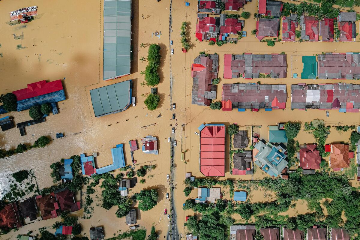
That turnaround supports dynamic operations where conditions change hourly: tornado damage paths require immediate search grid definition, earthquake-damaged buildings need structural triage before rescue teams enter, and hurricane storm surge requires real-time inundation mapping for evacuation adjustments. The same georeferenced models that guide commanders during active response also support search and rescue operations, enabling teams to prioritize high-probability victim locations from aerial data rather than conducting systematic grid searches blind.
Commanders can measure affected structure counts, identify still-passable access routes, and coordinate multi-agency resource deployment from the same authoritative spatial dataset. For multi-day events, comparing sequential daily models tracks debris clearance progress, documents infrastructure restoration, and verifies resource deployment effectiveness as recovery evolves.

How does drone mapping support multi-hazard documentation and resource prioritization?
SkyeBrowse's Premium tier delivers 0.25-inch accuracy at 8K resolution, sufficient for engineering-level triage of structure collapse, road blockages, and utility infrastructure damage without requiring site visits. For catastrophic events requiring federal disaster declarations—major hurricanes, earthquakes, and wildfires—Premium Advanced delivers 16K resolution with 0.1-inch accuracy and AI moving-object removal. The LAZ point cloud exports directly to FEMA damage assessment tools, enabling quantification of affected populations, debris volumes, and infrastructure losses using standardized methodologies.
Lite delivers damage-extent models in minutes at 2–6 inch accuracy — the right tier for initial damage assessment when speed outranks precision. When wildfires, floods, or tornadoes affect multiple counties simultaneously, Lite captures broad coverage quickly; detailed Premium assessments follow in priority zones requiring immediate resource deployment.
Federal disaster assistance applications improve when supported by georeferenced damage documentation. FEMA's Initial Damage Assessment process specifically requires quantified loss estimates to justify Public Assistance funding requests—SkyeBrowse's 3D models and orthomosaics provide that evidence in a format compatible with federal reporting systems.
How does SkyeBrowse enable secure multi-agency data sharing?
FEMA and state emergency management agencies require federal data handling standards — SkyeBrowse's FedRAMP Moderate authorization and AWS GovCloud hosting meet those requirements for disaster documentation. State emergency operations centers, county incident commands, federal response teams, and mutual aid partners access the same disaster models without emailing large files or managing version control conflicts. Controlled sharing allows each agency to access only relevant zones while protecting sensitive operational details.
Search and rescue teams can view building collapse areas, utility crews can access infrastructure damage sectors, and public information officers can receive annotated maps for media briefings—all from one source dataset with appropriate permission levels. The FAA's UAS integration guidance for public safety underscores coordinated airspace and data management as essential for effective multi-agency drone operations during disasters.
Audit trails document situational awareness access during post-incident reviews. When after-action reports analyze response timelines and decision quality, the access logs show exactly when spatial intelligence became available and which agencies utilized the data—critical documentation for improving future response plans.
How does real-time aerial mapping improve disaster decision cycles?
Traditional aerial damage assessment waits 3–7 days for commercial contractors to mobilize, fly, and deliver processed imagery. SkyeBrowse compresses disaster reconnaissance into same-hour intelligence delivery, allowing resource requests, mutual aid deployments, and federal assistance applications to proceed based on quantified damage evidence instead of preliminary estimates. When search and rescue teams receive georeferenced collapse maps within hours of tornadoes, they prioritize high-probability victim locations rather than conducting systematic grid searches—directly improving outcomes during the critical first 24 hours.
Evacuation decision support improves when inundation extent is quantified rapidly. During flood events, comparing water level models against population density maps identifies neighborhoods requiring immediate evacuation versus areas where shelter-in-place is safer—decisions that prevent evacuation-related casualties. Debris management operations benefit from volumetric analysis: when hurricanes or tornadoes generate millions of cubic yards of debris, the 3D models quantify removal requirements and help secure appropriate contractor resources before operations begin.
Infrastructure restoration prioritization also uses spatial damage correlation. When electrical grids, water systems, and transportation networks fail simultaneously, the orthomosaic reveals which repairs unblock the most critical facilities—hospitals, emergency shelters, and fuel distribution points—optimizing restoration sequences for maximum community benefit. For fire departments integrating drone mapping into their emergency operations, the best 3D mapping software for fire departments guide covers pre-incident planning and post-incident documentation workflows that complement disaster response capabilities. When collapse or structural failure investigation follows a disaster, forensic engineering workflows using the same drone platform extend the value of the initial aerial dataset.

FAQ
How quickly can SkyeBrowse produce disaster maps after a drone flight?
SkyeBrowse matches video length to processing time — a three-minute aerial pass becomes a usable damage model in three minutes. Incident commanders can review spatial damage data within the same operational period as the flight.
What drones work with SkyeBrowse for disaster response?
First responders upload video from whatever device is available — patrol drones, smartphones, body cameras — through a single web interface. No specialized hardware is required beyond what is already in the field. See the full supported drones list for compatible models.
Can SkyeBrowse data be shared with FEMA and other federal agencies?
Yes. SkyeBrowse's FedRAMP Moderate authorization and AWS GovCloud hosting meet federal data handling requirements. The platform exports LAZ point clouds, GeoTIFF orthomosaics, and GLB 3D models compatible with FEMA damage assessment tools and federal GIS platforms. Controlled sharing allows each agency to access only their relevant data zones.