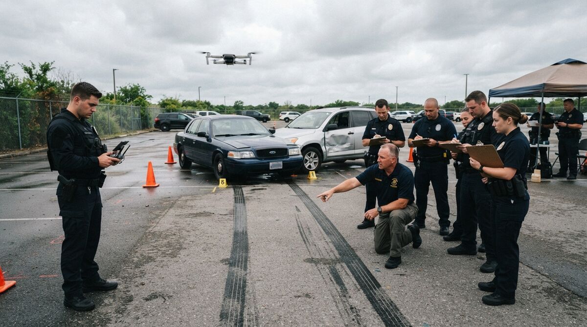
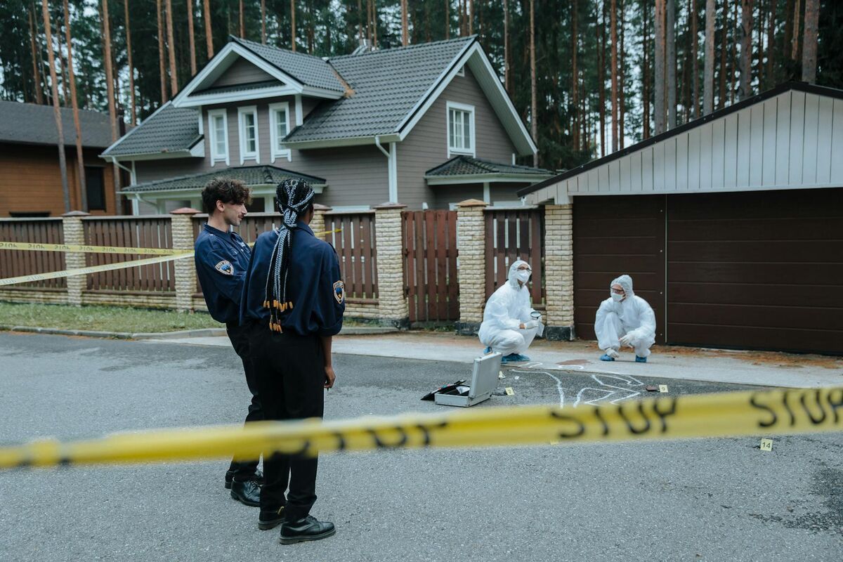
Accident reconstruction drone mapping means flying a crash scene with a drone and converting that footage into a measurable 3D model of the roadway, the vehicles, and the evidence on the ground. What makes it fast is videogrammetry, which builds a model from one continuous video clip instead of hundreds of overlapping still photos. This guide covers the roadway flight pattern, night capture, model accuracy, exports, and which agencies run the workflow.
Key Takeaways
- A single orbit video becomes a measurable 3D scene, so one officer replaces the crew that walked a total station across a closed roadway.
- Middletown Police Department cut scene documentation from 2.5 hours with five officers to 7.5 minutes with one, a 98% reduction, and credits $4.7 million in savings.
- Measurement accuracy reaches 0.5 inch on Commercial and Pro, and 0.1 inch on Public Safety and Enterprise, without ground control points.
- Pro and Public Safety and Enterprise export LAZ point clouds, GLB meshes, and GeoTIFF orthomosaics; Public Safety and Enterprise adds the Factual Diagram PDF.
Contents
- What is accident reconstruction drone mapping?
- How do you fly a crash scene for 3D reconstruction?
- How accurate is a drone-mapped crash scene?
- What outputs does a reconstructionist get from the 3D model?
- How much scene-clearance time does drone mapping save?
- Which agencies use drone mapping for vehicle accident investigations?
- What does it cost compared with a total station or scanner workflow?
- FAQ
What is accident reconstruction drone mapping?
Accident reconstruction drone mapping documents a collision scene by flying a drone over it and processing the footage into a scaled 3D model anyone can measure later. The model records final rest positions, roadway geometry, skid and gouge marks, and the debris field as spatial data rather than tape measurements on a field sketch. Investigators measure, annotate, and diagram after the road reopens, working from the model instead of the memory of people who were there.
Photogrammetry, the older technique, stitches hundreds of overlapping still images into a model and needs a long grid flight. Videogrammetry extracts the same geometry from continuous video, which is why a capture that meant a long photo mission now means a short orbit. For what evidence gets collected and why, see collision reconstruction; for the method comparison including laser scanning, see crash reconstruction.
One constraint is worth stating up front: SkyeBrowse builds models from video only, and still photos attach as annotations rather than reconstruction input. Phone and body-worn video work too, so a close walk-around of vehicle crush processes like the aerial orbit, as forensic accident reconstruction with SkyeBrowse shows.
How do you fly a crash scene for 3D reconstruction?
For a scene under an acre, which covers most roadway collisions, fly a two-orbit pattern around the area of interest at a consistent altitude with the camera angled down. Larger scenes, such as a pileup spread across several hundred yards of highway, need a grid pattern instead. Record the drone's GPS subtitle file during the flight so the model is georeferenced automatically, and keep one object of known size in frame as a scale reference.
In the SkyeBrowse Flight App, Orbit automates the two-orbit pattern for scenes under one acre and WideBrowse automates the grid for anything larger, on the DJI and Autel aircraft the app supports (Autel automation is iOS only). Crews flying a Skydio, a Parrot, an Avata, or any aircraft outside that list fly the pattern manually and send the clip through Universal Upload, which accepts .MP4 and .MOV. Either way, upload the telemetry file with the video: .SRT for DJI, .ASS for Autel. That file georeferences the scene, so enable GPS subtitle recording before the shift starts. The accident reconstruction checklist covers the rest of the pre-flight sequence.
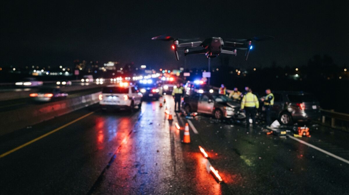
Night work is the normal case for serious collisions, and it breaks a photo-grid workflow first, because every frame needs its own exposure. Continuous video handles low light more gracefully, as our nighttime accident investigation writeup covers. Light the scene as you would for evidence photography, fly lower and slower, and confirm night currency under FAA Part 107.
How accurate is a drone-mapped crash scene?
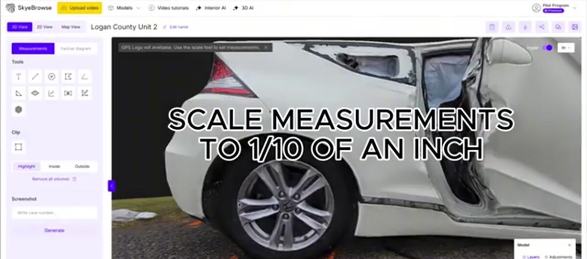
Measurement accuracy reaches 0.5 inch on Commercial and Pro models and 0.1 inch on Public Safety and Enterprise models, which process at 16K resolution. That accuracy comes from the video itself, with no ground control points laid on the roadway. Accuracy scales with capture distance, so flying closer to the vehicles, or walking a phone camera around a crush profile, tightens the result further.
Two different things get called accuracy here, and separating them prevents an argument you don't want on cross-examination. Measurement accuracy is how closely a distance read in the model matches the same distance on the roadway, and it governs rest positions, lane offsets, skid lengths, and crush depth. Absolute georeferenced accuracy is how closely the model's coordinates match a real-world coordinate system, which is what RTK and ground control points improve. Reconstruction almost always turns on the first. Dropping a known-size object into frame during capture, a cone or scale bar, gives you a verification measurement for the record.
Public Safety and Enterprise models also run AI Moving Object Removal, which matters at an active scene where responders and passing traffic cross the frame during the orbit.
What outputs does a reconstructionist get from the 3D model?
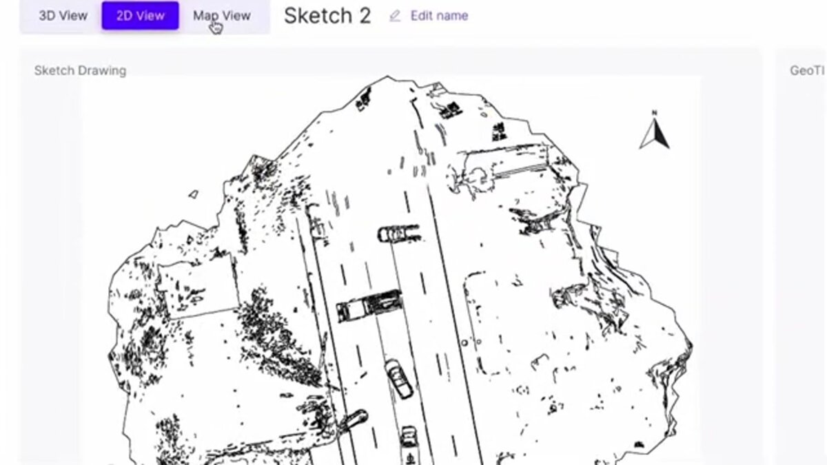
From the finished model a reconstructionist takes point-to-point, area, and angle measurements, plus annotations tied to specific locations in the scene. Pro and Public Safety and Enterprise models export as a LAZ point cloud, a GLB mesh, or a GeoTIFF orthomosaic for CAD and forensic software; Commercial models don't include exports. Public Safety and Enterprise adds a Factual Diagram PDF built from the top-down overview, the sketch page, and the logged measurements.
Walk Mode drops the viewer to eye level, which is how you check a driver or witness sightline against the model. Case Gallery attaches evidence photos as clickable annotations, so the close-up of a tire mark lives at the point on the roadway where it was taken. Import Custom 3D Model brings an exemplar vehicle in as a .glb or .stl layer, scaled against the captured scene, on Pro and Public Safety and Enterprise. Case Gallery, Icons, sketch drawing, and the Factual Diagram workflow are Public Safety and Enterprise features.
The AI Factual Diagram option drafts a neutral description from your scene notes plus the model's measurements and metadata. It's scoped deliberately: factual description only, never fault, speed, cause, or reconstruction opinion. Those conclusions stay with the reconstructionist, which is how they survive a challenge. For the courtroom side, see is SkyeBrowse Daubert ready and 3D model viewers for court.
How much scene-clearance time does drone mapping save?
Agencies that replaced laser scanner and total station documentation with drone capture report scene times dropping from hours to minutes. Middletown Police Department went from an average of 2.5 hours with five officers to 7.5 minutes with one, a 98% reduction. Seward, Weatherford, and Huntington Beach each report cutting roughly 3 hours of documentation to about 10 minutes.
Clearance time is a safety number before it's a budget number. The Federal Highway Administration reports that approximately 20 percent of all incidents are secondary incidents, and that traffic incidents cause about one-third of all congestion delay on the nation's highways. Every hour a lane stays closed for measurement is an hour of queue producing its own crashes, and the officers directing traffic around that queue are standing in it.
Middletown's five-officer, 2.5-hour documentation became a one-officer, 7.5-minute capture, and the department credits that with $4.7 million in savings. Four officers return to patrol instead of holding tape at a closed intersection. In Seward, Alaska, tying up four officers for three hours leaves the town without patrol coverage.
Which agencies use drone mapping for vehicle accident investigations?
More than 1,200 agencies worldwide use SkyeBrowse, with accident reconstruction as the most common public-safety workflow. Published examples include Middletown PD in Ohio, Seward PD in Alaska, Weatherford PD in Texas, and Huntington Beach PD in California. Forensic engineering firms use the same capture-and-export workflow for civil casework.
The pattern is consistent. A traffic unit already flying for scene overwatch adds a documentation orbit to the flight it was making anyway, and the reconstruction team picks up the model afterward. Weatherford PD deals with an interstate that has no practical local detour, so lane time is the whole problem. Huntington Beach PD runs it during events that consume most patrol hours.
On the civil side, forensic engineering firms and accident reconstruction experts use the exports rather than the viewer, pulling the LAZ point cloud into the software they testify from. New units can start with accident reconstruction training on the operator side and drone mapping on the platform side.
What does it cost compared with a total station or scanner workflow?
SkyeBrowse is priced per model with no seat fees. A Commercial model runs $24.99, or $19.99 billed annually, and keeps the scene viewable 3 months without exports. A Pro model is $49.99, or $39.99 annually, with 1 year of storage and full exports. Public Safety and Enterprise is $199 per model per year, adding 16K processing, 0.1 inch accuracy, CJIS compliance, chain of custody, Factual Diagrams, unlimited users, and 5-year storage.
The comparison that matters isn't software against hardware. Total station and scanner workflows carry the instrument purchase, annual calibration and service, and above all the personnel hours above. Per-model pricing means an agency pays for the scenes it documents, and unlimited users on Public Safety and Enterprise lets the reconstructionist, prosecutor, and supervisor open the same model without another license.
Heavy-caseload agencies can take an unlimited annual plan instead of a model count, priced by agency size from $9,999 per year. Current figures live on the pricing page, and the full picture is at /use-cases/public-safety.
FAQ
How long does it take to map a crash scene with a drone?
Plan on 5 to 10 minutes of flight for a typical roadway scene, plus cloud processing of roughly a minute per minute of video. Middletown PD averages 7.5 minutes of scene time with one officer, down from 2.5 hours with five. The best accident reconstruction software comparison covers how that timeline differs by platform.
Is a drone-mapped crash scene admissible in court?
That depends on your jurisdiction and on the reconstructionist qualifying the method, typically against the Daubert standard. The model supports that by preserving the original capture video, logging measurements and annotations, and producing a Factual Diagram PDF. Full CJIS compliance and chain of custody come with Public Safety and Enterprise subscriptions. See SkyeBrowse and the Daubert standard.
Do you need ground control points for accident reconstruction drone mapping?
No. Measurement accuracy of 0.5 inch on Commercial and Pro, and 0.1 inch on Public Safety and Enterprise, comes from the video alone, and the drone's .SRT or .ASS telemetry file georeferences the model on upload. RTK and ground control points improve certified absolute coordinates, which matters more for survey deliverables than scene measurements.