Hi SkyeBrowsers,
I spent most of the last two weeks flying houses to test our newest tool, and it shipped this week: Roof Damage Analysis. This issue also covers maps that open in the software you already use, contours you can hand straight to CAD, and GCPs that now move your model onto your survey.
Measure And Screen A Roof From One Flight
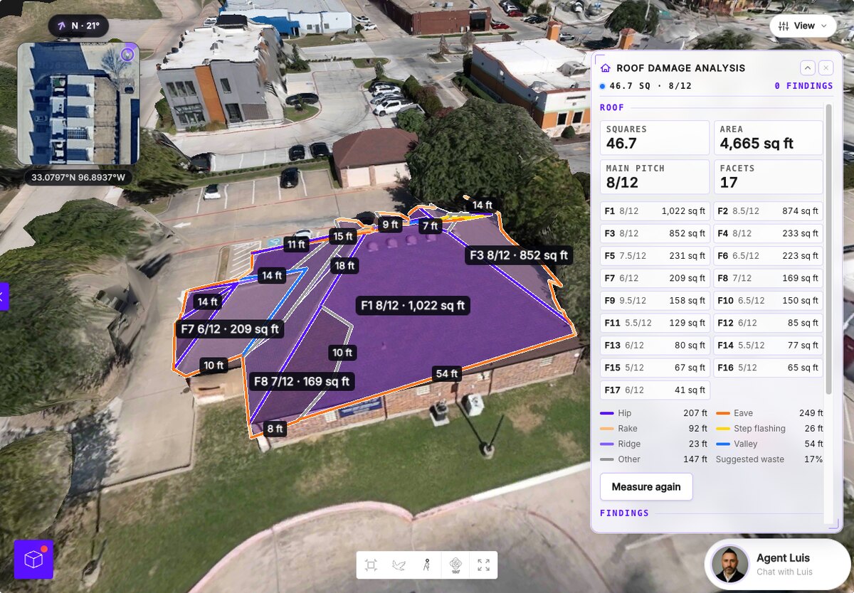
A storm rolls through and suddenly you have twenty roofs to check and one ladder. Open Roof Damage Analysis on the model and SkyeBrowse finds the roof for you, then measures it.
- Measurements: squares, area, main pitch, facets, ridge, hip, valley, eave, rake and step lengths, and suggested waste.
- AI damage scan: reviews your flight frames and photos in about 20 seconds and pins hail hits, wind creases, missing shingles, granule loss and more, tagged Likely or Possible.
- Storm history: NOAA hail, wind and tornado reports within 40 km over the year before your flight, with the date of loss filled in from the nearest hail report.
- Report: a Roof Damage Report PDF with per-facet measurements, a top-down roof diagram, photo evidence and your sign-off.
The AI is a screening aid: you approve or reject every finding, and only the approved ones reach the report. A ladder should be the last step of a roof inspection, never the first.
Maps That Open Where You Work
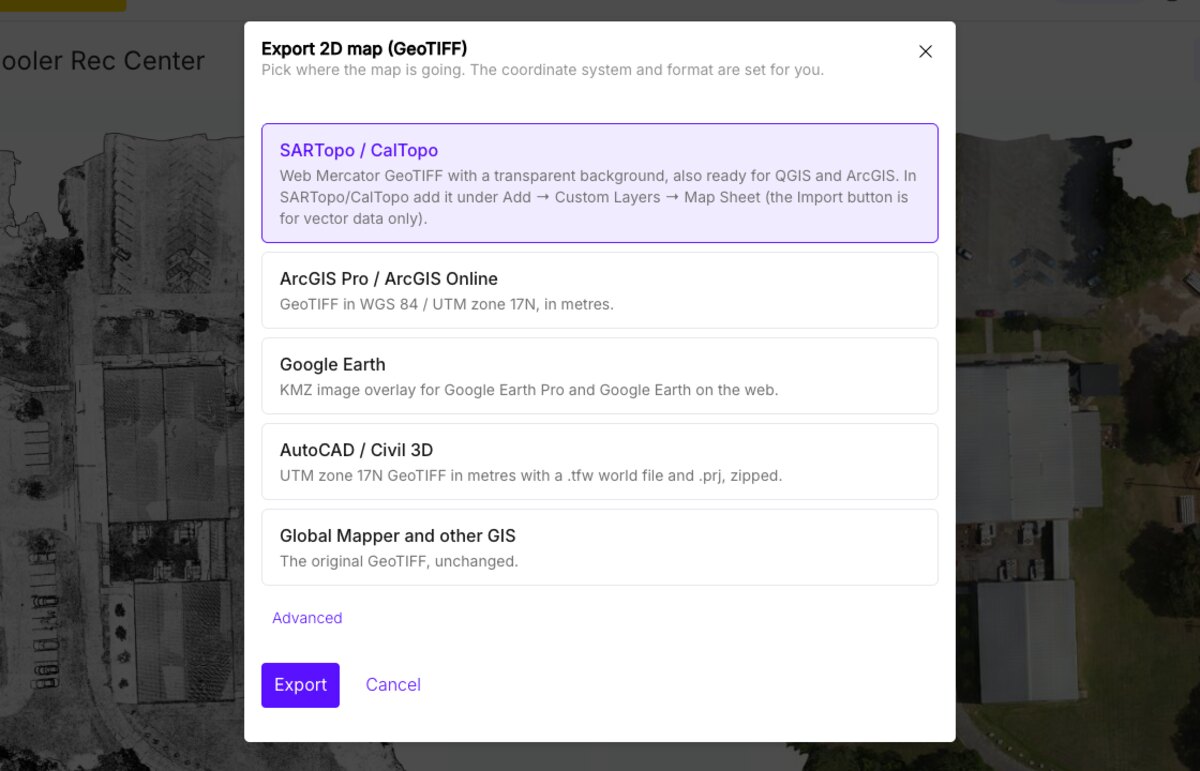
Ever downloaded a GeoTIFF and watched your mapping software refuse it? Download on the 2D map now asks where the map is going and builds the right file in your browser.
- SARTopo / CalTopo: Web Mercator GeoTIFF with a transparent background.
- ArcGIS Pro / ArcGIS Online: GeoTIFF in your site's UTM zone.
- Google Earth: a KMZ image overlay.
- AutoCAD / Civil 3D: UTM GeoTIFF with a world file and .prj, zipped.
- Global Mapper and other GIS: the original GeoTIFF.
A search team can have the map in SARTopo minutes after landing, and SkyeBrowse remembers your pick for next time.
Contours Your CAD Tech Can Use
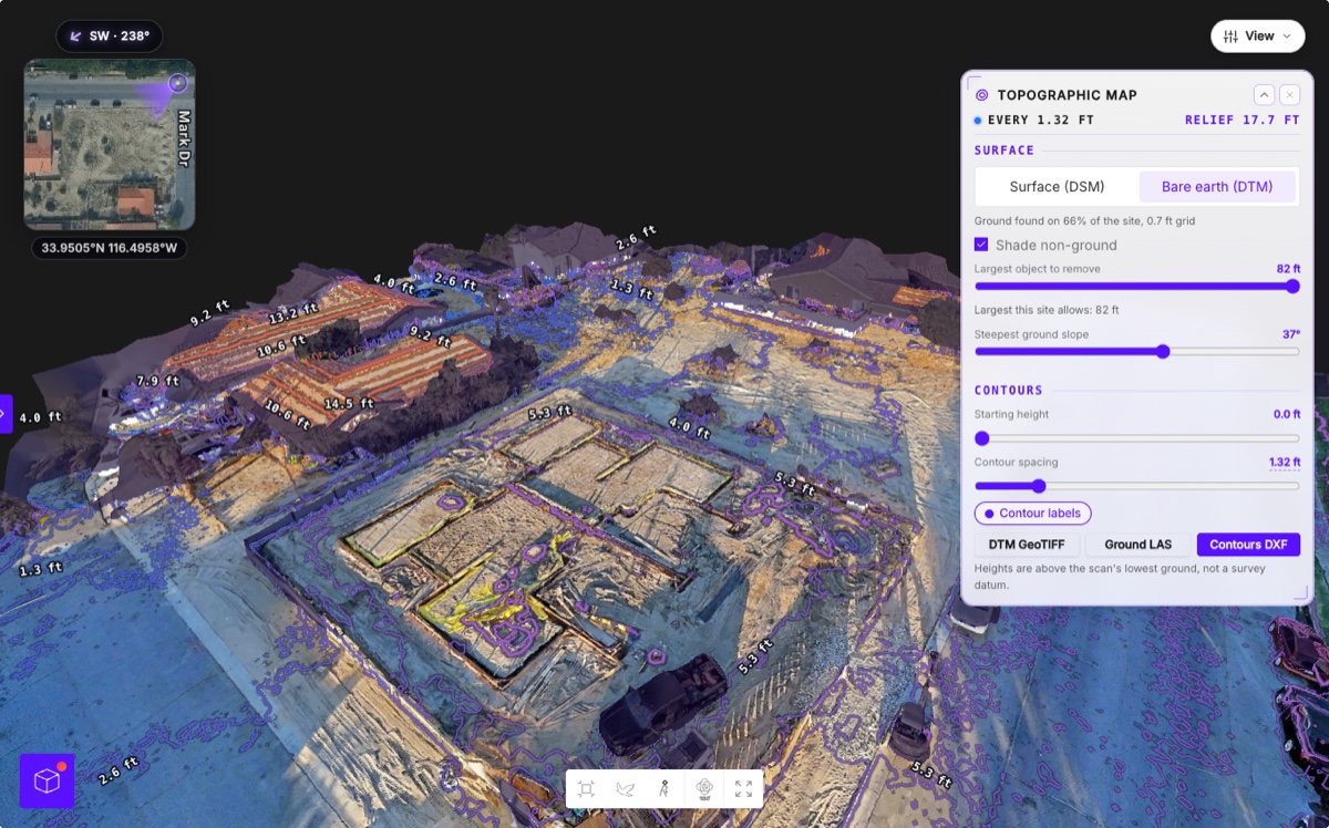
Redrawing contours by hand is nobody's favorite afternoon. Topographic Map now exports a Contours DXF next to the DTM GeoTIFF and ground LAS. Every elevation label matches its line's height, so the file drops into CAD ready to annotate.
Switch on Bare earth first and the lines follow the ground under the trucks and trees. Heights run from the scan's lowest ground, so tie them to your datum before design work.
Your GCPs Now Move The Model
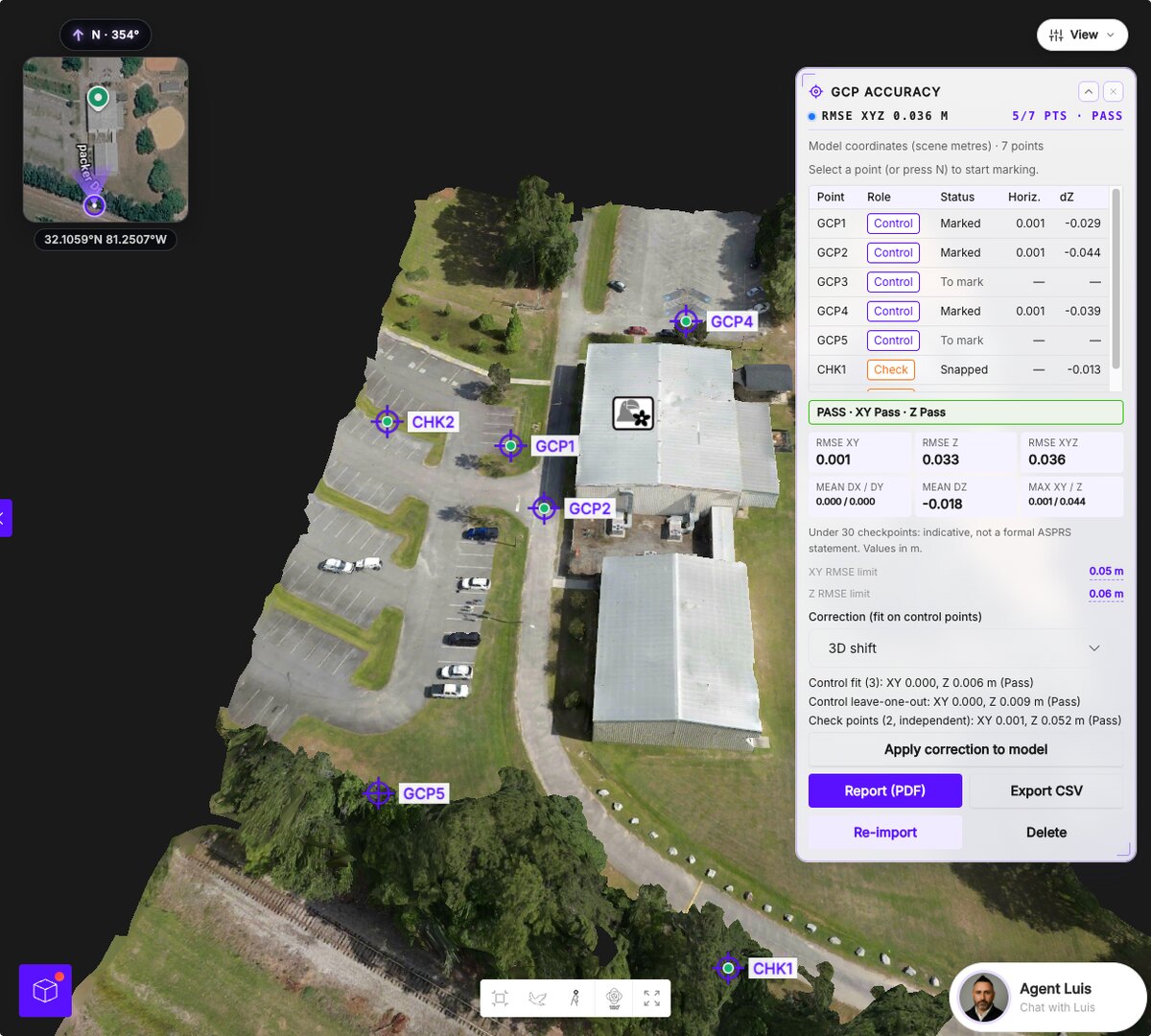
The GCPs tool already proved how close your model sits to your survey. Now it closes the gap. Set each surveyed point to Control or Check and hit Apply correction: SkyeBrowse fits a vertical offset, a 3D shift or a full 7-parameter correction, and the point cloud, mesh, measurements and annotations move together.
LAZ, GeoTIFF, GLB, OBJ, USDZ and CAD downloads all follow it. Check points stay out of the fit, so your accuracy report stays independent, and Remove correction puts the model back.
In Case You Missed It: Timelines
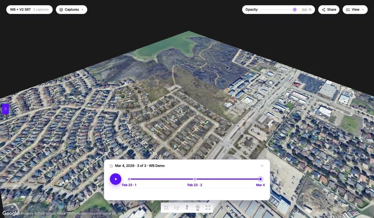
Fly the same site every month? Timelines puts up to 10 surveys on one date rail, lines each one up to your base survey, and crossfades between dates. Share it with clients through a read-only link.
Who Gets What
Roof Damage Analysis, GCPs, topographic exports and Timelines run on Pro models and Public Safety & Enterprise. Export 2D map works anywhere you can download the 2D map. Your $5 first Commercial model includes GCPs and the topographic exports.
Share A Roof Or A Timeline, Get 2 Pro Models
Roof Damage Analysis and Timelines get better with every real flight we learn from. If you have a model of a storm-damaged roof, or a site you've flown more than once, email its share link to bobby@skyebrowse.com with a note that we can use it to improve the system. If we use it, I'll add 2 free Pro models to your account.
We ship updates every week. More soon.