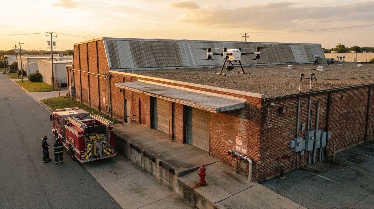
San Bernardino County Fire is using SkyeBrowse cloud-based videogrammetry to improve situational awareness, support tactical planning, and enhance firefighter safety during emergency operations. The department turns drone footage into measurable 3D models and high-resolution, top-down orthomosaic maps that give firefighters and incident commanders a detailed view of scenes, structures, and surrounding hazards.
San Bernardino County is the largest county in the contiguous United States, covering more than 20,000 square miles of mountain communities, high desert, wildland-urban interface, and dense valley cities along the I-10 and I-15 corridors. A department responsible for that much ground needs scene information fast, and it needs that information without sending firefighters into danger just to look around.
Contents
- From Drone Video to a Measurable 3D Scene
- How San Bernardino County Fire Applies It
- Seeing the Hazard Before Committing Crews
- Pre-Incident Planning Across a Huge Response Area
- Immersive Walkthroughs with Enterprise VR
- Training and Disaster Response
- Strengthening Readiness for Complex Incidents
- Bring SkyeBrowse to Your Department
From Drone Video to a Measurable 3D Scene
SkyeBrowse uses patented videogrammetry: a pilot flies a single continuous video over or around a scene, uploads it, and the cloud builds the 3D model. Processing runs at roughly one minute per minute of video, so most models are ready within minutes of upload. Every model also generates a top-down orthomosaic map automatically.
Because Universal Upload accepts nearly any .MP4 or .MOV file, crews can use the drones already in their fleet, along with smartphones and 360 cameras for interior work. There is no need for ground control points or a dedicated mapping specialist on scene.
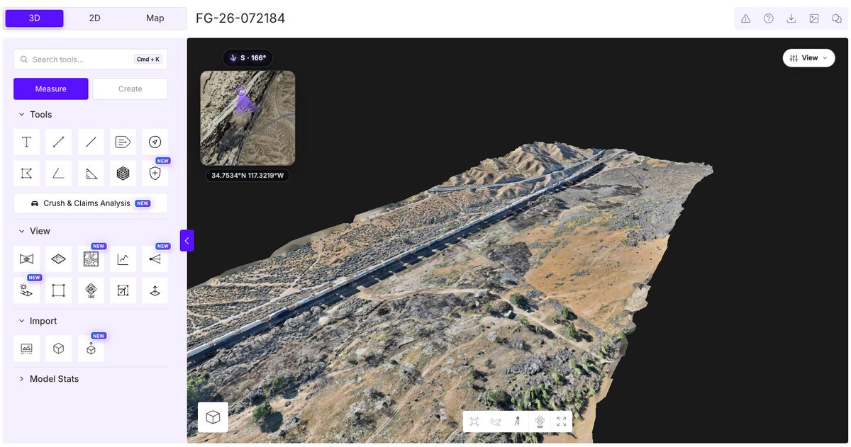
A SkyeBrowse 3D model of a railroad fire, built from drone video. The burn area along the tracks can be measured and viewed from any angle.
How San Bernardino County Fire Applies It
In its own announcement, San Bernardino County Fire lists a wide range of applications for the platform:
- Fire scene documentation
- Pre-incident planning
- Tactical operations
- Disaster response
- Hazardous materials incidents
- Interior mapping
- Firefighter training
That breadth matters. A single capture workflow covers a structure fire in Fontana, a hazmat release on an interstate, a pre-plan walkthrough of a commercial building in Victorville, and a damage survey after a wildfire in the mountain communities.
Seeing the Hazard Before Committing Crews
The department highlights one benefit above the rest: remote scene assessment can reduce the need to place firefighters in dangerous environments solely to gather information.
A drone orbit of a damaged structure or a hazmat scene gives incident commanders a navigable 3D view they can measure, rotate, and walk through on a laptop or tablet. Walk Mode lets a viewer move through the model at eye level, and measurement tools capture distances, areas, and heights directly from the model. Command staff can evaluate collapse risk, access routes, and exposure hazards before deciding who goes in and where.
Every model can also be shared with a link, so mutual aid partners and command staff see the same scene without file transfers.
Pre-Incident Planning Across a Huge Response Area
San Bernardino County Fire notes that providing detailed scene information before operations helps personnel evaluate hazards, understand building layouts, and develop response strategies. Pre-planning is where that starts.
With the Interior Mapping toggle, a crew member can record a slow walkthrough of a target occupancy and produce an interior model of hallways, stairwells, and fire protection features. 3D Overlay merges that interior model with an exterior drone model into a single scene, so crews see the roof, walls, and rooms together.
The Public Safety Icons tool turns that model into a pre-plan crews can read at a glance. A searchable icon picker places standardized symbols directly on the 3D model, drawn from the NAPSG (National Alliance for Public Safety GIS) all-hazards library and an NFPA-170-style fire pre-plan set covering hydrants, fire alarm control panels, suppression equipment, and facility markers. Placed icons are listed in the object tree, where they can be shown, hidden, or removed.
For occupancies that store hazardous materials, crews can also drop an NFPA 704 hazard diamond on the model and enter the health, flammability, instability, and special hazard ratings for that location. Responders reviewing the pre-plan see where the hazards are and how severe they are before they arrive on scene.
For a county this size, the speed of capture is the point. Pre-plans that once took a full survey day can be recorded during a routine visit and reviewed by any responding company.
Immersive Walkthroughs with Enterprise VR
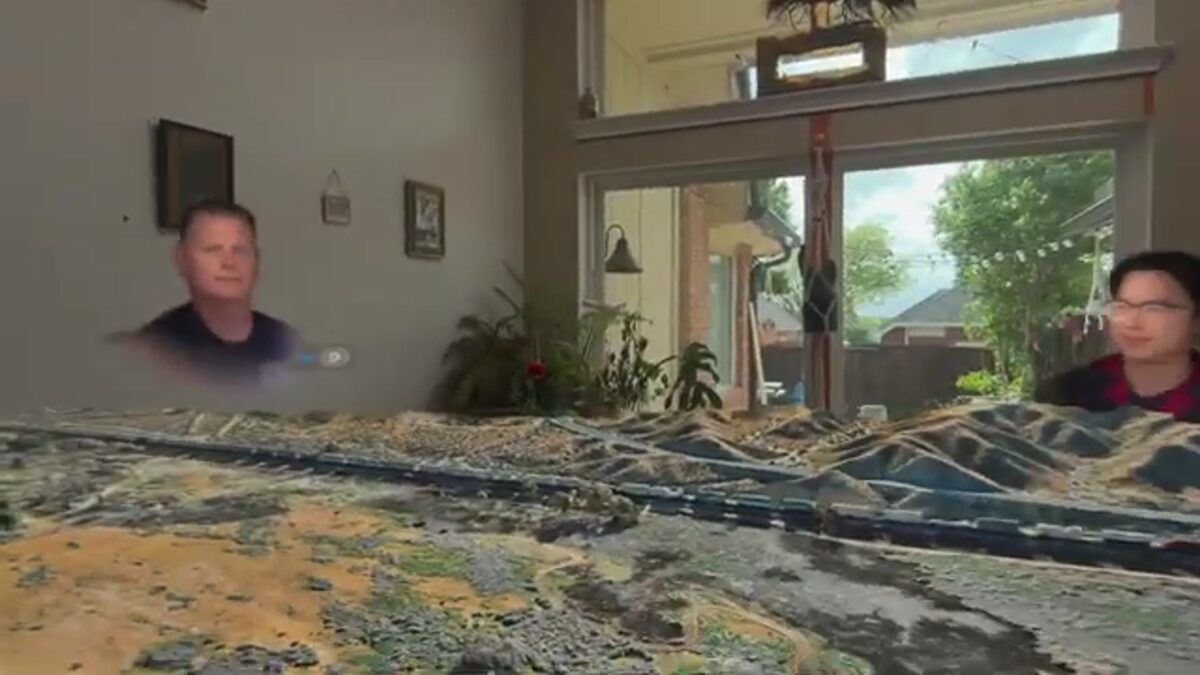
San Bernardino County Fire is also a SkyeBrowse Enterprise VR customer. Enterprise VR runs on Apple Vision Pro and lets personnel view their 3D models in passthrough VR, walking through a mapped scene at full scale as if they were standing in it.
For a fire department, that means an incident commander can step through a building pre-plan, a burn scene, or a hazmat site from a training room or the command post. Crews get a sense of scale, sightlines, and access that is hard to convey on a flat screen, and they can rehearse a response in a space they have never physically entered.
Training and Disaster Response
Models of past incidents become training material. Recruits can study the layout of a real scene, the location of hazards, and how the incident developed, all from a classroom.
During large-scale disasters, orthomosaic maps and 3D models give the department a current picture of affected areas for damage assessment and planning. Exports including LAZ point clouds, GLB models, and GeoTIFF maps let that data move into GIS and other county systems.
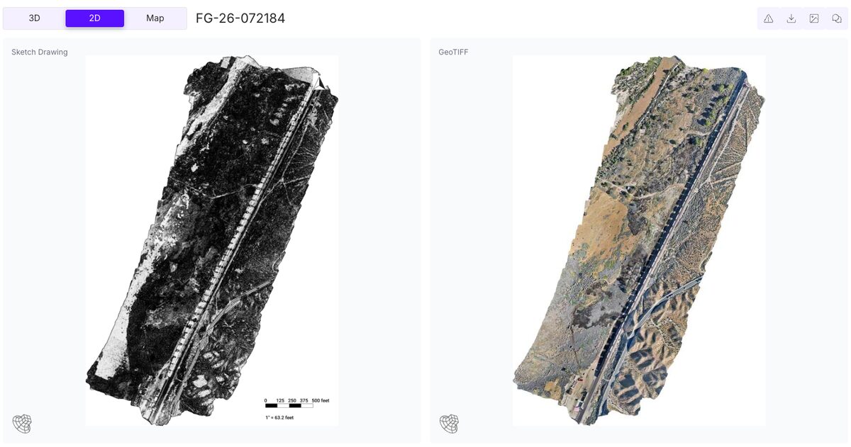
The same railroad fire as an auto-generated sketch drawing with a scale bar and a top-down GeoTIFF orthomosaic.
Strengthening Readiness for Complex Incidents
San Bernardino County Fire describes the capability as part of its ongoing commitment to improving operational effectiveness and reducing risk to personnel. By incorporating aerial data and 3D mapping into emergency response, the department is strengthening its ability to prepare for and manage complex incidents.
SkyeBrowse is used by more than 1,200 agencies worldwide, and data is hosted on AWS GovCloud (US) at FedRAMP Impact Level 2. We are proud to support San Bernardino County Fire and the firefighters who serve one of the most demanding response areas in the country.
Bring SkyeBrowse to Your Department
Public safety and government agencies can apply for the Pilot Program, a free trial of about two weeks with full Public Safety & Enterprise access. To plan a purchase, request a quote.