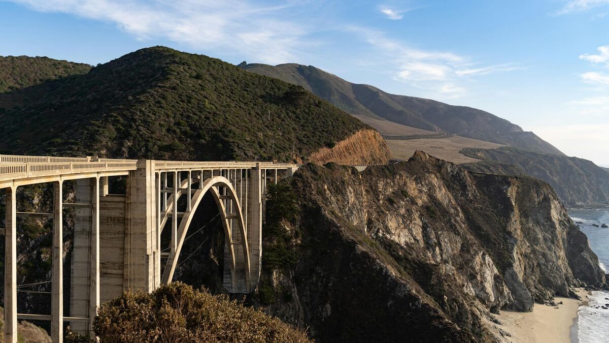
At the I-5/I-405 interchange in Irvine, lane closures are not abstractions — they are measured in commuter-minutes lost, Caltrans coordination calls placed, and CHP staffing hours consumed. Orange County's largest planned city spreads across 66 square miles of tech campuses, University of California Irvine, the Irvine Spectrum Center, and the Great Park redevelopment. The collision volume generated by 318,683 residents routing through that infrastructure demands documentation that closes scenes fast and produces evidence that holds in court. Irvine PD adopted SkyeBrowse videogrammetry — a platform that converts drone video into measurable 3D models — because speed to lane reopening and courtroom-grade precision are not competing priorities with this technology. They arrive together.
Key Takeaways
- Multi-vehicle crashes at the I-5/I-405 interchange that once required Caltrans coordination and multi-officer coverage are now fully documented by one officer in about 10 minutes, reopening lanes before commuter backup reaches adjacent surface streets.
- Irvine Boulevard, Culver Drive, and Sand Canyon Avenue off-ramp scenes are captured with courtroom-grade geometric fidelity exceeding total station benchmarks, preserving lane geometry and debris fields that determine fault in Orange County Superior Court.
- Freeway interchange closures that stretch from 10 minutes to two hours generate cascading congestion delays across the Spectrum commercial district and residential feeders — faster documentation quantifiably reduces that economic and safety impact.
- Premium Advanced tier precision meets the threshold that Orange County DA prosecutors need to withstand defense expert challenges in reconstruction-disputed cases.
- Footage from drones already in Irvine PD's UAS program uploads directly to SkyeBrowse — no additional hardware budget required.
Contents
- Why Irvine Police Department Chose Videogrammetry
- Accident and Crime Scene Documentation
- CJIS-Compliant 3D Evidence for Orange County Superior Court
- Lane Reopening Speed and Freeway Interchange Economics
- FAQ
Why Irvine Police Department Chose Videogrammetry
Irvine PD adopted SkyeBrowse videogrammetry to replace manual tape-and-photo reconstruction workflows that required multiple officers and several hours per scene. The platform accepts video from existing department drones and processes footage at a 1:1 ratio, making a standardized, scalable workflow accessible to patrol, traffic, and investigation units alike.
The I-5/I-405 interchange is one of the highest-volume junctions in Southern California. Multi-vehicle collisions on either freeway spill onto Irvine's surface streets through the Culver Drive, Jeffrey Road, and Sand Canyon Avenue off-ramps. Traditional reconstruction at these locations meant officers measuring for hours while Caltrans and CHP coordinated lane closures and traffic control.
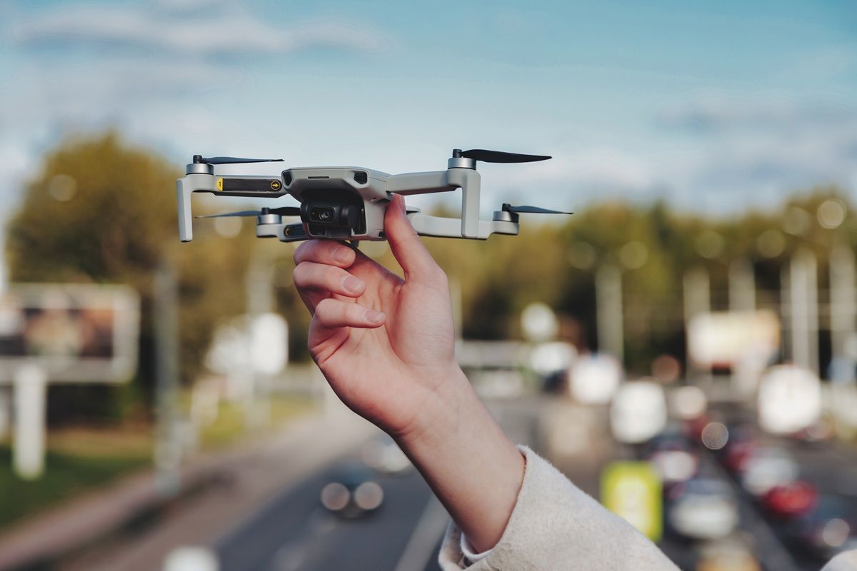
Irvine PD needed a process that matched the city's operational expectations: efficient, data-driven, and scalable. SkyeBrowse replaces manual tape-and-photo workflows with continuous video capture. The responding officer flies a drone orbit or walks the scene, and the platform processes the footage at a 1:1 ratio. One minute of video yields one minute of processing.
The department deployed SkyeBrowse using drones already in its UAS program, eliminating additional hardware procurement. Footage uploads as .MP4 or .MOV directly to app.skyebrowse.com, and the 3D model is available to analysts and supervisors before the officer leaves the scene perimeter.
The result is a standardized workflow that produces consistent, measurable 3D models regardless of which officer responds. That consistency matters in a department where patrol, traffic, and investigation units all contribute to scene documentation.
Accident and Crime Scene Documentation
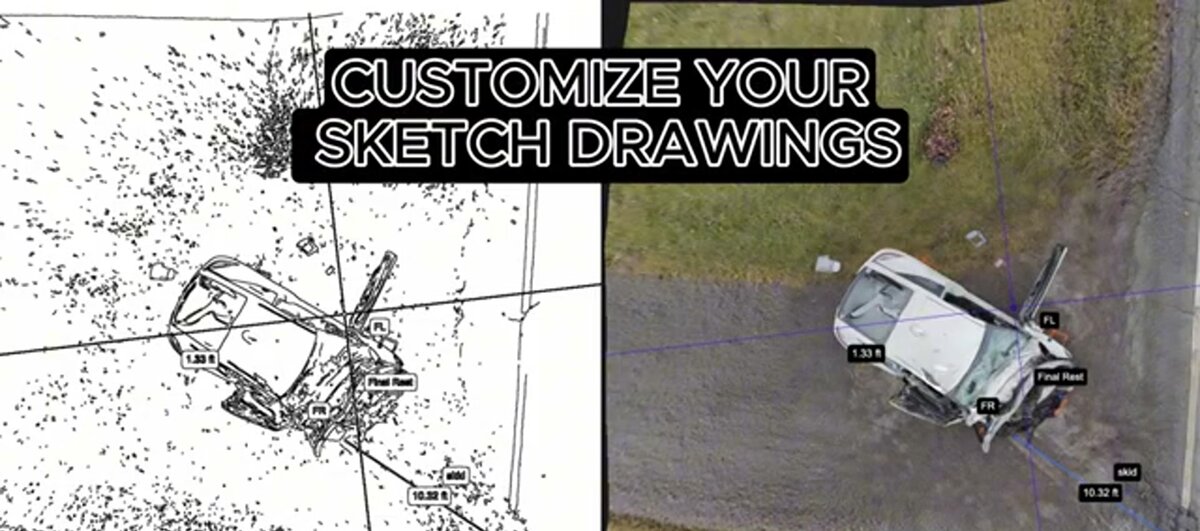
SkyeBrowse captures Irvine accident and crime scenes in about 10 minutes, preserving lane geometry, vehicle rest positions, crosswalk markings, and debris fields in a measurable 3D model. Analysts extract measurements and reconstruct trajectories without a return visit, and detectives share cloud-based model views directly with the Orange County DA's office.
Irvine's wide boulevards and high speed limits generate severe collisions. The Irvine Boulevard-Culver Drive corridor sees broadside crashes during commuter hours. University Drive near UCI experiences pedestrian and cyclist conflicts, particularly during the academic year. The Spectrum area's dense commercial traffic produces fender-benders that escalate to injury accidents during holiday shopping surges.
SkyeBrowse captures each of these scene types in about 10 minutes. The 3D model preserves lane geometry, vehicle rest positions, crosswalk markings, and debris fields. Analysts extract measurements and reconstruct trajectories without a return visit.
Crime scene documentation uses the same capture method. A shooting investigation in a Northwood neighborhood or a vehicle theft recovery in a Spectrum parking structure produces a complete spatial record. Detectives access the model through the cloud platform, share views with the Orange County DA's office, and export stills for case filings.
Irvine's planned-community layout means many scenes involve similar-looking intersections and streetscapes. The 3D model captures the specific geometry of each location, preventing confusion between otherwise visually similar sites when cases go to trial months later.

CJIS-Compliant 3D Evidence for Orange County Superior Court
Orange County Superior Court's digital evidence requirements and discovery production standards demand that forensic models be precise, reproducible, and accompanied by a verifiable chain of custody. SkyeBrowse Premium Advanced delivers courtroom-grade geometric fidelity exceeding total station benchmarks, stored on CJIS-compliant infrastructure with a tamper-evident audit trail that the Orange County DA's office can independently verify during discovery.
Orange County Superior Court cases from Irvine require evidence that survives expert challenge and discovery scrutiny. When defense reconstruction experts submit competing trajectory analyses, the geometry underlying each party's model becomes the battleground. SkyeBrowse Premium Advanced delivers courtroom-grade geometric fidelity exceeding total station benchmarks — precision that gives Irvine prosecutors a defensible foundation when cross-examining competing expert testimony.
The court's digital evidence requirements extend beyond accuracy to chain of custody. Discovery production in serious crash and criminal cases requires that the originating agency demonstrate who handled the evidence, when, and under what conditions. Irvine PD models reside on CJIS-compliant cloud infrastructure with role-based access controls. Every view, download, or share action generates a time-stamped audit entry that the Orange County DA's office can produce during pre-trial discovery — the kind of provenance record that opposing counsel cannot easily dispute.
Bystanders and emergency vehicles in raw footage are scrubbed from models before they enter the evidence chain through an automated process that flags and removes transient objects — ensuring the spatial record reflects scene conditions at the time of the incident rather than the response footprint. Prosecutors working with the Orange County DA's office can share a cloud-based model link directly with expert witnesses and the court. GLB format exports give juries an interactive 3D view of the scene as it existed at the time of the incident, while LAZ point clouds give reconstruction experts the raw geometric data needed for independent speed and trajectory calculations.
Lane Reopening Speed and Freeway Interchange Economics
Every additional hour that I-5 or I-405 interchange lanes remain closed translates into cascading commuter-delay minutes across Irvine's arterial network. SkyeBrowse compresses documentation from multi-hour reconstruction windows to a roughly 10-minute capture cycle, giving Caltrans the green light to restore traffic flow before congestion reaches residential feeders and the Spectrum commercial district.
The I-5/I-405 interchange processes tens of thousands of vehicles during morning and evening commutes. When a serious collision forces ramp closures, traffic engineers track the delay in commuter-minutes — a unit that compounds fast. Research on Southern California freeway incidents consistently shows that each 10 minutes of additional closure during peak hours adds thousands of vehicle-delay-minutes to the regional network. A documentation window that runs two hours longer than necessary at this interchange generates a measurable economic impact across the Spectrum commercial district, UCI campus, and the residential communities that feed both.
Caltrans incident management protocols prioritize lane restoration. When Irvine PD clears and reopens ramps quickly, Caltrans can execute its standard reopening sequence without extended holds. The officer who arrives on scene and completes a drone documentation pass in approximately 10 minutes gives Caltrans that opportunity — instead of the multi-hour reconstruction timeline that previously defined how long interchange lanes stayed closed.
The staffing picture reinforces the traffic benefit. Officers who finish documentation rapidly return to patrol across Irvine's 66-square-mile jurisdiction, maintaining coverage during the congestion-induced window when secondary incident risk rises. Reduced scene time also limits overtime expenditure on complex incidents that would otherwise extend past shift boundaries — a budget consideration that supervisors weigh when freeway scenes approach the two-hour mark.
Consistent documentation further strengthens pattern analysis over time. Every model follows the same capture protocol, making it straightforward for analysts to compare scene geometry across similar intersection types and identify collision patterns on corridors like Jamboree Road or Alton Parkway — work that informs engineering requests to Caltrans for interchange modifications.
FAQ
How does SkyeBrowse compress scene time on Irvine's high-volume freeway corridors?
On corridors like the I-5/I-405 interchange, where Caltrans and CHP coordinate lane closures, a single Irvine PD officer can complete a drone orbit of the crash scene in roughly 10 minutes. SkyeBrowse converts that video into a spatially accurate 3D model with sub-inch measurements, letting reconstruction analysts work from the office rather than holding ramps closed for hours. See workflow details at skyebrowse.com/tutorials.
Is SkyeBrowse CJIS-compliant for California court evidence?
Yes. Evidence captured by Irvine PD is stored on CJIS-compliant cloud infrastructure with a tamper-evident audit trail the Orange County DA's office can verify independently during discovery. SkyeBrowse Premium Advanced delivers courtroom-grade geometric fidelity exceeding total station benchmarks — a precision level that allows Irvine prosecutors to rebut competing expert reconstruction testimony in Orange County Superior Court proceedings.
Can Irvine PD use its existing UAS program hardware with SkyeBrowse?
Yes. SkyeBrowse ingests .MP4 and .MOV files from any drone already cleared for Irvine PD operations, as well as smartphones and body-worn cameras. There is no mandatory hardware upgrade — departments simply upload footage from the field to app.skyebrowse.com and processing begins immediately. See the full compatibility list at skyebrowse.com/supported-drones.
Get a SkyeBrowse Quote for Irvine Police Department
Irvine PD manages one of Orange County's most demanding patrol jurisdictions — 66 square miles of planned infrastructure, two major freeways, and a community that measures response quality precisely. SkyeBrowse fits that standard: one officer, one video, court-ready geometry before the scene clears.