Incorporated just two decades ago, Johns Creek has grown into one of Georgia's fastest-growing suburbs, adding residents at a pace that has consistently outrun its original road infrastructure. State Route 141 — locally Medlock Bridge Road — carries the brunt of that growth, funneling commuters toward Technology Park and the Chattahoochee River corridor through a series of intersections that now see roughly 15 percent more crash calls per year than they did five years ago. SkyeBrowse's videogrammetry platform, which converts continuous drone or smartphone video into measurable 3D models, gives Johns Creek PD a way to document that growing caseload without growing the reconstruction staff to match.

Key Takeaways
- Johns Creek handles roughly 15% more crash calls per year on State Route 141 than it did five years ago — SkyeBrowse lets the department absorb that volume increase without adding reconstruction specialists.
- One officer captures a complete Medlock Bridge Road crash scene in about ten minutes, freeing the rest of the shift to respond across the remaining 31 square miles.
- Scene geometry is verified to the standard Fulton County prosecutors require for vehicular homicide charges, with sub-inch accuracy and a reproducible, auditable capture process.
- Cloud-based model sharing lets Johns Creek detectives, Fulton County investigators, and the DA's office work from the same 3D scene simultaneously — no joint return visits required.
- Because any patrol officer can run the capture checklist, documentation quality scales with call volume rather than with the availability of a single certified reconstructionist.
Contents
- Why does documentation capacity matter as Johns Creek's crash volume keeps climbing?
- How does Johns Creek PD document crash and crime scenes on State Route 141?
- Does SkyeBrowse evidence hold up in Fulton County Superior Court?
- How does faster scene clearance affect State Route 141 traffic flow?
- FAQ
Why does documentation capacity matter as Johns Creek's crash volume keeps climbing?
Johns Creek is one of Georgia's fastest-growing suburbs, and its crash call volume on State Route 141 has risen roughly 15 percent per year as the population expands northward. SkyeBrowse lets the department document each of those scenes accurately enough for Fulton County Superior Court without adding reconstruction staff — the workflow scales with incident volume rather than headcount.
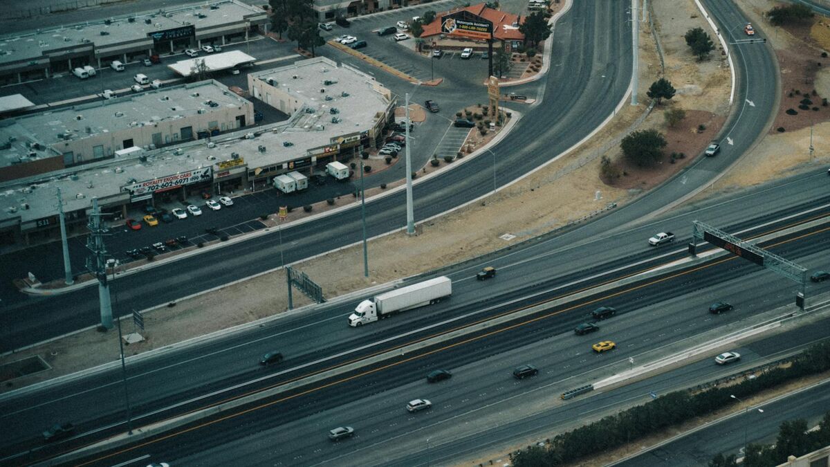
Johns Creek sits at the intersection of rapid suburban growth and legacy road infrastructure. Medlock Bridge Road was designed for a quieter corridor; it now absorbs commuter and commercial traffic that was never part of its original capacity calculation. The result is a reliable pattern of T-bone and left-turn collisions at peak hours — scenes that demand thorough forensic documentation to support Fulton County felony prosecutions.
Traditional manual measurement workflows are not built to scale. They require multiple officers, extended lane closures, and a reconstruction specialist whose availability becomes the rate-limiting factor as incident volume climbs. Johns Creek recognized that adding incidents without adding workflow capacity meant either slower scene processing or thinner patrol coverage during those events.
SkyeBrowse changes the arithmetic. Any patrol officer follows a short capture checklist — drone orbit or handheld smartphone walk — and the footage processes cloud-side into a measurable 3D model. No post-processing workstation, no specialized hardware beyond what the department already issues. When crash calls increase 15 percent, documentation capacity increases with them because the workflow lives with every officer on every shift.
How does Johns Creek PD document crash and crime scenes on State Route 141?
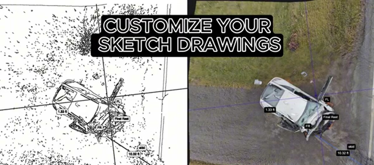
A drone orbit over a collision at the Medlock Bridge Road intersection captures lane markings, vehicle positions, debris fields, and skid marks in a single continuous video pass. The footage uploads to SkyeBrowse's cloud platform and returns as a measurable 3D model in about ten minutes — preserving every spatial relationship before traffic crews move anything.
The Chattahoochee River forms Johns Creek's western boundary, and the winding roads near its bluffs create limited-visibility curves where severe crashes occur. Technology Park's corporate campuses generate heavy morning and evening traffic on roads that were built for lighter suburban loads. Each crash type produces a distinct scene geometry, but the capture process is identical.
A drone orbit or handheld video pass covers the full intersection footprint in one continuous shot. Analysts can measure distances, verify sightlines, and examine vehicle crush profiles from the resulting model without returning to the physical location. Johns Creek detectives, Fulton County investigators, and the DA's office can pull up the same interactive model simultaneously from any browser — no coordinating schedules for a joint site visit.
Crime and property-crime scenes follow the same videogrammetry process. A residential neighborhood walk or commercial parking lot perimeter captures spatial relationships between evidence markers, creating a digital record detectives can revisit as many times as the case requires.

Does SkyeBrowse evidence hold up in Fulton County Superior Court?
Fulton County Superior Court handles Johns Creek felony and serious traffic cases, where both prosecution and defense teams arrive with expert witnesses capable of challenging measurement methodology. SkyeBrowse Premium Advanced produces scene geometry verified to the standard Fulton County prosecutors require for vehicular homicide charges — sub-inch accuracy from a reproducible, auditable video source.
Johns Creek felony cases move through Fulton County Superior Court, where the evidentiary bar for vehicular homicide and serious injury crash charges is high. Defense experts will challenge how measurements were taken, who had access to the evidence, and whether the collection methodology can be independently reproduced. SkyeBrowse's Premium Advanced tier is designed to withstand that scrutiny.
Every measurement in the model is derived from the same continuous video source — a reproducible process that expert witnesses on either side can examine step by step. GLB mesh exports give jurors an interactive 3D walkthrough of the collision scene, which is significantly more comprehensible than a scaled diagram drawn from memory and a tape measure. LAZ point cloud exports integrate with the forensic CAD tools prosecutors use for speed and trajectory analysis, connecting scene documentation directly to reconstruction testimony.
Data custody is fully documented. Evidence stores on AWS GovCloud (US) infrastructure with CJIS-aligned audit logs that record every access event from upload through trial. Defense counsel requesting discovery receives a model paired with a complete access history — no gaps in the chain, no ambiguity about who reviewed what and when. See the FBI CJIS Security Policy for the compliance framework that governs SkyeBrowse's evidence handling.
How does faster scene clearance affect State Route 141 traffic flow?
When a serious collision closes State Route 141 during morning rush hour, the backup reaches residential feeders within minutes. Compressing documentation from a multi-officer, multi-hour operation to a ten-minute single-officer capture reopens lanes before that congestion becomes self-reinforcing — and reduces the secondary crash risk that extended closures create.
State Route 141 is not an isolated road; it is the spine of Johns Creek's commuter network. Traffic that cannot move on Medlock Bridge Road redistributes onto neighborhood connectors and side streets not built for that volume. The longer the closure, the wider the disruption ripples — and the greater the chance that a secondary incident occurs in slowed or diverted traffic.
Extended closures also carry direct staffing costs. Multi-hour reconstruction events generate overtime, pull officers from proactive enforcement, and force other calls to queue. As crash frequency on State Route 141 has grown, so has the cumulative weight of those costs on a department sized for the residential population, not the traffic corridor.
SkyeBrowse compresses that operational footprint. One officer handles capture, the model processes while lanes are being prepped for reopening, and the rest of the shift returns to service. The NHTSA's Traffic Safety Facts data consistently shows that secondary incident risk rises sharply during extended primary scene closures — faster reopening on State Route 141 directly reduces that exposure.
Consistent capture across shifts also builds institutional documentation quality over time. When a new recruit documents their first serious crash on Medlock Bridge Road, the output meets the same standard as a ten-year veteran's because the checklist, not individual judgment, governs the result.
FAQ
What is videogrammetry and how does Johns Creek PD use it?
Videogrammetry extracts precise 3D measurements from continuous video. Johns Creek PD uses SkyeBrowse to document collisions along State Route 141 — a drone circles the intersection, the footage uploads to the cloud, and a measurable 3D model is ready in about the same time it takes traffic control to re-open lanes. Learn more at skyebrowse.com.
Does SkyeBrowse meet Fulton County Superior Court evidence standards?
Yes. SkyeBrowse Premium Advanced produces scene geometry verified to the standard Fulton County prosecutors require for vehicular homicide charges — sub-inch accuracy from a continuous video source with a fully auditable custody chain on AWS GovCloud infrastructure. See the FBI CJIS Security Policy for the compliance framework SkyeBrowse supports.
How does Johns Creek PD share scene models with Fulton County prosecutors?
SkyeBrowse's cloud-based sharing allows Johns Creek detectives, Fulton County investigators, and the DA's office to access the same interactive 3D model simultaneously — no scheduled site revisits and no waiting for a physical reconstruction report. See skyebrowse.com/pricing-premium for tier details including sharing controls.
Johns Creek is a city that grew fast and invested in infrastructure to match. SkyeBrowse fits that investment posture — documentation capacity that scales with crash volume on State Route 141 without requiring the department to scale its reconstruction staff in lockstep.