The third-largest port in the United States by tonnage sits at the heart of Corpus Christi, Texas, driving a constant flow of tanker trucks, freight haulers, and petrochemical transports through a city of roughly 326,000 residents. Nueces County's coastal geography means investigators contend with salt air, wind, and sudden Gulf rain while documenting scenes along South Padre Island Drive, the Harbor Bridge approaches, and the refineries lining the ship channel.
The challenge in Corpus Christi is not only accuracy — it is time. Evidence captured before environmental degradation sets in is evidence that survives to trial. Corpus Christi PD adopted SkyeBrowse, a platform that converts drone or smartphone video into precise, admissible 3D models, to close the gap between incident and permanent 3D record before the Gulf weather clock runs out.

Key Takeaways
- Gulf Coast humidity, salt air, and sudden rain can degrade crash scene evidence within an hour — CCPD's primary documentation challenge is the minutes between incident and permanent 3D record.
- SPID multi-vehicle pileups that once required a large crew measuring under the Gulf Coast sun now clear with one officer's drone pass and a ten-minute capture window.
- Port-city traffic means scene closures on South Padre Island Drive ripple into freight delays at the ship channel — faster documentation directly reduces that economic disruption.
- Documentation fidelity that preserves coastal crime scene details before Gulf weather erases them meets the evidentiary bar set by the 28th and 94th Judicial District Courts in Nueces County under the Texas Rules of Evidence.
- The Harbor Bridge construction zone, Westside crime scenes, and Naval Air Station approach roads all fall within the same SkyeBrowse workflow — one platform for a city's full incident range.
Contents
- Racing the Gulf Weather Clock: Why Environmental Degradation Drives Documentation Urgency
- Accident and Crime Scene Documentation
- CJIS-Compliant 3D Evidence for Texas Courts
- Patrol Capacity and Scene Throughput
- FAQ
Racing the Gulf Weather Clock: Why Environmental Degradation Drives Documentation Urgency {#racing-the-gulf-weather-clock}
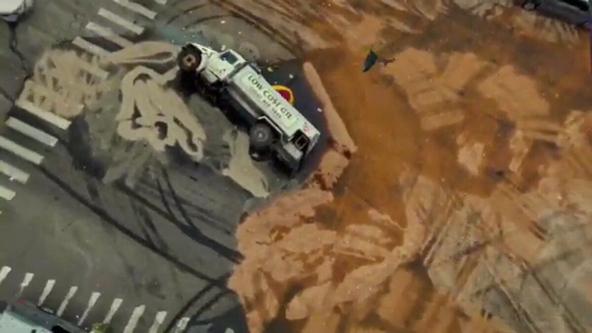
South Padre Island Drive is a six-lane divided highway that serves as the city's primary east-west corridor. Multi-vehicle pileups on SPID back traffic into Naval Air Station access roads and cost the port real money in freight delays. The documentation problem on the Gulf Coast is not just personnel — it is the environmental clock. Every minute after a crash is a minute that humidity, salt air, or a passing rain squall has to alter the physical evidence.
South Padre Island Drive, known locally as SPID, is a six-lane divided highway that serves as the city's primary east-west corridor. Multi-vehicle pileups during morning commutes can paralyze the south side for hours. The ongoing Harbor Bridge replacement project has rerouted traffic patterns, adding construction-zone collisions to an already heavy caseload.
Corpus Christi sits on the Gulf Coast, which creates documentation conditions found nowhere else in Texas. Salt air accelerates the oxidation of metalite debris. Gulf humidity lifts tire marks from asphalt faster than in inland climates. A passing rain cell — common in summer afternoons — can wash a skid pattern off the road entirely within thirty minutes of a crash. In tidal-proximity areas near the ship channel, even evidence markers can shift before investigators finish their walk.
SkyeBrowse replaces hours of manual measurement with continuous video capture. An officer flies a drone orbit or walks the perimeter with a smartphone, uploading footage directly from the field. The platform processes the video cloud-side and delivers a measurable 3D model — minutes between the incident and a permanent geometric record, not hours.
Officers use hardware already in the department's inventory. The platform accepts footage from department drones, patrol smartphones, or body cameras, with no additional equipment purchase needed to begin the program.
Accident and Crime Scene Documentation
Corpus Christi's mix of port-industrial traffic, coastal tourism, and construction zones creates a wide range of incident types across the city. SkyeBrowse captures all of them in about ten minutes, producing documentation fidelity that preserves coastal crime scene details before Gulf weather erases them — so analysts can reconstruct trajectories without a return visit and without hoping the physical evidence survived.
Corpus Christi's mix of port-industrial traffic and coastal tourism creates a wide range of incident types. SPID sees high-speed rear-end chains during commuter surges. The Harbor Bridge construction zone generates sideswipe and lane-departure crashes where temporary barriers complicate scene geometry. Residential areas near the Naval Air Station experience late-night single-vehicle rollovers on poorly lit curves.
SkyeBrowse captures all of these scenes in about 10 minutes. The resulting 3D model preserves lane striping, barrier positions, vehicle orientations, and debris scatter so analysts can reconstruct trajectories and measure distances without a return visit — and, critically, before any further weathering has occurred.
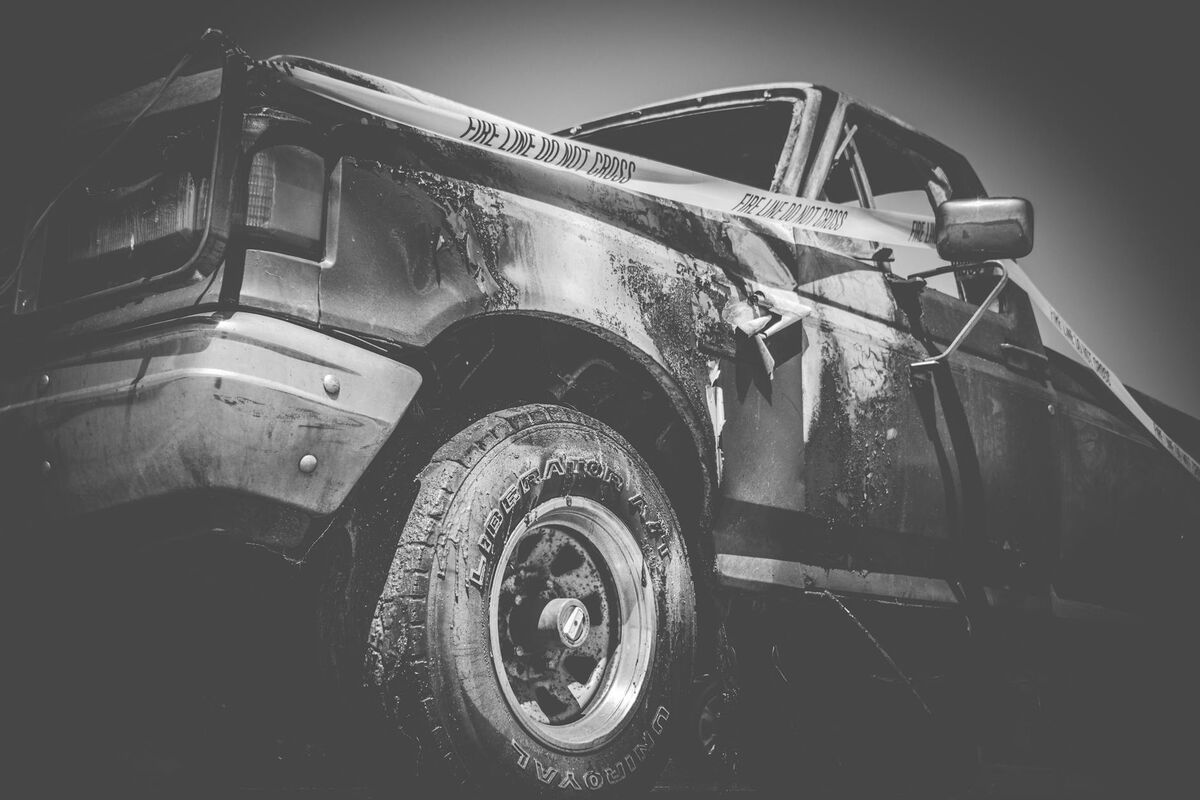
Crime scene documentation benefits equally. A shooting scene in a Westside neighborhood or a vehicle pursuit endpoint on Ocean Drive can be documented with a handheld video walk, preserving spatial relationships between evidence markers, casings, and vehicles before the next Gulf rain event. Detectives review the model remotely instead of relying on static photographs and hand-drawn sketches that cannot capture three-dimensional geometry.
The coastal environment means the window for accurate physical evidence collection is genuinely short. Fast capture preserves the scene as it was at the moment of discovery, not as it becomes after an hour of Gulf Coast weather exposure.
CJIS-Compliant 3D Evidence for Texas Courts
Texas District Courts demand precise, reproducible evidence, and cases from Nueces County move through the 28th and 94th Judicial District Courts where juries expect clear, verifiable measurements. Under the Texas Rules of Evidence, digital demonstrative evidence must meet reliability standards for admissibility. SkyeBrowse's sub-inch accuracy, AWS GovCloud hosting, and CJIS-ready audit trails satisfy those standards — and the Nueces County court standard for digital evidence presented in serious traffic and felony proceedings.
Corpus Christi cases involving serious crashes or felony offenses move through the 28th and 94th Judicial District Courts in Nueces County, where prosecutors present reconstruction evidence to juries increasingly accustomed to technical exhibits. A hand-drawn scene diagram and a set of photographs no longer carry the evidentiary weight they once did when the defense retains its own reconstruction expert.
Under the Texas Rules of Evidence, digital demonstrative evidence is evaluated for reliability, methodology, and chain of custody before it reaches the jury. SkyeBrowse's Premium Advanced tier produces models at sub-inch measurement precision — measurements derived from the same continuous video that generated the model, meaning every data point traces back to a documented source. Prosecutors use interactive GLB models to walk juries through collision geometry in three dimensions, which is considerably more persuasive than a scaled overhead diagram.
The security infrastructure behind those models satisfies Texas law enforcement's chain-of-custody requirements. Evidence is stored on AWS GovCloud (US) servers, with CJIS-aligned audit logs that record every access event from initial upload through trial. The FBI CJIS Security Policy sets the baseline that SkyeBrowse infrastructure is designed to support — and Premium Advanced tiers include data retention that covers the full appeals timeline for serious convictions in Texas courts.
Patrol Capacity and Scene Throughput
Corpus Christi covers over 460 square miles, and extended scene commitments compound staffing pressure across the entire city. SkyeBrowse compresses documentation from a multi-officer, multi-hour commitment into a ten-minute one-officer capture — freeing the rest of the crew to stay in service while also reducing freight delays at the port and secondary crash risk on SPID.
A multi-vehicle pileup on SPID during morning rush hour used to carry costs that spread well beyond the crash site. Multiple officers held at the scene for hours meant an extended lane closure that backed freight traffic headed to the port — compounding economic disruption while officers measured skid marks by hand under the Gulf Coast sun.
With SkyeBrowse, the documentation portion of that scenario takes about ten minutes. Officers not needed for capture return to patrol while the model is still processing. Lanes re-open sooner, freight moves again, and the overtime that extended reconstructions triggered disappears from the shift report. Across a jurisdiction covering more than 460 square miles, recovering those officer-hours on every significant scene produces a meaningful shift in daily patrol capacity.
Consistency matters at scale too. Corpus Christi handles a high volume of incidents across diverse terrain — port approaches, construction corridors, coastal residential roads, Westside neighborhoods. SkyeBrowse delivers the same documentation standard regardless of which officer responds or where the incident occurs. Supervisors reviewing case files see comparable outputs built on the same methodology, which simplifies both quality review and courtroom preparation.

FAQ
How does SkyeBrowse handle crash documentation on busy port-city corridors like SPID?
A CCPD officer captures a full South Padre Island Drive crash scene in about ten minutes using a drone or smartphone. The footage uploads to the cloud and generates a measurable 3D model while the officer is still on scene — so lane closures end sooner, freight traffic to the port moves again, and no secondary reconstruction visit is needed. Learn more at skyebrowse.com.
Does SkyeBrowse meet Texas court evidentiary standards?
Yes. SkyeBrowse Premium Advanced delivers sub-inch measurement precision backed by AWS GovCloud hosting and CJIS-aligned audit trails. Models carry the documentation fidelity that preserves coastal crime scene details before Gulf weather erases them, meeting the standards of the 28th and 94th Judicial District Courts in Nueces County under the Texas Rules of Evidence. See the FBI CJIS Security Policy for the compliance baseline SkyeBrowse infrastructure is built to support.
How does coastal weather affect scene documentation and how does SkyeBrowse help?
Gulf Coast conditions make scene preservation time-sensitive: wind moves debris, salt air accelerates evidence degradation, rain washes tire marks, and tidal proximity can shift physical markers within an hour. SkyeBrowse captures the complete scene geometry in a single video pass — before environmental conditions alter it — and stores the model permanently in the cloud for as long as the case requires. See skyebrowse.com/tutorials for workflow guides.
Corpus Christi operates at a scale and pace that demands documentation tools built for the environment — not adapted from it. SkyeBrowse's video-to-3D workflow was designed to work fast enough to outrun Gulf Coast weather and flexible enough to handle everything from SPID pileups to Westside crime scenes, with the same officer and the same hardware, before the coastal climate has a chance to rewrite the scene.