Utah's 29 counties span 84,899 square miles of terrain that ranges from the Uintah Basin's oil and gas infrastructure to the Wasatch Front's dense suburban corridors to the canyon country of the Colorado Plateau. The Fire Marshal's Office is responsible for fire investigation standards and training across every one of those counties — but the departments doing the on-the-ground work vary enormously. A career department in West Valley City has resources that a rural volunteer department in Sanpete County does not. Before SkyeBrowse, that gap meant the state had to dispatch its own investigators on multi-hour drives to rural incidents, burning time while evidence at the scene degraded. SkyeBrowse's videogrammetry platform closes that gap by giving any department — career or volunteer, urban or remote — the ability to produce investigation-grade 3D documentation with hardware they already own.

Key Takeaways
- Rural volunteer departments across Utah's 29 counties can now produce investigation-grade documentation that previously required a state-level team to drive hours to the scene — reducing state drive-time hours per investigation significantly.
- Investigation-grade fidelity that meets the evidentiary bar for state-level arson prosecution is accessible from any drone or smartphone, with no dedicated hardware purchase required.
- Char depth gradients, pour patterns, and structural collapse sequences are preserved at sub-inch precision, giving the Utah Attorney General's Office measurable forensic evidence that survives months between scene clearance and trial.
- The same capture workflow trains volunteer departments in Sanpete County and career departments in West Valley City — one statewide documentation standard with no hardware restrictions.
- GeoTIFF exports tie fire scene locations into Utah's statewide GIS infrastructure, enabling the Fire Marshal's Office to run spatial pattern analysis across incidents spanning multiple counties.
Contents
- Why Utah State Fire Marshal's Office Chose Videogrammetry
- Pre-Incident Planning and Post-Fire Documentation
- Training, Hazmat Response, and Multi-Agency Coordination
- Compliance and Data Security for Utah
- Statewide Reach and Rural Department Capability
- FAQ
Why Utah State Fire Marshal's Office Chose Videogrammetry
Fire investigation in Utah presents a geographic diversity problem that few other states match. The Wasatch Front corridor generates a high volume of structural fire investigations, while rural counties demand response times that make repeat state-level site visits impractical. SkyeBrowse's videogrammetry workflow lets any department — regardless of size or resources — capture and process a complete 3D fire scene before leaving the property, producing documentation that meets state investigation standards from the first visit.
The Wasatch Front corridor from Ogden to Provo holds roughly 80 percent of the state's 3.4 million residents, generating a high volume of structural fire investigations. Meanwhile, investigators also respond to incidents in rural counties where the nearest state office may be two hours away — and where the local volunteer department lacks the equipment to produce documentation that meets Utah Administrative Code fire investigation standards on its own.
Traditional documentation methods required a specialized team to spend hours measuring char patterns, photographing debris layers, and sketching floor plans. By the time a state investigator drove from Salt Lake City to a scene in St. George or Vernal, weather and cleanup crews had often already begun altering evidence. That lag created a documentation gap that affected both criminal prosecution quality and compliance with the reporting requirements the Utah State Fire Marshal's Office is charged with enforcing.
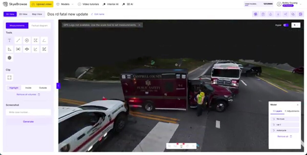
Video footage from a drone, smartphone, or body-worn camera feeds directly into SkyeBrowse's processing pipeline. An investigator — or a trained local volunteer — arrives at a rural scene, captures a complete video walkthrough, and has a measurable 3D model building before the drive back begins.
Pre-Incident Planning and Post-Fire Documentation
Utah's ski resort towns and oil and gas infrastructure create distinct documentation demands — high-elevation structures with limited road access require spatial pre-planning, while wellhead incidents demand rapid evidence capture before hazmat decontamination alters the scene. SkyeBrowse handles both with accuracy tiers scaled to each use case, from Lite models for pre-planning to Premium Advanced for forensic investigation.
Utah's ski resort towns present unique pre-incident planning challenges. Structures in Park City, Deer Valley, and Snowbird sit at elevations above 7,000 feet, often on steep slopes with limited road access. A Lite-tier 3D model of a resort lodge or condominium complex gives fire crews spatial awareness they cannot get from flat blueprints — more than sufficient accuracy for pre-planning purposes, capturable with any drone on a routine visit.
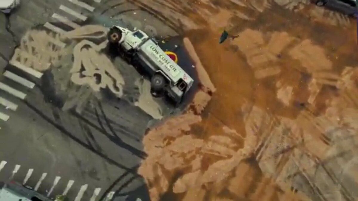
Post-fire investigation demands higher precision. Investigators use SkyeBrowse to document fire scenes with Premium Advanced's sub-inch spatial accuracy. Char depth measurements, collapse patterns, and origin indicators are preserved in the model. Forensic analysts can revisit the digital scene months later without relying on memory or static photographs.
The Uintah Basin's oil and gas infrastructure creates another documentation priority. Wellhead fires and tank battery incidents involve hazardous materials, confined spaces, and complex piping layouts. A drone orbit captured before crews disturb the scene locks in evidence geometry for both criminal investigation and regulatory review by EPA or UDEQ.
GeoTIFF exports integrate with Utah's GIS infrastructure, allowing investigators to overlay fire progression data with property records, hydrant locations, and access routes across the Wasatch Front. According to the U.S. Fire Administration, systematic documentation is a cornerstone of defensible fire investigation methodology.
Training, Hazmat Response, and Multi-Agency Coordination
The Fire Marshal's Office trains local departments across all 29 Utah counties. SkyeBrowse simplifies that training pipeline because one workflow works across all hardware — a volunteer department in Sanpete County using a consumer drone follows the same process as a career department in West Valley City using a DJI Matrice.
The Fire Marshal's Office trains local departments across all 29 Utah counties. SkyeBrowse simplifies that training pipeline because the capture workflow is identical regardless of hardware. A volunteer department in Sanpete County using a consumer drone follows the same process as a career department in West Valley City using a DJI Matrice — and the resulting model meets the same investigation-grade standard.
Hazmat responses near the Uintah Basin refineries and along I-80 and I-15 freight corridors require rapid documentation before decontamination begins. One investigator or trained local responder can capture the spill perimeter, container positions, and plume boundaries in minutes. The resulting model supports both the Fire Marshal's investigation and EPA or UDEQ regulatory filings.
Multi-agency coordination improves when everyone works from the same spatial reference. Cloud-based model sharing lets the Fire Marshal's Office, local fire departments, ATF investigators, and Utah Department of Public Safety review identical 3D evidence without scheduling joint site visits.
Compliance and Data Security for Utah
Fire investigation evidence presented in Utah District Courts must meet Utah Administrative Code fire investigation standards for accuracy, chain of custody, and reproducibility. SkyeBrowse's security architecture — built on AWS GovCloud with CJIS-compliant workflows — protects that evidence from capture through trial, whether the case is prosecuted at the county level or escalated to the Utah Attorney General's Office.
Arson cases in Utah can travel from a remote county sheriff's investigation all the way to the Utah Attorney General's Office, and the evidentiary record must hold up at every step. SkyeBrowse's AWS GovCloud hosting keeps fire scene data on FedRAMP Moderate-aligned infrastructure, while CJIS-compliant audit trails log every access event and export action. That chain of custody is documented and reproducible — a requirement for evidence admitted in Utah District Court and a direct support to Utah Administrative Code fire investigation reporting standards.
Transient object removal addresses a common rural scene problem: livestock, cleanup crew vehicles, or passing traffic that would otherwise contaminate a scene model. Each model is rendered clean of objects present during capture but absent at the time of ignition, leaving investigators with an accurate spatial record of the fire scene itself. Data retention on Premium and Premium Advanced tiers covers multiple years — long enough to support post-conviction appeals or civil litigation arising from major incidents.
NFPA 921, the authoritative guide for fire and explosion investigations, emphasizes scientific methodology and documentation integrity — requirements that SkyeBrowse's precision models and audit trails directly support. GeoTIFF exports connect individual fire scenes to the broader GIS record, giving investigators the spatial context to identify pattern evidence across multiple incidents throughout the state.
Statewide Reach and Rural Department Capability
The true value of SkyeBrowse for the Utah State Fire Marshal's Office is what it does to the gap between urban and rural departments. Rural volunteer departments that previously could not produce documentation meeting state investigation standards now capture 3D models with investigation-grade fidelity — reducing the drive-time hours state investigators spend on scenes that local departments can now handle independently.
Before SkyeBrowse, a volunteer department responding to a structure fire in Emery or Juab County faced an evidence documentation problem with no good solution. The department lacked the equipment and specialized training to produce forensic-quality documentation. The state would need to dispatch its own team — a round trip that could consume eight hours of drive time on top of the investigation itself, often arriving after the scene had been partially disturbed.
With SkyeBrowse, that same volunteer department completes a scene capture during its initial response. The video uploads when the crew returns to cell coverage, and the 3D model arrives complete and measurable — investigation-grade fidelity that meets the evidentiary bar for state-level arson prosecution, produced by personnel who received the same workflow training as career departments on the Wasatch Front.
The statewide impact accumulates across every rural callout where the state no longer needs to dispatch its own team. Drive-time hours saved per investigation represent investigator capacity that can be redirected to Wasatch Front caseloads or to more complex multi-fire pattern analysis. For an office responsible for 29 counties, that reallocation of investigator time is as consequential as the documentation quality itself.

FAQ
How does SkyeBrowse help rural volunteer departments meet state fire investigation standards?
Before SkyeBrowse, a rural volunteer department in Sanpete or Emery County lacked the equipment and trained personnel to produce documentation at the level required by Utah Administrative Code fire investigation standards. A state-level team would have to drive hours to capture that evidence. With SkyeBrowse, the same volunteer department captures a complete video walkthrough of the fire scene with a drone or smartphone they already own, and the resulting 3D model meets the investigation-grade fidelity required for state-level arson prosecution — without waiting for Salt Lake City to send a team.
What accuracy does SkyeBrowse provide for arson prosecution in Utah courts?
SkyeBrowse Premium Advanced produces investigation-grade fidelity that meets the evidentiary bar for state-level arson prosecution in Utah. Char depth gradients, pour pattern geometry, and structural collapse sequences are preserved at sub-inch precision in a format forensic analysts can measure months after the scene has been cleared and rebuilt. That level of spatial accuracy satisfies the documentation requirements under Utah Administrative Code fire investigation standards and supports cases that travel from a rural county sheriff's investigation to the Utah Attorney General's Office.
How does SkyeBrowse support coordination across all 29 Utah counties?
Cloud-based model sharing in SkyeBrowse means a rural volunteer department in Sanpete County and the statewide office in Salt Lake City can review the same 3D evidence simultaneously — without scheduling joint site visits or shipping physical documentation. Because the capture workflow is identical regardless of the device used, a volunteer department that completes SkyeBrowse training produces models directly comparable to those from a career department on the Wasatch Front, making statewide evidence review and quality control straightforward.
Get a SkyeBrowse Quote for Utah State Fire Marshal's Office
Utah's 84,899 square miles demands a documentation platform that works as well for a volunteer department in Emery County as it does for a career crew in Salt Lake City. Contact SkyeBrowse to discuss licensing options, training schedules for rural departments, and how the platform fits into the Fire Marshal's existing investigation workflow from the Colorado Plateau to the Wasatch Front.