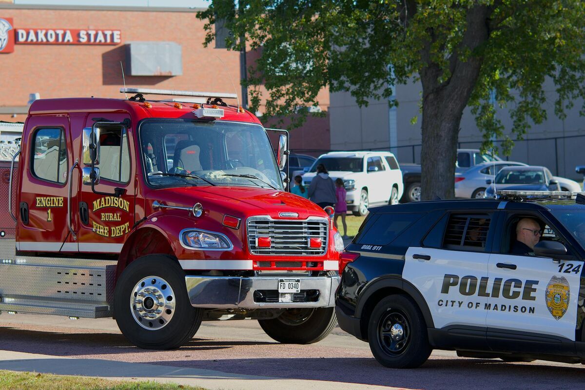
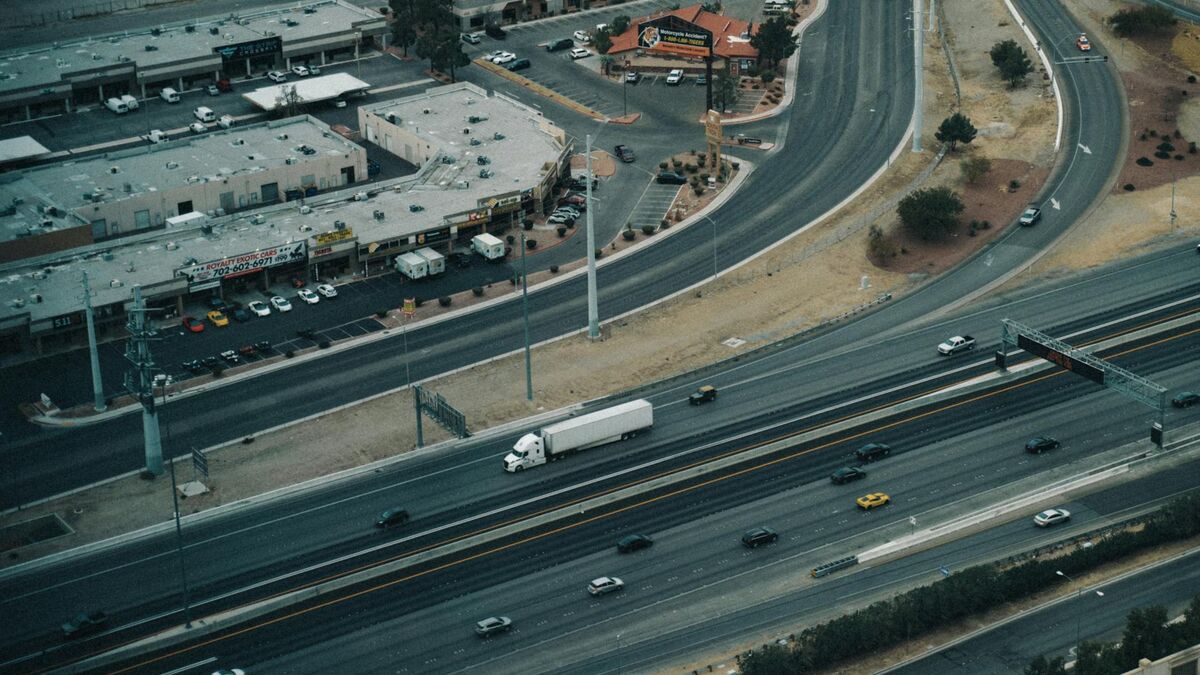
For freight carriers running the I-80 corridor, a multi-vehicle pileup near the I-74 interchange is not just a law enforcement event — it is a clock ticking against delivery schedules, driver hours-of-service windows, and downstream receiving operations across two states. Bettendorf, Iowa, sits at that chokepoint. Scott County's largest city, with roughly 39,000 residents on the Mississippi River's western bank, absorbs a disproportionate share of cross-state commercial traffic. When an incident closes the I-74 bridge approach or backs up I-80, the economic cost accumulates by the minute in delayed freight and lost commuter productivity. Bettendorf PD's adoption of SkyeBrowse was driven by a straightforward operational mandate: compress the time between incident and reopening without sacrificing the documentation accuracy Iowa District Court demands.
Key Takeaways
- The I-74 bridge and I-80 interchange make Bettendorf a chokepoint for Quad Cities cross-state commerce — every minute those corridors stay closed ripples across freight schedules and commuter patterns on both sides of the Mississippi, so documentation speed has a measurable economic consequence.
- A Bettendorf officer capturing scene geometry on a winter morning — icy pavement, limited sight lines, Illinois traffic backing up on the bridge — can complete the full documentation record before Iowa DOT's detour signage is fully deployed.
- Bettendorf officers already carry the equipment SkyeBrowse requires; the platform accepts video from drones, patrol-car-mounted cameras, and smartphones, meaning no specialized hardware procurement was needed.
- SkyeBrowse Premium Advanced delivers reconstruction precision that survives Daubert challenges in Iowa's Seventh Judicial District, with tamper-evident audit trails meeting both prosecution and defense expert standards.
- A model captured by a Bettendorf officer is simultaneously available to Scott County investigators and Iowa State Patrol the moment processing completes, replacing multi-agency coordination meetings that used to follow separate measurements.
Contents
- Why Bettendorf Police Department Chose Videogrammetry
- Interstate Corridor Documentation: Closing the Gap Between Incident and Reopening
- CJIS-Compliant 3D Evidence for Iowa Courts
- Interstate Reopening Minutes Saved and Freight-Delay Cost Avoided
- FAQ
Why Bettendorf Police Department Chose Videogrammetry
Bettendorf PD handles a high volume of interstate incidents along I-80 and the I-74 bridge corridor, where traditional reconstruction methods required multiple officers measuring lane geometry and vehicle positions for hours while Iowa DOT and Illinois counterparts waited for clearance. SkyeBrowse replaces that bottleneck with a repeatable video capture workflow that any patrol officer can execute without waiting for a specialist.
The Quad Cities metro spans two states and four municipalities, and Bettendorf handles a disproportionate share of high-speed incidents along the I-80 corridor. Traditional reconstruction tied up multiple officers for hours measuring lane geometry and vehicle positions, during which Iowa DOT held the corridor closed and Illinois traffic backed up on the bridge approaches.
SkyeBrowse replaces that bottleneck with continuous video capture. An officer flies a drone orbit or walks the perimeter with a smartphone, and the platform generates a measurable 3D model quickly enough that the roadway can reopen before detour traffic has fully rerouted. The department did not need to purchase specialized hardware — officers use drones and smartphones already in the fleet.
The result is a repeatable, trainable workflow. Any patrol officer can document a scene to standards acceptable in Iowa District Court without waiting for a reconstruction specialist to arrive from across the metro. On a winter morning when an ice event produces multiple simultaneous incidents along the I-74 approach ramps, having every officer capable of documentation is not a convenience — it is operational necessity.
Interstate Corridor Documentation: Closing the Gap Between Incident and Reopening
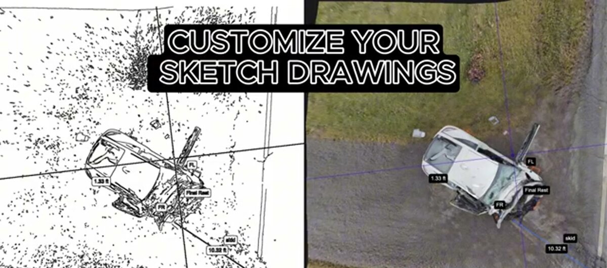
Bettendorf's I-74 bridge approach ramps and I-80 interchange generate high-speed collisions that demand rapid documentation. SkyeBrowse captures full scene geometry including skid marks, vehicle positions, and debris fields in about 10 minutes, allowing analysts to reconstruct trajectories without returning to the roadway — and allowing Iowa DOT to reopen the corridor while processing continues in the cloud.
Bettendorf's geography creates distinct challenges. The I-74 bridge approach ramps funnel traffic from Illinois into tight merge zones, and the I-80 interchange generates high-speed rear-end collisions during commuter surges. Winter conditions on the Mississippi River bluffs add ice and visibility hazards that extend scene times when officers must work carefully around slick pavement.
SkyeBrowse lets officers capture these scenes in about 10 minutes. The 3D model preserves skid marks, vehicle rest positions, debris fields, and road geometry so analysts can measure distances and reconstruct trajectories without returning to the roadway.
Crime scene documentation follows the same capture method. A shooting scene near the TPC Deere Run area or a vehicle pursuit ending on State Street can be recorded with a handheld video walk. Detectives access the model remotely, reducing the need for repeated site visits.
Cloud-based sharing means Scott County investigators, Iowa State Patrol, and Bettendorf detectives can review the same model simultaneously, improving coordination across jurisdictions without requiring anyone to drive to a shared conference room.

CJIS-Compliant 3D Evidence for Iowa Courts
Iowa District Courts require precise, reproducible evidence. SkyeBrowse Premium Advanced delivers reconstruction precision that survives Daubert challenges in Iowa's Seventh Judicial District, with CJIS-ready audit trails and long-term data retention that keeps evidence defensible throughout the entire case lifecycle.
Scott County cases move through Iowa's Seventh Judicial District, where serious crash prosecutions routinely involve competing reconstruction experts — each analyzing the same scene geometry and arriving at different conclusions about speed and fault. The credibility of Bettendorf PD's documentation determines which expert's analysis survives. A model with a documented chain of custody, verified capture timestamp, and AI-cleaned scene geometry gives the prosecution a foundation that is difficult to undermine on methodology grounds.
SkyeBrowse Premium Advanced delivers high-resolution models at sub-inch accuracy — reconstruction precision that survives Daubert challenges in Iowa's Seventh Judicial District. The platform's scene cleanup step strips passing vehicles, emergency responders, and bystanders from the model before it enters the evidence record. What remains is the physical geometry of the incident, not the response activity around it. All data is stored on secure government-grade cloud infrastructure with CJIS-ready access controls, and every view, share, and download is logged in an audit trail that travels with the case file through arrest, charging, and trial.
LAZ point cloud exports integrate with the CAD and forensic reconstruction software that Iowa State Patrol and county reconstruction specialists already use, making cross-agency analysis straightforward without file-format negotiations. Long-term retention on Premium and Premium Advanced tiers keeps evidence accessible through the full appeals cycle — critical for serious cases in the Seventh Judicial District where post-conviction review can extend for years.
Interstate Reopening Minutes Saved and Freight-Delay Cost Avoided
Every minute the I-74 bridge or I-80 interchange stays closed represents freight delay costs for carriers and lost productivity for the Quad Cities economy. SkyeBrowse compresses scene documentation time to roughly 10 minutes with one officer, freeing the roadway for Iowa DOT clearance while the 3D model processes in the cloud.
Every hour the I-74 bridge stays closed represents lost freight time for carriers moving goods between Illinois and Iowa, and lost revenue for Quad Cities businesses that depend on that corridor. Bettendorf PD does not control how long an investigation takes — but it does control how long the roadway stays closed for documentation. With SkyeBrowse, that window compresses from hours to roughly 10 minutes for the capture itself. The 3D model continues processing in the cloud while the road reopens, meaning Iowa DOT no longer has to choose between thorough documentation and timely clearance.
The staffing math reinforces this advantage. Under traditional methods, multiple officers committing several hours to a single scene represented significant personnel cost per incident. One officer completing capture in about 10 minutes returns the remaining officers to patrol, reducing overtime and maintaining coverage on the rest of the interstate system while the scene is still being processed in the cloud.
Over a full year of incidents — including Iowa winter months when ice events on the I-74 approach ramps can produce multiple simultaneous closures on a single shift — those per-scene savings in both personnel time and freight-delay cost avoided add up to meaningful budget flexibility. Supervisors can also deploy any patrol officer knowing documentation standards will be consistent, rather than waiting for a specialist whose availability may not match incident timing.
FAQ
How does SkyeBrowse reduce I-74 and I-80 closure times for Bettendorf PD?
A Bettendorf officer flies a drone orbit or walks the scene perimeter with a smartphone, and SkyeBrowse generates a full 3D model — skid marks, vehicle positions, debris fields, road geometry — in roughly 10 minutes. Iowa DOT no longer has to wait hours for reconstruction teams to finish measuring before the corridor reopens. See skyebrowse.com/tutorials for capture guides.
Does SkyeBrowse meet Iowa District Court evidence requirements?
Yes. SkyeBrowse Premium Advanced delivers reconstruction precision that survives Daubert challenges in Iowa's Seventh Judicial District, with CJIS-ready audit trails and guaranteed long-term retention. Scott County cases prosecuted in the Seventh Judicial District meet chain-of-custody and reproducibility standards whether challenged by prosecution or defense reconstruction experts. Details at skyebrowse.com/pricing-premium.
Can SkyeBrowse models be shared with Scott County and Iowa State Patrol simultaneously?
Yes. Because SkyeBrowse is cloud-based, a model captured by a Bettendorf officer at the I-74 bridge approach is accessible to Scott County investigators, Iowa State Patrol, and Illinois counterparts the moment processing completes. Each agency reviews the same model rather than conducting independent measurements that may later conflict in court.