Transform Construction with SkyeBrowse
Create precise 2D maps and 3D models from drone video footage with one click. Save time, reduce costs, and increase accuracy in your construction projects.
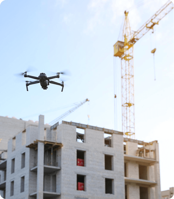
Why SkyeBrowse for Construction?
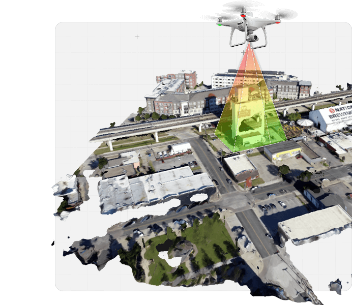
Site Mapping
Generate highly accurate topographic maps and terrain models using drone-captured data to streamline construction planning. SkyeBrowse enables you to visualize the site in 3D, identify potential challenges like uneven terrain or drainage issues, and make informed decisions before breaking ground. This reduces costly surprises and ensures alignment with project specifications, saving time and resources from the outset.
Structural Inspections
Conduct detailed inspections of buildings, bridges, and other infrastructure without the need for expensive scaffolding, cranes, or manual labor. SkyeBrowse transforms drone imagery into precise 3D models, allowing you to assess structural integrity, identify cracks, corrosion, or other defects, and document findings efficiently. This approach enhances worker safety, accelerates inspection timelines, and provides reliable data for maintenance or compliance reporting.
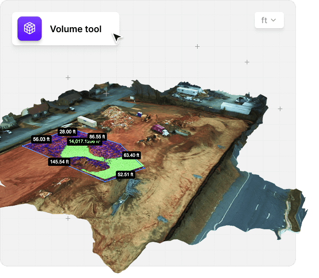
Inventory Control
Optimize material management by accurately measuring stockpile volumes and tracking inventory on your construction site. With SkyeBrowse, you can create 3D models and orthomosaics to calculate the volume of materials like gravel, sand, or concrete with high precision. This minimizes over-ordering or shortages, improves supply chain efficiency, and reduces waste, ultimately lowering project costs and enhancing operational control.
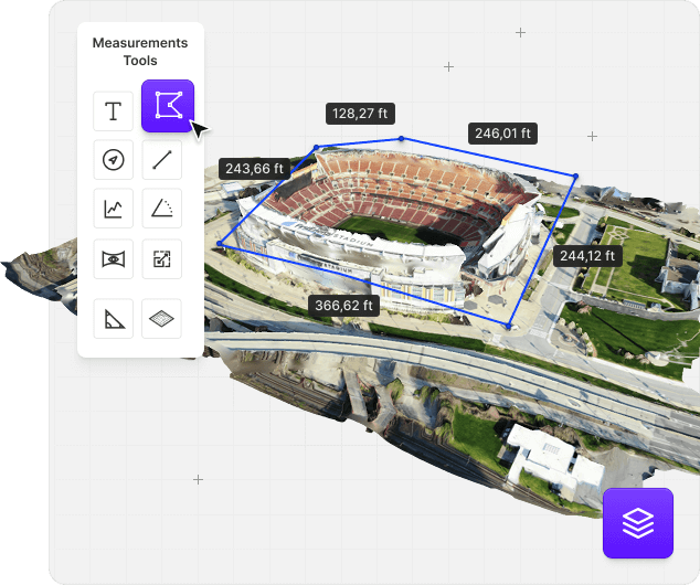
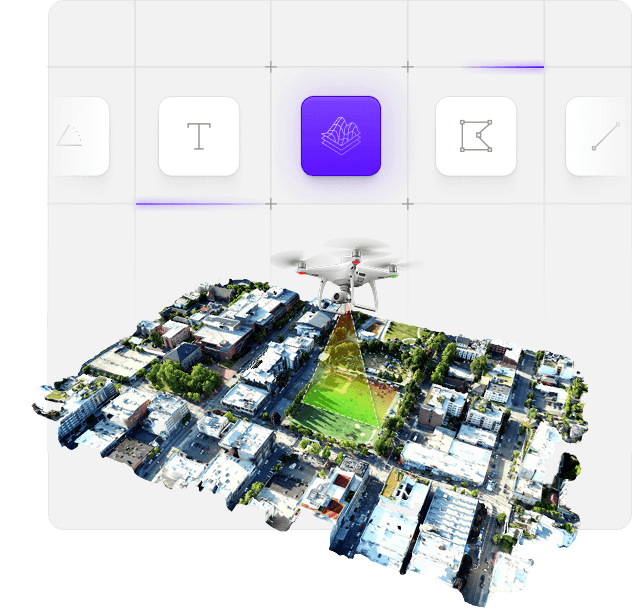
Measurement Tools
Leverage SkyeBrowse's advanced measurement tools to perform precise calculations directly on 3D models and orthomosaics, such as distances, areas, and volumes. Whether verifying dimensions of structural elements, calculating cut-and-fill requirements, or assessing clearance heights, these tools eliminate the need for manual measurements, reducing errors and saving time. This functionality supports accurate cost estimation, quality control, and seamless collaboration with project stakeholders.
Transform Your Construction Operations
SkyeBrowse empowers construction with drone mapping technology that streamlines workflows and enhances decision-making.
Significantly Reduce Project Timelines Through Rapid Mapping
Substantial Cost Savings On Surveying And Documentation
Improved Client Communication With 3D Visualizations
Enhanced Construction Site Safety Monitoring
Accurate Material And Resource Planning
Professional Documentation For Stakeholders
Start Transforming Your Construction Projects Today
Join hundreds of companies using SkyeBrowse to create precise 3D models and streamline construction processes.