# Site Plan Drawing: How to Make an Accurate Site Plan From Drone Video
> What a site plan drawing shows, what goes on one, which software to use, and how to make an accurate, CAD-ready site plan from drone video in minutes.
Source: https://www.skyebrowse.com/news/posts/site-plan-drawing
Published: 2026-10-15
A site plan drawing is a scaled, top-down view of a property that shows the lot lines, buildings, driveways, setbacks and utilities in their true positions. Permit offices, contractors and designers use it to see what's on a site and what's proposed. This guide covers what belongs on one, the common ways to make it, how site plan software compares, and how to turn a few minutes of drone video into a CAD-ready site plan and exterior elevations.
## Key Takeaways
- A site plan shows existing and proposed features of a lot from above, drawn to a stated scale with a north arrow.
- You can make one by hand, in CAD or diagramming software, or by tracing a fresh orthophoto captured by drone.
- SkyeBrowse AI Site Plan (CAD) traces a model's orthophoto into a CAD-ready overlay that exports as DXF or GeoJSON, with georeferenced export when the model is georeferenced.
- AI Wall Elevation turns a wall face into a flat 2D elevation DXF with on-wall measurements and annotations.
- Pro models measure to 0.5 inch; legal property corners come from the deed, the plat and a licensed surveyor.
## Contents
- [What is a site plan drawing?](#what-is-a-site-plan-drawing)
- [What goes on a site plan?](#what-goes-on-a-site-plan)
- [How do you make a site plan drawing?](#how-do-you-make-a-site-plan-drawing)
- [What site plan software options are there?](#what-site-plan-software-options-are-there)
- [How do you make a site plan drawing from drone video?](#how-do-you-make-a-site-plan-drawing-from-drone-video)
- [What is an exterior elevation drawing and how do you get one?](#what-is-an-exterior-elevation-drawing-and-how-do-you-get-one)
- [How accurate is a drone site plan?](#how-accurate-is-a-drone-site-plan)
- [FAQ](#faq)
## What is a site plan drawing?
A site plan drawing is a scaled plan view of an entire property, drawn as if you were looking straight down from above. It shows where buildings, paving, landscaping and utilities sit relative to the lot lines. Permit applications, renovation bids, landscape designs and site development projects all start from one.
A floor plan shows the inside of one building; a site plan zooms out to the whole parcel. Architects often split it into an existing-conditions plan and a proposed plan showing the addition, pool or parking lot being added.
The [City of Mississauga's residential site plan sample](https://www.mississauga.ca/publication/site-plan-sample-drawing/) shows what a reviewer wants: dimensions to every lot line, labeled structures and a clear scale. Commercial sheets usually follow drafting conventions from the [United States National CAD Standard](https://www.nibs.org/ncs), which governs layer names, line types and sheet layout.
## What goes on a site plan?
A complete site plan includes property lines with dimensions, every existing and proposed structure, setbacks from each lot line, driveways and walkways, easements, utilities, trees and drainage features. It also carries a north arrow, a written or graphic scale, the address and a title block identifying who drew it.
Here's the checklist most permit reviewers work from:
- **Property lines** with lengths, from the deed, plat or a boundary survey
- **Structures**: house, garage, sheds, decks, pools and fences, with footprint dimensions
- **Setbacks**: distances from each structure to the front, side and rear lot lines
- **Hardscape**: driveways, sidewalks, patios and parking
- **Utilities**: water, sewer or septic, gas, electric service and meter locations
- **Easements and rights-of-way** that limit where you can build
- **Grading and drainage**: slopes, swales and downspout discharge points
- **North arrow, scale, address and title block**
Structures, hardscape and setbacks are where most mistakes happen, and they're the elements you can measure straight from an aerial capture.
## How do you make a site plan drawing?
There are three common methods: measure the lot by hand and draw on graph paper, draft it in CAD or site plan software from field measurements, or capture the site by drone and trace an orthophoto. The drone method replaces the tape measure stage, which is the slowest and most error-prone part of the other two.
**By hand.** Walk the property with a 100-foot tape, sketch the footprint of each structure and measure offsets to the lot lines. It's free and fine for a shed permit. Curved driveways, large lots and tall buildings make it slow and easy to get wrong.
**CAD or diagramming software.** You still collect measurements in the field, then draw clean lines at scale, so the result is only as accurate as those measurements.
**Drone capture.** Fly the site, build a model and work from an orthophoto, a top-down image corrected so every pixel sits at true scale. Learn more in our guide to [orthomosaic maps](https://www.skyebrowse.com/news/posts/what-is-orthomosaic). Anyone flying a drone for paid work in the US needs an FAA remote pilot certificate under [Part 107](https://www.faa.gov/uas/commercial_operators).
## What site plan software options are there?
General CAD programs, 3D modelers, template-based diagramming tools, landscape design suites and capture-based platforms can all produce a site plan. The right choice depends on whether you already have measurements or need to collect them. Most drafting tools assume you bring the dimensions yourself.
| Tool | Best for | How you get measurements |
| --- | --- | --- |
| AutoCAD (Autodesk) | Architects and engineers needing DWG/DXF files | Field measurements or survey file |
| SketchUp (Trimble) | Quick 3D massing and presentation site plans | Field measurements or imported imagery |
| SmartDraw | Homeowners and contractors using templates and symbols | Field measurements |
| Vectorworks Landmark | Landscape architects designing planting and hardscape | Survey or imported base file |
| SkyeBrowse | A current, measurable base from drone or phone video | Captured from video, traced by AI |
The drafting tools are sold by subscription, with free tiers or trials varying by vendor, so check current terms on each vendor's site. SkyeBrowse creates the base layer itself, and its DXF export opens in the CAD tools above for final drafting. For a wider look at capture platforms, see our roundup of [drone mapping software](https://www.skyebrowse.com/news/posts/free-drone-mapping-software) and the best [drone mapping app](https://www.skyebrowse.com/news/posts/drone-mapping-app) options.
## How do you make a site plan drawing from drone video?
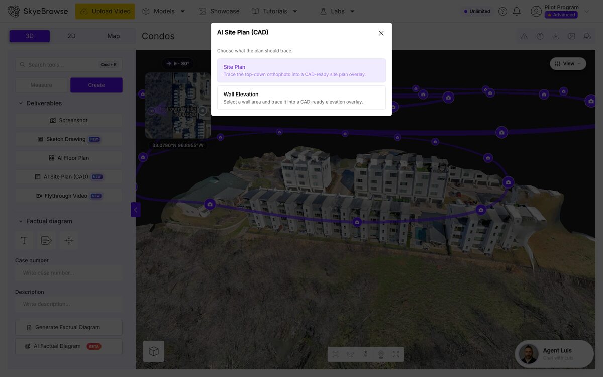
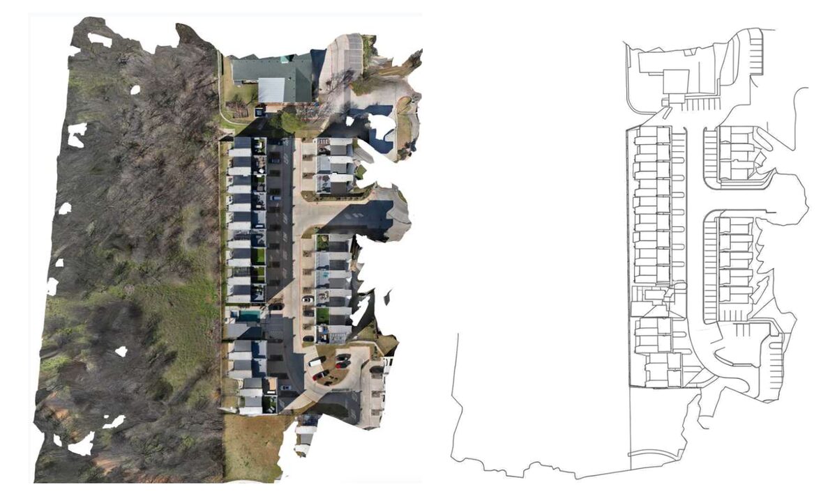
Fly a short video of the property, upload it to SkyeBrowse and open the finished model. In the Create panel, choose AI Site Plan (CAD), then Site Plan, and the AI traces the orthophoto into a CAD-ready overlay. Export it as DXF or GeoJSON and finish the sheet in your CAD software.
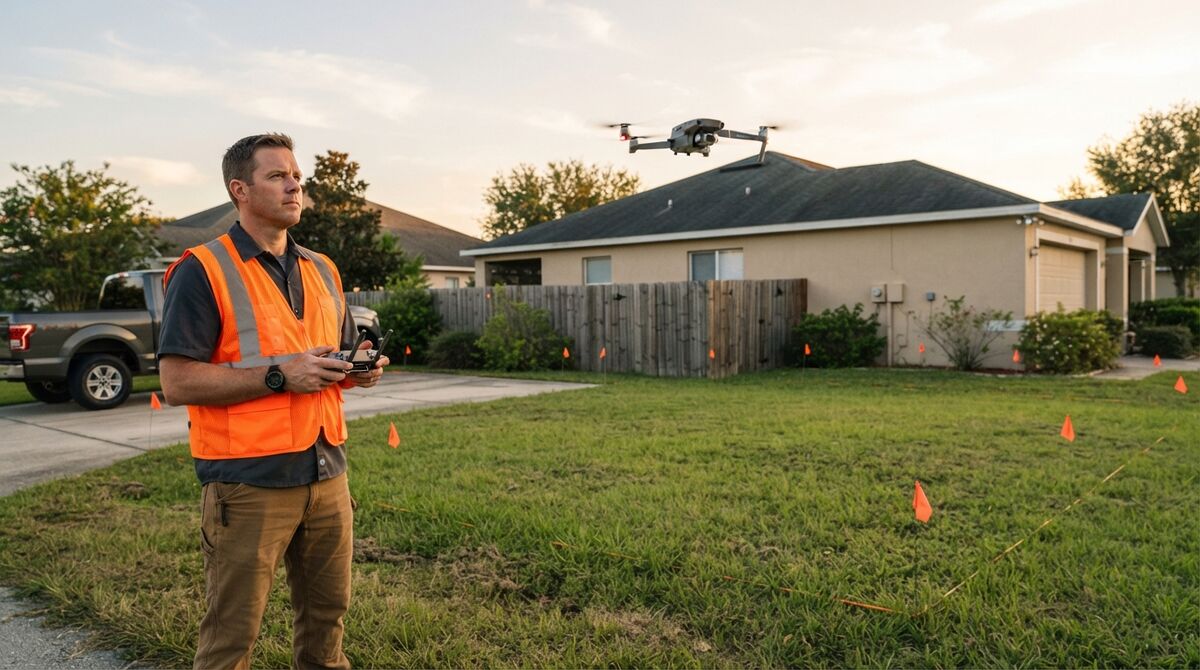
**1. Capture.** On a [supported drone](https://www.skyebrowse.com/supported-drones), such as certain DJI models or an Autel Evo II V1 or V2 with the iOS app, the SkyeBrowse Flight App flies an automated two-orbit pattern for lots under an acre and, on aircraft that support it, a WideBrowse grid for larger parcels. Any other drone, or a phone walked around a small yard, works through Universal Upload with a standard MP4 or MOV file. Turn on your drone's GPS subtitle recording (.SRT on DJI, .ASS on Autel) so the model is georeferenced, meaning tied to real-world GPS coordinates.
**2. Process.** SkyeBrowse uses videogrammetry, which reconstructs 3D geometry from the frames of a continuous video. Most models are ready within 5 to 10 minutes of upload, in the browser.
**3. Trace.** Open Create, choose AI Site Plan (CAD) and pick Site Plan. The AI traces the model's top-down orthophoto into a CAD-ready site plan overlay and saves it to the model as a CAD Site Plan.
**4. Export.** Use Export CAD to download the overlay and your measurements as DXF, the drawing exchange format CAD programs open, or GeoJSON, a standard GIS format. When the model is georeferenced, georeferenced export modes place the drawing in real-world coordinates. The [3D model viewer tutorial](https://www.skyebrowse.com/news/posts/tutorial-3d-model-viewer) covers the Create tools.
AI Site Plan and exports come with a Pro model ($49.99 per model, or $39.99 per model billed annually) and with Public Safety & Enterprise. A Commercial model ($24.99) covers viewing, measuring and sharing for 3 months and excludes exports and AI tools, AI Site Plan included. Current options are on the [pricing page](https://www.skyebrowse.com/pricing).
## What is an exterior elevation drawing and how do you get one?
An exterior elevation drawing is a flat, straight-on view of one side of a building, showing wall heights, windows, doors and rooflines to scale. SkyeBrowse produces one with AI Wall Elevation: click opposite corners of a wall on the model and it traces that face into a 2D elevation with measurements and annotations.
Designers pair elevations with the site plan when a permit involves a facade change, an addition or a height limit.
With a model in hand, open AI Site Plan (CAD) and choose Wall Elevation. Click two opposite corners of the wall, and the tool traces that face into a CAD-ready elevation with on-wall measurements and text annotations. It exports as a flat 2D elevation-view DXF that opens correctly in CAD software. For tall facades, the WideBrowse Side Scan option adds an orbital pass that captures walls in more detail. Contractors can carry the same workflow into [as-built drawings](https://www.skyebrowse.com/news/posts/drone-as-built-documentation) and [3D mapping for construction](https://www.skyebrowse.com/news/posts/3d-mapping-for-construction).
## How accurate is a drone site plan?
A site plan traced from a SkyeBrowse Pro model inherits that model's 0.5 inch accuracy from 8K-resolution processing, and Public Safety & Enterprise models reach 0.1 inch. In independent testing, SkyeBrowse video models measured more accurately than photo-based photogrammetry, at laser-scanner-level accuracy.
That testing came from a [January 2021 AirBorne Works quality-control study](https://www.skyebrowse.com/whitepaper). With a Leica BLK360 laser scan as ground truth, SkyeBrowse was closest to the scan on 8 of 9 measured lines, within about 1 cm (0.39 inch) at all but one, ahead of photo-based Pix4D Mapper and Leica BLK3D. Accuracy also scales with capture distance, so a lower orbit or a phone pass along a wall tightens detail where it matters.
Measurement accuracy and legal boundaries are separate questions. A drone model shows where a fence, foundation or driveway sits today. The legal lot line comes from the deed, the plat and a licensed land surveyor, so bring their corner coordinates into any drawing that depends on a boundary.
## FAQ
**Is a site plan the same as a blueprint?**
No. A site plan is one sheet in a drawing set that shows the whole lot from above: property lines, buildings, driveways, setbacks and utilities. Blueprints is an older catch-all term for the full set, which also includes floor plans, elevations and construction details.
**Can I draw a site plan using Google Maps?**
You can trace a rough sketch over satellite imagery, and some homeowners do for simple permits. Satellite photos are often months or years old, can be offset from true position, and lean at tall objects, so a fresh drone capture gives a current, measurable base you can trace and dimension. Eligible Freemium organizations can try their first full Commercial model for $5 at [app.skyebrowse.com](https://app.skyebrowse.com), with every Pro tool and export included and 90-day storage.
**Do I need a surveyor for a site plan?**
It depends on the jurisdiction and the project. Many residential permits accept an owner-drawn site plan, while new construction, subdivisions and boundary questions usually require a licensed land surveyor. Ask your permit office before you start, and rely on a surveyor for legal property corners.