# Scene Documentation With Drones: A Public Safety SOP and Field Checklist
> How police, fire and EMS document scenes with drones: what to capture, flight patterns by incident, chain of custody, a field checklist, and 3D models.
Source: https://www.skyebrowse.com/news/posts/public-safety-drone-scene-documentation
Published: 2026-11-21
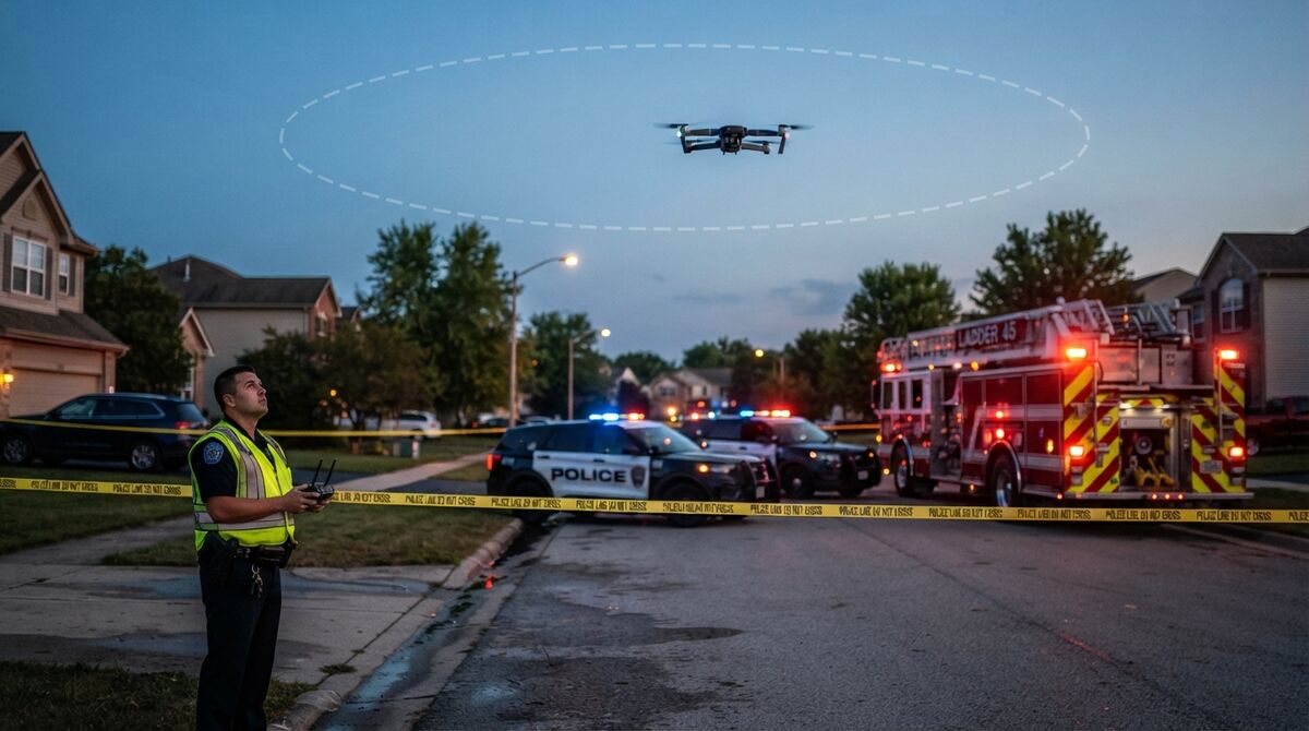
Scene documentation with drones gives a patrol sergeant, fire officer or drone coordinator one repeatable way to record crashes, crime scenes, fires and disasters before anything moves. The core record is a measurable 3D model built through videogrammetry (reconstructing 3D geometry from the frames of a continuous video). This guide lays out a cross-incident standard operating procedure (SOP) from call-out to evidence storage, which flight pattern fits which scene, and a printable public safety drone checklist.
## Key Takeaways
- One SOP covers crash, crime, fire, hazmat, search and rescue, and disaster scenes; only the flight pattern and deliverables change.
- Scenes under about an acre get an automated two-orbit flight, while larger areas get a WideBrowse grid, with Cross Grids or Side Scan when structures matter.
- A known-size reference in the scene and the drone's GPS file make the model verifiable and georeferenced without ground control points.
- Middletown Police Department cut crash documentation from five officers and an average of 2.5 hours to one officer and an average of 7.5 minutes.
- Evidence handling (CJIS, chain-of-custody logs, 2FA, 5-year storage) belongs in the SOP from day one, before the first case goes to court.
## Contents
- [What is scene documentation with drones in public safety?](#what-is-scene-documentation-with-drones-in-public-safety)
- [Which scenes do agencies document with drones?](#which-scenes-do-agencies-document-with-drones)
- [How should a drone capture a scene so it can be measured later?](#how-should-a-drone-capture-a-scene-so-it-can-be-measured-later)
- [How do you document the indoor parts of a scene?](#how-do-you-document-the-indoor-parts-of-a-scene)
- [What goes on a public safety drone checklist for scene work?](#what-goes-on-a-public-safety-drone-checklist-for-scene-work)
- [How do agencies keep drone scene data as evidence?](#how-do-agencies-keep-drone-scene-data-as-evidence)
- [What deliverables come out of a documented scene?](#what-deliverables-come-out-of-a-documented-scene)
- [FAQ](#faq)
## What is scene documentation with drones in public safety?
Drone scene documentation is the practice of flying a scene once, in a planned pattern, and turning that video into a measurable 3D model and a top-down orthomosaic (a scaled, distortion-corrected aerial map). The model becomes the permanent record investigators measure, annotate and present. It replaces hours of hand measurements with a capture that takes minutes.
The [NIJ crime scene investigation guide](https://nij.ojp.gov/library/publications/crime-scene-investigation-guide-law-enforcement) remains the baseline for securing and recording a scene. A drone adds a complete spatial record that anyone on the case can revisit after the road reopens. The [NIST OSAC Crime Scene Investigation and Reconstruction Subcommittee](https://www.nist.gov/osac/subcommittees/crime-scene-investigation-reconstruction) supports standards and guidance for scene work, so write your SOP to be auditable. The [FAA's public safety UAS page](https://www.faa.gov/uas/public_safety_gov) covers flying under Part 107 or a Certificate of Waiver or Authorization (COA). See the [public safety overview](/use-cases/public-safety) and the [public safety topic hub](/topics/public-safety) for SkyeBrowse's agency tools.
## Which scenes do agencies document with drones?
Agencies use the same drone workflow for six common scene types: traffic crashes, crime scenes, fires, hazmat releases, search and rescue areas, and disaster zones. The capture pattern and the deliverables change by scene. The SOP, the evidence handling and the review steps stay the same.
**Crash scenes.** Crash teams capture rest positions, debris fields and roadway marks so lanes can reopen quickly. Our [accident reconstruction drone mapping guide](/news/posts/accident-reconstruction-drone-mapping) covers the workflow, and the crash-specific steps live in the [accident reconstruction checklist](/news/posts/accident-reconstruction-checklist).
**Crime scenes.** Investigators fly outdoor scenes and walk interiors to preserve evidence placement for later testimony. [Drone crime scene mapping](/news/posts/drone-crime-scene-mapping) explains capture and admissibility.
**Fires.** Departments map structures before incidents and document fire scenes afterward. Start with [fire pre-plan 3D mapping](/news/posts/fire-pre-plan-3d-mapping).
**Hazmat.** Teams document spills from upwind standoff positions outside the hot zone, as described in [hazmat incident documentation](/news/posts/hazmat-incident-documentation).
**Search and rescue.** Teams map wide search areas, and thermal video can also be processed into 3D models; see [drone search and rescue](/news/posts/search-and-rescue-operations).
**Disasters.** Large damage areas call for grid flights and repeat surveys, covered in [drone disaster response mapping](/news/posts/disaster-response).
## How should a drone capture a scene so it can be measured later?
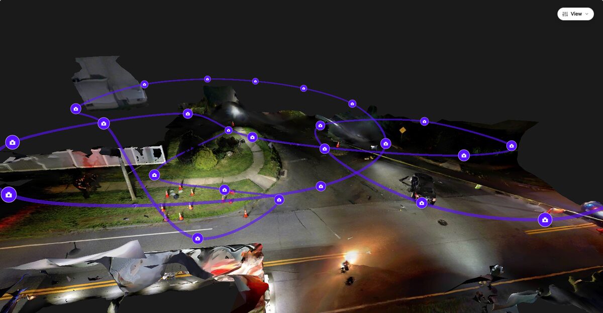
Fly a scene under about one acre with an automated two-orbit flight, and switch to a WideBrowse grid for anything larger. Keep zoom locked, move around the subject smoothly, and capture several angles with overlap at the end. Place a known-size object in the scene so every measurement can be checked.
The SkyeBrowse Flight App automates both patterns on supported DJI and Autel drones and works offline in the field. WideBrowse adds two options for structured scenes: Cross Grids flies a second pass perpendicular to the first for better lateral detail, and Side Scan adds an orbital pass that captures building facades. Drones outside the Flight App list, including Skydio, fly manually and upload the video through Universal Upload.
Move around evidence instead of panning in place, keep the frame from filling with sky, and avoid long stares at glass, water or mirrors, which confuse reconstruction. Turn on GPS subtitle recording (.SRT on DJI, .ASS on Autel) so the model lands on the map; ground control points aren't required. Measurements hold to 0.1 inch on a Public Safety & Enterprise model, or 0.5 inch on Commercial and Pro. In an [independent 2021 AirBorne Works study](https://www.skyebrowse.com/whitepaper) at a staged night-time crash, SkyeBrowse video models were closest to the Leica BLK360 laser scan used as ground truth on 8 of 9 measured lines, ahead of photo-based Pix4D Mapper and Leica BLK3D.
## How do you document the indoor parts of a scene?
Walk the interior slowly with a phone or 360 camera, then upload the video with the Interior Mapping toggle turned on. Steady, unhurried movement through every room gives the best result. The interior model can then be combined with the aerial exterior so investigators move from the street into the building in one viewer.
Universal Upload accepts .MP4 and .MOV video from phones, action cameras and body-worn cameras, plus native Insta360 .INSV and .OSV files. Public Safety & Enterprise adds Enhanced Interior Mapping for more detailed indoor models. Large 360 interior captures can go through Rapid Upload, which skips the per-video size limit; it has no Interior Mapping toggle. 3D Overlay then merges interior and exterior models into one scene.
## What goes on a public safety drone checklist for scene work?
A public safety drone checklist adds scene-specific steps on top of the standard FAA preflight. It covers scene clearance and case details before launch, capture discipline in the air, upload and coverage review after landing, evidence handling, and the deliverables the case needs. Print it and keep it in the drone kit.
Complete your aircraft inspection with the [drone preflight checklist](/news/posts/drone-preflight-checklist) first. Then work through these blocks.
### Before launch
☐ Scene secured; incident commander or case agent clears the flight
☐ Case or incident number, location, date, time, pilot and visual observer logged
☐ GPS subtitle recording turned on
☐ Known-size reference (scale bar or tape) placed in the scene
☐ Lighting, weather and anything moved before arrival noted
☐ Pattern chosen: orbit under about one acre, WideBrowse grid above
### Capture
☐ Zoom locked, smooth motion, no panning in place
☐ Multiple angles and heights over key evidence
☐ Interior walked with phone or 360 camera if needed
☐ Final pass overlaps the start
### After landing and upload
☐ Original video files kept unedited
☐ Video and GPS file uploaded together, model named with the case number
☐ Finished model reviewed on a phone or tablet before the scene is released
### Evidence handling
☐ Model access limited to the case team
☐ Two-factor authentication on for every user
☐ Exports copied to the agency evidence system per policy
### Deliverables
☐ Key measurements checked against the scale reference
☐ Annotations, icons and photos attached
☐ Diagram PDF and exports generated for the case file
## How do agencies keep drone scene data as evidence?
Agencies keep drone scene models on a platform that logs every access, action and share, enforces two-factor authentication, and stores the model for the life of the case. On SkyeBrowse, full CJIS compliance, chain of custody and 5-year model storage come with Public Safety & Enterprise. The agency owns its data.
SkyeBrowse hosts processing and storage on AWS GovCloud (US) at FedRAMP Impact Level 2, and the [FBI CJIS Security Policy](https://www.fbi.gov/services/cjis/cjis-security-policy-resource-center) sets the access rules your IT team will check. Agencies on Axon download the model's exports, PDFs and videos from SkyeBrowse and upload them to Evidence.com; there's no direct sync, and chain of custody is maintained through that export. Public Safety & Enterprise is priced per model at $199 per year with unlimited users, so prosecutors and command staff can view a case without seat licenses. Our [CJIS compliant drone mapping](/news/posts/cjis-compliant-drone-mapping) guide lists what to verify with any vendor.
## What deliverables come out of a documented scene?
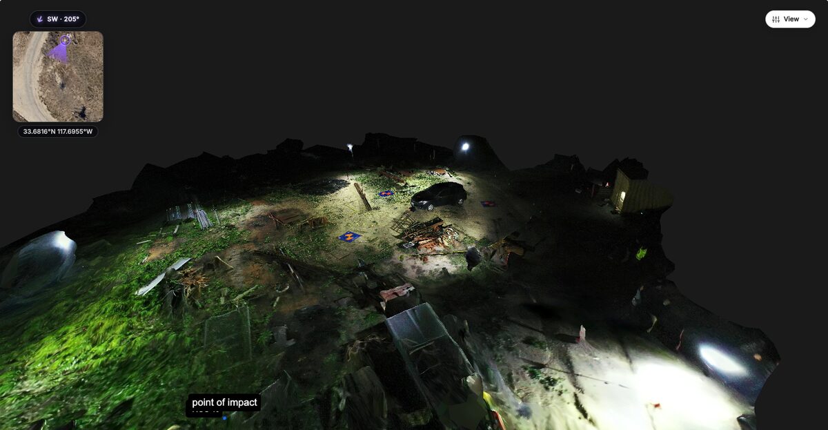
A documented scene yields measurements, annotations, scaled diagrams and shareable 3D views. Investigators measure distances, areas and angles, mark evidence with standardized icons, and attach photos to exact locations. The model then produces court-ready PDFs and exports for reconstruction software.
Public Safety & Enterprise adds the tools built for cases: Public Safety Icons from the NAPSG all-hazards library (including an NFPA 704 hazard diamond), Case Gallery photo annotations, Sketch Drawing, Line of Sight, and the Factual Diagram PDF with measurement pages and annotation callouts. Walk Mode, available on every plan, moves through the scene at eye level. Exports include LAZ point clouds, GLB meshes and GeoTIFF orthomosaics for [crime scene 3D mapping software](/news/posts/crime-scene-3d-mapping-software) and CAD tools. The [Middletown Police Department case study](/news/posts/case-study-middletown-police-department-saved-47-million) shows the payoff: one officer now documents a crash in an average of 7.5 minutes, where five officers once spent an average of 2.5 hours. For training, start with the 1 Day In-Person Training ($1,999 per student), or Virtual Training ($499 per person) when travel is the barrier.
## FAQ
**How do police and fire departments document a scene with a drone?**
They secure the scene, place a known-size reference, fly an orbit around scenes under about an acre or a grid over larger ones, and record the drone's GPS file. The video is uploaded to a videogrammetry platform such as SkyeBrowse, which returns a measurable 3D model and 2D orthomosaic, usually within minutes, for measurements, annotations and court diagrams.
**Do you need ground control points for drone scene documentation?**
No. SkyeBrowse reaches survey-grade model accuracy without ground control points. A known-size object or measuring tape placed in the scene gives investigators an independent check, and the drone's GPS subtitle file georeferences the model.
**How long does it take to get a 3D model of a scene?**
Processing time on SkyeBrowse roughly matches the length of the video, so most scene models are ready 5 to 10 minutes after the upload finishes, depending on the connection. That's often fast enough to review coverage before the scene is released.
**Can drone scene data be stored as CJIS-compliant evidence?**
Yes, on the Public Safety & Enterprise plan. It adds full CJIS compliance, chain-of-custody logging of model access, user actions and sharing, two-factor authentication, and 5-year model storage, with data hosted on AWS GovCloud (US) at FedRAMP Impact Level 2. Agencies can test the workflow first through the free 14-day [Pilot Program](/quote).